ATLAS of ANTIENT GEOGRAPHY by SAMUEL BUTLER 1843John McInnis Auctioneers,LLC4.6(502)See Sold PriceFeb 24, 2024
18TH C. ANTIQUE MAP: FRENCH & INDIAN WAR, FRAMEDThomaston Place Auction Galleries4.4(386)See Sold PriceFeb 24, 2024
Rand McNally Railroad Map Cabinet w/ 21 Railroad MapsRail & Road Auctions4.6(165)See Sold PriceMar 08, 2024
Keith Haring - Ink on New York Map, Best Buddies, Inscribed, Signed, and DatedSapphire Auction Gallery4(67)See Sold PriceMar 02, 2024
LATE 17TH C. FRENCH MAP OF THE NEW WORLD BY ALEXIS-HUBERT JAILLOT (1632-1712)Thomaston Place Auction Galleries4.4(386)See Sold PriceFeb 24, 2024
Central Railroad of New Jersey Map of Sandy Hook Route-ca. 1903JM Hobby Supply and Railroad Artifact Auctions4.4(126)See Sold PriceFeb 24, 2024
Lot of Six Mixed Atlas Box Cars-HO Scale-New in BoxJM Hobby Supply and Railroad Artifact Auctions4.4(126)See Sold PriceFeb 25, 2024
Rand McNally/Santa Fe Railroad Map of Iowa-1912JM Hobby Supply and Railroad Artifact Auctions4.4(126)See Sold PriceFeb 24, 2024
NICOLAES VISSCHER (NETHERLANDS, 1618-1709) MAP OF THE NEW WORLDThomaston Place Auction Galleries4.4(386)See Sold PriceFeb 24, 2024
17TH C. WORLD MAP BY NICOLAES VISSCHER (NETHERLANDS, 1618-1709)Thomaston Place Auction Galleries4.4(386)See Sold PriceFeb 24, 2024
Lot of Six Mixed Atlas Cabooses-HO Scale-New in BoxJM Hobby Supply and Railroad Artifact Auctions4.4(126)See Sold PriceFeb 25, 2024
RARE map of Southern Poland. 1596Title:RARE map of Southern Poland. 1596 Date/Period: 1596 Materials: Copperplate engraved Dimensions: 14" x 10 1/4" Southern Poland from Weysel river in the north to the Carpathian Mountains and HungaSee Sold Price
RARE map of Southern Poland. 1596Title: RARE map of Southern Poland. 1596 Date/Period: 1596 Materials: Copperplate engraved Size: 14" x 10 1/4" Description: Southern Poland from Weysel river in the north to the Carpathian Mountains aSee Sold Price
RARE map of Southern Poland. 1596Title: RARE map of Southern Poland. 1596 Date/Period: 1596 Materials: Copperplate engraved Size: 14" x 10 1/4" Southern Poland from Weysel river in the north to the Carpathian Mountains and HungarianSee Sold Price
RARE map of Southern Poland. 1596Title: RARE map of Southern Poland. 1596 Date/Period: 1596 Materials: Copperplate engraved Size: 14" x 10 1/4" Southern Poland from Weysel river in the north to the Carpathian Mountains and HungarianSee Sold Price
RARE map of Southern Poland. 1596Title: RARE map of Southern Poland. 1596 Date/Period: 1596 Materials: Copperplate engraved Size: 14" x 10 1/4" Southern Poland from Weysel river in the north to the Carpathian Mountains and HungarianSee Sold Price
RARE map of Southern Poland. 1596Title: RARE map of Southern Poland. 1596 Date/Period: 1596 Materials: Copperplate engraved Size: 14" x 10 1/4" Southern Poland from Weysel river in the north to the Carpathian Mountains and HungarianSee Sold Price
RARE map of Southern PolandTitle: RARE map of Southern Poland Date/Period: 1596 Materials: Copperplate engraved Size: 14" x 10 1/4" Description: Southern Poland from Weysel river in the north to the Carpathian Mountains and HunSee Sold Price
RARE map of Silesia, southern PolandTitle:RARE map of Silesia, southern Poland Date/Period: 1596 Materials: Copperplate engraved Dimensions: 14" x 10 1/4" Silesia. Centered on Breslau (Wroclaw). This map is based on a map produced by MaSee Sold Price
RARE map of Silesia, southern PolandTitle: RARE map of Silesia, southern Poland Date/Period: 1596 Materials: Copperplate engraved Size: 14" x 10 1/4" Silesia. Centered on Breslau (Wroclaw). This map is based on a map produced by MartinSee Sold Price
RARE map of Silesia, southern PolandTitle: RARE map of Silesia, southern Poland Date/Period: 1596 Materials: Copperplate engraved Size: 14" x 10 1/4" Description: Silesia. Centered on Breslau (Wroclaw). This map is based on a map producSee Sold Price
RARE map of Silesia, southern PolandTitle: RARE map of Silesia, southern Poland Date/Period: 1596 Materials: Copperplate engraved Size: 14" x 10 1/4" Silesia. Centered on Breslau (Wroclaw). This map is based on a map produced by MartinSee Sold Price
SoldRARE map of Silesia, southern PolandTitle: RARE map of Silesia, southern Poland Date/Period: 1596 Materials: Copperplate engraved Size: 14" x 10 1/4" Description: Silesia. Centered on Breslau (Wroclaw). This map is based on a map producSee Sold Price
RARE map of Silesia, southern PolandTitle: RARE map of Silesia, southern Poland Date/Period: 1596 Materials: Copperplate engraved Size: 14" x 10 1/4" Description: Silesia. Centered on Breslau (Wroclaw). This map is based on a map producSee Sold Price
RARE map of northern Germany and saxony regionTitle: RARE map of northern Germany and saxony region Description: Covers a area from Westfalia to Poland. Is centered on Saxony two ships are shown one firing cannons. Good condition.1596, (RARE EDITSee Sold Price
SoldMAP, Southern Poland, OrteliusSouthern Poland. Abraham Ortelius, Silesiae Typus Descriptus et Editus a Martino Heilwig Neisense, et Nobili Viro Nicolao Rhedinger Dedicatus Anno 1561, from Theatrum Orbis Terrarum, 1584 (published).See Sold Price
SoldMAPS, Southern Poland, Covens/MortierSouthern Poland. Jean Covens & Corneille Mortier, [On 2 Sheets] Novissimum Silesiae Theatrum id est Exactissimus Superioris et Inferioris Silesiae Comitatus Glacensis..., 1748 (dated). Hand Color. ThiSee Sold Price
SoldAbraham Ortelius Rare Map of Poland Late 16th C.Abraham Ortelius Scarce map of Poland and Lithuania during the late 16th century. Titled "Poloniae, Litvaniaeq. Descriptio". The map shows major cities and towns, as well as geographical features. IncSee Sold Price
SoldAbraham Ortelius Rare Map of Poland Late 16th C.Abraham Ortelius Scarce map of Poland and Lithuania during the late 16th century. Titled "Poloniae, Litvaniaeq. Descriptio". The map shows major cities and towns, as well as geographical features. 22.See Sold Price
SoldRARE 1697 MAP SOUTHERN ITALY - CLUVERRare engraved antique map of Ancient Southern Italy, with a very decorative cartouch. In near fine condition, folded as issued. It is fully engraved to illustrate topography with ancient place names aSee Sold Price
Sold1743 Le Rouge Map of Southern Poland and parts of CzechTitle/Content of Map: 1743 Le Rouge Map of Southern Poland and parts of Czech Republic (Silesia) -- Le Duche De Silesie divse en XVII Principautees . . . Date: 1743, Paris Cartographer: G Le Rouge SizSee Sold Price
Extremely rare map of Southern Italy showing coinTitle: Extremely rare map of Southern Italy showing coin producing cities during ancient Greek era. Date: 1708 Cartographer: H. Verdussen Size:15 1/2x9” Provenance: Antwerp Additional Information: VSee Sold Price
SoldA Rare Map of Poland and Prussia,C.1714, Pierre van der Aa (1659-1733), cartouche reads 'Grande Pologne et Prusse avec les frontieres de la Misnie, Lusace, Moravie et Lithuanie . . .' copper plate engraving, hand coloured, no restoraSee Sold Price
Extremely rare map of Southern Italy showing coinReserve Reduced! Title/Content of Map: Extremely rare map of Southern Italy showing coin producing cities during ancient Greek era Date: 1708 Size: 14 1/2x 9” Virtually impossible to acquire loose.See Sold Price
1743 Le Rouge Map of Southern Poland and parts of CzechTitle/Content of Map: 1743 Le Rouge Map of Southern Poland and parts of Czech Republic (Silesia) -- Le Duche De Silesie divse en XVII Principautees . . . Date: 1743, Paris Cartographer: G Le Rouge SizSee Sold Price
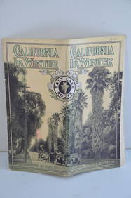
Los Angeles and Salt Lake RR California in Winter Brochure-October 1912JM Hobby Supply and Railroad Artifact Auctions4.4(126)See Sold PriceFeb 24, 2024
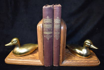
Southern Pacific RR Book West By South-Half South-1890JM Hobby Supply and Railroad Artifact Auctions4.4(126)See Sold PriceFeb 24, 2024
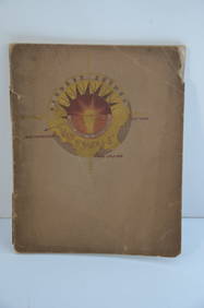
Southern Pacific RR Four Gateways to the Pacific Coast Brochure-1917JM Hobby Supply and Railroad Artifact Auctions4.4(126)See Sold PriceFeb 24, 2024
Southern Pacific RR Oregon Outdoors Brochure-May 1916JM Hobby Supply and Railroad Artifact Auctions4.4(126)See Sold PriceFeb 24, 2024
1822 Rare Map by Ambroise Tardieu Napoleon Caldiero Battle of Vento 17" x 11Luis Porretta Fine Arts4.3(10)See Sold PriceMar 02, 2024
1870 Commentary on the Gospels Vol I St Mathew & Vol II St Mark 1st EditionsNorth American Artifact Auctions4.6(182)See Sold PriceApr 20, 2024
D'Entrecasteaux - Map of Australia (New Holland), New Zealand, and southern Asia and surroundingTrillium Antique Prints & Rare Books4.5(30)See Sold PriceFeb 24, 2024
1816 MAP SOUTHERN PART OF RUSSIA or MUSCOVY in EUROPE copper engraving ANTIQUEJasper524.5(9.8k)See Sold PriceFeb 27, 2024
1790 AFRICA TRAVELS Voyages dans le pays des Hottentots ILLUSTRATED antique RAREJasper524.5(9.8k)See Sold PriceFeb 27, 2024
ANTIQUE ILLUSTRATED HANDBOOK OF GEOGRAPHY AND TRAVEL IN ASIA, VOLUME 2, 1896NY Elizabeth 4.3(84)See Sold PriceMar 03, 2024
Rare 19thc Colton Map, Argentine Republic, Chile, Uruguay, PataguayConnoisseur Auctions4(333)See Sold PriceMar 16, 2024