ATLAS of ANTIENT GEOGRAPHY by SAMUEL BUTLER 1843John McInnis Auctioneers,LLC4.6(502)See Sold PriceFeb 24, 2024
18TH C. ANTIQUE MAP: FRENCH & INDIAN WAR, FRAMEDThomaston Place Auction Galleries4.4(386)See Sold PriceFeb 24, 2024
Rand McNally Railroad Map Cabinet w/ 21 Railroad MapsRail & Road Auctions4.6(165)See Sold PriceMar 08, 2024
Keith Haring - Ink on New York Map, Best Buddies, Inscribed, Signed, and DatedSapphire Auction Gallery4(67)See Sold PriceMar 02, 2024
LATE 17TH C. FRENCH MAP OF THE NEW WORLD BY ALEXIS-HUBERT JAILLOT (1632-1712)Thomaston Place Auction Galleries4.4(386)See Sold PriceFeb 24, 2024
Central Railroad of New Jersey Map of Sandy Hook Route-ca. 1903JM Hobby Supply and Railroad Artifact Auctions4.4(126)See Sold PriceFeb 24, 2024
Lot of Six Mixed Atlas Box Cars-HO Scale-New in BoxJM Hobby Supply and Railroad Artifact Auctions4.4(126)See Sold PriceFeb 25, 2024
Rand McNally/Santa Fe Railroad Map of Iowa-1912JM Hobby Supply and Railroad Artifact Auctions4.4(126)See Sold PriceFeb 24, 2024
NICOLAES VISSCHER (NETHERLANDS, 1618-1709) MAP OF THE NEW WORLDThomaston Place Auction Galleries4.4(386)See Sold PriceFeb 24, 2024
17TH C. WORLD MAP BY NICOLAES VISSCHER (NETHERLANDS, 1618-1709)Thomaston Place Auction Galleries4.4(386)See Sold PriceFeb 24, 2024
Lot of Six Mixed Atlas Cabooses-HO Scale-New in BoxJM Hobby Supply and Railroad Artifact Auctions4.4(126)See Sold PriceFeb 25, 2024
SoldLetts & Son 1890 Map of RomePlan of Rome with over a hundred buildings, churches, gardens, arches, ruins, fortifications, plazas, and convents. Conservation framed. MEASUREMENTS: 12" high x 16" wide; overall with frame 19-3/4" hSee Sold Price
1890 Map of RomeAuthor: Bulla Title: 1890 Map of Rome Medium: Ink on paper Dimensions: 25"X21" Black and white hand drawn map of Rome dated 1890. Published by the famous Bulla house in Milan. Detailed with monumentsSee Sold Price
1890 Map of RomeAuthor: Bulla Title: 1890 Map of Rome Medium: Ink on Paper Dimensions: 25"X21" Elephant size map of Rome dated 1890.Hand drawn and hand colored. Pubished by the famous Bulla house in Milan. Detailed wSee Sold Price
Letts & Son 1890 Map of RomeDESCRIPTION: Plan of Rome with over a hundred buildings, churches, gardens, arches, ruins, fortifications, plazas, and convents. Conservation framed. MEASUREMENTS: 12" high x 16" wide; overall with frSee Sold Price
EUROPEAN CITIES.London Paris Berlin Rome Vienna St.Petersburg Istanbul 1890 mapTITLE/CONTENT OF MAP: 'Environs of London; Environs of Paris; Berlin; Rome; Environs of Vienna; St. Petersburg; Constantinople; Copenhagen' DATE PRINTED: 1890 IMAGE SIZE: Approx 30.0 x 41.0cm, 11.75 xSee Sold Price
Map of RomeTitle: Map of Rome Artist: Bulla Medium:Paper Dimensions: 25" X 21" Description: Hand drawn and hand colored map of Rome dated 1890. Pubished by the famous Bulla house in Milan. Detailed with monumentSee Sold Price
Sweden and Norway. Scandinavia. Railways. HUGHES 1876 old antique map chartTITLE/CONTENT OF MAP: 'Environs of London; Environs of Paris; Berlin; Rome; Environs of Vienna; St. Petersburg; Constantinople; Copenhagen' DATE PRINTED: 1890 IMAGE SIZE: Approx 30.0 x 41.0cm, 11.75 xSee Sold Price
Sold1890 Map of HawaiiTitle: 1890 Map of Hawaii Medium: Ink on Paper Dimensions: 14.5"X11" Description: Map of Hawaii dated 1890. Printed and published by Watson in Chicago. Part of his World Atlas. Key upper right. ExplanSee Sold Price
Sold1890 Map of ColoradoAuthor: Watson Title: 1890 Map of Colorado Medium: Ink on Paper Dimensions: 14.5"X11" Map of Colorado dated 1890. Printed and published by Watson in Chicago. Part of his World Atlas. Key lower left. ESee Sold Price
Sold1890 Map of TexasAuthor: Gaskell Title: 1890 Map of Texas Medium: Ink on Paper Dimensions: 21.5"X13.5" Map of Texas dated 1890. This double folio map was part of Gaskell's Atlas of the World. Published by John F. WaitSee Sold Price
Sold1890 Map of DenverAuthor: Watson Title: 1890 Map of Denver Medium: Ink on Paper Dimensions: 14.5"X11.5" Map of Denver dated 1890. Engraved and published by Watson in Chicago. Part of his World Atlas. Color coded for geSee Sold Price
Sold1890 Map of ChinaAuthor: Watson Title: 1890 Map of China Medium: Ink on Paper Dimensions: 22.5"X14.5" Map of the Chinese Empire dated 1890. Published by Watson in Chicago. Double folio map. Key lower right. ExplanatioSee Sold Price
Sold1890 Map of OregonAuthor: Watson Title: 1890 Map of Oregon Medium: Ink on Paper Dimensions: 15"X11" Map of Oregon dated 1890. Engraved by Watson. Published by the People's Publishing Co. in Chicago. Key upper middle. CSee Sold Price
Sold75 Helena, Montana 1890 MapsThis lot features 75 Helena Montana maps dated 1890. The maps show the city on this date and was printed in 1890, but these are prints from of the original. The maps measure 11"x17.25" Great map withSee Sold Price
1890 Map of BostonAuthor: Watson Title: 1890 Map of Boston Medium: Ink on Paper Dimensions: 11"X14.5" Map of Boston dated 1890. Printed and engraved by Watson in Chicago. Part of his World Atlas. With steam roads and hSee Sold Price
Sold1890 Map of West TexasTitle: 1890 Map of West Texas Medium: Ink on Paper Dimensions: 14.5"X22.5" Description: Map of West Texas dated 1890. Engraved and published by George Cram in Chicago. Part of his Family Atlas. DoubleSee Sold Price
Sold1890 Map of OmahaAuthor: Cram Title: 1890 Map of Omaha Medium: Ink on Paper Dimensions: 11"X14.5" Map of Omaha dated 1890. Engraved and published by George Cram in Chicago. Very detailed. Color coded for geography. CrSee Sold Price
Sold1890 Map of MontanaAuthor: Watson Title: 1890 Map of Montana Medium: Ink on Paper Dimensions: 22"X14.5" Map of Montana dated 1890. Published by Watson in Chicago. Key lower left. Double folio. Color coded for territoriaSee Sold Price
1890 Map of St. PetersburgAuthor: Cram Title: 1890 Map of St. Petersburg Medium: Ink on Paper Dimensions: 13.5"X11" Map of St. Petersburg dated 189o. Engraved and published by George Cram in Chicago. Part of his World Atlas. VSee Sold Price
1890 Map of St. LouisAuthor: Watson Title: 1890 Map of St. Louis Medium: Ink on Paper Dimensions: 11.5"X14.5" Map of St. Louis dated 1890. Engraved and published by Watson in Chicago. Insets of Carondelet and city center.See Sold Price
Sold1890 Map of ArizonaAuthor: Watson Title: 1890 Map of Arizona Materials: Ink on Paper Dimensions: 11"X14.5" Description: Map of Arizona dated 1890. Printed and published by Watson in Chicago. Part of his Family Atlas. KeSee Sold Price
Sold1890 Map of MadridAuthor: Cram Title: 1890 Map of Madrid Medium: Ink on Paper Dimensions: 14.5"X11.5" Map of Madrid dated 1890. Printed and published by George Cram in Chicago. Part of his Family Atlas. Color coded forSee Sold Price
1890 Map of MontanaAuthor: Cram Title: 1890 Map of Montana Materials: Ink on Paper Size/Dimensions: 22"X14.5" Description: Map of Montana dated 1890. Printed and published by George Cram in Chicago. Part of his Family ASee Sold Price
Sold1890 Map of MexicoAuthor: Cram Title: 1890 Map of Mexico Medium: Ink on Paper Dimensions: 22"X14.5" Map of Mexico dated 1890. Printed and published by George Cram in Chicago. Double folio map. Inset of Lower CaliforniaSee Sold Price
Crams Township and Railroad Map of New York-1890JM Hobby Supply and Railroad Artifact Auctions4.4(126)See Sold PriceFeb 24, 2024
Chicago Burlington and Quincy RR Spring 1890 Public TimetableJM Hobby Supply and Railroad Artifact Auctions4.4(126)See Sold PriceFeb 24, 2024
A J HANDFORD British Lithographer Rome from Mount Aventi Signed c1910 FramedLuis Porretta Fine Arts4.3(10)See Sold PriceMar 02, 2024
L9 Perris Signed Watercolor of Rome D?cor, Dated 1890Auction Plus, Inc.4.3(4)See Sold PriceMar 01, 2024
Pretty And Large Oil On Canvas Painting (Still Life) Signed RutaRalph Fontaine Heritage Auctions Inc.4.7(235)See Sold PriceFeb 25, 2024
A quantity of World War II / Two military ephemera to include assorted 1940s newspapers pages toClaydon Auctioneers Ltd4.3(125)See Sold PriceFeb 26, 2024
Italian edition of Sanson's map of North America, 1677PBA Galleries4.7(381)See Sold PriceMar 07, 2024
AFRICA. Antiqua; Rome Carthage, start Punic War 1908 old antique map chartJasper524.5(9.8k)See Sold PriceFeb 28, 2024
NORTH & WEST AFRICA. Gold Coast (Ghana) Slave Coast. Tribal names 1890 mapJasper524.5(9.8k)See Sold PriceFeb 28, 2024
Central Africa. Map showing great forest traversed by Mr Stanley, 1890Jasper524.5(9.8k)See Sold PriceFeb 28, 2024
SCIENCE, MEMORY, NATURE. 12 BOOKS SOLD TOGETHERToronto Book Auctions4.3(13)See Sold PriceMar 07, 2024
Carl Johan Billmark - Set of 4 Prints depicting Rome, Italy - Church in Sweden - Views of EuropeProverde Auctions4.3(3)See Sold PriceFeb 28, 2024
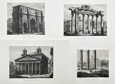
Domenico Amici - Set of 4 prints - Tempio di Giove Statore - Arco di Costantino in Rome, ItalyProverde Auctions4.3(3)See Sold PriceFeb 28, 2024
Vintage Map of Roman Forum - Vatican City - Versailles parkProverde Auctions4.3(3)See Sold PriceFeb 28, 2024