ATLAS of ANTIENT GEOGRAPHY by SAMUEL BUTLER 1843John McInnis Auctioneers,LLC4.6(502)See Sold PriceFeb 24, 2024
18TH C. ANTIQUE MAP: FRENCH & INDIAN WAR, FRAMEDThomaston Place Auction Galleries4.4(386)See Sold PriceFeb 24, 2024
Rand McNally Railroad Map Cabinet w/ 21 Railroad MapsRail & Road Auctions4.6(165)See Sold PriceMar 08, 2024
Keith Haring - Ink on New York Map, Best Buddies, Inscribed, Signed, and DatedSapphire Auction Gallery4(67)See Sold PriceMar 02, 2024
LATE 17TH C. FRENCH MAP OF THE NEW WORLD BY ALEXIS-HUBERT JAILLOT (1632-1712)Thomaston Place Auction Galleries4.4(386)See Sold PriceFeb 24, 2024
Central Railroad of New Jersey Map of Sandy Hook Route-ca. 1903JM Hobby Supply and Railroad Artifact Auctions4.4(126)See Sold PriceFeb 24, 2024
Lot of Six Mixed Atlas Box Cars-HO Scale-New in BoxJM Hobby Supply and Railroad Artifact Auctions4.4(126)See Sold PriceFeb 25, 2024
Rand McNally/Santa Fe Railroad Map of Iowa-1912JM Hobby Supply and Railroad Artifact Auctions4.4(126)See Sold PriceFeb 24, 2024
NICOLAES VISSCHER (NETHERLANDS, 1618-1709) MAP OF THE NEW WORLDThomaston Place Auction Galleries4.4(386)See Sold PriceFeb 24, 2024
17TH C. WORLD MAP BY NICOLAES VISSCHER (NETHERLANDS, 1618-1709)Thomaston Place Auction Galleries4.4(386)See Sold PriceFeb 24, 2024
Lot of Six Mixed Atlas Cabooses-HO Scale-New in BoxJM Hobby Supply and Railroad Artifact Auctions4.4(126)See Sold PriceFeb 25, 2024
Maine Highway Maps, 1944 and 1959.Large bound map collections, each 24 x 18 1/2 inches. Detailed condition reports are available upon request. Due to the current stay at home order, in-person preview will not be available until May 1See Sold Price
Maine Highway Maps, 1944 and 1959.Large bound map collections, each 24 x 18 1/2 inches.See Sold Price
World War 2. Pacific Theatre. August 1942-December 1944 area recovered 1959 mapTITLE/CONTENT OF MAP: 'The War with Japan - Situation 31 December 1944 and area Recovered Since August 1942' DATE PRINTED: 1959 IMAGE SIZE: Approx 25.0 x 32.5cm, 10 x 12.75 inches (Large) TYPE: AntiquSee Sold Price
Sold1940’s-1960’s Canadian & U.S. Road MapsLot of 19 assorted 1940’s-1960’s Canadian & U.S. recreational, sightseeing & state highway system maps includes: Alabama highway, Pennsylvania highway, Maine highway, New Jersey highway, New YorkSee Sold Price
SoldSix Framed Stock Certificates 1944-1959 Incl. R.R.Six Framed Stock Certificates 1944-1959 including railroads.(1) 100 shares The Sperry Corporation 1954 (1) 200 shares Boston and Maine Railroad 1944 (1) 100 shares Gulf Mobile and Ohio Railroad CompanSee Sold Price
Sold1959 Official MINNESOTA State Highway Roadmap FoldoutVintage 1959 Official MINNESOTA State Highway Roadmap Map. A nice foldout map that measures 9-1/2" x 4" when folded. Paper is crisp with no writing or staining. Overall excellent+ condition.See Sold Price
World War 2. Western Europe 6 June 1944. Bomber Offensive/Overlord plan 1959 mapTITLE/CONTENT OF MAP: 'The War in Western Europe - The Combined Bomber Offensive - Overlord, High Command and Plan - German Dispositions, D-Day, 6 June 1944' DATE PRINTED: 1959 IMAGE SIZE: Approx 25.0See Sold Price
World War 2. Western Europe 6 June 1944. Bomber Offensive/Overlord plan 1959 mapTITLE/CONTENT OF MAP: 'The War in Western Europe - The Combined Bomber Offensive - Overlord, High Command and Plan - German Dispositions, D-Day, 6 June 1944' DATE PRINTED: 1959 IMAGE SIZE: Approx 25.0See Sold Price
World War 2. Eastern Front. Jan-June 1944 Russian Winter Offensive 1959 mapTITLE/CONTENT OF MAP: 'The War in Eastern Europe - Russian Winter Offensive of 1944 Operations, 15 January-1 March 1944 // The War in Eastern Europe - Russian Winter Offensive of 1944 Operations, 2 MaSee Sold Price
World War 2. Eastern Front. August-Dec 1944 Russian Summer Offensive 1959 mapTITLE/CONTENT OF MAP: 'Europe Ethnographic' This map was printed in an atlas that was published during the Second World War. Many of the maps show the advance of the Axis powers including the dominatiSee Sold Price
World War 2. Eastern Front. August-Dec 1944 Russian Summer Offensive 1959 mapTITLE/CONTENT OF MAP: 'The War in Eastern Europe - Russian Summer Offensive of 1944 Operations, 8 August-14 September 1944 // The War in Eastern Europe - Russian Summer Offensive of 1944 Operations, 1See Sold Price
World War 2. Eastern Front. 23 June-7 Aug 1944 Russian Summer Offensive 1959 mapTITLE/CONTENT OF MAP: 'Russia No.5' DATE PRINTED: 1883 IMAGE SIZE: Approx 43.5 x 36.0cm, 17.25 x 14.25 inches (Large); Please note that this is a folding map. TYPE: Antique colour atlas map CONDITION:See Sold Price
World War 2. Eastern Front. 23 June-7 Aug 1944 Russian Summer Offensive 1959 mapTITLE/CONTENT OF MAP: 'The War in Eastern Europe - Russian Summer Offensive of 1944 Operations, 23 June-7 August 1944' DATE PRINTED: 1959 IMAGE SIZE: Approx 25.0 x 33.0cm, 9.75 x 13 inches (Large) TYPSee Sold Price
World War 2. Eastern Front. Jan-June 1944 Russian Winter Offensive 1959 mapTITLE/CONTENT OF MAP: 'The War in Eastern Europe - Russian Winter Offensive of 1944 Operations, 15 January-1 March 1944 // The War in Eastern Europe - Russian Winter Offensive of 1944 Operations, 2 MaSee Sold Price
World War 2. Nov 1943-Dec 1944. Gilbert Islands. Pacific landings & Ops 1959 mapTITLE/CONTENT OF MAP: 'The War with Japan - Landings in the Gilbert Islands, 21 November 1943 and Operations in the Central and Southwest Pacific Areas, January-December 1944' DATE PRINTED: 1959 IMAGESee Sold Price
MEDITERRANEAN SEA 1940. WW2 Naval Bases. Italian Dodecanese Albania 1940 mapTITLE/CONTENT OF MAP: 'The War in Eastern Europe - Russian Summer Offensive of 1944 Operations, 23 June-7 August 1944' DATE PRINTED: 1959 IMAGE SIZE: Approx 25.0 x 33.0cm, 9.75 x 13 inches (Large) TYPSee Sold Price
SoldMini Calif. Highway Atlas 1944Heading: (Automobile Atlas) Author: Title: California Highway Atlas: Showing Highways and Roads, County Boundaries, Mileage between Cities, Detail Maps of Los Angeles Area & San Francisco Bay Area (wSee Sold Price
World War 2. Eastern Front Dec 1944-April 1945 Russian Winter Offensive 1959 mapTITLE/CONTENT OF MAP: 'The War in Eastern Europe - Russian Winter Offensive of 1945 - Operations, 16 December 1944-15 February 1945 // The War in Eastern Europe - Russian Winter Offensive of 1945 OperSee Sold Price
World War 2. Eastern Front Dec 1944-April 1945 Russian Winter Offensive 1959 mapTITLE/CONTENT OF MAP: 'The War in Eastern Europe - Russian Winter Offensive of 1945 - Operations, 16 December 1944-15 February 1945 // The War in Eastern Europe - Russian Winter Offensive of 1945 OperSee Sold Price
SoldLarmat: Bordeaux Vins Wine Map, 1944Map: ' "Les Vins de Bordeaux" - Entre-Deux-Mers - Graves de Vayres - Sainte-Foy-Bordeaux' Date Printed: 1944 Image Size: Approx 63.5 x 45.0cm, 25 x 17.75 inches (Large) Type: Very decorative vintage cSee Sold Price
SoldWWII US ARMY / AIR NORMANDY INVASION MAP 1944WWII US ARMY / AIR NORMANDY INVASION MAP 1944 Paper made maps of Normandy " Cherbourg & Caen ". Published by the War office 1914. 4th edition 1943. special print ( Army / Air ) of 50.000 , 6 / 1944 foSee Sold Price
SoldLarmat: Bordeaux Vins Wine Map, 1944Title/Content of Map: ' "Les Vins de Bordeaux" - Graves - Graves Supérieures - Cérons'. Date Printed: 1944. Image Size: Approx 64.0 x 45.0cm, 25.25 x 17.75 inches (Large); Please note that this is aSee Sold Price
SoldLarmat: Bordeaux Vins Wine Map, 1944Map: ' "Les Vins de Bordeaux" - Les Vins de Bordeaux: St Emilion - Pomerol - Néac - Côtes de Fronsac - Côtes Canon-Fronsac.' Date Printed: 1944 Image Size: Approx 64.0 x 45.0cm, 25.25 x 17.75 incheSee Sold Price
SoldPORTLAND MAINE MAPSLOT 2 PORTLAND MAINE MAPS - 1 FRAMED 9'' X 23'' & 1 SHRINKWRAPPED 17'' X 26 1/4''See Sold Price
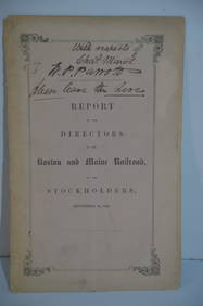
Boston and Maine RR Annual Report-September 12, 1849JM Hobby Supply and Railroad Artifact Auctions4.4(126)See Sold PriceFeb 24, 2024
Map of Missouri Highways and Railroads-1921JM Hobby Supply and Railroad Artifact Auctions4.4(126)See Sold PriceFeb 24, 2024
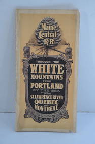
Maine Central RR Through the White Mtns-Portland to the St Lawrence River Book-1901JM Hobby Supply and Railroad Artifact Auctions4.4(126)See Sold PriceFeb 24, 2024
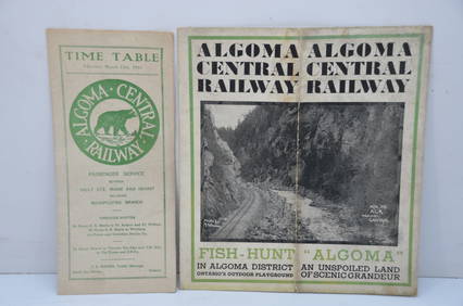
Algoma Central RY March 12, 1944 Public Timetable and BrochureJM Hobby Supply and Railroad Artifact Auctions4.4(126)See Sold PriceFeb 24, 2024
[DAVIS, Angela (b. 1944)]. Angela Davis Urges - Declare Your Independence, Vote for Hall and Tyner.Freeman's | Hindman4.4(1.6k)See Sold PriceFeb 27, 2024
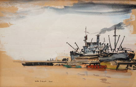
JACK IOWA (JOHN) LEWIS (1912-2012) "SHIP AT HARBOR".Amelia Jeffers, Auctioneers & Appraisers4.6(101)See Sold PriceMar 07, 2024
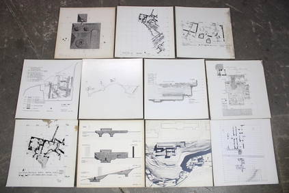
Set of 11 Mid Century Modern Architectural Plans & Site Map RenderingsPUBLIC SALE4.7(217)See Sold PriceMar 02, 2024
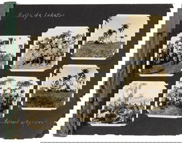
Photograph album of over 240 silverprints of Rio & Brazil 1944PBA Galleries4.7(381)See Sold PriceMar 07, 2024
World War 2 Europe Battle of the Atlantic 1939-43 Axis Expansion limits 1959 mapJasper524.5(9.8k)See Sold PriceFeb 28, 2024
F.L. Carsten Princes And Parliaments In Germany. 1959 EditionChurchill Galleries3.7(213)See Sold PriceFeb 26, 2024
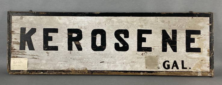
Kerosene Gal. Wood Advertising Pricing SignMatthew Bullock Auctioneers4.7(1.8k)See Sold PriceMar 02, 2024
Vintage 1920s Rand McNally Auto Trails MapThe Benefit Shop Foundation Inc.4.3(2.9k)See Sold PriceMar 20, 2024


![[DAVIS, Angela (b. 1944)]. Angela Davis Urges - Declare Your Independence, Vote for Hall and Tyner. (1 of 1)](https://p1.liveauctioneers.com/197/319238/171467912_1_x.jpg?height=282&quality=70&version=1707520367)