ATLAS of ANTIENT GEOGRAPHY by SAMUEL BUTLER 1843John McInnis Auctioneers,LLC4.6(502)See Sold PriceFeb 24, 2024
18TH C. ANTIQUE MAP: FRENCH & INDIAN WAR, FRAMEDThomaston Place Auction Galleries4.4(386)See Sold PriceFeb 24, 2024
Rand McNally Railroad Map Cabinet w/ 21 Railroad MapsRail & Road Auctions4.6(165)See Sold PriceMar 08, 2024
Keith Haring - Ink on New York Map, Best Buddies, Inscribed, Signed, and DatedSapphire Auction Gallery4(67)See Sold PriceMar 02, 2024
LATE 17TH C. FRENCH MAP OF THE NEW WORLD BY ALEXIS-HUBERT JAILLOT (1632-1712)Thomaston Place Auction Galleries4.4(386)See Sold PriceFeb 24, 2024
Central Railroad of New Jersey Map of Sandy Hook Route-ca. 1903JM Hobby Supply and Railroad Artifact Auctions4.4(126)See Sold PriceFeb 24, 2024
Lot of Six Mixed Atlas Box Cars-HO Scale-New in BoxJM Hobby Supply and Railroad Artifact Auctions4.4(126)See Sold PriceFeb 25, 2024
Rand McNally/Santa Fe Railroad Map of Iowa-1912JM Hobby Supply and Railroad Artifact Auctions4.4(126)See Sold PriceFeb 24, 2024
NICOLAES VISSCHER (NETHERLANDS, 1618-1709) MAP OF THE NEW WORLDThomaston Place Auction Galleries4.4(386)See Sold PriceFeb 24, 2024
17TH C. WORLD MAP BY NICOLAES VISSCHER (NETHERLANDS, 1618-1709)Thomaston Place Auction Galleries4.4(386)See Sold PriceFeb 24, 2024
Lot of Six Mixed Atlas Cabooses-HO Scale-New in BoxJM Hobby Supply and Railroad Artifact Auctions4.4(126)See Sold PriceFeb 25, 2024
1860 Map of DenmarkAuthor: Johnston Title: 1860 Map of Denmark Medium: Ink on Paper Dimensions: 14.5"X18.5" Map of Denmark and some of the German states dated 1860. Engraved and printed by A.K. Johnston. Published y WilSee Sold Price
SoldColton: Antique Map of Denmark & Iceland, 1860Title/Content of Map: Denmark with insert of Iceland Date Printed: 1860's Cartographer: J H. Colton Material/Medium: Paper Size: 14" x 17" Hand colored. Published in New York City. Joseph Hutchins ColSee Sold Price
SoldC1860 HC Litho Map Johnson's Prussia NorwayCirca 1860 hand-colored litho map "Johnson's Prussia, Norway, Sweden and Denmark", 26 1/2" x 18". Good condition.See Sold Price
SoldC1860 HC Litho Map Johnson's Prussia NorwayCirca 1860 hand-colored litho map "Johnson's Prussia, Norway, Sweden and Denmark", 26 1/2" x 18". Good condition.See Sold Price
SoldRapkin, John 1860 Lot of 5 British & European MapsIncl Scotland, Germany, England/Wales, Denmark and Northern Italy. Steel Engraved Maps Published 1860 by The London Printing & Published Company, London for "The Royal Dictionary-Cyclopedia for UniverSee Sold Price
SoldRapkin, John 1860 Lot of 5 European MapsIncl Belgium, Switzerland, Denmark, Turkey in Europe, and Sweden/Norway. Steel Engraved Maps Published 1860 by The London Printing & Published Company, London for "The Royal Dictionary-Cyclopedia forSee Sold Price
Sold1860 MAP OF NORTH AMERICA BY S.A. MITCHELLBy S. Augustus Mitchell, shown in political divisions, matted, 14 x 11.5 inch sight size. Not examined outside wrapping, appears excellent.See Sold Price
SoldUNITED STATES 1860 MAP, J.W. LOWRY, TERRITORIESFramed map: "The United States of North America (General Map)" c. 1860, drawn and engraved by J.W. Lowry (Joseph Wilson Lowry, British, 1803-1879), published by Blackie & Son, Glasgow, Edinburgh & LonSee Sold Price
Sold1860 map of Persia, Turkey, Afghanistan andFrom Mitchell’s New General Atlas of 1866 comes this lovely map of the Middle East, with an inset map of Palestine. Hand-colored as published by S. Augustus Mitchell. Good impression. Two light pinpSee Sold Price
SoldRapkin, John 1860 Map. World HemispheresSteel Engraved Map Published 1860 by The London Printing & Published Company, London for "The Royal Dictionary-Cyclopedia for Universal Reference" by Thomas Wright. Drawn & Engraved by John Rapkin. FoSee Sold Price
SoldM. Dripps 1860 Map New York City County & Vacinity By M. DrippsM. Dripps 1860 Map New York City County & Vacinity By M. Dripps 22.5" x 30"See Sold Price
SoldLarge 1860 Map of York County, PAApproximately 62"H x 60"W. Colored map of York County, PA, with lithograph scenes of prominent York County buildings. Paper over cloth. Produced by W.O. Shearer & D. J. Lake. Dated 1860. Wooden post aSee Sold Price
Sold1860 Map of Paris11.5" x 17", Victor Levasseur, Dept de la Seine, Pub in Paris 1860See Sold Price
SoldPhilip, George 1856 LG Hand Col Map. DenmarkLarge Folio Lithograph Map Published Published 1856 by George Philip, Liverpool for "Philips' Commercial Atlas of the World" Paper Size: 26 x 21 inch (66 x 53cm) Light horizontal bend in centre. NeatlSee Sold Price
1860 map of North America by S. Augustus Mitchell; nearMap of North America Showing Its Political Divisions and Recent Discoveries in the Polar Regions. This is the 1860 pre-Civil War plate, but was published in 1866 by Mitchell in his New General Atlas.See Sold Price
Sold1860 MAP OF PHILADELPHIA & TRENTON1860 MAP OF PHILADELPHIA & TRENTON. 64 X 63 INCHES.See Sold Price
Sold2 Antique Framed Maps (Denmark & Saxony)Dania Regnvm, Denmark map circa 1650, colored (frame: 22.5" x 27.5" paper sight: 23.75" x 19.5) and Leonard Valk & Gerardi Circulus Saxoniae Inferioris divifa in Ducatus Brunsuici Zellae…. (frame: 2See Sold Price
Sold(2) 1860 MAP, MOSTLY TEXAS & SOUTHERN STATES MAP(2) Framed Map: Louisiana, Mississippi, Arkansas and Part of Texas, from Smith's New Geography, J.B. Lippincott & Co., 1861, Philadelphia (Roswell C. Smith, 1797-1875), hand colored, sight: 11.75"h, 1See Sold Price
Sold1860 MAP LOUISIANA, MISSISSIPPI, ARKANSASFramed hand colored 1860 map, 'Map of Louisiana, Mississippi and Arkansas" by Augustus Mitchell (American, 1790-1868), sight: 14"h, 11.25"w, overall: 21.5"h, 18.75"w, 4.25lbs Start Price: $100.00See Sold Price
SoldRapkin, John 1860 Map. World on Mercator's ProjectionSteel Engraved Map Published 1860 by The London Printing & Published Company, London for "The Royal Dictionary-Cyclopedia for Universal Reference" by Thomas Wright. Drawn & Engraved by John Rapkin. FoSee Sold Price
Soldc. 1860 map of the U. S. published by Edinburgh firmHeading: Author: Johnston, Keith Title: United States From Keith Johnston’s Royal Atlas Place Published: Edinburgh Publisher:W & A. K. Johnston Date Published: [1860] Description:See Sold Price
Sold1860 Map of ItalyAuthor: Stockley Title: 1860 Map of Italy Medium: Ink on Paper Dimensions: 9"X10.5" Description: Map of Italy and Switzerland dated 1860. Engraved by James Stockley. Published by James Wyld engraver tSee Sold Price
Sold1860 Map of EgyptAuthor: Stockley Title: 1860 Map of Egypt Medium: Ink on Paper Dimensions: 9"X10.5" Description: Map of Egypt dated 1860. Engraved by James Stockley. Published by James Wyld engraver to Queen VictoriaSee Sold Price
Sold1860 Map of the United StatesAuthor: Stockley Title: 1860 Map of the United States Medium: Ink on Paper Dimensions: 10.5"X9" Map of the United States dated 1860. Engraved by James Stockley. Published by James Wyld engraver to QueSee Sold Price
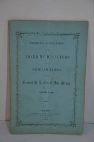
Central Railroad of New Jersey 13th Annual Report-January 1, 1860JM Hobby Supply and Railroad Artifact Auctions4.4(126)See Sold PriceFeb 24, 2024
Two Michigan Central RR Annual Reports-June 1860 and December 31, 1897JM Hobby Supply and Railroad Artifact Auctions4.4(126)See Sold PriceFeb 24, 2024
MAP - Dufour, A. H. ( Malte / Brun ) :MAP - ESPAGNE PARTIE SUD DIVISEE EN PROVINCES ANCIENNES ( MAPLuis Porretta Fine Arts4.3(10)See Sold PriceMar 02, 2024
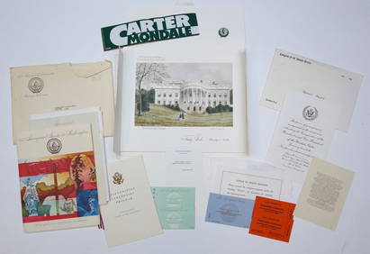
1977 INAUGURATION of PRESIDENT JIMMY CARTERJohn McInnis Auctioneers,LLC4.6(502)See Sold PriceFeb 25, 2024
Jesenske & Mucha's Ballady a Pisne - Ornately Bound Volume with Frontispiece illustrated by MuchaTrillium Antique Prints & Rare Books4.5(30)See Sold PriceFeb 24, 2024
Western Africa by Edward Weller. Early British/French settlements 1860 old mapJasper524.5(9.8k)See Sold PriceFeb 28, 2024
Africa. Mauritius, Bourbon (Reunion) & Natal by Edward Weller 1860 old mapJasper524.5(9.8k)See Sold PriceFeb 28, 2024
Africa inc. discoveries of Livingstone Barth Vogel Chadda Exp. SWANSTON 1860 mapJasper524.5(9.8k)See Sold PriceFeb 28, 2024
Two Hand-Colored 19th Century Maps of New Orleans and Louisiana, Larger- H.- 12 1/2 in., W.- 15 1/2Crescent City Auction Gallery4.3(229)See Sold PriceMar 08, 2024
Cooke, George 1801 Antique Map. Sweden, Denmark, Norway, IcelandAlbion Auctions4.6(336)See Sold PriceMar 01, 2024
Elias Fries (1794 - 1878) - Set of 4 Mushroom Prints - Cantarellus Aurantiacus - Merulius LacrymansProverde Auctions4.3(3)See Sold PriceFeb 28, 2024
Elias Fries (1794 - 1878) - Set of 4 Mushroom Prints - Agaricus Rubescens - Polyporus FomentariusProverde Auctions4.3(3)See Sold PriceFeb 28, 2024
Carl J. Sundevall (1801 - 1875) Set of 4 Bird Prints - Dove - Woodpecker - DuckProverde Auctions4.3(3)See Sold PriceFeb 28, 2024
Joachim Ferdinand Richardt - Set of 8 Prints - Topographical views of Castels in Sweden - SkabersjöProverde Auctions4.3(3)See Sold PriceFeb 28, 2024
Joachim Ferdinand Richardt - Set of 8 Prints - Topographical views of Castels in Sweden - RosendahlProverde Auctions4.3(3)See Sold PriceFeb 28, 2024
Set of 4 Maps - Netherlands - Seven United Provinces - Germany - Sweden, Denmark, Norway, FinlandProverde Auctions4.3(3)See Sold PriceFeb 28, 2024