ATLAS of ANTIENT GEOGRAPHY by SAMUEL BUTLER 1843John McInnis Auctioneers,LLC4.5(505)See Sold PriceFeb 24, 2024
18TH C. ANTIQUE MAP: FRENCH & INDIAN WAR, FRAMEDThomaston Place Auction Galleries4.4(393)See Sold PriceFeb 24, 2024
Rand McNally Railroad Map Cabinet w/ 21 Railroad MapsRail & Road Auctions4.6(165)See Sold PriceMar 08, 2024
Keith Haring - Ink on New York Map, Best Buddies, Inscribed, Signed, and DatedSapphire Auction Gallery4(67)See Sold PriceMar 02, 2024
LATE 17TH C. FRENCH MAP OF THE NEW WORLD BY ALEXIS-HUBERT JAILLOT (1632-1712)Thomaston Place Auction Galleries4.4(393)See Sold PriceFeb 24, 2024
Central Railroad of New Jersey Map of Sandy Hook Route-ca. 1903JM Hobby Supply and Railroad Artifact Auctions4.4(127)See Sold PriceFeb 24, 2024
Lot of Six Mixed Atlas Box Cars-HO Scale-New in BoxJM Hobby Supply and Railroad Artifact Auctions4.4(127)See Sold PriceFeb 25, 2024
Rand McNally/Santa Fe Railroad Map of Iowa-1912JM Hobby Supply and Railroad Artifact Auctions4.4(127)See Sold PriceFeb 24, 2024
NICOLAES VISSCHER (NETHERLANDS, 1618-1709) MAP OF THE NEW WORLDThomaston Place Auction Galleries4.4(393)See Sold PriceFeb 24, 2024
17TH C. WORLD MAP BY NICOLAES VISSCHER (NETHERLANDS, 1618-1709)Thomaston Place Auction Galleries4.4(393)See Sold PriceFeb 24, 2024
Lot of Six Mixed Atlas Cabooses-HO Scale-New in BoxJM Hobby Supply and Railroad Artifact Auctions4.4(127)See Sold PriceFeb 25, 2024
SoldA quantity of 3 maps comprising two maps of Ireland'sA quantity of 3 maps comprising two maps of Ireland's East Coast 'Strangford Lough' published by Admiralty 1930/31 & June 1956 Chart 2156, together with a map of the North Atlantic Ocean, published bySee Sold Price
SoldA quantity of 3 maps comprising two maps of Ireland'sA quantity of 3 maps comprising two maps of Ireland's East Coast 'Strangford Lough' published by Admiralty 1930/31 & June 1956 Chart 2156, together with a map of the North Atlantic Ocean, published bySee Sold Price
SoldA small, mixed group of maps of IrelandIreland.- A small, mixed group of maps of Ireland, comprising 3 of Ireland, 2 of Howth Harbour, 1 of the road from Howth Harbour to Dublin, a road map of county Clare, Galway, Roscommon and MaSee Sold Price
Two National Geographic MapsTwo National Geographic Maps, comprising one of India and one of Europe Each overall: 33-1/2"h x 26-3/4"w Each sight: 28-1/4"h x 21-3/4"wSee Sold Price
Sold(2) Late 19th c. maps of Ireland, unframedTwo late 19th century colored maps of Ireland, comprising a map of Ireland printed for The Century Atlas, circa 1897, 16"h x 11"w, unframed, and a map of Ireland printed for The Society for the DiffusSee Sold Price
SoldWorld Travel 10 volumes, comprisingLandor, A. Henry Savage Across Widest Africa. London: Hurst and Blackett Ltd., 1907. 2 volumes, 8vo, 2 frontispieces (repaired in volume 1), 145 plates & 3 maps (two folding, one large), original blueSee Sold Price
Sold32 VINTAGE MAPS OF THE BRITISH ISLES32 VINTAGE MAPS OF THE BRITISH ISLES. Comprising over 30 maps from various makers depicting England, Ireland, Scotland, and Wales including an 1890 George Phillip and Son map of Ireland on two sheetsSee Sold Price
SoldTwo Pocket MapsComprising Sectional Map of Minnesota published by Silas Chapman Milwaukee Wisconsin 1865 and The New Pocket Map of Victoria Australia published by EL Robinson Melbourne 1862. 29 1/2"h x 28 3/4"w,17 1See Sold Price
SoldCollection of David Birney: Two Antique Mapseach: etching; the first: "Ireland from the Best Authorities", frame: 13 1/2 x 14 in. (34.3 x 35.6 cm.); the second: "Lutetia vulgo Paris Anno 1575" (reproduction), frame 18 x 24 in. (45.7 x 61 cm.);See Sold Price
SoldHERMAN MOLL HAND COLORED ENGRAVED MAPS 18TH C. TWOHERMAN MOLL, HAND COLORED ENGRAVED MAPS, 18TH C., TWO, GREAT BRITAIN, IRELAND, GALLOWAY:Under glass and matted in matched frames. Lyons Ltd., Antique Prints label. Visible image size 7 3/4" x 10 1/4".See Sold Price
HERMAN MOLL HAND COLORED ENGRAVED MAPS 18TH C. TWOHERMAN MOLL, HAND COLORED ENGRAVED MAPS, 18TH C., TWO, GREAT BRITAIN, IRELAND, GALLOWAY:Under glass and matted in matched frames. Lyons Ltd., Antique Prints label. Visible image size 7 3/4" x 10 1/4".See Sold Price
SoldEllis (John) - Ellis's English Atlas, or, A Compleatcomplete with 50 maps, numbered 1, 3, then 5 to 52, corresponding in quantity to the published index numbered 1, 2, then 5 to 52, engraved maps, the first two folding out to 485 x 420mm. and 530 x 430See Sold Price
Sold3 PCS, GROUP OF U.S. MILITARY WWII SURVIVAL MAPSU.S. Government. Collection of three armed services World War II-era fabric survival maps comprising C 41 and C 42 (Philippine series) Mindoro Island and Samar Island; and two copies of C 52 and C 53See Sold Price
SoldForlani Map of the British IslesFORLANI, Paolo & LILY, George Lily.Britannia insula quae duo regna continent Angliam et Scotiam cum Hibernia (The British Isles, comprising two kingdoms, England and Scotland, with Ireland).Engraved mSee Sold Price
SoldFour Antique Continental MapsFour Antique Continental Maps , 17th to 19th c., incl. map of Ireland, British Colonies, Virginia, and two bird's-eye-views, largest 18 3/4 in. x 26 in Provenance: Property deaccessioned from the LouiSee Sold Price
SoldTolkien (J.R.R.) The Lord of the RingsTolkien (J.R.R.) The Lord of the Rings,3 vol., comprising The Fellowship of the Ring, map of the Shire, folding map at end, 1954; The Two Towers, folding map, 1955; The Return of the King, foSee Sold Price
Group of (3) Massachusetts Maps, two 19th C.Group of three (3) Massachusetts maps, including: "Russell's Map of Massachusetts", 1874, 17" x 26" (overall), stains at center fold, light toning; "Plymouth County", 25 1/2" x 17" (overall), light toSee Sold Price
SoldGroup of (3) Massachusetts Maps, two 19th C.Group of three (3) Massachusetts maps, including: "Russell's Map of Massachusetts", 1874, 17" x 26" (overall), stains at center fold, light toning; "Plymouth County", 25 1/2" x 17" (overall), light toSee Sold Price
Sold[MAPS -- WORLD AND UNITED STATES]. Two maps,[MAPS -- WORLD AND UNITED STATES]. Two maps, comprising: [FACSIMILE]. SPEED, John (1552-1629). A New and Accurate Map of the World... N.p., 20th century. Printed in color. Matted and framed (not eSee Sold Price
SoldIreland. [in Counties]Reserve Reduced! Title: Ireland. [in Counties] Publication Date: 1847 Cartographer: Sidney Hall Publisher: Adam & Charles Black Size: 19X15.25 Larger of two maps of Ireland showing highways, topographSee Sold Price
SoldBowen maps of the American coloniesHeading: Author: Bowen, Thomas Title: A Map of the British and French Settlements in North America... Place Published: London Publisher: Date Published: 1759 Description: TSee Sold Price
General Progress Sketch Hawaiian Islands | Porto RicoTitle/Content of Map: General Progress Sketch Hawaiian Islands | Porto Rico Date Printed: 6/30/1910 Cartographer: U.S. GEOLOGICAL SURVEY Size: 14X14.3 Two maps on same sheet. Shows triangulated areas,See Sold Price
Sold3 Pennsylvania Pocket Maps, Two 1857 and one Town3 Pennsylvania Pocket Maps, Two 1857 and one Township Map-- Dimensions: ---See Sold Price
Sold[Europe]. 3 Maps.[Europe]. 3 Maps. First two Blaeu. ++ Hungaria Regnum. 20 x 16. ++ Transylvania Sibenburgen. 19 5/8 x 14 3/4. Both [c1640] in contemporary outline color, Latin text verso, mild toning, soiling, and weSee Sold Price
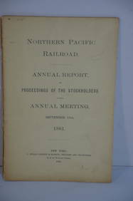
Northern Pacific RR 17th Annual Report-Version 1-September 15, 1881JM Hobby Supply and Railroad Artifact Auctions4.4(127)See Sold PriceFeb 24, 2024
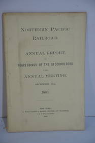
Northern Pacific RR 17th Annual Report-Version 2-September 15, 1881JM Hobby Supply and Railroad Artifact Auctions4.4(127)See Sold PriceFeb 24, 2024
Hand Colored Map of the city of Amsterdam 1720Global Auctions Company4.3(36)See Sold PriceMar 03, 2024
Willem Blaeu, Etc. 17th C. Antiquarian Maps, 2Auctions at Showplace4.6(740)See Sold PriceMar 17, 2024
Chatelain - 3 Maps of the British Isles (England, Ireland, Scotland)Trillium Antique Prints & Rare Books4.5(32)See Sold PriceFeb 24, 2024
Militaria : a quantity of 20thC medals and insignia, comprising two WWI campaign medals to Gnr. W.Claydon Auctioneers Ltd4.3(125)See Sold PriceFeb 26, 2024
A quantity of World War II / Two military ephemera to include assorted 1940s newspapers pages toClaydon Auctioneers Ltd4.3(125)See Sold PriceFeb 26, 2024
Alfred Salzman, Etc. JNF Tin Tzedakah Boxes, 3Auctions at Showplace4.6(740)See Sold PriceApr 07, 2024
Late 18th century map of England and Wales sampler and two printsFellows4.3(159)See Sold PriceMar 05, 2024
THE ANTIQUE ILLUSTRATED BOOK "1856 ARCTIC EXPLORATIONS: SECOND GIRNEL EXPEDITION 2" BY E. KANENY Elizabeth 4.2(86)See Sold PriceMar 03, 2024
1675: ANTIQUE ILLUSTRATED JULIUS CAESAR MAPS OF ROMAN HISTORYNY Elizabeth 4.2(86)See Sold PriceMar 03, 2024
A quantity of boxed 1:72 scale WWII aircraft models by Easy Model, ((51))Bonhams4.1(320)See Sold PriceMar 01, 2024


![[MAPS -- WORLD AND UNITED STATES]. Two maps, (1 of 1)](https://p1.liveauctioneers.com/197/161882/81723397_1_x.jpg?height=282&quality=70&version=1581711364)
![Ireland. [in Counties] (1 of 1)](https://p1.liveauctioneers.com/5584/130079/66157224_1_x.jpg?height=282&quality=70&version=1540941379)


![[Europe]. 3 Maps. (1 of 3)](https://p1.liveauctioneers.com/179/1435/617490_1_x.jpg?height=282&quality=70)