ATLAS of ANTIENT GEOGRAPHY by SAMUEL BUTLER 1843John McInnis Auctioneers,LLC4.6(502)See Sold PriceFeb 24, 2024
18TH C. ANTIQUE MAP: FRENCH & INDIAN WAR, FRAMEDThomaston Place Auction Galleries4.4(386)See Sold PriceFeb 24, 2024
Rand McNally Railroad Map Cabinet w/ 21 Railroad MapsRail & Road Auctions4.6(165)See Sold PriceMar 08, 2024
Keith Haring - Ink on New York Map, Best Buddies, Inscribed, Signed, and DatedSapphire Auction Gallery4(67)See Sold PriceMar 02, 2024
LATE 17TH C. FRENCH MAP OF THE NEW WORLD BY ALEXIS-HUBERT JAILLOT (1632-1712)Thomaston Place Auction Galleries4.4(386)See Sold PriceFeb 24, 2024
Central Railroad of New Jersey Map of Sandy Hook Route-ca. 1903JM Hobby Supply and Railroad Artifact Auctions4.4(126)See Sold PriceFeb 24, 2024
Lot of Six Mixed Atlas Box Cars-HO Scale-New in BoxJM Hobby Supply and Railroad Artifact Auctions4.4(126)See Sold PriceFeb 25, 2024
Rand McNally/Santa Fe Railroad Map of Iowa-1912JM Hobby Supply and Railroad Artifact Auctions4.4(126)See Sold PriceFeb 24, 2024
NICOLAES VISSCHER (NETHERLANDS, 1618-1709) MAP OF THE NEW WORLDThomaston Place Auction Galleries4.4(386)See Sold PriceFeb 24, 2024
17TH C. WORLD MAP BY NICOLAES VISSCHER (NETHERLANDS, 1618-1709)Thomaston Place Auction Galleries4.4(386)See Sold PriceFeb 24, 2024
Lot of Six Mixed Atlas Cabooses-HO Scale-New in BoxJM Hobby Supply and Railroad Artifact Auctions4.4(126)See Sold PriceFeb 25, 2024
SoldNANTUCKET 1881 MAPOld framed birdseye view of Nantucket from 1881 by JJ Stoner, color lighograph, 20 x 29 inches, framed 29 x 38 inchesSee Sold Price
SoldOLD BIRDSEYE NANTUCKET MAP1948 reprint of an 1881 map BIRDSEYE VIE OF NANTUCKET by Lincoln of Hingham MA 19.5 x 28.5 image size (stains).See Sold Price
SoldPictorial Map of Nantucket by Austin StrongHand colored in original and great condition, professionally matted and framed, c. 1921, 14 H inches x 17 W inches sight, 23 H inches x 26 W inches, overall. Austin Strong (1881-1952)Austin Strong, stSee Sold Price
Sold1881 Map of Yellowstone National ParkThis is an 1881 map of Yellowstone National Park. The map is marked "Compiled from the official Explorations & Surveys of the Superintendent of the Park and other authentic sources under the directionSee Sold Price
Sold1926 Tony Sarg Nantucket Map Print1926 Tony Sarg (1880-1942) Nantucket Map Print 15 in. x 18 in. Overall 22 in. x 24 in.See Sold Price
SoldTony Sarg 1926 Nantucket MapWell illustrated vignettes of Nantucket history by Tony Sarge and dated 1926, colorful border with Nantucket scenes and locations, minor tears in the border edges but overall in excellent condition. FSee Sold Price
Sold1881 MAP AMERICAN OVERLAND ROUTE RAND MCNALLYFRAMED MAP OF AMERICAN OVERLAND ROUTE.CIRCA 1881. 36" x 18" (VIEW), 40" x 22" (FRAME).See Sold Price
Sold1881 Map of Yellowstone National ParkThis is an 1881 map of Yellowstone National Park. The map is marked "Compiled from the official Explorations & Surveys of the Superintendent of the Park and other authentic sources under the directionSee Sold Price
SoldBryce, James 1881 Map of New ZealandLithograph Map Published 1881, London for ""The International Atlas and Geography..." by James Bryce. Maps by Edward Weller & John Bartholomew. Uncommon. Paper Size: 18 x 13 inch (46 x 33cm) Good CondSee Sold Price
Sold19th Century Historical Nantucket Map 1869Historical Nantucket map with information, points, and references for the 17th, 18th, and 19th Century. Surveyed and drawn by The Reverend F. C. Ewer, D.D., this piece is a J. Ottmann Of New York LithSee Sold Price
SoldTOWN OF NANTUCKET MAP1948 reprint of a rare Nantucket map BIRDSEYE VIEW OF THE TOWN OF NANTUCKET by Wm O. Lincoln of Hingham Mass. 21.5 x 29.5, framed 24 x 31.5 in (some stains lower margin).See Sold Price
SoldTynietoy Paintings and Nantucket MapA pair of rare and early hand-painted floral paintings in oval frames 2" H, ink stamped on back and a rare Tynietoy Nantucket map in mint condition 3" X 4.5".See Sold Price
SoldANTIQUE REV. EWER NANTUCKET MAP 1869Large rare antique map of Nantucket 1869 by Rev. FC Ewer. 28 x 43.5 inches. Loosely mounted under shrink wrap. Map is in fair condition needing restoration as shown.See Sold Price
SoldNantucket Map, c. 1890Two U.S. geological survey topographical chart maps framed and matted together, showing Nantucket Tuckernuck and Muskeget,c.1890, Overall, 35” x 45”See Sold Price
SoldRARE 1926 NANTUCKET MAP BY TONY SARGDimensions: (Frame) H 21" x W 24.75", (Sight) H 14.5" x W 17.5" Condition: Some toning. Tear to lower right corner of map. Some buckling to paper.See Sold Price
SoldRARE 1881 MAP OF WISCONSIN CENTRAL RAILROAD LANDRare map of Wisconsin released to promote travel and purchase of lands at the time. Lawrence Miller Print- The Milwaukee Litho & Engr. co 1881See Sold Price
SoldBryce, James 1881 Map of South USA. Texas, Florida, etcLithograph Map Published 1881, London for ""The International Atlas and Geography..." by James Bryce. Maps by Edward Weller & John Bartholomew. Uncommon. Paper Size: 18 x 13 inch (46 x 33cm) Good CondSee Sold Price
SoldBryce, James 1881 Map of USA Border StatesIncl Ohio, Kentucky, Virginia, W. Virginia, Maryland, Tennessee & N. Carolina. Lithograph Map Published 1881, London for ""The International Atlas and Geography..." by James Bryce. Maps by Edward WellSee Sold Price
SoldBryce, James 1881 Map of Islands. Singapore, Hong KongAlso Channel Islands, Malta, Malaysia, Gibraltar, and Aden. Lithograph Map Published 1881, London for ""The International Atlas and Geography..." by James Bryce. Maps by Edward Weller & John BartholomSee Sold Price
SoldBryce, James 1881 Map of ScotlandLithograph Map Published 1881, London for ""The International Atlas and Geography..." by James Bryce. Maps by Edward Weller & John Bartholomew. Uncommon. Paper Size: 18 x 13 inch (46 x 33cm) Good CondSee Sold Price
SoldBryce, James 1881 Map of IrelandLithograph Map Published 1881, London for ""The International Atlas and Geography..." by James Bryce. Maps by Edward Weller & John Bartholomew. Uncommon. Paper Size: 18 x 13 inch (46 x 33cm) Good CondSee Sold Price
SoldBryce, James 1881 Map of Madras. India & CeylonLithograph Map Published 1881, London for ""The International Atlas and Geography..." by James Bryce. Maps by Edward Weller & John Bartholomew. Uncommon. Paper Size: 18 x 13 inch (46 x 33cm) Good CondSee Sold Price
SoldBryce, James 1881 Map of IndiaLithograph Map Published 1881, London for ""The International Atlas and Geography..." by James Bryce. Maps by Edward Weller & John Bartholomew. Uncommon. Paper Size: 18 x 13 inch (46 x 33cm) Good CondSee Sold Price
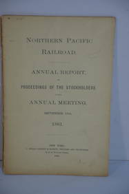
Northern Pacific RR 17th Annual Report-Version 1-September 15, 1881JM Hobby Supply and Railroad Artifact Auctions4.4(126)See Sold PriceFeb 24, 2024
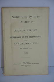
Northern Pacific RR 17th Annual Report-Version 2-September 15, 1881JM Hobby Supply and Railroad Artifact Auctions4.4(126)See Sold PriceFeb 24, 2024
Crams Railroad Map of New York-1881JM Hobby Supply and Railroad Artifact Auctions4.4(126)See Sold PriceFeb 24, 2024
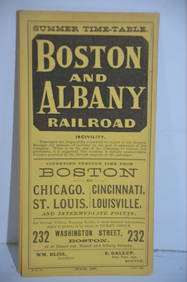
Boston and Albany RR March 17, 1881 Public TimetableJM Hobby Supply and Railroad Artifact Auctions4.4(126)See Sold PriceFeb 24, 2024
Autobiography Mark Rutherford Dissenting Minister 1st ed 1881 Scarce CalfLuis Porretta Fine Arts4.3(10)See Sold PriceMar 02, 2024
LADIES LARGE OVAL NANTUCKET BASKET PURSE DECORATED WITH TWO WHALES BY DONNA CIFRANIC (1936-2022)Thomaston Place Auction Galleries4.4(386)See Sold PriceFeb 24, 2024
LATE 17TH C. FRENCH MAP OF THE NEW WORLD BY ALEXIS-HUBERT JAILLOT (1632-1712)Thomaston Place Auction Galleries4.4(386)See Sold PriceFeb 24, 2024
18TH C. ANTIQUE MAP: FRENCH & INDIAN WAR, FRAMEDThomaston Place Auction Galleries4.4(386)See Sold PriceFeb 24, 2024
Caravan Routes in Palestine Linen Map - Germany, 1881Levy Auction House4.3(11)See Sold PriceFeb 27, 2024
PRICE, Harry (1881 – 1948). Group of Eight Works on Ghosts ...Potter & Potter Auctions4.6(539)See Sold PriceFeb 24, 2024
Early Pennsylvania Railroad Literature - 1881 New York and Chicago Limited Timetable Brochure andRail & Road Auctions4.6(165)See Sold PriceMar 07, 2024
Keith Haring - Ink on New York Map, Best Buddies, Inscribed, Signed, and DatedSapphire Auction Gallery4(67)See Sold PriceMar 02, 2024
Rand McNally Railroad Map Cabinet w/ 21 Railroad MapsRail & Road Auctions4.6(165)See Sold PriceMar 08, 2024
Putnam - First Map of the State of Ohio by Rufus PutnamTrillium Antique Prints & Rare Books4.5(30)See Sold PriceFeb 24, 2024
Pablo Picasso & Jean Cocteau's Picasso de 1916 ? 1961 - 24 LithographsTrillium Antique Prints & Rare Books4.5(30)See Sold PriceFeb 24, 2024
South Namibia coast. Walvis Bay-Orange River ADMIRALTY sea chart 1881 (1954) mapJasper524.5(9.8k)See Sold PriceFeb 28, 2024