ATLAS of ANTIENT GEOGRAPHY by SAMUEL BUTLER 1843John McInnis Auctioneers,LLC4.5(505)See Sold PriceFeb 24, 2024
18TH C. ANTIQUE MAP: FRENCH & INDIAN WAR, FRAMEDThomaston Place Auction Galleries4.4(393)See Sold PriceFeb 24, 2024
Rand McNally Railroad Map Cabinet w/ 21 Railroad MapsRail & Road Auctions4.6(165)See Sold PriceMar 08, 2024
Keith Haring - Ink on New York Map, Best Buddies, Inscribed, Signed, and DatedSapphire Auction Gallery4(67)See Sold PriceMar 02, 2024
LATE 17TH C. FRENCH MAP OF THE NEW WORLD BY ALEXIS-HUBERT JAILLOT (1632-1712)Thomaston Place Auction Galleries4.4(393)See Sold PriceFeb 24, 2024
Central Railroad of New Jersey Map of Sandy Hook Route-ca. 1903JM Hobby Supply and Railroad Artifact Auctions4.4(127)See Sold PriceFeb 24, 2024
Lot of Six Mixed Atlas Box Cars-HO Scale-New in BoxJM Hobby Supply and Railroad Artifact Auctions4.4(127)See Sold PriceFeb 25, 2024
Rand McNally/Santa Fe Railroad Map of Iowa-1912JM Hobby Supply and Railroad Artifact Auctions4.4(127)See Sold PriceFeb 24, 2024
NICOLAES VISSCHER (NETHERLANDS, 1618-1709) MAP OF THE NEW WORLDThomaston Place Auction Galleries4.4(393)See Sold PriceFeb 24, 2024
17TH C. WORLD MAP BY NICOLAES VISSCHER (NETHERLANDS, 1618-1709)Thomaston Place Auction Galleries4.4(393)See Sold PriceFeb 24, 2024
Lot of Six Mixed Atlas Cabooses-HO Scale-New in BoxJM Hobby Supply and Railroad Artifact Auctions4.4(127)See Sold PriceFeb 25, 2024
SoldSET OF FOUR MAPS. RESTRIKES OF ANTIQUE WORLD MAPSSET OF FOUR MAPS. RESTRIKES OF ANTIQUE WORLD MAPS. Height: 18 1/2 & 14 in. by Width: 21 & 16 in.See Sold Price
SET OF FOUR "MAPS OF THE WORLD" PRINTSSET OF FOUR "MAPS OF THE WORLD" PRINTS. Height: 22 in. by Width: 26 in.See Sold Price
SoldFOUR ANTIQUE MAP SETFOUR ANTIQUE MAP SET. MAP SET INCLUDED VERMONT, RHODE ISLAND, MAINE, NEW HAMPSHIRE. Height: 13 & 7 in. by Width: 12 & 6 in.See Sold Price
Bradford: Set of 2 Antique Maps, World in HemispheresTitle/Content of Map: Set of 2 Maps together World in globular projection by Bradford Date Printed: 1835 Cartographer: T.G. Bradford Material/Medium: Paper Size: 9 1/2" x 13" each A comprehensive AtlaSee Sold Price
SoldA SET OF FOUR ANTIQUE GERMAN MAPS, 17TH CEN.A set of four German civilian and military maps, 17th cen. Dimensions: Frame Size: 25 x 22 in. (63.5 x 55.9 cm.)Image Size: 23 1/2 x 20 1/2 in. (59.7 x 52 cm.)See Sold Price
SoldSet of four maps from "Colton's Atlas of the World" toSet of four maps from "Colton's Atlas of the World" to include New York, Massachusetts and Rhode Island, Texas, and Arkansas. sight size 13 3/4" x 16 3/4" Property from Credit Suisse's Americana CollSee Sold Price
Sold(116188470) A stainless steel quartz gentleman's JoJo J(116188470) A stainless steel quartz gentleman's JoJo Joe Rodeo Classic World Map chronograph wrist watch, the diamond set dial with a map of the world, date aperture to four o'clock, diamond set bezeSee Sold Price
T. Jefferys: Antique Map of the World, 1757Antique Map of the World T. Jefferys 1757 London 6 x 10.6 in. This is an attractive and charming double hemisphere map, colored, and framed. It is set against a background of allegorical figures, withSee Sold Price
SoldWWII 79th Infantry Division Pictorial Maps, CompleteWorld War II WWII 79th Infantry Division Pictorial Maps, Complete Set of 4! A complete set of four colorful pictorial maps designed by Steve Kaliher and Harry D. White, 79th Infantry servicemen and caSee Sold Price
160 Pc MahJongg Set World Traveller Map CaseThis Mah Jongg set comes in a World Traveller style case, adorned with old maps in an antique brown color. The case has a handle and latches. Inside are removable plastic boxes to hold the tiles. TherSee Sold Price
160 Pc MahJongg Set World Traveller Map CaseThis Mah Jongg set comes in a World Traveller style case, adorned with old maps in an antique brown color. The case has a handle and latches. Inside are removable plastic boxes to hold the tiles. TherSee Sold Price
SoldSet 3 Framed Maps. The World, Canada, and MediterraneanSet 3 Framed Maps. The World, Canada, and Mediterranean. -- Dimensions: H: 13.5 inches: W: 18 inches ---See Sold Price
SoldFramed Antique Map, Orbis TerranumFramed antique map of Orbis Terranum, double depiction of world atlas. Plate marks visible. Map is set behind glass in wood frame in wood frame. Measures approximately 22 inches in height by 26 inchesSee Sold Price
SoldLOT OF FOUR NATIONAL GEOGRAPHIC MAPSLOT OF FOUR NATIONAL GEOGRAPHIC MAPS OF THE WORLD OCEAN FLOOR, EUROPE, THE UNITED STATES & THE WORLD. Height: 29 1/2 in. by Width: 42 1/2 inSee Sold Price
SoldFour Antique Hand Colored MapsA grouping of four small framed hand-colored engraved maps to include New England and New York by John Seller, A Mapp of the World by John Seller, Terra Firma, and Moscovia (Moscow) of Russia. All inSee Sold Price
Sold1627 Carte de l'Amerique Corrigee, et Augmentee, dessusBy: Bertius/TavernierDate: 1627 (circa)Dimensions: 20 x 15.25 inches (50.75 x 38.5 cm)According to Burden, "This rare map is one of a set of the four known continents that Melchior Tavernier had engraSee Sold Price
Sold2 WWI Maps & 2 Field Gun SchematicsFour (4) World War I related items - two (2) tactical maps of France and two (2) field gun schematics. 1st-2nd items: Two (2) tactical maps of France, one (1) titled "Map of France, Showing the AmericSee Sold Price
SoldSet Of Four Chinese Antique MapsConsist of four pieces, including Asia, China and Japan, Siberia and Chinese tartary and Coltons China, published by GW. CB.Colton&Co.See Sold Price
SoldA SET OF FOUR ANTIQUE RUSSIAN IMPERIAL MAPSIncludes: The Russian Empire with its gradual Acquisitions traced and Explained; Russian in Europe, Sweden and Norway; Asiatiska Ryssland; The Aral sea according to Khanikoff drawn by Augustus PetermaSee Sold Price
SoldA set of four commemorative printed china dinner platesA set of four commemorative printed china dinner plates for Queen Victoria's Diamond jubilee , with printed double hemisphere world maps, late 19th and early 20th centurySee Sold Price
Elwe: Antique World Map, 1792Map: 1792 Elwe World Map -- Mappe Monde ou Description du Globe Terrestre & Aquatique Cartographer: J. Elwe Year / Place: 1792 Amsterdam Dimensions: 18 x 24 in. Condition: Very Good. Expertly repairedSee Sold Price
Covens and Mortier: Antique World Map, 1745Title/Content of Map: 1745 Covens and Mortier World Map -- Mappe-Monde Dressee sur les Observations de Mrs. de l'Academie Royale des Sciences et Quelques Autres et sur les Memoires les Plus Recens DatSee Sold Price
SoldFour Antique MapsFour antique maps. Including a very early hand made paper map of Florida and Virginia. Fragment of old newspaper on back dated 1630. Unframed, each approx H 21" W 24". All in excellent condition, minoSee Sold Price
SoldMitchell: Mercator Projection Antique World Map, 1867Map: Map of the World on the Mercator Projection Cartographer: S. A. Mitchell Place & Date: Philadelphia / 1867/1870 Size: 17 3/4" x 14" Condition: full color; light overall age toning; some spottingSee Sold Price
Arrowsmith & Lewis - Map of the World on Mercator's ProjectionTrillium Antique Prints & Rare Books4.5(32)See Sold PriceFeb 24, 2024
Arrowsmith & Lewis - Map of the United StatesTrillium Antique Prints & Rare Books4.5(32)See Sold PriceFeb 24, 2024
Carey, pub. 1796 - Map of KentuckyTrillium Antique Prints & Rare Books4.5(32)See Sold PriceFeb 24, 2024
Carey, pub. 1796 - Map of the Tennassee State formerly part of North Carolina (Tennessee)Trillium Antique Prints & Rare Books4.5(32)See Sold PriceFeb 24, 2024
De Jode, Rare, pub. 1593 - Map of Africa (Africae Vera Forma, et Situs)Trillium Antique Prints & Rare Books4.5(32)See Sold PriceFeb 24, 2024
1738 BIBLE in DUTCH ILLUSTRATED w/ MAPS antique MASSIVE FOLIO BIBLIAJasper524.5(9.9k)See Sold PriceFeb 27, 2024
1730 BIBLE in DUTCH ILLUSTRATED w/ MAPS antique MASSIVE FOLIO BIBLIAJasper524.5(9.9k)See Sold PriceFeb 27, 2024
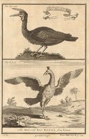
Gambian birds. Monoceros. A bird with four wings. CHILD 1745 old antique printJasper524.5(9.9k)See Sold PriceFeb 28, 2024
AFRICA. 'Reptiles & Birds'. Snakes Cerastes Hair/hood/horn serpents. CHILD 1746Jasper524.5(9.9k)See Sold PriceFeb 28, 2024