SoldMap of Galliae, Leonhard Euler (1701-1783)Engraved hand colored map of Galliae, circa 1756, produced under the direction of Leonhard Euler (1701-1783), note: In 1720 Leonhard Euler studied at the University of Basel under Johann Bernoulli, frSee Sold Price
SoldLeonhard Euler (Swiss, 1707-1783) Engraved Map of AsiaLeonhard Euler (Swiss, 1707-1783) Engraved Map of Asia with Colors German, 1753. An engraved and hand-colored map of Asia engraved by Nikolaus Friedrich Sauerbrey (German, ?-1770) under the directionSee Sold Price
SoldLeonhard Euler (Swiss, 1707-1783) Engraved Map ofLeonhard Euler (Swiss, 1707-1783) Engraved Map of Africa with Colors German, 1753. An engraved and hand-colored map of the African continent engraved by Nikolaus Friedrich Sauerbrey (German, ?-1770) uSee Sold Price
SoldMaps, Leonhard Euler, Scottland, Wales(Set of 2) unframed copper engraved maps with hand-coloring, ''Tabula Geographica Scotiae'' and ''Tabula Geographica Angliae et Walliae,'' 1756, under the direction of Swiss mathematician Leonhard EulSee Sold Price
SoldMaps, Leonhard Euler, Scottland, WalesSet of 2 unframed copper engraved maps with hand-coloring, ''Tabula Geographica Scotiae'' and ''Tabula Geographica Angliae et Walliae,'' 1756, under the direction of Swiss mathematician Leonhard EulerSee Sold Price
SoldTwo maps by Leonhard Euler c.1750Title: Two maps by Leonhard Euler Author: Euler, Leonhard Description: Includes: Tabula Geographica Imperii Turcici... * Untitled map of the Anatolian peninsula and surrounding region. Together, 2 copSee Sold Price
Two maps by Leonhard Euler c.1750Title: Two maps by Leonhard Euler Author: Euler, Leonhard Description: Includes: Tabula Geographica Imperii Turcici... * Untitled map of the Anatolian peninsula and surrounding region. Together, 2 copSee Sold Price
SoldMap, America Septentrionalis, Leonhard EulerUnframed map laid to board, ''Mappa Geographica Americae Septentrionalis ad emendatiora Exemplaria...Pars II'' c.1750, published by Leonhard von Euler, with small crest stamped lower right, plate: 14.See Sold Price
1753: Antique Map from School Atlas by Leonhard EulerDescription: Extremely rare double page map from the 1753 first edition of the School Atlas by Leonhard Euler. Entitled: Tabula Geographica Principatus Anhaltini et finitimarum Regionum correctior redSee Sold Price
1753: Antique Map from School Atlas by Leonhard EulerDescription: Extremely rare double page map from the 1753 first edition of the School Atlas by Leonhard Euler. Entitled: Tabula Geographica Principatus Anhaltini et finitimarum Regionum correctior redSee Sold Price
1753: Antique Map from School Atlas by Leonhard EulerDescription: Extremely rare double page map from the 1753 first edition of the School Atlas by Leonhard Euler. Entitled: Tabula Geographica Principatus Anhaltini et finitimarum Regionum correctior redSee Sold Price
SoldEuler's Map of North America on 4 sheets c.1750Title: Americae Septentrionalis Author: Euler, Leonhard Description: Copper-engraved map in 4 parts, hand-colored. Each part approx. 34x35 cm. (13¼x13¾"),North America in the mid-18th century. The fSee Sold Price
SoldFour 18th century maps by Zatta & Euler(lot of 4) Group of 18th century copper engraved maps, each handcolored, three maps produced under the supervision of Leonard Euler (1707-1783), the Swiss mathematician, including Regni Hiberniae (IreSee Sold Price
SoldEuler (Leonhard) Tab: Geogr: Imperii RussiciEuler (Leonhard) Tab: Geogr: Imperii Russici,the Russian Empire, from the Atlas Geographicus, with title cartouche lower left, engraved map with original hand-colouirng, 325 x 370mm., centralSee Sold Price
MAP, US & Mexico, Von EulerSouthwestern United States & Mexico. Leonhard von Euler, Americae Septentrionalis Pars III, from Atlas Geographicus Omnes Orbis Terrarum…, 1760 (circa). Hand Color. This scarce map is one sheet of vSee Sold Price
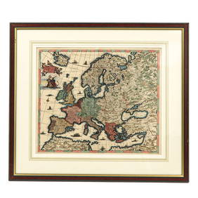
SoldEULER, LEONHARD. [Geographisher Atlas.]EULER, LEONHARD. [Geographisher Atlas.] Without title or text, 39 (of 44) double-page engraved maps with original hand-coloring (lacking the first two double-hemispheric maps, the XVII Provinces, andSee Sold Price
Mechanics.- Euler (Leonhard) Mechanica sive motusMechanics.- Euler (Leonhard) Mechanica sive motus scientia analytice exposita, 2 vol., engraved vignette to head of dedication, 32 folding engraved plates, private library stamp to title of vol.1, volSee Sold Price
SoldDANCKERTS ATLAS MAP OF FRANCE, C.1680Framed antique map of France, "Accuratissima Galliae Tabula Vulgo Royaume De France," published in Justus Danckerts (Dutch, 1635-1701) atlas, c.1680, sight: approx 19.5"h, 22.75"w, overall: approx 28"See Sold Price
SoldLEONHARD EULER EARLY CALCULUS BOOK."Introductio in Analysin Infinitorum" by Leonhard Euler. "Editio Nova" published Lugduni, apud Bernuset, Delamolliere, Falque & Soc. 1797. Multiple have pen and ink equations and English annotations wSee Sold Price
SoldStackhouse: Earliest Independent United States Map 1783Item: Earliest Independent United States Map Maker: Thomas Stackhouse Date: 1783 Measures 16" x 20 1/4" Map fully within boarder. Margin uneven on left side. Strong printing, plate mark easily visibleSee Sold Price
17th c. Engraved Map Galliae Veteris Typus, Peter KeereFine 17th Century Engraved Map Galliae Veteris Gaul France by Pieter van den (Peter) Keere (Kaerius), 1661 | Galliae Veteris [Of the Old Gaul], Depicting Gaul, France, British Channel, Belgium, FlandeSee Sold Price
SoldAN ANTIQUE MAP, "Galliæ, Biscajæ, et Gallissiæ Sinus,"AN ANTIQUE MAP, "Galliæ, Biscajæ, et Gallissiæ Sinus," CIRCA 1675, hand colored engraving on paper, published by Frederick de Wit (1629/30-1706), including two compass roses, 16 wiSee Sold Price
SoldHerman Moll 1701 Map of PolandThis quality matted and framed hand-colored bookplate map of Poland is from 1701 bt Herman Moll. The map itself measures 12" tall X 8" across.See Sold Price
SoldUnited States named on 1783 mapHeading: (United States & Mexico) Author: De l'Isle, Guillaume & J.A. Dezauche Title: Carte du Mexique et des Etats Unis d'Amerique, Partie Meridionale… Place Published: Paris Publisher: Date PubSee Sold Price
Central Railroad of New Jersey Map of Sandy Hook Route-ca. 1903JM Hobby Supply and Railroad Artifact Auctions4.4(126)See Sold PriceFeb 24, 2024
Rand McNally/Santa Fe Railroad Map of Iowa-1912JM Hobby Supply and Railroad Artifact Auctions4.4(126)See Sold PriceFeb 24, 2024
17TH C. WORLD MAP BY NICOLAES VISSCHER (NETHERLANDS, 1618-1709)Thomaston Place Auction Galleries4.4(386)See Sold PriceFeb 24, 2024
LATE 17TH C. FRENCH MAP OF THE NEW WORLD BY ALEXIS-HUBERT JAILLOT (1632-1712)Thomaston Place Auction Galleries4.4(386)See Sold PriceFeb 24, 2024
18TH C. ANTIQUE MAP: FRENCH & INDIAN WAR, FRAMEDThomaston Place Auction Galleries4.4(386)See Sold PriceFeb 24, 2024
NICOLAES VISSCHER (NETHERLANDS, 1618-1709) MAP OF THE NEW WORLDThomaston Place Auction Galleries4.4(386)See Sold PriceFeb 24, 2024
Keith Haring - Ink on New York Map, Best Buddies, Inscribed, Signed, and DatedSapphire Auction Gallery4(67)See Sold PriceMar 02, 2024
Rand McNally Railroad Map Cabinet w/ 21 Railroad MapsRail & Road Auctions4.6(165)See Sold PriceMar 08, 2024
Putnam - First Map of the State of Ohio by Rufus PutnamTrillium Antique Prints & Rare Books4.5(30)See Sold PriceFeb 24, 2024
Denis Diderot (1713 - 1784) & Jean Le Rond d’Alembert (1717 - 1783) - Set of 10 Military Prints -Proverde Auctions4.3(3)See Sold PriceFeb 28, 2024
Robert H Labberton - Map of The Territory of the Present United States - The territory of theProverde Auctions4.3(3)See Sold PriceFeb 28, 2024
Antique Map of The Kingdom of Spain, 1701 PrintAntiques Online Auctions4.6(407)See Sold PriceMar 14, 2024
Map of Turkey from Arabic and Persia, 1701 by Gillaume de Lisle, ParisAntiques Online Auctions4.6(407)See Sold PriceMar 14, 2024
Galliae Regionis Nova Descriptio Hand Colored Map of France on Laid Paper, Ca. 16th Century, H 10" WDuMouchelles4.6(825)See Sold PriceMar 15, 2024


![EULER, LEONHARD. [Geographisher Atlas.] (1 of 1)](https://p1.liveauctioneers.com/199/171650/86487384_1_x.jpg?height=282&quality=70&version=1592430092)