ATLAS of ANTIENT GEOGRAPHY by SAMUEL BUTLER 1843John McInnis Auctioneers,LLC4.5(505)See Sold PriceFeb 24, 2024
18TH C. ANTIQUE MAP: FRENCH & INDIAN WAR, FRAMEDThomaston Place Auction Galleries4.4(393)See Sold PriceFeb 24, 2024
Rand McNally Railroad Map Cabinet w/ 21 Railroad MapsRail & Road Auctions4.6(165)See Sold PriceMar 08, 2024
Keith Haring - Ink on New York Map, Best Buddies, Inscribed, Signed, and DatedSapphire Auction Gallery4.1(67)See Sold PriceMar 02, 2024
LATE 17TH C. FRENCH MAP OF THE NEW WORLD BY ALEXIS-HUBERT JAILLOT (1632-1712)Thomaston Place Auction Galleries4.4(393)See Sold PriceFeb 24, 2024
Central Railroad of New Jersey Map of Sandy Hook Route-ca. 1903JM Hobby Supply and Railroad Artifact Auctions4.4(127)See Sold PriceFeb 24, 2024
Lot of Six Mixed Atlas Box Cars-HO Scale-New in BoxJM Hobby Supply and Railroad Artifact Auctions4.4(127)See Sold PriceFeb 25, 2024
Rand McNally/Santa Fe Railroad Map of Iowa-1912JM Hobby Supply and Railroad Artifact Auctions4.4(127)See Sold PriceFeb 24, 2024
NICOLAES VISSCHER (NETHERLANDS, 1618-1709) MAP OF THE NEW WORLDThomaston Place Auction Galleries4.4(393)See Sold PriceFeb 24, 2024
17TH C. WORLD MAP BY NICOLAES VISSCHER (NETHERLANDS, 1618-1709)Thomaston Place Auction Galleries4.4(393)See Sold PriceFeb 24, 2024
Lot of Six Mixed Atlas Cabooses-HO Scale-New in BoxJM Hobby Supply and Railroad Artifact Auctions4.4(127)See Sold PriceFeb 25, 2024
SoldTransportation Image & Map LotIncludes antique & vintage maps of Minnesota & railwaysSee Sold Price
SoldEngraved Maps, Lot of 3, 18th c.Lot of 3 engraved maps, including: *** AN ACCURATE MAP OF EUROPE. Emanuel Bowen, ca. 1747. Image 7.75" x 6". Hand-colored. Creasing and soiling. *** AN ACCURATE MAP OF ASIA. [Emanuel Bowen, ca. 1747.]See Sold Price
SoldANTIQUE 19TH CENTURY SOUTH AMERICAN MAP LOTLot of two antique maps of South America. One is "Venezuela, New Granada & Ecuador" by Sidney Hall. Outline color. Map image measures 16.25 x 20 inches in size. On thin paper stock, published 1840. VeSee Sold Price
Topography Map of France, Institut GeographiqueMap: Collage Style Topography Map of France Maker: Institut Geographique National Origin: Paris, France Size: 30 x 30 inches (With square casing) Image of Map: 24 x 24 inches No Reserve: This lot starSee Sold Price
SoldAURORA, ELGIN & CHICAGO RR TIMETABLES CIRCA 1910Early colorful examples with topographical maps. Please see the lot images for a full depiction of this lot's contents. We happily provide seamless in-house packing and shipping services on nearly eveSee Sold Price
SoldSix (6) Vintage Prints of MapsLot of Six (6) Vintage Prints of Maps. Images of central Europe, atlas of the world, British colonies in North America, France, and Europe. Size range from 20-3/4 x 26-3/4" W to 15-3/4" H x 13-5/8" W.See Sold Price
SoldLarge lot early maps, New Orleans, Boston, New York,Large lot early maps, New Orleans, Boston, New York, Mamaroneck, also includes several atlas. All items sold as is as found, please refer to images for additional condition issues, all sales final.See Sold Price
Sold45Pcs Maps Guides ANTIQUE TRAVEL RELATED EPHEMERADetails: This lot consists of the approximately 45 pieces of antique travel-related ephemera shown in the corresponding images.Items include maps, souvenir books, and guides for places such the HawaiSee Sold Price
SoldGray's New Map of the U.S. by Frank A. Gray c1894Offered in this lot we have a map of the United States and shows the westward movement by way of population and drawn up by Frank A. Gray and originating from 1894. The map shows the image of the UnitSee Sold Price
1894 United States Map by Frank A. GrayOffered in this lot we have a map of the United States and shows the westward movement by way of population and drawn up by Frank A. Gray and originating from 1894. The map shows the image of the UnitSee Sold Price
SoldMap of New World Mining District Granite MountiansFeatured in this lot we have a map of New World Mining district and the Granite range Mont drawn in 1898. The map shows a detailed image of Granite Mountain range. The piece is drawn in blue ink and sSee Sold Price
SoldAntique Framed Map TRANQUILLO MOLLO ASIEN NACH F M FRDetails: This lot includes the engraved map on laid paper shown in the corresponding image. This work of European cartography is entitled "Asien nach F. M. Fr. Schmitz" and is by Tranquillo Mollo (17See Sold Price
SoldMaps, Philipp Cluver(lot of 2) Philipp Cluver (German, 1580-1622), "Veteris Cornithi," and "Macedoniae et Thessaliae Regiones," copper engraved maps with hand coloring, image (each): 7.75"h x 10"w, overall (with mat): 25See Sold Price
SoldLot of Five(5) Hand Colored MapsFive(5)hand colored maps; 12in. X 16in.(approx. image size), 16in. X 22in.(paper size)Please note: the number of maps has changedSee Sold Price
Sold1936 BERLIN OLYMPICS MAPS (3)Lot of three large, different maps printed in Germany for the 1936 Olympics, with images including the city of Berlin, the Olympia Stadium and surroundings, the Olympic Village, and a rare map showingSee Sold Price
SoldBonne: L'Isle de Cuba Map, 1760L'Isle de Cuba Map. M. Bonne, C. 1760 Paris. Professional repair to tear on right margin, not into image. Overall good condition, full sheet. Please note that this lot has a confidential reserve. WhenSee Sold Price
SoldMap Village Harbor, French Saint MaloLithograph Map Village Harbor - French Saint Malo Description: Vintage reproduction Map of a French Saint Malo village. Measures approximate: 14” x 18” (Image). Please note that this lot has a conSee Sold Price
SoldAssorted hand-colored world map engravings including 15(lot of 30) Assorted hand-colored world map engravings including 15 printed by Antonio Zatta in Venice, circa 1781. From his master work, "Atlante Novissimo." Images approx 15.5"h x 12"w, on sheets thSee Sold Price
Sold(4) French Department Maps c. 1840Hand colored. Dept. des Htes Pyrenees has tears on right side, but none close to the image.See Sold Price
SoldNATURE / TRAVEL VOLUMES, LOT OF FIVENATURE / TRAVEL VOLUMES, LOT OF FIVE, including Lorne, "Canadian Pictures", nd (circa 1885), with fold-out color map; Schweibert, "Trout", two volume set, 1978; and Abbey/Muench, Desert Images: An AmeSee Sold Price
SoldGreat 1950's Horror Comic Lot.(16) issues. Includes Atlas, ACG, Prize etc. See Images for details. Attic Find with some rust to some of the staples. Overall VG-VG/Fine copies.See Sold Price
SoldPhillips (Pub) 1823 Lot of 6 Folio Natural HistoryWood Engravings (With plain backs) Published 1823, London for "The Atlas of Nature, Being a Graphic Display of The Most Interesting Subjects…" Published by Richard Phillips. Rare. The same images weSee Sold Price
SoldPhillips (Pub) 1823 Lot of 6 Folio Natural HistoryWood Engravings (With plain backs) Published 1823, London for "The Atlas of Nature, Being a Graphic Display of The Most Interesting Subjects…" Published by Richard Phillips. Rare. The same images weSee Sold Price
SoldElmore Leonard. Lot of Advanced Reading Copies.(16) Volumes Advanced Reading and Wraps includes Get Shorty Signed, Rum Punch Signed, Glitz Signed and Inscribed, Stick Signed and Inscribed, Split Images Signed and Inscribed, Stick Signed and InscriSee Sold Price
1885 CIVIL WAR 1ed Famous Memoirs US Grant Sheridan Sherman 6v RARE LOT MapsSchilb Antiquarian Rare Books4.8(428)See Sold PriceMar 10, 2024
Oyster Bay Long Island NY Vintage Color Reproduction Map 12 x 18Mynt Auctions4.6(697)See Sold PriceFeb 23, 2024
MAXX #1 - 6 SAM KEITH 6 ISSUE COMIC LOT IMAGE 1993Big Bad Collectibles Auctions4.2(30)See Sold PriceFeb 26, 2024
Photography - Lot of 60 photos - Portraits and LandscapesProverde Auctions4.3(3)See Sold PriceFeb 28, 2024
Photography - Lot of 40 photos - Wildlife, nature and portraits photo from EuropeProverde Auctions4.3(3)See Sold PriceFeb 28, 2024
Photography - Lot of 50 photos - Wildlife, nature and portraits photo from EuropeProverde Auctions4.3(3)See Sold PriceFeb 28, 2024
Vintage Australia Airplane Ashtray [Kangaroo]Grant Zahajko Auctions, LLC4.7(1k)See Sold PriceMar 06, 2024
U. S. Forest Service Map Case and CanteenGrant Zahajko Auctions, LLC4.7(1k)See Sold PriceMar 06, 2024
Admiral Line Steamship Antique Mounted PhotoGrant Zahajko Auctions, LLC4.7(1k)See Sold PriceMar 06, 2024
Charlie Chaplin Antique Mounted Photo-Only KnownGrant Zahajko Auctions, LLC4.7(1k)See Sold PriceMar 06, 2024
1904 Photograph White Horse, Yukon TerritoryGrant Zahajko Auctions, LLC4.7(1k)See Sold PriceMar 06, 2024
California Vintage Maps & Brochures (44 Pcs)Grant Zahajko Auctions, LLC4.7(1k)See Sold PriceMar 06, 2024
Mostly U.S., Some Canada Maps etc (40 Pcs)Grant Zahajko Auctions, LLC4.7(1k)See Sold PriceMar 06, 2024
West Coast U.S. Vintage Travel Maps, Brochures 46Grant Zahajko Auctions, LLC4.7(1k)See Sold PriceMar 06, 2024
Colorado Vintage Maps & Travel Brochures (76 Pcs)Grant Zahajko Auctions, LLC4.7(1k)See Sold PriceMar 06, 2024
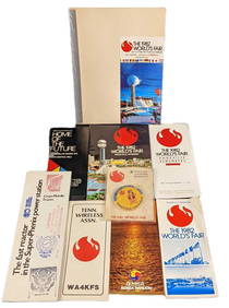
1982 Knoxville World's Fair Information And Maps LotRapid Estate Liquidators and Auction Gallery4.5(1.1k)See Sold PriceMar 02, 2024


![Vintage Australia Airplane Ashtray [Kangaroo] (1 of 7)](https://p1.liveauctioneers.com/5755/320282/172113950_1_x.jpg?height=282&quality=70&version=1708463029)
![Vintage Airplane Desk Model [Air France] (1 of 7)](https://p1.liveauctioneers.com/5755/320282/172113951_1_x.jpg?height=282&quality=70&version=1708463029)