ATLAS of ANTIENT GEOGRAPHY by SAMUEL BUTLER 1843John McInnis Auctioneers,LLC4.6(502)See Sold PriceFeb 24, 2024
18TH C. ANTIQUE MAP: FRENCH & INDIAN WAR, FRAMEDThomaston Place Auction Galleries4.4(386)See Sold PriceFeb 24, 2024
Rand McNally Railroad Map Cabinet w/ 21 Railroad MapsRail & Road Auctions4.6(165)See Sold PriceMar 08, 2024
Keith Haring - Ink on New York Map, Best Buddies, Inscribed, Signed, and DatedSapphire Auction Gallery4(67)See Sold PriceMar 02, 2024
LATE 17TH C. FRENCH MAP OF THE NEW WORLD BY ALEXIS-HUBERT JAILLOT (1632-1712)Thomaston Place Auction Galleries4.4(386)See Sold PriceFeb 24, 2024
Central Railroad of New Jersey Map of Sandy Hook Route-ca. 1903JM Hobby Supply and Railroad Artifact Auctions4.4(126)See Sold PriceFeb 24, 2024
Lot of Six Mixed Atlas Box Cars-HO Scale-New in BoxJM Hobby Supply and Railroad Artifact Auctions4.4(126)See Sold PriceFeb 25, 2024
Rand McNally/Santa Fe Railroad Map of Iowa-1912JM Hobby Supply and Railroad Artifact Auctions4.4(126)See Sold PriceFeb 24, 2024
NICOLAES VISSCHER (NETHERLANDS, 1618-1709) MAP OF THE NEW WORLDThomaston Place Auction Galleries4.4(386)See Sold PriceFeb 24, 2024
17TH C. WORLD MAP BY NICOLAES VISSCHER (NETHERLANDS, 1618-1709)Thomaston Place Auction Galleries4.4(386)See Sold PriceFeb 24, 2024
Lot of Six Mixed Atlas Cabooses-HO Scale-New in BoxJM Hobby Supply and Railroad Artifact Auctions4.4(126)See Sold PriceFeb 25, 2024
SoldTurkey 1858 Pair of Maps. Tallis & Rapkin, Istanbul"Turkey in Europe" and "Constantinople and the Bosphorus" Steel Engraved Maps Published 1858 by the London Printing and Publishing Co., London for "The History Of The War With Russia: Giving Full DetaSee Sold Price
SoldTallis & Rapkin 1858 Map of Turkey in EuropeSteel Engraved Map Published 1858 by the London Printing and Publishing Co., London for "The History Of The War With Russia: Giving Full Details Of The Operations Of The Allied Armies" by Henry TyrrelSee Sold Price
SoldTallis & Rapkin 1858 Pair of Battle Plans. Crimea"Plan of The Battle of The Alma" and "Siege of Sebastopol" Steel Engraved Maps Published 1858 by the London Printing and Publishing Co., London for "The History Of The War With Russia: Giving Full DetSee Sold Price
SoldTallis & Rapkin 1858 Map of The Black SeaSteel Engraved Map Published 1858 by the London Printing and Publishing Co., London for "The History Of The War With Russia: Giving Full Details Of The Operations Of The Allied Armies" by Henry TyrrelSee Sold Price
SoldTallis & Rapkin 1858 Map of Southern ItalySteel Engraved Map Published 1858 by the London Printing and Publishing Co., London for "The History Of The War With Russia: Giving Full Details Of The Operations Of The Allied Armies" by Henry TyrrelSee Sold Price
SoldTallis & Rapkin 1858 Map of The CrimeaSteel Engraved Map Published 1858 by the London Printing and Publishing Co., London for "The History Of The War With Russia: Giving Full Details Of The Operations Of The Allied Armies" by Henry TyrrelSee Sold Price
SoldTallis & Rapkin 1858 Map of The Baltic SeaSteel Engraved Map Published 1858 by the London Printing and Publishing Co., London for "The History Of The War With Russia: Giving Full Details Of The Operations Of The Allied Armies" by Henry TyrrelSee Sold Price
Crimean War 1858 Pair of Battle Maps by Rapkin"Siege of Sebastopol" and "Plan of the Battle of the Alma" Steel Engraved Map Published 1858 by the London Printing and Publishing Co., London for "The History Of The War With Russia: Giving Full DetaSee Sold Price
Crimean War 1858 Pair of Battle Maps by Rapkin"Siege of Sebastopol" and "Plan of the Battle of the Alma" Steel Engraved Map Published 1858 by the London Printing and Publishing Co., London for "The History Of The War With Russia: Giving Full DetaSee Sold Price
SoldTallis & Rapkin: Map of Turkey in Europe, 1850Map of Turkey in Europe. The London Printing and Publishing Company/John Tallis, Rapkin, J. 1850 ca. Three vignettes by H. Warren. The Balkans other than Greece. Largest vignette is a view of The BospSee Sold Price
SoldTallis (Pub) 1858 Map of Turkey in EuropeSteel Engraved Map Published 1858 by the London Printing and Publishing Co., London for "The History Of The War With Russia: Giving Full Details Of The Operations Of The Allied Armies" by Henry TyrrelSee Sold Price
Tallis (Pub) 1858 Map of Turkey in EuropeSteel Engraved Map Published 1858 by the London Printing and Publishing Co., London for "The History Of The War With Russia: Giving Full Details Of The Operations Of The Allied Armies" by Henry TyrrelSee Sold Price
Tallis / Rapkin: Antique Map of British India, 1858Title/Content of Map: 'British India' Railways. Military bases. Mutiny events. Date Printed: 1858 Image Size: Approx 33.5 x 25.5cm, 13.25 x 10 inches (Large) Type: Antique steel engraved map with origSee Sold Price
SoldMAPS: (2) 1851 Rapkin Tallis U.S. & N. AmericaMAPS: (2) 1851 Rapkin Tallis U.S. & N. America, Pair of maps Drawn & Engraved by J. Rapkin, published by J & F Tallis, London, Edinburgh & Dublin, with illustrations by J. Marchant engraved by J. RogeSee Sold Price
Tallis / Rapkin: Antique Map of the United States, 1851Title/Content of Map: 'United States' The map shows 30 of the then 31 states of the United States (the other being California), plus Minnesota territory (which became the 32nd state in 1858), and NebrSee Sold Price
Tallis / Rapkin: Antique Map of Asia, 1849'Asia' States marked on the map include Siberia, Cochin China, China, Hindoostan, Cabool (Kabul), Turkey, Arabia, Persia, Beloochistan, Birmah, Siam, Malaya, Independent Tartary, Japan, Dutch East IndSee Sold Price
SoldRapkin, John 1858 Map of The Crimea. TallisSteel Engraved Map Published 1858 by the London Printing and Publishing Co., London for "The History Of The War With Russia: Giving Full Details Of The Operations Of The Allied Armies" by Henry TyrrelSee Sold Price
BLACK SEA Istanbul Odessa Sevastopol Sinop Varna views. TALLIS / RAPKIN 1860 mapTITLE/CONTENT OF MAP: 'Black Sea' DATE PRINTED: 1860 IMAGE SIZE: Approx 27.0 x 35.5cm, 10.5 x 14 inches (Large); Please note that this is a folding map. TYPE: Antique steel engraved map with originalSee Sold Price
BLACK SEA Istanbul Odessa Sevastopol Sinop Varna views. TALLIS / RAPKIN 1860 mapTITLE/CONTENT OF MAP: [Europe south west sheet] DATE PRINTED: 1842 IMAGE SIZE: Approx 43.0 x 50.0cm, 17 x 19.75 inches (Large); Please note that this is a folding map. TYPE: Antique 19th century atlasSee Sold Price
TURKEY IN EUROPE. Constantinople view. Rumilia Balkans. TALLIS & RAPKIN 1851 mapCAPTION PRINTED BELOW PICTURE: 'Turkey in Europe' Vignettes: The Bosphorus and Constantinople; Ali Pasha; Greek Caloyer. The Balkans: Rumilia, Macedonia, Albania, Wallachia, Moldavia, Bulgaria, ServiaSee Sold Price
SoldTallis (Pub) 1858 Map of The Black Sea by RapkinSteel Engraved Map Published 1858 by the London Printing and Publishing Co., London for "The History Of The War With Russia: Giving Full Details Of The Operations Of The Allied Armies" by Henry TyrrelSee Sold Price
SoldRapkin, John 1858 Map of The Crimea. After TallisSteel Engraved Map Published 1858 by the London Printing and Publishing Co., London for "The History Of The War With Russia: Giving Full Details Of The Operations Of The Allied Armies" by Henry TyrrelSee Sold Price
SoldRapkin, John 1858 Map of The Baltic Sea. TallisSteel Engraved Map Published 1858 by the London Printing and Publishing Co., London for "The History Of The War With Russia: Giving Full Details Of The Operations Of The Allied Armies" by Henry TyrrelSee Sold Price
SoldRapkin, John 1858 Map of the Black Sea. TallisSteel Engraved Map Published 1858 by the London Printing and Publishing Co., London for "The History Of The War With Russia: Giving Full Details Of The Operations Of The Allied Armies" by Henry TyrrelSee Sold Price
Joseph Martin Kronheim Pair Early Color Glamor Prints c1850Luis Porretta Fine Arts4.3(10)See Sold PriceMar 02, 2024
1876 The Centennial Exhibition Pennsylvania Railroad Worlds Fair Guide with Map and Trade CardRail & Road Auctions4.6(165)See Sold PriceMar 07, 2024
Early Pennsylvania Railroad Literature - 1881 New York and Chicago Limited Timetable Brochure andRail & Road Auctions4.6(165)See Sold PriceMar 07, 2024
Pair of Early Railroad Maps - 1874 Delaware, Lackawanna & Western and 1876 Pennsylvania RailroadRail & Road Auctions4.6(165)See Sold PriceMar 07, 2024
Pair of Early Railroad Maps - 1862 Pittsburgh, Ft. Wayne & Chicago Railway and 1873 PennsylvaniaRail & Road Auctions4.6(165)See Sold PriceMar 07, 2024
PAIR AYCE WILSON BATHING BEAUTY WATERCOLORSCharleston Estate Services Ltd.4.5(58)See Sold PriceMar 03, 2024
Duval - Pair: Map of India & Map of MaldivesTrillium Antique Prints & Rare Books4.5(30)See Sold PriceFeb 24, 2024
Donovan - Pair: Rufous Orang Outang (Orangutan): Wild Man of the Woods & Two Studes of the HeadTrillium Antique Prints & Rare Books4.5(30)See Sold PriceFeb 24, 2024
Edwards & Seligmann - Pair of Diver or Loon EngravingsTrillium Antique Prints & Rare Books4.5(30)See Sold PriceFeb 24, 2024
Audubon, NYSE Best Watercolor Ed - Pair: Brown Pelican & Reddish EgretTrillium Antique Prints & Rare Books4.5(30)See Sold PriceFeb 24, 2024
NORTHERN AFRICA. Morocco Tunisia Algeria. Caravan routes. RAPKIN/TALLIS 1851 mapJasper524.5(9.8k)See Sold PriceFeb 28, 2024
NORTHERN AFRICA. Morocco Tunisia Algeria. Caravan routes.TALLIS/RAPKIN 1851 mapJasper524.5(9.8k)See Sold PriceFeb 28, 2024
NORTHERN AFRICA. Morocco Tunisia Algeria. Caravan routes. RAPKIN/TALLIS 1851 mapJasper524.5(9.8k)See Sold PriceFeb 28, 2024
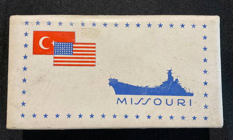
Box of Commemorative Cigarettes from the USS Missouri, 1946GCB Estate Sales4.5(86)See Sold PriceMar 02, 2024
Paterson & Mogg 1822 Pair of British Road Maps. Deal, Hythe, Shoreham, ChichesterAlbion Auctions4.6(336)See Sold PriceMar 01, 2024
Pair of Antique Japanese Ando Hiroshige (1797-1858) Hand Colored Signed Woodblock PrintsHess Fine Auctions4.5(197)See Sold PriceMar 02, 2024
Map of Turkey from Arabic and Persia, 1701 by Gillaume de Lisle, ParisAntiques Online Auctions4.6(407)See Sold PriceMar 14, 2024