ATLAS of ANTIENT GEOGRAPHY by SAMUEL BUTLER 1843John McInnis Auctioneers,LLC4.6(504)See Sold PriceFeb 24, 2024
18TH C. ANTIQUE MAP: FRENCH & INDIAN WAR, FRAMEDThomaston Place Auction Galleries4.4(389)See Sold PriceFeb 24, 2024
Rand McNally Railroad Map Cabinet w/ 21 Railroad MapsRail & Road Auctions4.6(165)See Sold PriceMar 08, 2024
Keith Haring - Ink on New York Map, Best Buddies, Inscribed, Signed, and DatedSapphire Auction Gallery4.1(67)See Sold PriceMar 02, 2024
LATE 17TH C. FRENCH MAP OF THE NEW WORLD BY ALEXIS-HUBERT JAILLOT (1632-1712)Thomaston Place Auction Galleries4.4(389)See Sold PriceFeb 24, 2024
Central Railroad of New Jersey Map of Sandy Hook Route-ca. 1903JM Hobby Supply and Railroad Artifact Auctions4.4(126)See Sold PriceFeb 24, 2024
Lot of Six Mixed Atlas Box Cars-HO Scale-New in BoxJM Hobby Supply and Railroad Artifact Auctions4.4(126)See Sold PriceFeb 25, 2024
Rand McNally/Santa Fe Railroad Map of Iowa-1912JM Hobby Supply and Railroad Artifact Auctions4.4(126)See Sold PriceFeb 24, 2024
NICOLAES VISSCHER (NETHERLANDS, 1618-1709) MAP OF THE NEW WORLDThomaston Place Auction Galleries4.4(389)See Sold PriceFeb 24, 2024
17TH C. WORLD MAP BY NICOLAES VISSCHER (NETHERLANDS, 1618-1709)Thomaston Place Auction Galleries4.4(389)See Sold PriceFeb 24, 2024
Lot of Six Mixed Atlas Cabooses-HO Scale-New in BoxJM Hobby Supply and Railroad Artifact Auctions4.4(126)See Sold PriceFeb 25, 2024
SoldCivil War-era US coastal surveyHeading: Author: U.S. Coast Survey Title: Report of the Superintendent of the Coast Survey, Showing the Progress of the Survey During the Year 1862 Place Published: Washington Publisher:Government PrSee Sold Price
SoldCivil War Era U.S. Coast Survey, 1859Civil War Era U.S. Coast Survey, 1859: (1) "Report of the Superintendent of the Coast Survey showing The Progress of the Survey during The Year 1859" (Washington: Thomas H. Ford, Printer, 1860), 370 pSee Sold Price
SoldAN ANTIQUE AMERICAN CIVIL WAR/RECONSTRUCTION ERA U.S.AN ANTIQUE AMERICAN CIVIL WAR/RECONSTRUCTION ERA U.S. COAST SURVEY MAP, "Galveston Entrance, Texas," 1867, ink engraving on paper, plate no. 13, Benjamin Pierce, Superintendent; survey triangulation,See Sold Price
Sold1864 CIVIL WAR MAP OF OHIO RIVERBetween Mound City and Cairo. Of the above title, 17” x 24”. Surveyed by F.E. Gerdes, U.S. Coastal Survey, ordered by Rear Admiral D.D. Porter Commander of Mississippi Squadron,1864.See Sold Price
Sold1816 U.S. Coastal SurveyPost-Revolutionary War to Civil War“Accurate Survey of the Coast of the United States” 1816, The First “Accurate Survey of the Coast of the United States,"" Secretary of the TreasurSee Sold Price
Sold1816 U.S. Coastal SurveyPost-Rev. War to Civil War“Accurate Survey of the Coast of the United States” 1816, The First “Accurate Survey of the Coast of the United States," Secretary of the Treasury, WashingSee Sold Price
Sold1816 U.S. Coastal Survey"Post-Rev. War to Civil War“Accurate Survey of the Coast of the United States” 1816, The First “Accurate Survey of the Coast of the United States,"" Secretary of the Treasury, WashiSee Sold Price
Civil War Era Sea Chart of Southeast CoastBlunt, Edmund. & G. W. (fl. 1810-1870). The Coast of the United States Sheet No.2 from Cape Lookout to Cape Canaveral from The U.S. Coast Surveys. Lithographed map. E. & G. W. Blunt, 1865. 47 ½" xSee Sold Price
SoldCoast of South Carolina during Civil WarTitle: Coast of South Carolina from Charleston to Hilton Head Author: U.S. Coast Survey Description: Lithographed chart, modern hand-coloring. 50.5x88 cm. (20x34¾").Interesting Civil War era chart ofSee Sold Price
Ohio River Between Mound City and CairoTitle: Ohio River Between Mound City and Cairo Cartographer: GERDES, F. H. Publication Date: 1864 Publisher: U.S. COAST SURVEY Size: 17Height - 24Width Civil War era survey of the Ohio River where itSee Sold Price
Metompkin Inlet, Virginia, 1862Original maritime map by the U.S. Coast Survey and John Farley, 1862. Map features Metompkin Bay, Long Boat Creek and Folly Creek. Published during the civil war and one of the first coastal surveys eSee Sold Price
Metompkin Inlet, Virginia, 1862Original maritime map by the U.S. Coast Survey and John Farley, 1862. Map features Metompkin Bay, Long Boat Creek and Folly Creek. Published during the civil war and one of the first coastal surveys eSee Sold Price
Metompkin Inlet, Virginia, 1862Original maritime map by the U.S. Coast Survey and John Farley, 1862. Map features Metompkin Bay, Long Boat Creek and Folly Creek. Published during the civil war and one of the first coastal surveys eSee Sold Price
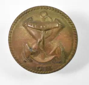
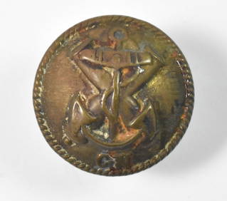
SoldCivil War Era US Military Complete Belt BuckleNice Civil War era US military belt buckle. Stamped RD-NY. Very nice condition with wear from age. Measures approximately 6 1/2" long by 2 1/4" wide.See Sold Price
SoldRARE CIVIL WAR ERA U.S. ARMY INFANTRY KEPI HAT CAPRARE CIVIL WAR ERA U.S. ARMY INFANTRY KEPI HAT CAP. IN GOOD OVERALL SHAPE AND CONDITION WITH A BEAUTIFUL OVERALL PATINA. HAS THE CROSSED GUNS ARMY INFANTRY CLOTH INSIGNIA ON THE FRONT. THIS HAT IS COMSee Sold Price
Sold36 star Civil War era U.S. flag, 1865-186736 star Civil War era U.S. flag, 1865-1867, 36 star United States flag, c. 1865-1867, approx. 72"h x 117"w, cord sewn into hoist edge, no grommets Provenance: Property from the Collection of Charles ESee Sold Price
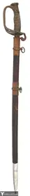
SoldCivil War Era U.S. Staff Officer's Sword & Scabbard.Civil War era U.S. Staff Officer's sword and scabbard. Blade marked W. Clauberg Solingen, Schuyler, Hartley & Graham N.Y. Eagle and floral etching with shield on one side and "U.S." on the other. OpenSee Sold Price
SoldCivil War era US UNION Flag 38 Stars W/Markings/ImagesCivil War era US UNION Flag 38 Stars marked K ink type stamped PHILIP. KEILENT. post CIVIL WAR ERA US FLAG metal 1 inch grommets 5 x 7 ft approximate; Shipping cost: $35, Different rate(s) to CalifornSee Sold Price
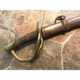
SoldCivil War Era U.S. Ames Model 1840 Sword W672Civil War Era U.S. Ames Model 1840 NCO Sword Marked US AHK 1864. This is a Civil War Era U.S. Ames Model 1840 Non-commissioned Officer’s Sword. The NCO sword was adapted from European-pattern swordsSee Sold Price
SoldCIVIL WAR ERA US MILITARY BELT BUCKLECIVIL WAR ERA US MILITARY BELT BUCKLE US military belt buckle. Lead backed. Size: 3.5"See Sold Price
Sold3 Civil War Era US Brass Belt BucklesDESCRIPTION: 3 Civil War era US brass belt buckles. Two with three prongs on the back, smaller buckle with one. \r\nMEASUREMENTS: Range from 2-3/4\" x 1-5/8\" to 3-1/2\" x 2-1/8\". \r\nCONDITION: AllSee Sold Price
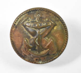
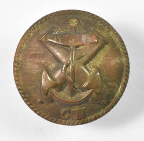
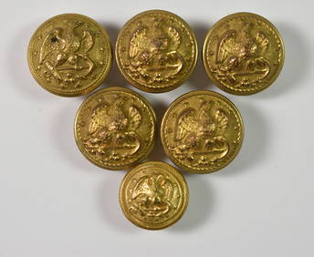
SoldCIVIL WAR ERA US CAVALRY OFFICER SHOULDER BOARDSCIVIL WAR ERA US CAVALRY OFFICER SHOULDER BOARDS Country: US Size: 4" Provenance: From the collection of Darryl E. KinnisonSee Sold Price
SoldPossible Civil War Era U.S. Militia SwordEtched 31" blade, U.S. shield and eagle on pommel. Etched scabbard with American eagle and has Civil War style Virginia belt buckle which is unmarked on reverse.See Sold Price
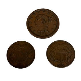
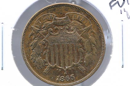
Two US 2 Cent Coins and 1854 Large One CentPremier Auction Galleries4.3(329)See Sold PriceMar 09, 2024
Model 1840 Sheble Fisher US Cavalry Saber SwordConnoisseur Auctions3.9(335)See Sold PriceMar 02, 2024
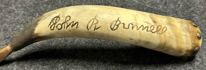
Antique John R Bunnell 189th New York Infantry Carved Civil War Era Powder HornHoller and Hammer4.5(57)See Sold PriceFeb 24, 2024
1863-65 Civil War era handwritten diary of young ne Ohio womanJasper524.5(9.8k)See Sold PriceFeb 27, 2024
1864 Lg Motto US 2c. Civil War Era, Nice DetailsRichard L. Edwards Auctioneering4.8(2.3k)See Sold PriceFeb 27, 2024
WOW 1865 US 2 Cent Piece. GORGEOUS. FULL "WE." SUPER High Grade. Civil War EraRichard L. Edwards Auctioneering4.8(2.3k)See Sold PriceFeb 27, 2024
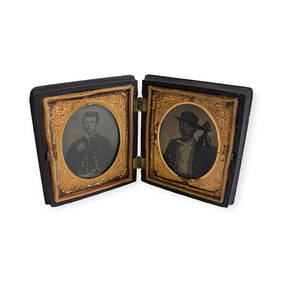
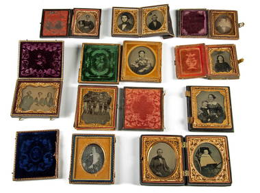
19th C. Photos Daguerreotype, Ambrotype & Tintypes (10)Artemis Fine Arts4.8(1.4k)See Sold PriceMar 01, 2024