2 Illuminated Books of Hours LeavesSchmidt's Antiques Inc. Since 19114.8(431)See Sold PriceMar 02, 2024
Illuminated Manuscript Leaf of The CrucifixionSchmidt's Antiques Inc. Since 19114.8(431)See Sold PriceMar 02, 2024
RARE 1930s AUTOGRAPH BOOK FEATURING RUTH & GEHRIGJohn McInnis Auctioneers,LLC4.5(505)See Sold PriceFeb 25, 2024
Timetable, Paper and Ephemera Lot-Eastern USA RailroadsJM Hobby Supply and Railroad Artifact Auctions4.4(127)See Sold PriceFeb 24, 2024
SCARCE 1971 Kim Il Sung Signed Book "ON THE WORK OF THE WOMAN'S UNION"Rbfinearts4.5(578)See Sold PriceFeb 24, 2024
1885 CIVIL WAR 1ed Famous Memoirs US Grant Sheridan Sherman 6v RARE LOT MapsSchilb Antiquarian Rare Books4.8(428)See Sold PriceMar 10, 2024
"WINTER AND SUMMER IN MAINE" 1904 PHOTO ALBUMJohn McInnis Auctioneers,LLC4.5(505)See Sold PriceFeb 25, 2024
1821 THE (3) VOYAGES of CAPT JAMES COOK VOL. I-VIIJohn McInnis Auctioneers,LLC4.5(505)See Sold PriceFeb 24, 2024
[BASEBALL]. [SHEET MUSIC]. KALBFLEISCH, J. H. The Live Oak ...Potter & Potter Auctions4.6(545)See Sold PriceMar 07, 2024
Illuminated Manuscript Leaf of The VisitationSchmidt's Antiques Inc. Since 19114.8(431)See Sold PriceMar 02, 2024
Illuminated Manuscript Leaf of GethsemaneSchmidt's Antiques Inc. Since 19114.8(431)See Sold PriceMar 02, 2024
c1700s RARE Arabic Handwritten Manuscript Middle East Persia Journal ARABIASchilb Antiquarian Rare Books4.8(428)See Sold PriceMar 10, 2024
SoldCoast survey reports, 1848-1850, with chartsHeading: Author: U.S. Coast Survey Title: Letter from the Secretary of the Treasury, Transmitting the report of the Superintendent of the Coast Survey...1848, 1849 [and] 1850. Place Published: WashinSee Sold Price
SoldCoast Survey report with 27 charts 1850Heading: Author: U.S. Coast Survey Title: Letter from the Secretary of the Treasury, Transmitting the report of the Superintendent of the Coast Survey, showing the progress of that work during the yeSee Sold Price
Sold4 early Coast Survey reports: 1844-1855.[Coast Survey] 4 early reports with charts: Alexander Bache. REPORT OF THE SUPERINTENDENT OF THE COAST SURVEY, SHOWING THE PROGRESS OF THAT WORK DURING THE YEAR ENDING NOVEMBER, 1844. Wash: 1844. 28thSee Sold Price
SoldCoast Survey chart of Nantucket 1848Title: Nantucket Harbor Author: U.S. Coast Survey Description: Engraved map/chart, modern hand-coloring. 36x48 cm. (25x19").Nicely colored chart of Nantucket Harbor and map of the town, with 2 recogniSee Sold Price
Sold7 large Coast Survey maps[Coast Survey]. 7 Maps. About 23 x 34 - 43 x 28 in., most in not all published by M.F. Maury. ++ Maury's Wind & Current Chart: No. 5, Series A. (1850). Charts the Hudson Bay region, with the St. LaureSee Sold Price
Coast Survey Report 1851Title: Sketches Accompanying the Annual Report of the Superintendent of the United States Coast Survey, 1851 Author: U.S. Coast Survey Description: With 58 charts and plans, most folding. 29x23.5 cm.See Sold Price
SoldHarbors Of Black Rock And Bridgeport, 1848Title: Harbors Of Black Rock And Bridgeport Subject: Chart of Connecticut Harbors Maker: US Coast Survey Date: 1848, US Coast Survey: Washington DC Size: 18 x 14 inches Detailed chart focusing on BlacSee Sold Price
SoldNautical Chart of HATTERAS SHOALS, CA 1850, 1/120000:Nautical Chart of HATTERAS SHOALS, CA 1850, 1/120000: US Coast Survey of the "GRAVEYARD OF THE ATLANTIC" with Sailing Instructions around Diamond Shoals/Cape Hatteras. Framed in Black Beaded Wood FramSee Sold Price
SoldSketch J Showing the Progress of the Survey in thEngraved chart, later hand-coloring in outline. 23.5x25 cm. (9¼x10"), matted and framed. Author: U.S. Coast Survey Place Published: Washington Date Published: 1850See Sold Price
SoldU.S. Coast Survey for 1850 in Original WrappersTitle: [Report of Professor Alexander D. Bache]. Coast Survey. Letter from the Secretary of the Treasury, Transmitting the report of the Superintendent of the Coast Survey, showing the progress of thaSee Sold Price
Maritime Chart, U.S. Coast Survey, San Diego To PtCHART. U.S. Coast Survey, Sketch showing the progress of the survey in Section no. X, (lower sheet), from San Diego to Pt. Sal, from 1850-1877, scale 600.000, 1877, good condition, folds, 29 1/2" T xSee Sold Price
Report of the Superintendent of the U.S. Coast SurveyReport of the Superintendent of the U.S. Coast Survey for 1854. Washington. Beverley Tucker, Public Printer. 1855. Embossed hard-cover; the back-half of the book with fold-out maps and charts. ConditiSee Sold Price
SoldWith early Coast Survey charts of west coast 1851Heading: Author: U.S. Coast Survey Title: Sketches Accompanying the Annual Report of the Superintendent of the United States Coast Survey, 1851 (caption title) Place Published: Washington, D.C. PubliSee Sold Price
SoldU.S. Coast Survey During the Year 1853Title: Report of the Superintendent of the Coast Survey, Showing the Progress of the Survey During the Year 1853 Author: U.S. Coast Survey Description: vi, 186, [2] pp. + 54 engraved map charts and diSee Sold Price
SoldReport of the Superintendent of the United StatesAuthor: U.S. Coast Survey xxii, 419 pp. 88 maps, charts, etc. most folding. (4to) 11¼x9, original black cloth. First Edition. Several notable articles in this annual report includes: On the DeterminaSee Sold Price
SoldMaps of the United States Coast Survey, 1851Title: Sketches Accompanying the Annual Report of the Superintendent of the United States Coast Survey, 1851 Author: U.S. Coast Survey Description: With 50 (of 58) charts and plans, most folding. 29x2See Sold Price
SoldReport of the Superintendent of the United StatesAuthor: U.S. Coast Survey Description: xii, 334 pp. + 26 (of 27) folding charts & other plates. 11¼x8¼, cloth, spine lettered in gilt. Important volume of the Coast Survey, covering surveys the yearSee Sold Price
Chart of Pacific Coast on 3 sheets 1850Heading: Author: U.S. Coast Survey A.D. Bache Superintendent Title: Reconnoissance of the Western Coast of the United States from Monterey to the Columbia River in three sheets... By the HydrographicSee Sold Price
U.S. Coast Survey From San Diego to Pt. Sal. 1875.EARLY CALIFORNIA CHART. U.S. Coast Survey, Sketch showing the progress of the survey in Section no. X, (lower sheet), from San Diego to Pt. Sal, from 1850-1877, scale 600.000, 1877, good condition, foSee Sold Price
SoldU.S Coast Survey 1853 Map. Gargathy Machipongo Inlet VA"Preliminary Chart of the Sea Coast of Virginia From Gagathy Inlet to Gr. Machipongo Inlet" Electrotype Map Published 1843-65, Washington for "Report of the Superintendent of the U.S. Coast Survey..."See Sold Price
SoldU.S Coast Survey 1853 Map. Ship Island Shoal, Louisiana"Preliminary Chart of Ship Island Shoal Louisiana" Electrotype Map Published 1843-65, Washington for "Report of the Superintendent of the U.S. Coast Survey..." Published under the supervision and direSee Sold Price
U.S Coast Survey 1853 Map. Ship Island Shoal, Louisiana"Preliminary Chart of Ship Island Shoal Louisiana" Electrotype Map Published 1843-65, Washington for "Report of the Superintendent of the U.S. Coast Survey..." Published under the supervision and direSee Sold Price
U.S Coast Survey 1853 Map. Gargathy Machipongo Inlet VA"Preliminary Chart of the Sea Coast of Virginia From Gagathy Inlet to Gr. Machipongo Inlet" Electrotype Map Published 1843-65, Washington for "Report of the Superintendent of the U.S. Coast Survey..."See Sold Price
U.S Coast Survey 1853 Map. Ship Island Shoal, Louisiana"Preliminary Chart of Ship Island Shoal Louisiana" Electrotype Map Published 1843-65, Washington for "Report of the Superintendent of the U.S. Coast Survey..." Published under the supervision and direSee Sold Price
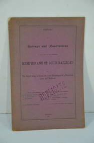
Memphis and St. Louis RR Surveys and Observations Report-August 21, 1872JM Hobby Supply and Railroad Artifact Auctions4.4(127)See Sold PriceFeb 24, 2024
Northern RR of New Hampshire Original Bylaws-1847JM Hobby Supply and Railroad Artifact Auctions4.4(127)See Sold PriceFeb 24, 2024
Ohio and Pennsylvania RR 2nd Annual Report-March 4, 1850JM Hobby Supply and Railroad Artifact Auctions4.4(127)See Sold PriceFeb 24, 2024
Ohio and Pennsylvania RR 2nd Annual Report-1850JM Hobby Supply and Railroad Artifact Auctions4.4(127)See Sold PriceFeb 24, 2024
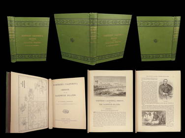
1874 HAWAII 1ed Northern California Oregon Pacific Island Travel Puget RedwoodsSchilb Antiquarian Rare Books4.8(428)See Sold PriceMar 10, 2024
LATE 18TH C. VERY LARGE CHART OF NORTHEAST CANADA BY DES BARRES (1721-1824), 1780, FRAMEDThomaston Place Auction Galleries4.4(393)See Sold PriceFeb 24, 2024
BOTH TITLE PAGES OF COLLINS" COASTAL SURVEY, 1776, IN MATCHING FRAMESThomaston Place Auction Galleries4.4(393)See Sold PriceFeb 24, 2024
CHART "SOUTHERN COAST OF LONG ISLAND FROM MONTAUK POINT TO EAST HAMPTON" Circa 1877 11.25" x 22.75"Eldred's4.7(419)See Sold PriceFeb 27, 2024
1848 First Annual Report of Pennsylvania Railroad Chief Engineer with Fold Out PlansRail & Road Auctions4.6(165)See Sold PriceMar 07, 2024
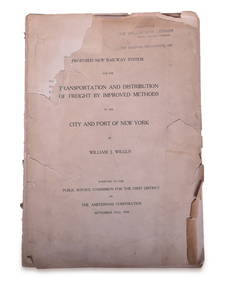
1908 Report on Proposed New York / New Jersey New Railway SystemRail & Road Auctions4.6(165)See Sold PriceMar 08, 2024
1852 CHART SHOWING POSITIONS of DAVIS'S SOUTH SHOAL & OTHER DANGERS antiqueJasper524.5(9.9k)See Sold PriceFeb 27, 2024
West Indies. South Coast of Jamaica from Port Royal to Pedro Bluff.Jasper524.5(9.9k)See Sold PriceFeb 27, 2024
MARSHALL JOHNSON, JR. (Massachusetts, 1850-1921), Fishing schooner off the coast., Watercolor onEldred's4.7(419)See Sold PriceMar 07, 2024
CHART: UNITED STATES - EAST COAST NEW YORK/ HUDSON RIVER/ POUGHKEEPSIE TO HUDSONChurchill Galleries3.7(217)See Sold PriceFeb 26, 2024


![[BASEBALL]. [SHEET MUSIC]. KALBFLEISCH, J. H. The Live Oak ... (1 of 5)](https://p1.liveauctioneers.com/928/318880/171361400_1_x.jpg?height=282&quality=70&version=1707501302)