ATLAS of ANTIENT GEOGRAPHY by SAMUEL BUTLER 1843John McInnis Auctioneers,LLC4.6(502)See Sold PriceFeb 24, 2024
18TH C. ANTIQUE MAP: FRENCH & INDIAN WAR, FRAMEDThomaston Place Auction Galleries4.4(386)See Sold PriceFeb 24, 2024
Rand McNally Railroad Map Cabinet w/ 21 Railroad MapsRail & Road Auctions4.6(165)See Sold PriceMar 08, 2024
Keith Haring - Ink on New York Map, Best Buddies, Inscribed, Signed, and DatedSapphire Auction Gallery4(67)See Sold PriceMar 02, 2024
LATE 17TH C. FRENCH MAP OF THE NEW WORLD BY ALEXIS-HUBERT JAILLOT (1632-1712)Thomaston Place Auction Galleries4.4(386)See Sold PriceFeb 24, 2024
Central Railroad of New Jersey Map of Sandy Hook Route-ca. 1903JM Hobby Supply and Railroad Artifact Auctions4.4(126)See Sold PriceFeb 24, 2024
Lot of Six Mixed Atlas Box Cars-HO Scale-New in BoxJM Hobby Supply and Railroad Artifact Auctions4.4(126)See Sold PriceFeb 25, 2024
Rand McNally/Santa Fe Railroad Map of Iowa-1912JM Hobby Supply and Railroad Artifact Auctions4.4(126)See Sold PriceFeb 24, 2024
NICOLAES VISSCHER (NETHERLANDS, 1618-1709) MAP OF THE NEW WORLDThomaston Place Auction Galleries4.4(386)See Sold PriceFeb 24, 2024
17TH C. WORLD MAP BY NICOLAES VISSCHER (NETHERLANDS, 1618-1709)Thomaston Place Auction Galleries4.4(386)See Sold PriceFeb 24, 2024
Lot of Six Mixed Atlas Cabooses-HO Scale-New in BoxJM Hobby Supply and Railroad Artifact Auctions4.4(126)See Sold PriceFeb 25, 2024
SoldThompson & West Santa Clara Atlas MapHeading: (California - Santa Clara County) Author: Title: Historical Atlas Map of Santa Clara County, California Place Published: San Francisco Publisher:Thompson & West Date Published: 1876See Sold Price
SoldThompson & West Santa Clara Atlas MapHeading: (California - Santa Clara County) Author: Title: Historical Atlas Map of Santa Clara County, California Place Published: San Francisco Publisher:Thompson & West Date Published: 1876See Sold Price
SoldThompson & West Santa Clara Atlas MapHeading: (California - Santa Clara County) Author: Title: Historical Atlas Map of Santa Clara County, California Place Published: San Francisco Publisher:Thompson & West Date Published: 1876See Sold Price
SoldThompson & West Santa Clara Atlas MapHeading: (California - Santa Clara County) Author: Title: Historical Atlas Map of Santa Clara County, California Place Published: San Francisco Publisher:Thompson & West Date Published: 1876See Sold Price
Thompson & West Santa Clara Atlas MapHeading: (California - Santa Clara County) Author: Title: Historical Atlas Map of Santa Clara County, California Place Published: San Francisco Publisher:Thompson & West Date Published: 1876See Sold Price
Thompson & West Santa Clara Atlas MapHeading: (California - Santa Clara County) Author: Title: Historical Atlas Map of Santa Clara County, California Place Published: San Francisco Publisher:Thompson & West Date Published: 1876See Sold Price
SoldTHOMPSON & WEST ATLAS OF SANTA CLARA CO. MAP BOOKTHOMPSON & WEST ATLAS OF SANTA CLARA CO. MAP BOOK1876 size of book- 15" x 17 3/4"See Sold Price
SoldBooks. Santa Clara County Related including ReminBooks. Santa Clara County Related including Reminiscences of Santa Clara Valley and San Jose Cal. by Amaury Mars. 1901. Historical Atlas Map of Santa Clara County California By Thompson & West San FraSee Sold Price
SoldAtlas Map of Santa Clara County 1876Title: Historical Atlas Map of Santa Clara County, California Author:Thompson & West Description:110 pp. Illustrated with 21 hand-colored maps (some maps in sections, 9 are double-page) and 54 views.See Sold Price
SoldAtlas Map of Santa Clara County 1876Title: Historical Atlas Map of Santa Clara County, California Author: Thompson & West Description: 110 pp. Illustrated with 21 hand-colored maps (some maps in sections, 9 are double-page) and 54 viewsSee Sold Price
SoldAtlas Map of Santa Clara County 1876Title: Historical Atlas Map of Santa Clara County, California Author: Thompson & West Description: 110 pp. Illustrated with 21 hand-colored maps (some maps in sections, 9 are double-page) and 54 viewsSee Sold Price
SoldAtlas Map of Santa Clara County 1876Title: Historical Atlas Map of Santa Clara County, California Author: Thompson & West Description: 110 pp. Illustrated with 21 hand-colored maps (some maps in sections, 9 are double-page) and 54 viewsSee Sold Price
Atlas Map of Santa Clara County 1876Title: Historical Atlas Map of Santa Clara County, California Author: Thompson & West Description: 110 pp. Illustrated with 21 hand-colored maps (some maps in sections, 9 are double-page) and 54 viewsSee Sold Price
SoldHistorical Atlas Map of Santa Clara County 1876Title: Historical Atlas Map of Santa Clara County, California Author: Thompson & West Description: 110 pp. Illustrated with 21 hand-colored maps (some maps in sections, 9 are double-page) and 54 viewsSee Sold Price
The Bank of San Jose, LithographHeading: (California) Author: Thompson & West Title: Handcolored Stone Lithograph from 1876 Santa Clara Atlas Place Published: Publisher: Date Published: 1876 Description:See Sold Price
The Bank of San Jose, LithographHeading: (California) Author: Thompson & West Title: Handcolored Stone Lithograph from 1876 Santa Clara Atlas Place Published: Publisher: Date Published: 1876 Description:See Sold Price
SoldAtlas, Maps of Alameda County, 1878Thompson & West, ''Official and Historical Atlas Map of Alameda County California, Compiled, Drawn and Published from Personal Examinations and Surveys,'' Oakland, 1878, incomplete, rebound in buckramSee Sold Price
Official Historical Atlas Map of Alameda County, CAOfficial and Historical Atlas Map of Alameda County, California. Compiled, Drawn and Published From Personal Examinations and Surveys. [Thompson & West]. Fresno: Valley Publishers, 1976. Profusely illSee Sold Price
SoldThompson & West Atlas of Solano County Cal. 1878Heading: (California - Solano County) Author: Title: Historical Atlas Map of Solano County, California Place Published: San Francisco Publisher:Thompson & West Date Published: 1878 DesSee Sold Price
SoldThompson & West Atlas of Solano County Cal. 1878Title: Historical Atlas Map of Solano County, California Author: ** Description: 68 pp. Lithographed title-page; 13 hand-colored lithographed map sheets, 8 of them double-page; 17 lithographed plates,See Sold Price
Thompson & West Atlas of Solano County Cal. 1878Heading: (California - Solano County) Author: Title: Historical Atlas Map of Solano County, California Place Published: San Francisco Publisher:Thompson & West Date Published: 1878 DesSee Sold Price
Official and Historical Atlas Map of Alameda County, CaOfficial and Historical Atlas Map of Alameda County, California. Compiled, Drawn and Published From Personal Examinations and Surveys. [Thompson & West]. Bicentennial edition facsimile of the originalSee Sold Price
Official Historical Atlas Map Alameda County CaliforniaOfficial and Historical Atlas Map of Alameda County, California. Compiled, Drawn and Published From Personal Examinations and Surveys. Thompson & West. Valley Publishers. Reprint. 4to. Lithographic reSee Sold Price
Official Historical Atlas Map Alameda County CaliforniaOfficial and Historical Atlas Map of Alameda County, California. Compiled, Drawn and Published From Personal Examinations and Surveys. Thompson & West. Valley Publishers. Reprint. 4to. Lithographic reSee Sold Price
West Indies. Rand, McNally & Co.'S Indexed Atlas Map of the West Indies.Jasper524.5(9.8k)See Sold PriceFeb 27, 2024
WEST AFRICA. British Cameroons & Togoland mandates. Gold Coast Nigeria 1947 mapJasper524.5(9.8k)See Sold PriceFeb 28, 2024
FRENCH WEST AFRICA. Afrique Occidentale Française. Saint-Louis, Senegal 1931 mapJasper524.5(9.8k)See Sold PriceFeb 28, 2024
West Africa. Liberia Sahara Senegambia Guinea. Mountains of Kong COLTON 1869 mapJasper524.5(9.8k)See Sold PriceFeb 28, 2024
FRENCH WEST AFRICA. Afrique Occidentale Française. Saint-Louis, Senegal 1938 mapJasper524.5(9.8k)See Sold PriceFeb 28, 2024
North west Africa. Liberia inset. Sahara Senegambia Guinea. COLTON 1863 mapJasper524.5(9.8k)See Sold PriceFeb 28, 2024
Colonial & French West Africa. Gold Coast Dahomey Upper Volta. TIMES 1922 mapJasper524.5(9.8k)See Sold PriceFeb 28, 2024
FRENCH WEST AFRICA. Afrique Occidentale Française. Saint-Louis, Senegal 1929 mapJasper524.5(9.8k)See Sold PriceFeb 28, 2024
FRENCH WEST AFRICA. Afrique Occidentale Française. Plan of Niger floods 1938 mapJasper524.5(9.8k)See Sold PriceFeb 28, 2024
FRENCH WEST AFRICA. Senegal & Mauritanie/Mauritania. Dakar plan 1929 old mapJasper524.5(9.8k)See Sold PriceFeb 28, 2024
North & West Africa. Dahomey. Gold Coast. Military Territory. THE TIMES 1922 mapJasper524.5(9.8k)See Sold PriceFeb 28, 2024
FRENCH WEST AFRICA. Afrique Occidentale Française. Plan of Niger floods 1929 mapJasper524.5(9.8k)See Sold PriceFeb 28, 2024
Colonial West Africa. Nigeria Cameroon Congo. British German. TIMES 1900 mapJasper524.5(9.8k)See Sold PriceFeb 28, 2024
FRENCH WEST AFRICA Nigeria Gold Coast Rio de Oro Portuguese Guinea 1912 mapJasper524.5(9.8k)See Sold PriceFeb 28, 2024
Colonial West Africa. Nigeria Cameroon Congo. British German. TIMES 1895 mapJasper524.5(9.8k)See Sold PriceFeb 28, 2024
FRENCH WEST AFRICA. Senegal & Mauritanie/Mauritania. Dakar plan 1938 old mapJasper524.5(9.8k)See Sold PriceFeb 28, 2024
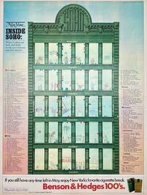
Map Inside Soho - Manhattan - New York Magazine 1974Proverde Auctions4.3(3)See Sold PriceFeb 28, 2024
Three Santa Clara Pueblo diminutive seed potsJohn Moran Auctioneers, Inc.4.7(453)See Sold PriceMar 12, 2024
Two Santa Clara Pueblo blackware pottery vesselsJohn Moran Auctioneers, Inc.4.7(453)See Sold PriceMar 12, 2024
Three Santa Clara Pueblo blackware pottery basketsJohn Moran Auctioneers, Inc.4.7(453)See Sold PriceMar 12, 2024
Three Santa Clara Pueblo blackware pottery vesselsJohn Moran Auctioneers, Inc.4.7(453)See Sold PriceMar 12, 2024