ATLAS of ANTIENT GEOGRAPHY by SAMUEL BUTLER 1843John McInnis Auctioneers,LLC4.6(502)See Sold PriceFeb 24, 2024
18TH C. ANTIQUE MAP: FRENCH & INDIAN WAR, FRAMEDThomaston Place Auction Galleries4.4(386)See Sold PriceFeb 24, 2024
Rand McNally Railroad Map Cabinet w/ 21 Railroad MapsRail & Road Auctions4.6(165)See Sold PriceMar 08, 2024
Keith Haring - Ink on New York Map, Best Buddies, Inscribed, Signed, and DatedSapphire Auction Gallery4(67)See Sold PriceMar 02, 2024
LATE 17TH C. FRENCH MAP OF THE NEW WORLD BY ALEXIS-HUBERT JAILLOT (1632-1712)Thomaston Place Auction Galleries4.4(386)See Sold PriceFeb 24, 2024
Central Railroad of New Jersey Map of Sandy Hook Route-ca. 1903JM Hobby Supply and Railroad Artifact Auctions4.4(126)See Sold PriceFeb 24, 2024
Lot of Six Mixed Atlas Box Cars-HO Scale-New in BoxJM Hobby Supply and Railroad Artifact Auctions4.4(126)See Sold PriceFeb 25, 2024
Rand McNally/Santa Fe Railroad Map of Iowa-1912JM Hobby Supply and Railroad Artifact Auctions4.4(126)See Sold PriceFeb 24, 2024
NICOLAES VISSCHER (NETHERLANDS, 1618-1709) MAP OF THE NEW WORLDThomaston Place Auction Galleries4.4(386)See Sold PriceFeb 24, 2024
17TH C. WORLD MAP BY NICOLAES VISSCHER (NETHERLANDS, 1618-1709)Thomaston Place Auction Galleries4.4(386)See Sold PriceFeb 24, 2024
Lot of Six Mixed Atlas Cabooses-HO Scale-New in BoxJM Hobby Supply and Railroad Artifact Auctions4.4(126)See Sold PriceFeb 25, 2024
Sold2 maps of the World and the United States. c.1850.[Folk Art] 2 maps. Hand drawn by Mehetable Gregory in the mid 1800s. (1) Map of the World based on Tanner’s Map of the World. Undated c.1850. 21 3/4” x 12 1/2”. Framed: 23” xSee Sold Price
SoldMAP OF ITALY, UNITED STATES AND THE WORLDMAP OF ITALY, UNITED STATES AND THE WORLD. 1. 1922-ITALY, YUGOSLAVIA, ALBANIA, EASTERN MEDITERRANEAN. 2. 1869-WORLD MAP WITH ALTITUDE GRAPHS. EASTERN UNITED STATES: FIM CORP, DBA THE CENTURIES. 1. 188See Sold Price
Sold2 Antique Maps Of The United States 1853, WorldRe-listed for non payment by Scott Zientarski. One called the new map of North America is in poor condition. Rand McNally Chart of the World on Mercator's Projection. Columbia Series64.5" x 49.5"See Sold Price
Sold2 Antique Maps Of The United States 1853, WorldOne called the new map of North America is in poor condition. Rand McNally Chart of the World on Mercator's Projection. Columbia Series64.5" x 49.5"See Sold Price
Sold2 Antique Maps Of The United States 1853, WorldOne called the new map of North America is in poor condition. Rand McNally Chart of the World on Mercator's Projection. Columbia Series64.5" x 49.5"See Sold Price
SoldAtlas for Willett's Geography in original wrappers 1826Heading: Author: Potter, Paraclete [and Jacob Willetts] Title: Atlas Designed To Illustrate Willetts' Geography, Containing The Following Maps: 1. The World. 2. North America. 3. United States. 4. SoSee Sold Price
Atlas for Willett's Geography in original wrappers 1826Heading: Author: Potter, Paraclete [and Jacob Willetts] Title: Atlas Designed To Illustrate Willetts' Geography, Containing The Following Maps: 1. The World. 2. North America. 3. United States. 4. SoSee Sold Price
SoldAJ Nystrom 2-Sided Chalkboard School Map, US & WorldLarge AJ Nystrom Roll Up 2 Sided Chalkboard Classroom Map Chart, US & World. Wonderful chart has maps of the United States and the World outlined in yellow on a black chalkboard backing. From the RoyaSee Sold Price
RARE 1820 JACOB WILLETS & P. POTTER BOOK OF WORLD MAPSRARE 1820 JACOB WILLETS & P. POTTER BOOK OF WORLD MAPS: Comprising; 1- 2 Hemisphere of the World, 1- hand colored "North America", 1- hand colored "United States of America, 1- of Europe, 1- of Asia,See Sold Price
SoldLOT OF FOUR NATIONAL GEOGRAPHIC MAPSLOT OF FOUR NATIONAL GEOGRAPHIC MAPS OF THE WORLD OCEAN FLOOR, EUROPE, THE UNITED STATES & THE WORLD. Height: 29 1/2 in. by Width: 42 1/2 inSee Sold Price
SoldMackay (Alexander)Mackay (Alexander) The Western World; Or, Travels in the United States... including a Chapter on California, 3 vol., 2 folding lithographed maps, vol. I half-title, some foxing, browning and sSee Sold Price
SoldUnited States. 1850 by Thomas.Title: United States. 1850 by Thomas. Date/Period: c1850. Materials: Hand colored steel engraved Size: 27 x 16 1/2” Important map made during time of great changes. Inserts of California’s gold ruSee Sold Price
LOT OF FOUR NATIONAL GEOGRAPHIC MAPSLOT OF FOUR NATIONAL GEOGRAPHIC MAPS OF THE WORLD OCEAN FLOOR, EUROPE, THE UNITED STATES & THE WORLD. Height: 29 1/2 in. by Width: 42 1/2 inSee Sold Price
WORLD WAR 2 MARINES MILITARY UNIFORMS & BATTLE MAPUnited States Marines World War II Group of 3 Uniforms, Hat and Personal Ephemera. All Patches and Insignia Buttons Present and in overall Excellent Condition.See Sold Price
WORLD WAR 2 MARINES UNIFORM COAT & TARGET MAPUnited States Marines World War II Military Uniform Long Coat , Hat and Target Map of Asia . Insignia Buttons present. From the Estate of the Late 6th Infantry Veteran Soldier.See Sold Price
WORLD WAR 2 MARINES UNIFORM COAT & TARGET MAPUnited States Marines World War II Military Uniform Long Coat , Hat and Target Map of Asia . Insignia Buttons present. From the Estate of the Late 6th Infantry Veteran Soldier.See Sold Price
United States. 1850 by Thomas.Title: United States. 1850 by Thomas. Date/Period: c1850. Materials: Hand colored steel engraved Size: 16 1/2 x 13 1/2 inches. Important map made during time of great changes. Inserts of California’See Sold Price
United States. 1850 by Thomas.Title: United States. 1850 by Thomas. Date/Period: c1850. Materials: Hand colored steel engraved Size: 16 1/2 x 13 1/2 inches. Important map made during time of great changes. Inserts of California’See Sold Price
MAPS - Western US, Railroads. Rand McNallyWestern United States, Railroads. Rand McNally& Co., [Lot of 2] Map of the Chicago, Rock Island & Pacific Railway and Connections [and] Map Exhibiting the Leading Transportation Lines of the Pacific CSee Sold Price
Secret records of World War IITitle: Ninth United States Army Operations… Author: ** Description: Includes: Ninth United States Army Operations II: Five Nation Front, September-November, 1944. [2], 105 leaves. With 11 maps & 2 mSee Sold Price
SoldRichfield News Map of Europe | the World | Europe AirMap Title: Richfield News Map of Europe | the World | Europe Air Mileage Distances | Map of United States East Coast Defense Bases | Africa Publication Date: 2/14/1941Cartographer: RAND MCNALLY & COMPSee Sold Price
SoldSet of Framed 19th C. Relief Maps (3)Printed in Chicago, 1893, set includes a framed relief map of the United States, a relief map of Europe, and a relief map of the world, 27" x 37 1/2" sight, 34" x 47 1/2" framed.See Sold Price
Sold12 Maps, 19th C.: Pacific Islands-- 4 color.[Pacific]. 13 maps. ++ 4 of Oceania from various editions of ''Gray's Atlas of the United States with General Maps of the World.'' Mid-later 19th century. Color. Approx. 12 1/2 x 15 3/4. Toning to marSee Sold Price
SoldJohnson and Ward (American, ca. 1864)Johnson and Ward (American, ca. 1864) "Maps", group of five double-page hand-colored lithographs, including the world, two hemispheres, North America, the United States and Texas, sight 17-1/2" x 25-1See Sold Price
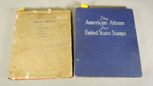
Two Stamp Albums: "United States of America" & World Stamp CollectionNeo FineArts Inc4.4(12)See Sold PriceFeb 25, 2024
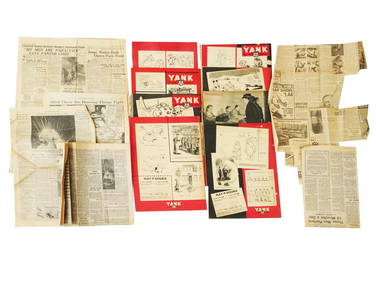
WWII AMERICAN NEWSPAPERS AND YANK MAGAZINE ISSUESAntique Arena Inc.4.5(852)See Sold PriceFeb 24, 2024
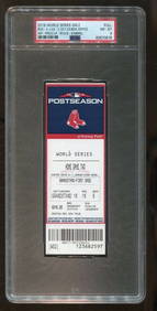
2018 World Series Game 2 Full Ticket 10/24 Dodgers v Red Sox PSA 8Mynt Auctions4.6(680)See Sold PriceFeb 26, 2024
1905 20th Century Atlas of Boone County IllinoisMatthew Bullock Auctioneers4.7(1.8k)See Sold PriceFeb 24, 2024
Carey, pub. 1796 - A Chart of the West IndiesTrillium Antique Prints & Rare Books4.5(30)See Sold PriceFeb 24, 2024
Carey, pub. 1796 - Map of the State of MarylandTrillium Antique Prints & Rare Books4.5(30)See Sold PriceFeb 24, 2024
Carey, pub. 1796 - Map of GeorgiaTrillium Antique Prints & Rare Books4.5(30)See Sold PriceFeb 24, 2024
Carey, pub. 1796 - Map of The State of South CarolinaTrillium Antique Prints & Rare Books4.5(30)See Sold PriceFeb 24, 2024
Carey, pub. 1796 - Map of KentuckyTrillium Antique Prints & Rare Books4.5(30)See Sold PriceFeb 24, 2024
Carey, pub. 1796 - Map of the Tennassee State formerly part of North Carolina (Tennessee)Trillium Antique Prints & Rare Books4.5(30)See Sold PriceFeb 24, 2024
Map of United States of North America, 1785Antiques Online Auctions4.6(407)See Sold PriceMar 14, 2024
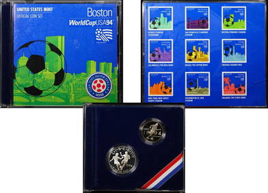
1994 United States Mint Official Coin Set Boston World Cup Commerative 2 Coin SetKey Date Coins4.2(1.2k)See Sold PriceFeb 25, 2024
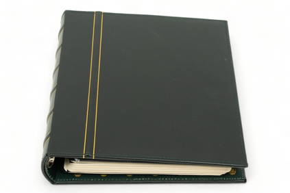
Stamp Collection Album, United States & World Stamps, H 11.75" W 2.25" Depth 10.75"DuMouchelles4.6(825)See Sold PriceMar 14, 2024
Goddess Relief / Statue Carved in Logs - Set of 2King's Auctions Inc4.2(121)See Sold PriceDec 29, 2024
Wooden Head Rest Carved in the Shape of a Dog - Ivory CoastKing's Auctions Inc4.2(121)See Sold PriceDec 29, 2024