ATLAS of ANTIENT GEOGRAPHY by SAMUEL BUTLER 1843John McInnis Auctioneers,LLC4.5(494)See Sold PriceFeb 24, 2024
18TH C. ANTIQUE MAP: FRENCH & INDIAN WAR, FRAMEDThomaston Place Auction Galleries4.4(386)See Sold PriceFeb 24, 2024
Rand McNally Railroad Map Cabinet w/ 21 Railroad MapsRail & Road Auctions4.6(165)See Sold PriceMar 08, 2024
Keith Haring - Ink on New York Map, Best Buddies, Inscribed, Signed, and DatedSapphire Auction Gallery3.9(67)See Sold PriceMar 02, 2024
LATE 17TH C. FRENCH MAP OF THE NEW WORLD BY ALEXIS-HUBERT JAILLOT (1632-1712)Thomaston Place Auction Galleries4.4(386)See Sold PriceFeb 24, 2024
Central Railroad of New Jersey Map of Sandy Hook Route-ca. 1903JM Hobby Supply and Railroad Artifact Auctions4.4(126)See Sold PriceFeb 24, 2024
Lot of Six Mixed Atlas Box Cars-HO Scale-New in BoxJM Hobby Supply and Railroad Artifact Auctions4.4(126)See Sold PriceFeb 25, 2024
Rand McNally/Santa Fe Railroad Map of Iowa-1912JM Hobby Supply and Railroad Artifact Auctions4.4(126)See Sold PriceFeb 24, 2024
NICOLAES VISSCHER (NETHERLANDS, 1618-1709) MAP OF THE NEW WORLDThomaston Place Auction Galleries4.4(386)See Sold PriceFeb 24, 2024
17TH C. WORLD MAP BY NICOLAES VISSCHER (NETHERLANDS, 1618-1709)Thomaston Place Auction Galleries4.4(386)See Sold PriceFeb 24, 2024
Lot of Six Mixed Atlas Cabooses-HO Scale-New in BoxJM Hobby Supply and Railroad Artifact Auctions4.4(126)See Sold PriceFeb 25, 2024
SoldHerman Moll Map of Africa ca. 1720Herman Moll (ca. 1654-1732). Map of Africa, London, ca. 1720. With an elaborate dedication cartouche reading "To the right honourable Charles, Earl of Peterborow and Monmouth, etc this map of Africa aSee Sold Price
SoldA Map of the North Pole,Herman Moll, A Map of the North Pole, engraving (hand colored), ca. 1720 , 8.5 x 11 8.5 x 11See Sold Price
SoldMoll. A Map of Guinea, Loango &c.[Africa]. H. [Herman] Moll. A Map Of Guijnea, Loango &c. [Ca. 1730]. 7” x 10 1/8”. Inset: “A Map of ye Si[tuition] of the British [Facto]ry at Sherbro &c.”See Sold Price
SoldMOLL - Map of Europe ... ; Map of Africa ...MAPS. - MOLL, Herman. Map of Europe ... ; Map of Africa ...London: printed for H. Moll, D. Midwinter, T. Bowles and P. Overton, "1708"- [n.d., but both published circa 1720]. 2 engraved maps (See Sold Price
Lot of 3 Maps of Plans of Fort St. George at MadrasA Plan of Fort St. George and the City of Madras Labeled “V.I.” in upper left corner; “P 274” in upper right corner , ca. 1720 Herman Moll 20 cm x 19 cm Watermarked paper (flowSee Sold Price
SoldTartary. Great Tartary, The Isle of Japon.,Herman Moll, Tartary. Great Tartary, The Isle of Japon., engraving (hand colored), ca. 1720 , 7.5 x 7 7.5 x 7See Sold Price
SoldHerman Moll, Five Maps of Africa and the Middle EastHeading: Author: Moll, Herman Title: Five maps of Africa and the Middle East Place Published: London Publisher:Printed for Tim. Childe Date Published: 1701 Description: FivSee Sold Price
Herman Moll, Five Maps of Africa and the Middle EastHeading: Author: Moll, Herman Title: Five maps of Africa and the Middle East Place Published: London Publisher:Printed for Tim. Childe Date Published: 1701 Description: FivSee Sold Price
SoldA Plan of Fort St. George and the City of Madras[Labeled “V.I.” in upper left corner; “P 274” in upper right corner], [ca. 1720][Herman Moll]20 cm x 19 cm Watermarked paper (flower with leaf at the end of a second stem). ModSee Sold Price
SoldGrp: Maps of AsiaGroup of eighteen maps of Asia, including two maps of Sumatra; one map of Java; one Herman Moll (ca. 1654-1732) map of the Eurasian steppes; one map of China, Korea, and Japan; one map of Sulawesi (CeSee Sold Price
SoldGrp: 13 Maps from Herman Moll Atlas MinorGroup of twelve maps from Herman Moll's (ca. 1654-1732) "Atlas Minor," together with the colophon from the book. Includes maps of Hungary and Transylvania, Poland, Russia ("the Dominion of Muscovy"),See Sold Price
SoldHerman Moll Map Virginia and Maryland 1741Herman Moll (ca. 1654-1732), "A New Map of Virginia and Maryland," London, 1741. Hand colored engraved map of the Chesapeake Bay region, showing what is now Virginia, Maryland, Delaware, and parts ofSee Sold Price
SoldMap, engraved, Scotland, hand-colored, 1720Map, engraved, Scotland, hand-colored, 1720 Title: Map of Scotland Artist: Herman Moll Publisher: Hermom Moll Engraver: Hermon Moll Description: Hand colored map by Herman Moll,17 the century. Date: 1See Sold Price
SoldFAFR Moll (Herman) Congo. Angola. Cafres. MonoemugFAFR Moll (Herman) Congo. Angola. Cafres. Monoemugi.map of Africa from south of the Equator, including Madagascar, hand-coloured engraving, 170 x 200mm., central vertical fold, minor spotting,See Sold Price
SoldAfrica: With all the European Settlements, and...Africa: With all the European Settlements, and Federal Remarks. Herman Moll. engraved map with original hand-color in full. London: H. Moll, 1719. 25 x 40 1/4 inches, 29 3/4 x 43 1/4 inches framed. FaSee Sold Price
Moll Map of AfricaMoll, Herman (1654-1732). To the Right Honourable Charles Earl of Peterborow, and Monmouth, &c, This Map of Africa... Engraving with hand color in full. London, 1716 or later. 25" x 39" sheet, 29 3/4"See Sold Price
Moll map of Africa c.1740Title: Africa, According to ye Newest and Most Exact Observations Author: Moll, Herman Description: Copper-engraved map. 18x25 cm. (7x10"). Heading: zzhPlace Published: London Publisher: Date PubliSee Sold Price
HERMAN MOLL (British 1654-1732) FIVE ENGRAVED MAPS FROMHERMAN MOLL (British 1654-1732) FIVE ENGRAVED MAPS FROM THOMAS SALMON'S "Modern History," London, 1744, comprising hand colored copper engraved maps titled "Africa," "Lybia," "Aegyptus," "Graecorum,"See Sold Price
SoldMoll Map of Independent Tartary China ca. 1717Herman Moll (ca. 1654-1732), "A Map of Independent Tartary Containing the Territories of Usbeck, Gasgar, Tibet, Lassa," London, ca. 1711-1717. This early hand colored engraving map depicts the regionSee Sold Price
SoldGrp: 5 Maps of Germany Europe and the MediterraneGroup of five 18th century maps. This group includes a hand colored map of Germany by Herman Moll (ca. 1654-1732); one map of the Turkish empire by Tobias Conrad Lotter (1717-1777); one map of the BriSee Sold Price
SoldMoll: Antique Map of Newfound Land, 1720Map: New Map of Newfound Land, Publication Date: 1720 ca. Cartographer: MOLL, H. Size: Octavo – 7.00 H x 10.10 W Inches New Scotland the isles of Breton, Anticoste, St. Iohns & c. Together with theSee Sold Price
SoldMoll (Herman) Composite atlasMoll (Herman) Composite atlas,comprising 30 large, mostly double-page maps, the majority by Moll, including A Map of the East Indies, Map of North America, Map of Africa, Map of Moscovy, PolanSee Sold Price
SoldMoll: Antique Map of Africa, 1746Title/Content of Map: Africa by Moll Date Printed: 1746 Cartographer: Thomas Salmom & Herman Moll Material/Medium: Paper Size: 14 1/2" x 9 1/2" Copperplate engraved. Published in London in the 'presenSee Sold Price
SoldMap, Herman MollHerman Moll (British, c. 1654-1732), "To the Right Honorable William Lord Cowper... This Map of Asia," circa 1720, hand-colored engraving, image (sight): 24.5"h x 43"w, overall (with mat/unframed): 30See Sold Price
[MOTORCYCLES]. Two Photo Albums of Snapshots of a South Afr...Potter & Potter Auctions4.6(538)See Sold PriceMar 07, 2024
Chatelain - Map of the Americas and Details and Insets of Government CounselsTrillium Antique Prints & Rare Books4.5(28)See Sold PriceFeb 24, 2024
Chatelain - 3 Maps of the British Isles (England, Ireland, Scotland)Trillium Antique Prints & Rare Books4.5(28)See Sold PriceFeb 24, 2024
Carey, pub. 1796 - A Chart of the West IndiesTrillium Antique Prints & Rare Books4.5(28)See Sold PriceFeb 24, 2024
Carey, pub. 1796 - Map of the State of MarylandTrillium Antique Prints & Rare Books4.5(28)See Sold PriceFeb 24, 2024
Carey, pub. 1796 - Map of GeorgiaTrillium Antique Prints & Rare Books4.5(28)See Sold PriceFeb 24, 2024
Carey, pub. 1796 - Map of The State of South CarolinaTrillium Antique Prints & Rare Books4.5(28)See Sold PriceFeb 24, 2024
Carey, pub. 1796 - Map of KentuckyTrillium Antique Prints & Rare Books4.5(28)See Sold PriceFeb 24, 2024
Carey, pub. 1796 - Map of the Tennassee State formerly part of North Carolina (Tennessee)Trillium Antique Prints & Rare Books4.5(28)See Sold PriceFeb 24, 2024
De Jode, Rare, pub. 1593 - Map of Africa (Africae Vera Forma, et Situs)Trillium Antique Prints & Rare Books4.5(28)See Sold PriceFeb 24, 2024
Pre-colonial Africa. Mountains of Kong/Moon. Caravan routes. THOMSON 1817 mapJasper524.5(9.7k)See Sold PriceFeb 28, 2024
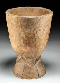
Large 20th C. Liberian Wood Mortar - ex-Arte PrimitivoArtemis Gallery4.8(1.3k)See Sold PriceFeb 26, 2024
Herman Moll A New Map of Ye North Parts of AmericaWillow Auction House4.5(280)See Sold PriceMar 14, 2024


![[MOTORCYCLES]. Two Photo Albums of Snapshots of a South Afr... (1 of 6)](https://p1.liveauctioneers.com/928/318880/171361283_1_x.jpg?height=282&quality=70&version=1707501302)


![Vintage Airplane Desk Model [Air France] (1 of 7)](https://p1.liveauctioneers.com/5755/320282/172113951_1_x.jpg?height=282&quality=70&version=1708463029)


