SoldAN 1836 CORRECT MAP OF TEXAS with alphabetical refAN 1836 CORRECT MAP OF TEXAS with alphabetical references to the prominent points of interest which have grown out of the present contest with Mexico. 6" x 9"See Sold Price
SoldAN ANTIQUE PROMOTIONAL MAP, "Correct Map of Texas,"AN ANTIQUE PROMOTIONAL MAP, "Correct Map of Texas," DECEMBER 28, 1876-1880, newsprint on paper with hand coloring, advertising, "Homes in Texas! The Farmer, Mechanic, Merchant and Laborer should locatSee Sold Price
SoldStephen F. Austin (1793-1836), Map of Texas with Parts of Adjoining StatesStephen F. Austin (1793-1836), Map of Texas with Parts of Adjoining States, published 1836, published by H.S. Tanner (Philadelphia), engraved by John and William W. Warr, (Philadelphia), limited editiSee Sold Price
SoldCASE XX TEXAS SPECIAL ENGRAVED BLADE KNIFE 4165Case XX Texas Special knife, blade engraved with longhorn, Texas map, 1836 (independence), tang marked CASE XX STAINLESS USA, SN 1472, other side of tang marked 4165-SSP, never sharpenedSee Sold Price
SoldTexas Centennial Map of Texas 1836 - 1986Ex-Large Texas Centennial Map of Texas 1836 - 1986 | Framed Measures 44 x 48See Sold Price
Sold[MAP]. AUSTIN, Stephen F. Map of Texas.... 1836240. [MAP]. AUSTIN, Stephen F. Map of Texas with Parts of the Adjoining States... Philadelphia: H.S. Tanner 1836. Copper-engraved map on bank note paper, original color, neat line to neat line: 74.9 xSee Sold Price
SoldEdward's Texas with important map 1836Heading: Author: Edward, David B Title: The History of Texas, or the Emigrant's, Farmer's and Politician's Guide to the Character, Climate, Soil and Productions of that Country: Geographically ArrangSee Sold Price
Sold(2) FRAMED REPRODUCTION TEXAS REVOLUTION MAPS(lot of 2) Framed reproduction maps of Texas, late 20th c., comprising: (1) Texas 1836 Revolutionary map, depicting battle sites; (1) Texas Republic 1845 map; each sight: 30"h, 24"w, overall: 40"h, 33See Sold Price
Sold1836 Young-Mitchell Emigration Pocket Map of TXHighly Influential 1836 Young-Mitchell Emigration Pocket Map of Texas 374. [MAP]. YOUNG, J[ames] H[amilton]. A New Map oSee Sold Price
SoldScarce 1836 Texas History Retaining Map of GrantsEdward, David B. The History of Texas; or, The Emigrant's, Farmer's, and Politician's Guide to the Character, Climate, Soil and Productions of that Country: Geographically Arranged From Personal ObserSee Sold Price
Linen-backed Sea Chart of the Texas Coast in 1836Linen-backed Sea Chart of the Texas Coast in 1836 305. [MAP]. [GULF OF MEXICO]. SPAIN. DEPÓSITO HIDROGRÁFICOSee Sold Price
SoldLaurie and Whittle Map of British ColoniesLAURIE, Robert (1755-1836) & WHITTLE, James (1757-1818). New and Correct Map of the British Colonies in North America with the Adjacent States of New England, Vermont, New York, Pennsylvania and New JSee Sold Price
SoldHenry Schenck Tanner (1786-1858), 1836 MapHenry Schenck Tanner (1786-1858), 1836 map of North America, framed frame: 21.5 x 18" Provenance: A Dallas, TX Estate Henry Schenck Tanner was active/lived in Pennsylvania, New York. Henry TanneSee Sold Price
West India Islands, Florida, Texas & Central AmericaBowen, Emanuel (1694–1767). New and Correct Map of North America... Engraved map. Robert Sayer, c. 1763. 20 x 45 ½" sheet. "...divided according to the last treaty of peace at Paris 10th FebSee Sold Price
SoldLARGE FRAMED TEXAS SESQUICENTENNIAL MAP1836-1986Framed map under plexiglass, Texas Sesquicentennial, 1836-1986, a depiction of The Republic of Texas c. 1836, sight: 50"h, 41"w, overall: 53.25"h, 44.25"w, 17.5lbs Start Price: $200.00See Sold Price
SoldAN ANTIQUE EARLY REPUBLIC OF TEXAS MAP, "New Map ofAN ANTIQUE EARLY REPUBLIC OF TEXAS MAP, "New Map of Texas with the Contiguous American & Mexican States," PHILADELPHIA, 1836, hand-colored lithograph on paper, first edition-second issue, engraved bySee Sold Price
SoldColored map of Texas as RepublicTitle: Texas. In 1836 Author: Kemble, W., engraver Description: Engraved map, hand-colored. 21x24 cm. (8½x9½").Map of Texas as a Republic with an uncertain western boundary that is similar to BradfoSee Sold Price
SoldSamuel Augustus Mitchell. New Map of Texas withSamuel Augustus Mitchell. New Map of Texas with the Contiguous American & Mexican States, 1836 by J. H. Young. Philadelphia: S. Augustus Mitchell, 1836. Brightly colored engraved map, 15.5" x 13".See Sold Price
SoldStephen F. Austin 1830 Map of TexasMap of Texas with Parts of Adjoining States Compiled by Stephen F. Austin. Stephen F. Austin (1793-1836). Engraved Map with original hand color. Philadelphia, 1830. First Edition. 28 3/4 x 23 inches sSee Sold Price
SoldJames Hamilton YoungThe First Year of Texas as a Republic , A New Map of Texas, with Contiguous American and Mexican States 12 3/4 x 15 1/4 " Phil.: Samuel Augustus Mitchell, 1836. RESERVE.See Sold Price
SoldREPUBLIC OF TEXAS ENGRAVED MAP CONTAINING THE LATEREPUBLIC OF TEXAS ENGRAVED MAP CONTAINING THE LATE GRANTS & DISCOVERIES BY E.F. LEE, 1836, published in Cincinnati. David Edwards authored the book The History of Texas from which this map is taken. HSee Sold Price
Sold[MAP]. KEMBLE, W. (engraver). Texas in 1836643. [MAP]. KEMBLE, W. (engraver). Texas in 1836. [below neat line] Harper & Brothers, New York. Engd. by W. Kemble, N.Y. [New York, ca. 1846-1848]. Neat line to neat line:See Sold Price
Untitled. [Jefferson, Texas]Map: Untitled. [Jefferson, Texas] Date: 1873 Cartographer: HENSEY, HUGH/O.F.L. SMITH Size (inches): 13.5x7.5 Autograph note on reverse: "I hereby certify that the annexed map is a correct tracing andSee Sold Price
Texas Company Adlake Non-Sweating Semaphore LampJM Hobby Supply and Railroad Artifact Auctions4.4(127)See Sold PriceFeb 24, 2024
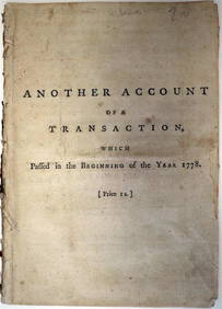
EARL of CHATHAM Scandal Sheet Debate Book c1778 by Dr AddingtonLuis Porretta Fine Arts4.3(10)See Sold PriceMar 02, 2024
17TH C. WORLD MAP BY NICOLAES VISSCHER (NETHERLANDS, 1618-1709)Thomaston Place Auction Galleries4.4(393)See Sold PriceFeb 24, 2024
Portfolio of 15 County Maps by Robert Morden (English 1650-1703)Nadeau's Auction Gallery4.7(409)See Sold PriceFeb 24, 2024
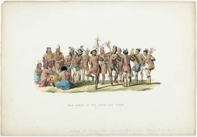
Vaillant - Hawaii: Stranding in the Sandwich Islands (Echouage aux Iles Sandwich). 43Trillium Antique Prints & Rare Books4.5(32)See Sold PriceFeb 24, 2024
Vaillant - Kealakekua Bay, Hawaii (Village de Kearakekoua, Iles Sandwich). 44Trillium Antique Prints & Rare Books4.5(32)See Sold PriceFeb 24, 2024
Vaillant - Honolulu, Hawaii (Vue de Honolulu, Iles Sandwich). 45Trillium Antique Prints & Rare Books4.5(32)See Sold PriceFeb 24, 2024
Vaillant - Hawaiian Dance (Scene de Danse aux Iles Sandwich). 42Trillium Antique Prints & Rare Books4.5(32)See Sold PriceFeb 24, 2024
AMERICAN FOLK JAMES BOWIE KNIFE PORTRAIT OIL PAINTINGAntique Arena Inc.4.5(878)See Sold PriceMar 02, 2024
New and Correct Map of North America With the West India Islands,Jasper524.5(9.9k)See Sold PriceFeb 27, 2024


![[MAP]. AUSTIN, Stephen F. Map of Texas.... 1836 (1 of 8)](https://p1.liveauctioneers.com/514/38480/16487084_1_x.jpg?height=282&quality=70&version=1363614971)


![[MAP]. KEMBLE, W. (engraver). Texas in 1836 (1 of 4)](https://p1.liveauctioneers.com/514/20078/6912995_1_x.jpg?height=282&quality=70)


![Untitled. [Jefferson, Texas] (1 of 3)](https://p1.liveauctioneers.com/5584/128081/65160646_1_x.jpg?height=282&quality=70&version=1537916495)