ATLAS of ANTIENT GEOGRAPHY by SAMUEL BUTLER 1843John McInnis Auctioneers,LLC4.5(505)See Sold PriceFeb 24, 2024
18TH C. ANTIQUE MAP: FRENCH & INDIAN WAR, FRAMEDThomaston Place Auction Galleries4.4(393)See Sold PriceFeb 24, 2024
Rand McNally Railroad Map Cabinet w/ 21 Railroad MapsRail & Road Auctions4.6(165)See Sold PriceMar 08, 2024
Keith Haring - Ink on New York Map, Best Buddies, Inscribed, Signed, and DatedSapphire Auction Gallery4(67)See Sold PriceMar 02, 2024
LATE 17TH C. FRENCH MAP OF THE NEW WORLD BY ALEXIS-HUBERT JAILLOT (1632-1712)Thomaston Place Auction Galleries4.4(393)See Sold PriceFeb 24, 2024
Central Railroad of New Jersey Map of Sandy Hook Route-ca. 1903JM Hobby Supply and Railroad Artifact Auctions4.4(127)See Sold PriceFeb 24, 2024
Lot of Six Mixed Atlas Box Cars-HO Scale-New in BoxJM Hobby Supply and Railroad Artifact Auctions4.4(127)See Sold PriceFeb 25, 2024
Rand McNally/Santa Fe Railroad Map of Iowa-1912JM Hobby Supply and Railroad Artifact Auctions4.4(127)See Sold PriceFeb 24, 2024
NICOLAES VISSCHER (NETHERLANDS, 1618-1709) MAP OF THE NEW WORLDThomaston Place Auction Galleries4.4(393)See Sold PriceFeb 24, 2024
17TH C. WORLD MAP BY NICOLAES VISSCHER (NETHERLANDS, 1618-1709)Thomaston Place Auction Galleries4.4(393)See Sold PriceFeb 24, 2024
Lot of Six Mixed Atlas Cabooses-HO Scale-New in BoxJM Hobby Supply and Railroad Artifact Auctions4.4(127)See Sold PriceFeb 25, 2024
SoldEarly European Map Views (10)Sebastian de Pontault, Knight of Beaulieu (1612? -1674). Plans and profiles of European cities. Engravings. Paris, late 17th Century. . 18 1/4" x 12".See Sold Price
Very early view of Pensacola, Florida from 1767Title/Content of Map: Very early view of Pensacola, Florida from 1767 Date Printed: 1767 Cartographer: Tirion, Isaac Size (in): 10 x 6 Antique elevation view of Pensacola, Florida on the Florida PanhaSee Sold Price
SoldChez Pierre Vander, "Nouvelle France," MapChez Pierre Vander, "Nouvelle France," hand colored early map of Canada, matted and framed, 10" h x 15" w (view), 15 1/2" h x 20" w (frame). Provenance: From a Massachusetts estate.See Sold Price
Chez Pierre Vander, "Nouvelle France," MapChez Pierre Vander, "Nouvelle France," hand colored early map of Canada, matted and framed, 10" h x 15" w (view), 15 1/2" h x 20" w (frame). Provenance: From a Massachusetts estate.See Sold Price
De Fer: Antique Map View of Constantinople, IstanbulTitle: 'Veue de Constantinopole [View of Istanbul]' Date Printed: 1705 Image Size: Approx 11.5 x 21.0cm, 4.5 x 8.25 inches (Small) Type: Early 18th century copperplate print Condition: Good; suitableSee Sold Price
SoldNicolas Bellin Circa 1750 early mapPanorama view by cartographer Jacques Nicolas Bellin  Chau Ceu Fu, Fuzhou. Circa 1750. 10" x 14" Jacques Nicolas Bellin was a French hydrographer, geographer, and member of the French intellSee Sold Price
Moreau: Antique Map, View of Place de la Concorde, 1780Title/Content of Map: 1780 Moreau View of Place de la Concorde in Paris -- Vue de la Place Neuve a Paris [... de Louis XV le Bien Aimé] Date Printed: 1780 c. Cartographer: J Moreau Size: 10.8 x 15.5See Sold Price
Map of Views of the North West Coast of America, 1798Map: Views of the North West Coast of America explored by the Boussole & Astrolabe in 1786 (1st, 2nd and 3rd Sheets) Maker: G Robinson (pub.) / J La Perouse Date: 1798 Origin: London Size: 10.7 x 16.8See Sold Price
SoldMallet: Antique Map, City View of Amsterdam, 1683Title: 'Amsterdam' Decorative view of the city. Many ships. Netherlands. Date Printed: 1683 Image Size: Approx Overall page size 13 x 21cm approximately (5 x 8 inches); image size 10.5 x 14.5cm approxSee Sold Price
SoldAntique Map, Paris View from 1815Title/Content of Map: Paris view from 1815 Date Printed: 1815 Cartographer: Unknown Material/Medium: Paper Size: 10 1/2" x 8 1/3" Published in London Please note that this lot has a confidential reserSee Sold Price
Mallet: Antique Map, City View of Paris, 1683Title: 'Paris' Decorative view of the city of Paris. Date Printed: 1683 Image Size: Approx Overall page size 13 x 21cm approximately (5 x 8 inches); image size 10.5 x 14.5cm approximately (4 x 5.5 incSee Sold Price
Mawman: Antique Map of Greece, Boeotia, 1791Map: Greece: Boeotia Date: 1791 Maker: J. Mawman Medium: Original copper engraving Size: 10 1/4" x 15 1/4" From the 1791 "Maps, Plans, Views, and Coins Illustrative of the Travels of Anacharsis the YoSee Sold Price
SoldCounty Cork Antique Ireland Map, Creighton & Dower 1846County Cork Antique Map For Lewis By Creighton & Dower. Ireland 1846 Approx 21.0 x 26.5cm, 8.25 x 10.25 inches Cork' The top image on the right hand side shows the entire map. To view a close up of thSee Sold Price
1587 Birds Eye View of Ghent -- [Untitled] Gent1587 Birds Eye View of Ghent -- [Untitled] Gent 1587 c. Anonymous 8.3 x 10.6 in. A very nice and detailed birds' eye view map of the market city of Ghent (Gent), Netherlands, at the confluence of ScheSee Sold Price
SoldTwelve Views of European CitiesTwelve Views of European Cities, 12 hand-colored engravings, late 18th/early 19th c., 10 of English locations, 2 of Italian locations, published by Bowles and Carver, London, sights 9 1/2 in. x 16 3/8See Sold Price
A View of the Principal Features of Western HemisphereMap: A Comparative View of the Principal Waterfalls, Islands, Lakes, Rivers and Mountains, in the Western Hemisphere Cartographer: J. Tallis Publishing: London, 1850 Medium: Engraving Size: 13 x 10 inSee Sold Price
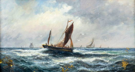
SoldTwo 19th C. Italian Seascape Paintings, OilTwo 19th century Italian seascape paintings, oil on canvas, 7 1/2" h x 10" w (view), in early gilt frame, 14" h x 17" w (frame). Provenance: The Estate of Former U.S. Ambassador Edmund Asbury Gullion.See Sold Price
Moreau: Antique View of Place de la Concorde Paris 1780Title/Content of Map: 1780 Moreau View of Place de la Concorde in Paris -- Vue de la Place Neuve a Paris [... de Louis XV le Bien Aimé] Date Printed: 1780 c. Cartographer: J Moreau Size: 10.8 x 15.See Sold Price
Sold(600-800) U.S. and European PostcardsExcellent lot of approx. (600-800) U.S. and European postcards, all early 20th c. cards. About 30% U.S. Many early views of large towns, several good small towns, some greetings, etc. Many good $1-10See Sold Price
Sold18th/19th C. Italian School, Mary & JesusLate 18th-early 19th century Italian school painting, Mary and Jesus, mixed media on cloth/overlay gouache, 13 1/2" h x 10 3/4" w (view), 16 1/2" h x 13 1/2" w (frame). Provenance: From a Florida estaSee Sold Price
Sold1600s View of Mexico Hand Colored Map PrintNot sure when this was printed, but probably 18th or early 19th century. It has been in its current for about 100 years. Image size is 9 x 10.5, but is larger with border. Framed to 12.75 x 14.75. ImaSee Sold Price
Early 20th C. French, Seated Figures, PencilEarly 20th century French framed drawing of three seated people and one standing, pencil drawing, signed on red hat lower right "Jules Pascin," 10" h x 13" w (view), 17 1/2" h x 20" w (frame). ProvenaSee Sold Price
1610 Saxton/Camden Map of Hundigtonshire UK --1610 Saxton/Camden Map of Hundigtonshire UK -- Huntingdon Comitatus qui Pars suir Icenorum 1610, London C Saxton / W Camden 13.2 x 10.8 in. An early map of the county of Huntingdon and based upon ChriSee Sold Price
SoldHansel & Gretel PortraitPortrait of Hansel and Gretel, inscribed "Zegal Chicago," circa early 20th century, 9" high x 7" wide (view), 15 1/2" high x 10 1/2" wide (frame). Provenance: from the personal collection of Larry andSee Sold Price
Jake Lee (CA,1915-1991) watercolor painting 2-sidedBroward Auction Gallery4.7(292)See Sold PriceMar 17, 2024
Corinthian Miniature Terracotta Skyphos CollectionTimeLine Auctions Ltd.4.6(183)See Sold PriceMar 05, 2024
China - Pair of carved cork port paintings with harbour views, early 20th century.GOLDFIELD AUCTION4.3(32)See Sold PriceMar 02, 2024
POSSIBLY THEODORE GERICAULT (1791-1824) "SKETCH WITH FIGURES".Amelia Jeffers, Auctioneers & Appraisers4.5(120)See Sold PriceMar 07, 2024
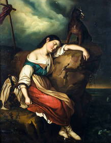
POSSIBLY GEORGE MORLAND (1763-1804) "EUROPEAN LANDSCAPE".Amelia Jeffers, Auctioneers & Appraisers4.5(120)See Sold PriceMar 07, 2024
CARL LARSSON (1853-1919) "CITY STREET SCENE".Amelia Jeffers, Auctioneers & Appraisers4.5(120)See Sold PriceMar 07, 2024
ABEL GEORGE (BUCK) WARSHAWSKY (1883-1962) "VILLAGE LANDSCAPE".Amelia Jeffers, Auctioneers & Appraisers4.5(120)See Sold PriceMar 07, 2024
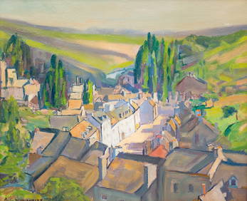
BROR JULIUS OLSSON NORDFELDT (1878-1955) "PORTRAIT OF A HOUSE".Amelia Jeffers, Auctioneers & Appraisers4.5(120)See Sold PriceMar 07, 2024
SYLVESTER MARTIN (1856-1906) "HUNT SCENE".Amelia Jeffers, Auctioneers & Appraisers4.5(120)See Sold PriceMar 07, 2024
1709 GREEK BIBLE ILLUSTRATED w/ MAPS antique VELLUM BOUND Septuagint editionJasper524.5(9.9k)See Sold PriceFeb 27, 2024
EARLY MEDIEVAL EUROPEAN RING, 9TH-11TH CENTURY AD SIZE 10 ½Jasper524.5(9.9k)See Sold PriceFeb 28, 2024
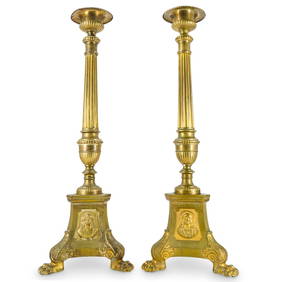
Pair Antique European Spanish Colonial Style Bronze Altar CandlesticksAkiba Galleries4.7(1.8k)See Sold PriceFeb 29, 2024
INDIA WITHIN THE GANGES SUSAN GOLE ILLUSTRATED MAPS EARLY CARTOGRAPHYJasper524.5(9.9k)See Sold PriceFeb 27, 2024
European Views 1847 Lot of 6 Steel Engravings by PayneAlbion Auctions4.6(341)See Sold PriceMar 07, 2024
European Views 1847 Lot of 6 Steel Engravings by PayneAlbion Auctions4.6(341)See Sold PriceMar 07, 2024
Graceful Playing Greyhounds Bronze SculptureWeatherham Estate Treasures3.9(159)See Sold PriceMar 21, 2024
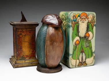
THREE VINTAGE BISCUIT TINS.Amelia Jeffers, Auctioneers & Appraisers4.5(120)See Sold PriceMar 09, 2024


![1587 Birds Eye View of Ghent -- [Untitled] Gent (1 of 1)](https://p1.liveauctioneers.com/5584/115198/59163928_1_x.jpg?height=282&quality=70&version=1516150533)