ATLAS of ANTIENT GEOGRAPHY by SAMUEL BUTLER 1843John McInnis Auctioneers,LLC4.6(502)See Sold PriceFeb 24, 2024
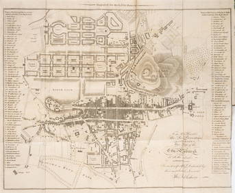
18TH C. ANTIQUE MAP: FRENCH & INDIAN WAR, FRAMEDThomaston Place Auction Galleries4.4(386)See Sold PriceFeb 24, 2024
Rand McNally Railroad Map Cabinet w/ 21 Railroad MapsRail & Road Auctions4.6(165)See Sold PriceMar 08, 2024
Keith Haring - Ink on New York Map, Best Buddies, Inscribed, Signed, and DatedSapphire Auction Gallery4(67)See Sold PriceMar 02, 2024
LATE 17TH C. FRENCH MAP OF THE NEW WORLD BY ALEXIS-HUBERT JAILLOT (1632-1712)Thomaston Place Auction Galleries4.4(386)See Sold PriceFeb 24, 2024
Central Railroad of New Jersey Map of Sandy Hook Route-ca. 1903JM Hobby Supply and Railroad Artifact Auctions4.4(126)See Sold PriceFeb 24, 2024
Lot of Six Mixed Atlas Box Cars-HO Scale-New in BoxJM Hobby Supply and Railroad Artifact Auctions4.4(126)See Sold PriceFeb 25, 2024
Rand McNally/Santa Fe Railroad Map of Iowa-1912JM Hobby Supply and Railroad Artifact Auctions4.4(126)See Sold PriceFeb 24, 2024
NICOLAES VISSCHER (NETHERLANDS, 1618-1709) MAP OF THE NEW WORLDThomaston Place Auction Galleries4.4(386)See Sold PriceFeb 24, 2024
17TH C. WORLD MAP BY NICOLAES VISSCHER (NETHERLANDS, 1618-1709)Thomaston Place Auction Galleries4.4(386)See Sold PriceFeb 24, 2024
Lot of Six Mixed Atlas Cabooses-HO Scale-New in BoxJM Hobby Supply and Railroad Artifact Auctions4.4(126)See Sold PriceFeb 25, 2024
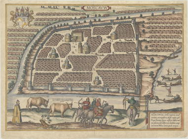
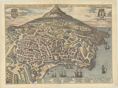
Pectoral map and city viewLondon: John Tallis & Co., 1854. Maps. Steel engraved map from the famous Victorian publisher John Tallis, well-known for the attractive vignette views surrounding the maps, which illustrate the peoplSee Sold Price
Chereau: Antique Map, City View of Florence, 1750Title: Florence. Florence Ville d'Italie, capitale de Toscane. . .Extremely rare and lovely mid-18th century town-view of Florence Map maker: Jacques Chereau, P. A. Aveline Place and Year: Paris, c. 1See Sold Price
SoldMallet: Antique Map, City View of Cuzco, Peru, 1683Title: 'Cusco' Decorative view of the city of Cuzco, Peru. Date Printed: 1683 Image Size: Approx Overall page size 13 x 21cm approximately (5 x 8 inches); image size 10.5 x 14.5cm approximately (4 x 5See Sold Price
SoldMallet: Antique Map, City View of Jerusalem, 1683Title: 'Ierusalem Moderne' Shows Muslims praying and many mosques. View of the city. Date Printed: 1683 Image Size: Approx Overall page size 13 x 21cm approximately (5 x 8 inches); image size 10.5 x 1See Sold Price
SoldMallet: Antique Map, City View of Amsterdam, 1683Title: 'Amsterdam' Decorative view of the city. Many ships. Netherlands. Date Printed: 1683 Image Size: Approx Overall page size 13 x 21cm approximately (5 x 8 inches); image size 10.5 x 14.5cm approxSee Sold Price
Mallet: Antique Map, City View of Paris, 1683Title: 'Paris' Decorative view of the city of Paris. Date Printed: 1683 Image Size: Approx Overall page size 13 x 21cm approximately (5 x 8 inches); image size 10.5 x 14.5cm approximately (4 x 5.5 incSee Sold Price
Mallet: Antique Map, City View of Tokyo, 1683Title: 'Iedo' TOKYO. View of the city of Yedo (Tokyo). Japan Date Printed: 1683 Image Size: Approx Overall page size 13 x 21cm approximately (5 x 8 inches); image size 10.5 x 14.5cm approximately (4 xSee Sold Price
Mallet: Antique Map, City View of Kyoto, 1683Title: 'Miaco' KYOTO. View of the city of Miyako (Kyoto) . Japan. Date Printed: 1683 Image Size: Approx Overall page size 13 x 21cm approximately (5 x 8 inches); image size 10.5 x 14.5cm approximatelySee Sold Price
SoldGeorge Braun and Frans Hogenberg etchingGeorge Braun (German 1541-1622) and Frans Hogenberg (Flemish 1535-1590)- Map City View - Rome- etching in color, paper loss in upper left and lower left corners, fold down center, minor creases. 15 xSee Sold Price
Sold2 Paris Map/City Views - Color Prints2 Paris Map/City Views, color printsDimensions: Frames 16 1/4" x 24 1/4" and 19 1/2" x 25 1/4" (VIRO010/2)(WT)See Sold Price
1652 1ed Theatrum Europaeum Geography ATLAS1652 1ed Theatrum Europaeum Geography ATLAS Maps City Views Illustrated Merian HUGE & EXTREMELY RARE FOLIO w/185 Copper Engravings! An absolutely incredible 17th-century German geography book filled wSee Sold Price
Sold1970's German Maps and City Views in Original BoxBox reads "ALTE DEUTSCHE LANDKARTEN UND STADTEANSICHTEN" and contains approx. 50 maps and city views of Germany.See Sold Price
German maps and city viewsGerman maps and city views Facsimile of old engravings of cities in the accompanying box, inside entry Copy No. 681. Paper size H.43cm, W.60cm or H.30cm, W.43cm. Deutsche Landkarten und StädteansSee Sold Price
SoldMetzger (Johann Balthasar) Itinera Christi...Metzger (Johann Balthasar) Itinera Christi...,29 engraved maps and city views, all mounted and remargined to make them folding, slight water-stain towards beginning and browning to edges, contSee Sold Price
SoldRollin, Charles 1828Rollin, Charles . The Ancient History of the Egyptians, Carthaginians.., London, 1828, fifteenth edition, 6 volumes, 4to, full leather, gilt tooling, illustrated with 17 fold-out maps and city views aSee Sold Price
SoldKONVOLUT AUS 46 LANDKARTEN UND STADTANSICHTEN J. B. HomannSET OF 46 MAPS AND CITY VIEWS J. B. Homann, Homann-Erben and others Engravings, part. colored, partly reproduction print (1). Min. 16.5 x 18.5 cm, max. 56 x 64.5 cm. Part. tanned, stained, crease markSee Sold Price
SoldAlte deutsche Landkarten und StädteansichtenOldAlte deutsche Landkarten und StädteansichtenOld (German maps and city views)See Sold Price
SoldNew York City View MapIn the Heart of Greater New York. Photographic airplane view print promoting John Wanamaker store. C.S. Hammond, NY, 1913. 19 1/4" x 26".See Sold Price
Sold1765 Paris FRANCE City View Maps Architecture Art1765 Paris FRANCE City View Maps Architecture Art Piganiol ILLUSTRATED A rare geographical study of France by Piganiol! Piganiol de la Force was an 18th-century French author known almost exclusivelySee Sold Price
Sold1765 Paris FRANCE City View Maps Architecture Art1765 Paris FRANCE City View Maps Architecture Art Piganiol ILLUSTRATED A rare geographical study of France by Piganiol! Piganiol de la Force was an 18th-century French author known almost exclusivelySee Sold Price
SoldFrench & English Palace & City Views & MapFrench hand colored palace engravings (2), "Vue Meridionale de la Place Royals de Nancy" by Daumont, "Vue Perspective d'une Maison de Plaisance du Roy d'Espagne" by Basset. Plates (2) from Rapin'sSee Sold Price
SoldMallet: Antique View of Prague, 1683TITLE OF THE MAP: 'Prague' Decorative city view. Figures. Czech Republic. DATE PRINTED: 1683 IMAGE SIZE: Approx Overall page size 13 x 21cm approximately (5 x 8 inches); image size 10.5 x 14.5cm approSee Sold Price
SoldPrints, (2) Augsburg & Munich c. 18th CCategory: Prints Description: These two prints depict city-view maps that highlight and label important landmarks. Each important location has been assigned a number or letter that explains what it isSee Sold Price
SoldPrints, (2) Augsburg & Munich, 18th CThese two prints depict city-view maps that highlight and label important landmarks. Each important location has been assigned a number or letter that explains what it is and where it is in relation tSee Sold Price
Strickler, Rare - San Francisco, CaliforniaTrillium Antique Prints & Rare Books4.5(30)See Sold PriceFeb 24, 2024
Scotland.- Sir Walter Scott's Edinburgh.- The Post-Office annual directory, from Whitsunday 1808, toForum Auctions4.3(52)See Sold PriceFeb 29, 2024
William H. Bartlett - Set of 12 views of America - Susquehanna - City of Louisville - ColoradoProverde Auctions4.3(3)See Sold PriceFeb 28, 2024