ATLAS of ANTIENT GEOGRAPHY by SAMUEL BUTLER 1843John McInnis Auctioneers,LLC4.6(502)See Sold PriceFeb 24, 2024
18TH C. ANTIQUE MAP: FRENCH & INDIAN WAR, FRAMEDThomaston Place Auction Galleries4.4(386)See Sold PriceFeb 24, 2024
Rand McNally Railroad Map Cabinet w/ 21 Railroad MapsRail & Road Auctions4.6(165)See Sold PriceMar 08, 2024
Keith Haring - Ink on New York Map, Best Buddies, Inscribed, Signed, and DatedSapphire Auction Gallery4(67)See Sold PriceMar 02, 2024
LATE 17TH C. FRENCH MAP OF THE NEW WORLD BY ALEXIS-HUBERT JAILLOT (1632-1712)Thomaston Place Auction Galleries4.4(386)See Sold PriceFeb 24, 2024
Central Railroad of New Jersey Map of Sandy Hook Route-ca. 1903JM Hobby Supply and Railroad Artifact Auctions4.4(126)See Sold PriceFeb 24, 2024
Lot of Six Mixed Atlas Box Cars-HO Scale-New in BoxJM Hobby Supply and Railroad Artifact Auctions4.4(126)See Sold PriceFeb 25, 2024
Rand McNally/Santa Fe Railroad Map of Iowa-1912JM Hobby Supply and Railroad Artifact Auctions4.4(126)See Sold PriceFeb 24, 2024
NICOLAES VISSCHER (NETHERLANDS, 1618-1709) MAP OF THE NEW WORLDThomaston Place Auction Galleries4.4(386)See Sold PriceFeb 24, 2024
17TH C. WORLD MAP BY NICOLAES VISSCHER (NETHERLANDS, 1618-1709)Thomaston Place Auction Galleries4.4(386)See Sold PriceFeb 24, 2024
Lot of Six Mixed Atlas Cabooses-HO Scale-New in BoxJM Hobby Supply and Railroad Artifact Auctions4.4(126)See Sold PriceFeb 25, 2024
Maps of Peru and Bolivia (3) 632131) Peru and Bolivia, engraved and hand colored by Cowperthwait, 1850. Approximately 17" x 14." 2) Peru and Bolivia, 1855. Engraved and hand colored by Colton, New York. Approximately 17.5" x 14.75." 3See Sold Price
SoldMaps of Peru and Bolivia (3) (63213)1) Peru and Bolivia, engraved and hand colored by Cowperthwait, 1850. Approximately 17" x 14." 2) Peru and Bolivia, 1855. Engraved and hand colored by Colton, New York. Approximately 17.5" x 14.75." 3See Sold Price
Tallis: Antique Map of Peru & Bolivia, 1851Map: Peru & Bolivia Cartographer: Tallis / Rapkin Place & Date: London / 1851 Size: 9 3/4" x 13 1/4" Condition: outline color; overall age toning Tallis' beautifully illustrated map of Peru and BoliviSee Sold Price
SoldMap of Peru & Bolivia, by Colton, 1875Original engraving by Colton, 1875. Map features insets of Lima. Dimensions: 13 3/4" x 17 1/4" No Reserve Buyer pays shipping - ships from Ocean View, DESee Sold Price
Map of Peru & Bolivia, by Colton, 1875Original engraving by Colton, 1875. Map features insets of Lima. Dimensions: 13 3/4" x 17 1/4" No Reserve This item ships from Ocean View, DE.See Sold Price
Colton: Antique Map of Peru and Bolivia, 1855Title/Content of Map: 1855 Colton's Map of Peru and Bolivia -- Colton's Map of Peru and Bolivia Date Printed: 1855, Philadelphia Cartographer: J Colton Size: 13.3 X 15.8 in. Handsome and highly detailSee Sold Price
1855 Colton's Map of Peru and Bolivia -- Colton's MapTitle/Content of Map: 1855 Colton's Map of Peru and Bolivia -- Colton's Map of Peru and Bolivia Date: 1855, Philadelphia Cartographer: J Colton Size: 13.3 X 15.8 in. Handsome and highly detailed map oSee Sold Price
1855 Colton's Map of Peru and Bolivia -- Colton's MapTitle/Content of Map: 1855 Colton's Map of Peru and Bolivia -- Colton's Map of Peru and Bolivia Date: 1855, Philadelphia Cartographer: J Colton Size: 13.3 X 15.8 in. Handsome and highly detailed map oSee Sold Price
1855 Colton's Antique Map of Peru and BoliviaTitle/Content of Map: 1855 Colton's Map of Peru and Bolivia -- Colton's Map of Peru and Bolivia Date Printed: 1855, Philadelphia Cartographer: J Colton Size: 13.3 X 15.8 in. Handsome and highly detailSee Sold Price
1855 Colton's Antique Map of Peru and BoliviaTitle/Content of Map: 1855 Colton's Map of Peru and Bolivia -- Colton's Map of Peru and Bolivia Date Printed: 1855, Philadelphia Cartographer: J Colton Size: 13.3 X 15.8 in. Handsome and highly detailSee Sold Price
SoldTallis / Rapkin: Peru, BoliviaCartographer: Tallis / Rapkin Place & Date: London / 1851 Size: 9 3/4" x 13 1/4" Condition: outline color; overall age toning Tallis' beautifully illustrated map of Peru and Bolivia ncludes four charmSee Sold Price
SoldTwo Maps by Johnson & Ward, consisting of "Venezuela,Two Maps by Johnson & Ward, consisting of "Venezuela, New Granada, Ecuador, Peru, Bolivia, Chile, and Guiana," 1867, hand colored, H.- 14 in., W.- 17 3/4 in.; together with "Brazil, Argentine RepublicSee Sold Price
SoldJ. H. Colton Maps [South America]Three (3) Joseph Hutchins Colton (American Cartographer 1800 - 1893) maps countries in South America, including Chili, Uruguay, Paraguay; New Granada, Ecuador; and Peru, Bolivia. (Text on back unrelatSee Sold Price
SoldBellin: Los Charcas Audiencia / Bolivia, Peru, ChileMap Title: Suite du Perou Audience de Charcas Cartographer: Bellin Place/Date: Paris / 1756/1760 Size: 11 3/4" x 8 1/2" Condition: b&w; light overall age toning; margins extended with contemporary papSee Sold Price
Bellin: Los Charcas Audiencia / Bolivia, Peru, ChileCartographer: Bellin Place/Date: Paris / 1756/1760 Size: 11 3/4" x 8 1/2" Condition: b&w; light overall age toning; margins extended with contemporary paper to fit the size of the atlas volume One ofSee Sold Price
Bellin: Los Charcas Audiencia / Bolivia, Peru, ChileMap Title: Suite du Perou Audience de Charcas Cartographer: Bellin Place / Date: Paris / 1756/1760 Size: 11 3/4" x 8 1/2" Condition: b&w; light overall age toning; margins extended with contemporary pSee Sold Price
Bellin: Audience of Los Charcas (Bolivia, Peru, Chile)Reserve Reduced! Map Title: Suite du Perou Audience de Charcas Cartographer: Bellin Place / Date: Paris / 1756/1760 Size: 11 3/4" x 8 1/2" Condition: b&w; light overall age toning; margins extended wiSee Sold Price
South America Sheet Vi Bolivia and Peru With Part ofTitle/Content of Map: South America Sheet Vi Bolivia and Peru With Part of Brazil Date Printed: 1850 ca. Cartographer: WALKER, J. & C. Size: 12.4X15.3 Details topography, towns, villages, roads from PSee Sold Price
SoldMap Peru Bolivia 1870 BellierPEROU ET BOLIVIA Beautiful big hand coloured map of 1870 circa featuring Peru and Bolivia. Date: 1870 circa Author: P. Bellier Technique: Copper etching coloured by hand Leaf Dimension: 30x37,5 cm (14See Sold Price
Tallis, John (Pub) 1852 Map. Peru & BoliviaSteel Engraved Map with Original Outline Hand Color Published 1852-56 by John Tallis, London for "The Universal Pronouncing Dictionary" by Thomas Wright. Drawn & Engraved by John Rapkin. Centre fold aSee Sold Price
PERU & BOLIVIA. Bolivia with Atacama litoral.PotosiTITLE/CONTENT OF MAP: 'Peru & Bolivia' The map shows Peru & Bolivia in 1851, at which time Bolivia still had a sea coast (Litoral) adjacent to the Atacama desert which it subsequently lost in the WarSee Sold Price
PERU & BOLIVIA: Bolivia with Atacama litoral.PotosiTITLE/CONTENT OF MAP: 'Peru & Bolivia' The map shows Peru & Bolivia in 1851, at which time Bolivia still had a sea coast (Litoral) adjacent to the Atacama desert which it subsequently lost in the WarSee Sold Price
Tallis / Rapkin: Antique Map of Peru & Bolivia, 1851Title/Content of Map: 'Peru & Bolivia' The map shows Peru & Bolivia in 1851, at which time Bolivia still had a sea coast (Litoral) adjacent to the Atacama desert which it subsequently lost in the WarSee Sold Price
PERU & BOLIVIA: Bolivia with Atacama litoral.PotosiTITLE/CONTENT OF MAP: 'Peru & Bolivia' The map shows Peru & Bolivia in 1851, at which time Bolivia still had a sea coast (Litoral) adjacent to the Atacama desert which it subsequently lost in the WarSee Sold Price
DUNLEVIE c1856 Map Counties Of Gaspe & Bonaventure Quebec Canada SCARCE! #1Luis Porretta Fine Arts4.3(10)See Sold PriceMar 02, 2024
6" x 6" Great Blue Moonset Butterfly Specimen - Napeocles Jucunda.Weatherham Estate Treasures3.9(157)See Sold PriceMar 07, 2024
6" x 6" Framed Zephyritis Morpho Butterfly - Morpho ZephyritisWeatherham Estate Treasures3.9(157)See Sold PriceMar 14, 2024
Chatelain - 3 Maps of the British Isles (England, Ireland, Scotland)Trillium Antique Prints & Rare Books4.5(30)See Sold PriceFeb 24, 2024
1675 ELZEVIER JULIUS CAESAR antique ILLUSTRATED w/ MAPS ROMAN HISTORYJasper524.5(9.8k)See Sold PriceFeb 27, 2024
1738 BIBLE in DUTCH ILLUSTRATED w/ MAPS antique MASSIVE FOLIO BIBLIAJasper524.5(9.8k)See Sold PriceFeb 27, 2024
Emory's Notes of a Military Reconnoissance larger issuePBA Galleries4.7(381)See Sold PriceMar 07, 2024
16th C. Spanish Silver Cob Coin (Macuquina) - 0.9 gArtemis Fine Arts4.8(1.4k)See Sold PriceFeb 26, 2024
Set of 3 Maps - Netherlands - Belgien - Switzerland - J. BarlowProverde Auctions4.3(3)See Sold PriceFeb 28, 2024
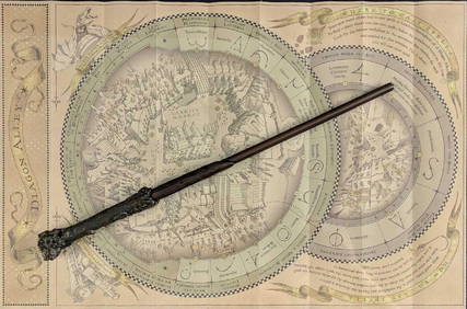
Universal Studios Harry Potter Wand BRapid Estate Liquidators and Auction Gallery4.5(1.1k)See Sold PriceFeb 28, 2024
ANTIQUE ARCHANGEL RAPHAEL CUZCO SCHOOL OIL PAINTINGAntique Arena Inc.4.5(852)See Sold PriceMar 09, 2024
Bolivian Aymara Handwoven Textile Mantles / ShawlsArtemis Fine Arts4.8(1.4k)See Sold PriceFeb 26, 2024
Post-Conquest Inca Stone Llama Conopa Offering EffigyArtemis Fine Arts4.8(1.4k)See Sold PriceMar 01, 2024


![J. H. Colton Maps [South America] (1 of 5)](https://p1.liveauctioneers.com/5755/162895/82236699_1_x.jpg?height=282&quality=70&version=1582932540)