ATLAS of ANTIENT GEOGRAPHY by SAMUEL BUTLER 1843John McInnis Auctioneers,LLC4.5(505)See Sold PriceFeb 24, 2024
18TH C. ANTIQUE MAP: FRENCH & INDIAN WAR, FRAMEDThomaston Place Auction Galleries4.4(393)See Sold PriceFeb 24, 2024
Rand McNally Railroad Map Cabinet w/ 21 Railroad MapsRail & Road Auctions4.6(165)See Sold PriceMar 08, 2024
Keith Haring - Ink on New York Map, Best Buddies, Inscribed, Signed, and DatedSapphire Auction Gallery4(67)See Sold PriceMar 02, 2024
LATE 17TH C. FRENCH MAP OF THE NEW WORLD BY ALEXIS-HUBERT JAILLOT (1632-1712)Thomaston Place Auction Galleries4.4(393)See Sold PriceFeb 24, 2024
Central Railroad of New Jersey Map of Sandy Hook Route-ca. 1903JM Hobby Supply and Railroad Artifact Auctions4.4(127)See Sold PriceFeb 24, 2024
Lot of Six Mixed Atlas Box Cars-HO Scale-New in BoxJM Hobby Supply and Railroad Artifact Auctions4.4(127)See Sold PriceFeb 25, 2024
Rand McNally/Santa Fe Railroad Map of Iowa-1912JM Hobby Supply and Railroad Artifact Auctions4.4(127)See Sold PriceFeb 24, 2024
NICOLAES VISSCHER (NETHERLANDS, 1618-1709) MAP OF THE NEW WORLDThomaston Place Auction Galleries4.4(393)See Sold PriceFeb 24, 2024
17TH C. WORLD MAP BY NICOLAES VISSCHER (NETHERLANDS, 1618-1709)Thomaston Place Auction Galleries4.4(393)See Sold PriceFeb 24, 2024
Lot of Six Mixed Atlas Cabooses-HO Scale-New in BoxJM Hobby Supply and Railroad Artifact Auctions4.4(127)See Sold PriceFeb 25, 2024
SoldFirst U.S. Atlas Map of North Carolina 1795Lewis, Samuel (1782-1865). State of North Carolina from Best Authorities. Engraved map. Matthew Carey, 1795. 11" x 18 ½" sheet.See Sold Price
SoldState of North Carolina from the best Authorities.[Southeast]. Samuel Lewis. The State of North Carolina from the best Authorities, &c. Above border at lower left: “Engraved by Vallance.” Probably from “Carey’s American Atlas,” published inSee Sold Price
State of North Carolina from The Best Authorities, &C.Title: State of North Carolina from The Best Authorities, &C. by Samuel Lewis. Engraved by Vallance. Publication Date:1795 Cartographer: LEWIS, SAMUEL Publisher: CAREY, MATHEW Brief Description: EngraSee Sold Price
State of North Carolina from The Best Authorities, &C.Title/Content of Map: State of North Carolina from The Best Authorities, &C. by Samuel Lewis. Engraved by Vallance. Date: 1795 Cartographer: LEWIS, SAMUEL Publisher: CAREY, MATHEW Size: 11Height - 20.See Sold Price
State of North Carolina from The Best Authorities, &C.Title/Content of Map: State of North Carolina from The Best Authorities, &C. by Samuel Lewis. Engraved by Vallance. Date: 1795 Cartographer: LEWIS, SAMUEL Publisher: CAREY, MATHEW Size: 11Height - 20.See Sold Price
SoldLewis - Map of North Carolina, 1795Samuel Lewis, (ca. 1754?1822),˜The State of North Carolina from the best Authorities, &c.,˜Philadelphia, 1795, engraved by Vallance, on laid paper, plate 11-3/8 x 19 in.; wood frame, 17 x 24-3/8 in.See Sold Price
Sold[Map] The State of North CarolinaLewis, Samuel. "The State of North Carolina from the best Authorities, &c." [Philadelphia: Mathew Carey, ca. 1795 or shortly after.] On heavy laid. Measured from plate-marks 49 x 29.5cm. Quite clean,See Sold Price
SoldRare 18th Century Map of North CarolinaRare 18th Century Map of North Carolina"The State of North Carolina from the best Authorities," a copperplate engraving on laid paper by Benjamin Tanner for John Reid's AMERICAN ATLAS published in NewSee Sold Price
SoldReid & Winterbotham Map of North CarolinaThe State of North Carolina from the Best Authorities. John Reid & W. Winterbotham. from 'The American Atlas.' Engraved Map with Original hand color in outline. New York: J Reid, L Wayland & C Smith,See Sold Price
SoldLewis. The State of North Carolina. 1795.[America/ North Carolina] Lewis, Samuel. “The State of North Carolina from the Best Authorities, &c.” Philadelphia, M. Cary, 1795. Engraved map: 18 1/2” x 11”. First state of map with counSee Sold Price
18th century North Carolina map,the State of North Carolina from the best Authorities, engraved by B. Tanner, published in John Reid's [American Atlas,] New York, 1796, engraving on laid paper, 14-1/2 x 19-1/2 in.; modern wood frameSee Sold Price
SoldLate 18th Century Map of North CarolinaLate 18th Century Map of North CarolinaThe State of North Carolina from the best Authorities from the American Atlas (New York: John Reid, 1796), copperplate engraving by Benjamin Turner with hand-colSee Sold Price
SoldNorth Carolina from the Best AuthoritiesNorth Carolina from the Best Authoritiesfrom Payne's Geography (New York: I. Low, 1800). 8.5 x 12.5 in. Additional high-resolution photos are available at LelandLittle.comSee Sold Price
SoldEarly American North Carolina MapEarly American North Carolina Map"North Carolina from the best Authorities.1800.," a copperplate engraving from John Payne's A NEW AND COMPLETE SYSTEM OF UNIVERSAL GEORGRAPHY, published in New York bySee Sold Price
SoldState of South Carolina from the Best Authorities...John Reid & W. Winterbotham. from the American Atlas. New York: J. Reid, L. Wayland & C. Smith, 1796. Engraved Map with Orignal Hand-color in Outline. 16 1/4 x 19 1/4 inchesSee Sold Price
Sold[Map] The State of South Carolina 1796Tanner, Benjamin. "The State of South Carolina: from the best Authorities." New York: John Reid, [ca. 1796.] On heavy laid. Measuring from neat-lines 17" x 15". Lower edge remargined, mild toning, oneSee Sold Price
SoldAmerican-Published Early Map of SouthCarolina [The State of South Carolina, from the best Authorities, 1799,] by John Payne, from Payne's [New and Complete Universal Geography], published by J. Low, New York, 1799, noting topographical dSee Sold Price
SoldTwo 18th Century South Carolina Mapsincluding The State of South Carolina from the best Authorities by Samuel Lewis, Engraved for Carey's American Edition of Guthrie's Geography improved, 1795, an uncolored map of South Carolina, 15-3/4See Sold Price
SoldTanner / Reid Map of South Carolina, 1796Tanner, Benjamin (1775-1848). State of South Carolina from the Best Authorities. Engraved map. J. Reid, 1796. 15" x 17" sheet. Published by John Reid New York. A very early and scarce folio map of SouSee Sold Price
SoldEarly South Carolina map dated 1799Early South Carolina map dated 1799 color engraving titled: The State of South Carolina, from the best Authorities, 1799; published by I. Low, New York. H7 1/2” W8 1/2”See Sold Price
MAP, South Carolina, PayneSouth Carolina. John Payne, The State of South Carolina from the Best Authorities, from A New and Complete Universal Geography, 1799 (dated). Hand Color. This early map of the state is finely engravedSee Sold Price
SoldEarly South Carolina Map Dated 1799Engraving titled "The State of South Carolina from the best Authorities 1799"; published by I. Low, New York; unframed; 8 1/2"W, 7 1/2"H; fold lines, creases--Private collection, Spartanburg, South CaSee Sold Price
SoldJIM VALVANOJIM VALVANO (1946-1993) American college basketball player, coach, and broadcaster, best known for leading North Carolina State University to victory in the 1983 NCAA Basketball Tournament against impSee Sold Price
SoldNorth Carolina State Sterling Silver 1oz. CoinNorth Carolina State Sterling Silver 1oz. Coin - Thank you for viewing this Item. We hope that you are successful in your bidding. For over 30 years we have given the best possible customer service toSee Sold Price
1873 RELIGIOUS DENOMINATIONS OF THE WORLDNorth American Artifact Auctions4.7(198)See Sold PriceApr 20, 2024
999 Silver Medal North Carolina State Seal Medallic Art Co. 4ozGalerie Du Louvre4.5(52)See Sold PriceMar 09, 2024
1947 Morgan State vs. North Carolina State Sideline Pass 10/11/47 Polo GroundsMynt Auctions4.6(697)See Sold PriceFeb 29, 2024
Carey, pub. 1796 - Map of the Tennassee State formerly part of North Carolina (Tennessee)Trillium Antique Prints & Rare Books4.5(32)See Sold PriceFeb 24, 2024
Chart: United States- East Coast/ NORTH CAROLINA/ RIVER INLET TO CAPE FEAR.Churchill Galleries3.7(217)See Sold PriceFeb 26, 2024
Sterling Silver North Carolina State University Post EarringsGolden Air Auctions4.4(265)See Sold PriceFeb 24, 2024
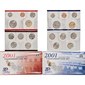
2001 20 piece United States Mint Set with Sacagawea Dollar in original Government packagingKey Date Coins4.4(1.4k)See Sold PriceFeb 28, 2024
2001 20 piece United States Mint Set with Sacagawea Dollar in original Government packagingKey Date Coins4.4(1.4k)See Sold PriceFeb 29, 2024
2001 20 piece United States Mint Set with Sacagawea Dollar in original Government packagingKey Date Coins4.4(1.4k)See Sold PriceFeb 28, 2024
2001 20 piece United States Mint Set with Sacagawea Dollar in original Government packagingKey Date Coins4.4(1.4k)See Sold PriceFeb 27, 2024
2001 20 piece United States Mint Set with Sacagawea Dollar in original Government packagingKey Date Coins4.4(1.4k)See Sold PriceFeb 29, 2024
2001 20 piece United States Mint Set with Sacagawea Dollar in original Government packagingKey Date Coins4.4(1.4k)See Sold PriceFeb 27, 2024
2001 20 piece United States Mint Set with Sacagawea Dollar in original Government packagingKey Date Coins4.4(1.4k)See Sold PriceFeb 27, 2024
2001 20 piece United States Mint Set with Sacagawea Dollar in original Government packagingKey Date Coins4.4(1.4k)See Sold PriceFeb 28, 2024
2001 20 piece United States Mint Set with Sacagawea Dollar in original Government packagingKey Date Coins4.4(1.4k)See Sold PriceFeb 29, 2024
2001 20 piece United States Mint Set with Sacagawea Dollar in original Government packagingKey Date Coins4.4(1.4k)See Sold PriceFeb 28, 2024
2001 20 piece United States Mint Set with Sacagawea Dollar in original Government packagingKey Date Coins4.4(1.4k)See Sold PriceFeb 29, 2024
1976 North Carolina State American Revolution Bicentennial Bronze Medal Coin (QTY=2)Richard L. Edwards Auctioneering4.8(2.3k)See Sold PriceFeb 28, 2024


![[Map] The State of North Carolina (1 of 5)](https://p1.liveauctioneers.com/3532/146911/74242522_1_x.jpg?height=282&quality=70&version=1564368564)


![[Map] The State of South Carolina 1796 (1 of 4)](https://p1.liveauctioneers.com/3532/146911/74242458_1_x.jpg?height=282&quality=70&version=1564368564)