ATLAS of ANTIENT GEOGRAPHY by SAMUEL BUTLER 1843John McInnis Auctioneers,LLC4.5(494)See Sold PriceFeb 24, 2024
18TH C. ANTIQUE MAP: FRENCH & INDIAN WAR, FRAMEDThomaston Place Auction Galleries4.4(386)See Sold PriceFeb 24, 2024
Rand McNally Railroad Map Cabinet w/ 21 Railroad MapsRail & Road Auctions4.6(165)See Sold PriceMar 08, 2024
Keith Haring - Ink on New York Map, Best Buddies, Inscribed, Signed, and DatedSapphire Auction Gallery3.9(67)See Sold PriceMar 02, 2024
LATE 17TH C. FRENCH MAP OF THE NEW WORLD BY ALEXIS-HUBERT JAILLOT (1632-1712)Thomaston Place Auction Galleries4.4(386)See Sold PriceFeb 24, 2024
Central Railroad of New Jersey Map of Sandy Hook Route-ca. 1903JM Hobby Supply and Railroad Artifact Auctions4.4(126)See Sold PriceFeb 24, 2024
Lot of Six Mixed Atlas Box Cars-HO Scale-New in BoxJM Hobby Supply and Railroad Artifact Auctions4.4(126)See Sold PriceFeb 25, 2024
Rand McNally/Santa Fe Railroad Map of Iowa-1912JM Hobby Supply and Railroad Artifact Auctions4.4(126)See Sold PriceFeb 24, 2024
NICOLAES VISSCHER (NETHERLANDS, 1618-1709) MAP OF THE NEW WORLDThomaston Place Auction Galleries4.4(386)See Sold PriceFeb 24, 2024
17TH C. WORLD MAP BY NICOLAES VISSCHER (NETHERLANDS, 1618-1709)Thomaston Place Auction Galleries4.4(386)See Sold PriceFeb 24, 2024
Lot of Six Mixed Atlas Cabooses-HO Scale-New in BoxJM Hobby Supply and Railroad Artifact Auctions4.4(126)See Sold PriceFeb 25, 2024
Sold[atlases] Arrowsmith, 1817Arrowsmith Aaron, Nouvel atlas universel-portatif de géographie ancienne et moderne contenant 39 cartes... Paris: Hyacinthe Langlois, 1817. In-4° (mm 340x250). 1 frontespizio inciso, 1 cartaSee Sold Price
SoldArrowsmith's General Atlas 1817Heading: Author: Arrowsmith, Aaron Title: A New General Atlas, Constructed from the latest Authorities... Place Published: Edinburgh Publisher:A. Constable & Co. Date Published: 1817 DSee Sold Price
SoldArrowsmith's New General Atlas 1817Heading: Author: Arrowsmith, Aaron Title: A New General Atlas, Constructed from the latest Authorities... Place Published: Edinburgh Publisher:A. Constable & Co. Date Published: 1817 DSee Sold Price
SoldArrowsmith's New General Atlas 1817Heading: Author: Arrowsmith, Aaron Title: A New General Atlas, Constructed from the latest Authorities... Place Published: Edinburgh Publisher:A. Constable & Co. Date Published: 1817 DSee Sold Price
Arrowsmith's New General Atlas 1817Heading: Author: Arrowsmith, Aaron Title: A New General Atlas, Constructed from the latest Authorities... Place Published: Edinburgh Publisher:A. Constable & Co. Date Published: 1817 DSee Sold Price
Sold5pc 19th Century British Maps of China5pc 19th Century British Maps of China. Includes 'A New Map of the Empire of China from Sieur Robert's Atlas with Improvements' (8.5x13.75''), Arrowsmith 'China, Published A. Constable' 1817 (9x11.5''See Sold Price
SoldArrowsmith (Aaron) A New General AtlasArrowsmith (Aaron) A New General Atlas,engraved vignette title, index leaf and 53 maps, some foxing and browning, mostly marginal, modern cloth, 4to, Edinburgh & London, 1817.See Sold Price
1817 UK Map Asia Minor Arrowsmith/Sy HallUp for sale from a recent estate in Honolulu Hawaii this 1817 British framed map of Asia Minor that was drawn by Aaron Arrowsmith and engraved by S. Y. Hall and published by A. Constable & Co. EdinburSee Sold Price
SoldRARE EARLY 19TH C ATLAS - Arrowsmith, Aaron; 'A NewRARE EARLY 19TH C ATLAS - Arrowsmith, Aaron; 'A New General Atlas, Constructed from the latest Authorities, by A. Arrowsmith, Hydrographer to the Prince Regent, Exhibiting the Boundaries and DivisionsSee Sold Price
SoldWest Indies.Title/Content of Map: West Indies. Date: 1817 Cartographer: THOMSON, JOHN & CO. Publisher: JOHN THOMSON, JUNR. & CO. Size: 19.25Height - 26.75Width No.46 from Thomson's New General Atlas 1817. Polar pSee Sold Price
SoldThomson: Antique Map of Canada & Nova Scotia, 1817Title/Content of Map: Canada and Nova Scotia. Date Printed: 1817 Cartographer: THOMSON, JOHN & CO. Size (inches): 16.1x22 No.43 (unnumbered) from Thomson's New General Atlas 1817. W. Dassauville engr.See Sold Price
Canada and Nova ScotiaEngineered by W. Dassauville, Edinburgh[Drawn and engraved for Thomson’s New General Atlas, 1817]48 cm x 59 cm Original color. Some light water staining in upper left and upper right corners. ISee Sold Price
1817 Canada and Nova Scotia & 1812 Partie Orientale deCanada and Nova Scotia Engineered by W. Dassauville, Edinburgh Drawn and engraved for Thomson’s New General Atlas, 1817 48 cm x 59 cm Original color. Some light water staining in upper left andSee Sold Price
Poland As Divided.Title: Poland As Divided. Publication Date: 1817 Cartographer: THOMSON, JOHN & CO. Publisher: JOHN THOMSON, JUNR. & CO. Dimension: 17.25Height - 19.25Width No.20 from Thomson's New General Atlas 1817.See Sold Price
Thomson: Map of Eastern & Western Hemisphere 1817Title/Content of Map: Eastern Hemisphere | Western Hemisphere. Date Printed: 1817 Cartographer: THOMSON, JOHN & CO. Size: X19.6 No.4,5 from Thomson's New General Atlas 1817. Hemisphere maps. ReissuedSee Sold Price
Thomson: Chart of the Northern Passage 1817Title/Content of Map: Chart of the Northern Passage Between Asia & America Cartographer: THOMSON, JOHN & CO. Size: 19.5X23.3 [No.56] from Thomson's New General Atlas 1817. Neele, engraver. Polar projeSee Sold Price
Map of West Indies Islands, St. Vincent, 1817Map: West Indies Islands. St. Vincent Maker: John Thomson & Co, Junr & Co. Date: 1817 Size: Double Folio, 19.6 inches high x 11.3 inches wide Part of No.52 from Thomson's New General Atlas 1817. KirkwSee Sold Price
SoldThomson, John. Porto Rico and Virgin IslesThomson, John. Porto Rico and Virgin Islesfrom Thomson's New General Atlas, 1817, engraving with outline color; behind mat in wooden frame. From a private North Carolina collection Additional high-resSee Sold Price
SoldMAP OF IRELANDDrawn and engraved for Thomson`s New General Atlas 1817. Together with a print map "A Balloon View of London." 20 1/2"h x 24"wSee Sold Price
North AmericaReserve Reduced! Title: North America Publication Date: 1817 Cartographer: THOMSON, JOHN & CO. Publisher: JOHN THOMSON, JUNR. & CO. Size: 19.5 x 23.5 No.42 from Thomson's New General Atlas 1817. N.R.See Sold Price
Spanish North America.Publication Date: 1817 Title: Spanish North America. Cartographer: THOMSON, JOHN & CO. Publisher: JOHN THOMSON, JUNR. & CO. Height: 20 Width: 24.25 No.45 from Thomson's New General Atlas 1817. Polar pSee Sold Price
Thomson Map of Korea and JapanThomson, John & Co. (c. 1777-1841). Corea and Japan. Engraved map. John Thomson, Junr & Co., 1817. 19 ⅜" x 24 ½" sheet. No. 37 from Thomson's New General Atlas 1817. J. & G. Menzies sculpt. ESee Sold Price
Spanish North America.Title/Content of Map: Spanish North America. Cartographer: THOMSON, JOHN & CO. Date: 1817 Publisher: JOHN THOMSON, JUNR. & CO. Size: 20Height - 24.25Width No.45 from Thomson's New General Atlas 1817.See Sold Price
1817 Capped Bust Half Dollar PGA AU50 Punctuated DGold Standard Auctions4.4(748)See Sold PriceFeb 24, 2024
English Milled Coins - George III - 1817 - AV Gold Half-SovereignTimeLine Auctions Ltd.4.5(183)See Sold PriceMar 09, 2024
English Georgian Sterling Silver Fish Server London 1817 pierced & engraved 11"Mynt Auctions4.6(658)See Sold PriceFeb 25, 2024
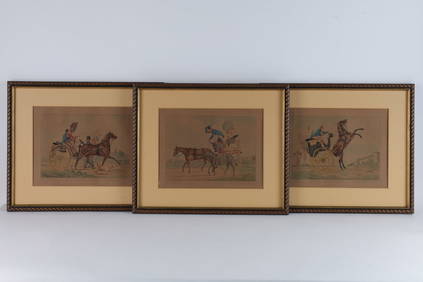
S. J. Fuller 1817 Horse / Carriage Coloured PrintsKavanagh Auctions4.6(287)See Sold PriceFeb 24, 2024
Arrowsmith & Lewis - Map of PolynesiaTrillium Antique Prints & Rare Books4.5(28)See Sold PriceFeb 24, 2024
Arrowsmith & Lewis - Map of North AmericaTrillium Antique Prints & Rare Books4.5(28)See Sold PriceFeb 24, 2024
Arrowsmith & Lewis - Map of the World on Mercator's ProjectionTrillium Antique Prints & Rare Books4.5(28)See Sold PriceFeb 24, 2024
Arrowsmith & Lewis - Map of LouisianaTrillium Antique Prints & Rare Books4.5(28)See Sold PriceFeb 24, 2024
Arrowsmith & Lewis - Map of the United StatesTrillium Antique Prints & Rare Books4.5(28)See Sold PriceFeb 24, 2024
West Indies Islands. Guadaloupe. | Mariegalante &C. | Antigua.Jasper524.5(9.7k)See Sold PriceFeb 27, 2024
West Africa by Arrowsmith & Lewis 1812 old antique vintage map plan chartJasper524.5(9.7k)See Sold PriceFeb 28, 2024
Pre-colonial Africa. Mountains of Kong/Moon. Caravan routes. THOMSON 1817 mapJasper524.5(9.7k)See Sold PriceFeb 28, 2024
ANCIENT NORTH AFRICA Septentrionalis. Mauretania Tripolitana ARROWSMITH 1828 mapJasper524.5(9.7k)See Sold PriceFeb 28, 2024
Africa by Arrowsmith & Lewis 1812 old antique vintage map plan chartJasper524.5(9.7k)See Sold PriceFeb 28, 2024
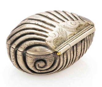
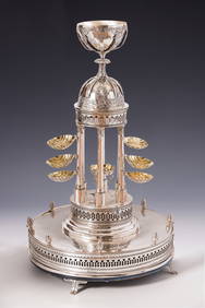
215.A RARE AND IMPORTANT NEOCLASSICAL SILVER PASSOVER COMPENDIUM. Berlin, 1817. By George HeinrichJ. Greenstein & Co., Inc.4.4(54)See Sold PriceApr 16, 2024
1817 US Coronet Head Large Cent. LOW MINTAGE. Better GradeRichard L. Edwards Auctioneering4.8(2.3k)See Sold PriceFeb 27, 2024
Attributed to Ivan Konstantinovich Aivazovsky (RUSSIAN FEDERATION, 1817 - 1900) oil painting onJoshua Kodner4.2(382)See Sold PriceMar 09, 2024
![[atlases] Arrowsmith, 1817 First Image](https://p1.liveauctioneers.com/1306/149409/75467403_1_x.jpg?height=282&quality=95&version=1567670708&width=282)

![[atlases] Arrowsmith, 1817 First Image](https://p1.liveauctioneers.com/1306/149409/75467403_1_x.jpg?height=282&quality=1&version=1567670708&width=282)


![[atlases] Arrowsmith, 1817 (1 of 3)](https://p1.liveauctioneers.com/1306/149409/75467403_1_x.jpg?height=282&quality=70&version=1567670708)