1952 MAY, J.F.K. HANDWRITTEN LETTER & ENVELOPEJohn McInnis Auctioneers,LLC4.6(502)See Sold PriceFeb 25, 2024
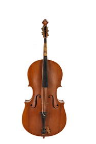
WARNER BECKMAN'S TIGER MAPLE CELLO / SEABROOK NHJohn McInnis Auctioneers,LLC4.6(502)See Sold PriceFeb 25, 2024
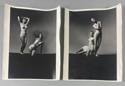
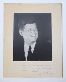
Victor Skrebneski Lingerie Fashion PhotographsEpic Auctions and Estate Sales4.6(204)See Sold PriceMar 02, 2024
[DOUGLASS, Frederick (1818-1895)]. ROBERTS, J.B., photographer. CDV of Frederick Douglass.Freeman's | Hindman4.4(1.6k)See Sold PriceFeb 27, 2024
1952 J.F.K. for SENATE TEAS & RECEPTION MATERIALJohn McInnis Auctioneers,LLC4.6(502)See Sold PriceFeb 25, 2024
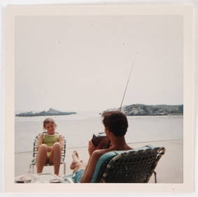
HUGH D. AUCHINCLOSS' 70th BIRTHDAY with FAMILYJohn McInnis Auctioneers,LLC4.6(502)See Sold PriceFeb 25, 2024
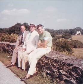
CAROLINE KENNEDY at BAILEYS BEACH, NEWPORT, RIJohn McInnis Auctioneers,LLC4.6(502)See Sold PriceFeb 25, 2024
WILLIAM LINSMAN PHOTO SIGNED by JACKIE KENNEDYJohn McInnis Auctioneers,LLC4.6(502)See Sold PriceFeb 25, 2024
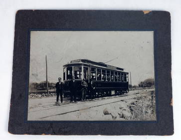
[BASEBALL]. Original Photographic Team Portrait of the Cuba...Potter & Potter Auctions4.6(539)See Sold PriceMar 07, 2024
SoldWillem Blaeu Map [The Holy Land]Willem Blaeu (cartographer) color map of The Holy Land, titled 'Terra Sancta quae in Sacris Terra Promissionis olim Palestina'. Published Amsterdam, circa 1630's. Copper-engraved map, hand-colored, wiSee Sold Price
Blaeu's map of the Holy LandTerra Sancta...Willem Janszoon Blaeu (1571-1638). Engraved map with original hand color in full. Amsterdam: Blaeu, 1629. 20 x 24 inches sheet. Magnificent map of the Holy Land. The map is oriented witSee Sold Price
SoldBlaeu (W J) Terra Sancta quae in SacrisBlaeu (Willem Janszoon) Terra Sancta quae in Sacris Terra Promissionis olim Palestina,the Holy Land, with decorative title cartouche, rose compasses, a ship and sea monsters, engraved map withSee Sold Price
SoldBlaeu map of the Holy LandHeading: Author: Blaeu, Willem Title: Terra Sancta quae in Sacris Terra Promissionis olim Palestina Place Published: Amsterdam Publisher: Date Published: c.1630 Description:See Sold Price
Blaeu map of the Holy LandHeading: Author: Blaeu, Willem Title: Terra Sancta quae in Sacris Terra Promissionis olim Palestina Place Published: Amsterdam Publisher: Date Published: c.1630 Description:See Sold Price
SoldMAP - Holy Land. BlaeuHoly Land. Hondius/Blaeu, Terra Sancta quae in Sacris Terra Promissionis olim Palestina, 1629 (dated). Hand Color. Magnificent map of the Holy Land, viewed as Moses would have seen it from atop Mt. PiSee Sold Price
Map of the Holy Land. Willem Albert Bachiene.Afbeeldinge van 'T Land Kanaan nog bewoond door Deszelvs Allereerste Bezitters de Nakomelingen Kanaans. Map of the Holy Land before its conquest by the Israelites. Copperplate engraving. Black and whtSee Sold Price
SoldEleven Antique Maps of EuropeEleven Antique Maps of Europe , 16th-18th c., incl. Ptolemy from 1541 (4); a Blaeu map of "Regno di Napoli", Hondius map of the Holy Land, de Wit map of Southern Spain, an undated manuscript map of MeSee Sold Price
SoldBachiene (Willem Albert) - Afbeelding van Alle demap showing the Holy Land, with large title cartouche with vignette showing the expulsion from Eden, upper left, engraving, 400 x 510 mm., central vertical fold, light spotting and browning, minor nicSee Sold Price
SoldMap of the Holy LandAn antique map of the Holy Land: Charte worauf das Iüdische Land vornehmlich, wie es zur Christi und der Apostel…", by Bachiene, Willem Albert, 1776. Dimensions: 43x35 cm, overall fair conditSee Sold Price
SoldAntique Map of the Holy Land \\\"Terra Sancta quae inAntique Map of the Holy Land \\\"Terra Sancta quae in Sacris Terra Promissionis Olim Palestina\\\", Janszoon Blaeu, 1629Includes large cartouche, two compass roses, sea monsters and other embellishmenSee Sold Price
MAP, Western Africa, BlaeuWestern Africa. Willem Blaeu, Guinea, from Theatre du Monde ou Nouvel Atlas, 1643 (circa). Hand Color. Elegantly engraved map covering the coast from Sierra Leone to Gabon. The land is filled with aniSee Sold Price
MAP, Western Africa, BlaeuWestern Africa. Willem Blaeu, Guinea, from Theatre du Monde ou Nouvel Atlas, 1643 (circa). Hand Color. Elegantly engraved map covering the coast from Sierra Leone to Gabon. The land is filled with aniSee Sold Price
SoldAtlante. Willem Janszoon Blaeu. Novus Atlas.Atlante. Willem Janszoon Blaeu. Novus Atlas, Das ist, Welt-beschreibung, mit schönen newen außführlichen Land-Taffeln. 1647 Amsterdam, J. Blaeu. 2 parti in un volume in folio grande, 508x320 mm. LeSee Sold Price
SoldWILLEM BLAEU Map of the World LithographWILLEM BLAEU Map of the World Lithograph, inscriptions to piece in Latin, label to reverse gives information on piece and artist, label to reverse reads ‘Picture Framing’, subject a map of the worSee Sold Price
SoldWILLEM BLAEU Map of the Americas Offset LithographWILLEM BLAEU Map of the Americas Offset Lithograph, inscriptions to piece in Latin, subject a map of North and South America, measures 20 1/2 x 24 1/2 inches, wooden frame, surface wear to frame, profSee Sold Price
SoldWILLEM BLAEU Map of Europe Offset LithographWILLEM BLAEU Map of Europe Offset Lithograph, inscriptions to piece in Latin, a map of Europe with representations of its people to border, measures 20 5/8 x 24 5/8 inches, wooden frame, surface wearSee Sold Price
SoldWILLEM BLAEU Map of Europe Offset LithographWILLEM BLAEU Map of Europe Offset Lithograph, inscriptions to piece in Latin, a map of Europe with representations of its people to border, measures 20 5/8 x 24 5/8 inches, wooden frame, surface wearSee Sold Price
SoldMAP - Holy Land. Mercator/HondiusHoly Land. Mercator/Hondius, Peregrinatio Israelitaru in Deserto, 1610 (published). Hand Color. A handsome small map depicting the Exodus and the wandering of the Children of Israel. An inset of the ESee Sold Price
Willem Blaeu: Map of the Island of Rugen, 1631Rugia Insula ac Ducatus accuratissime descripta ab E. Lubino. By: Willem Blaeu. Date: 1631 – 1635. Dimensions: 19.5 x 15 inches (49.5 x 38 cm) This is a nicely detailed map of the island of Rugen whSee Sold Price
SoldWillem Blaeu, MapBlaeu, Willem , "Insulae Americanae in Oceano Septentrionali, cum Terris Adiacentibus", Amsterdam, 1635, hand-colored engraved map, 14 3/4 in. x 20 1/4 in., framedSee Sold Price
SoldMap, holy land, Palestine, by Abraham Ortelius, 1612Early map, Palestine, holy land, by Abraham Ortelius, published in Antwerp, 1612, 14.5" by 18.5"See Sold Price
SoldWillem Blaeu Map of Guinea ca. 1631Willem Janszoon Blaeu (1571-1638), "Guinea," Amsterdam, ca. 1631. A hand colored map of the Gulf of Guinea region of Africa, including what is now Guinea, Sierra Leone, Liberia, Cote d'Ivoire, Ghana,See Sold Price
Sold1812 Hand Colored Map Holy landHandcolored map of the “Tribe of Manasseh” in the Holy land , printed by Mathews and Leigh, 1812. Measures 11 x 9”.See Sold Price
WILLEM JANSZOON BLAEU (NETHERLANDS, 1571-1638) MAP OF UMBRIAThomaston Place Auction Galleries4.4(386)See Sold PriceFeb 24, 2024
Eretz Israel Map Postcard - World Zionist OrganizationLevy Auction House4.3(11)See Sold PriceFeb 27, 2024
Jerusalem Map for British Soldiers in Palestine - WW2Levy Auction House4.3(11)See Sold PriceFeb 27, 2024
Proposed Sportsground Map - Haifa, Palestine - 1926Levy Auction House4.3(11)See Sold PriceFeb 27, 2024
Caravan Routes in Palestine Linen Map - Germany, 1881Levy Auction House4.3(11)See Sold PriceFeb 27, 2024
The Holy Land Tours - Hamburg American Line - 1911Levy Auction House4.3(11)See Sold PriceFeb 27, 2024
1849 Mitchell School ATLAS 24 MAPS America Holy Land France Africa Egypt AsiaSchilb Antiquarian Rare Books4.8(421)See Sold PriceMar 31, 2024
1872 Holy BIBLE & Hitchcock Analysis Gruden Concordance Theology MAPS Holy LandSchilb Antiquarian Rare Books4.8(421)See Sold PriceMar 31, 2024
Willem Blaeu, Etc. 17th C. Antiquarian Maps, 2Auctions at Showplace4.5(726)See Sold PriceMar 17, 2024
Georg Bockler Map of Ancient Jerulsaem EtchingAuctions at Showplace4.5(726)See Sold PriceApr 07, 2024
TWO ANTIQUE JEWISH NATIONAL FUND CHARITY BOXES. The first one made in Berlin c. 1920J. Greenstein & Co., Inc.4.3(55)See Sold PriceApr 16, 2024


![Willem Blaeu Map [The Holy Land] First Image](https://p1.liveauctioneers.com/5755/147592/74586079_1_x.jpg?height=282&quality=95&version=1565304210&width=282)
![Willem Blaeu Map [The Holy Land] First Image](https://p1.liveauctioneers.com/5755/147592/74586079_1_x.jpg?height=282&quality=1&version=1565304210&width=282)
![[DOUGLASS, Frederick (1818-1895)]. ROBERTS, J.B., photographer. CDV of Frederick Douglass. (1 of 2)](https://p1.liveauctioneers.com/197/319238/171467829_1_x.jpg?height=282&quality=70&version=1707520367)


![[BASEBALL]. Original Photographic Team Portrait of the Cuba... (1 of 2)](https://p1.liveauctioneers.com/928/318880/171361386_1_x.jpg?height=282&quality=70&version=1707501302)
![Willem Blaeu Map [The Holy Land] (1 of 3)](https://p1.liveauctioneers.com/5755/147592/74586079_1_x.jpg?height=282&quality=70&version=1565304210)


