ATLAS of ANTIENT GEOGRAPHY by SAMUEL BUTLER 1843John McInnis Auctioneers,LLC4.6(502)See Sold PriceFeb 24, 2024
18TH C. ANTIQUE MAP: FRENCH & INDIAN WAR, FRAMEDThomaston Place Auction Galleries4.4(386)See Sold PriceFeb 24, 2024
Rand McNally Railroad Map Cabinet w/ 21 Railroad MapsRail & Road Auctions4.6(165)See Sold PriceMar 08, 2024
Keith Haring - Ink on New York Map, Best Buddies, Inscribed, Signed, and DatedSapphire Auction Gallery4(67)See Sold PriceMar 02, 2024
LATE 17TH C. FRENCH MAP OF THE NEW WORLD BY ALEXIS-HUBERT JAILLOT (1632-1712)Thomaston Place Auction Galleries4.4(386)See Sold PriceFeb 24, 2024
Central Railroad of New Jersey Map of Sandy Hook Route-ca. 1903JM Hobby Supply and Railroad Artifact Auctions4.4(126)See Sold PriceFeb 24, 2024
Lot of Six Mixed Atlas Box Cars-HO Scale-New in BoxJM Hobby Supply and Railroad Artifact Auctions4.4(126)See Sold PriceFeb 25, 2024
Rand McNally/Santa Fe Railroad Map of Iowa-1912JM Hobby Supply and Railroad Artifact Auctions4.4(126)See Sold PriceFeb 24, 2024
NICOLAES VISSCHER (NETHERLANDS, 1618-1709) MAP OF THE NEW WORLDThomaston Place Auction Galleries4.4(386)See Sold PriceFeb 24, 2024
17TH C. WORLD MAP BY NICOLAES VISSCHER (NETHERLANDS, 1618-1709)Thomaston Place Auction Galleries4.4(386)See Sold PriceFeb 24, 2024
Lot of Six Mixed Atlas Cabooses-HO Scale-New in BoxJM Hobby Supply and Railroad Artifact Auctions4.4(126)See Sold PriceFeb 25, 2024
SoldBritish Isles with overseas possessions 1710Heading: Author: Chatelain, Henri Abraham Title: Nouvelle Carte d'Angleterre, d'Ecosse et d'Irlande, avec instructions pour connoitre les differents etats de la couronne d'Angleterre en Europe, Asie,See Sold Price
SoldBritish Isles with overseas possessions 1710Heading: (Maps) Author: Chatelain, Henri Abraham Title: Nouvelle Carte d'Angleterre, d'Ecosse et d'Irlande, avec instructions pour connoitre les differents etats de la couronne d'Angleterre en Europe,See Sold Price
British Isles with overseas possessions 1710Heading: Author: Chatelain, Henri Abraham Title: Nouvelle Carte d'Angleterre, d'Ecosse et d'Irlande, avec instructions pour connoitre les differents etats de la couronne d'Angleterre en Europe, Asie,See Sold Price
British Isles with overseas possessions 1710Heading: Author: Chatelain, Henri Abraham Title: Nouvelle Carte d'Angleterre, d'Ecosse et d'Irlande, avec instructions pour connoitre les differents etats de la couronne d'Angleterre en Europe, Asie,See Sold Price
A Collection of Historical Medals, the Property of aEngland, Peace Negotiations at Gertruydenberg, 1710, a silver medal by N. Roettiers, bust of James III right, rev. map of the British Isles, 38mm, 39.19g (Woolf 23:1a; MI II, 312/133; E 428). Almost eSee Sold Price
SoldNorth America.- Wyld (James) The British Possessions inNO RESERVE North America.- Wyld (James) The British Possessions in North America and the United States with the Hudson's Bay Territories, map showing Canada and the US, including the Canadian arctic nSee Sold Price
SoldTOBIAS LOTTER MAP OF BRITISH ISLESOriginal hand-colored engraving. 18th century. Three different hand-colored heraldic devices. Dimensions: (Frame) H 30.5" x W 26.5", (Sight) H 23.75" x W 20" Condition: Some light foxing. Unexamined oSee Sold Price
British Isles, Pieter Goos 1665-66Title: Pas-Caart vant Canaal Vertoonende in 't Gheheel Engelandt, Schotlandt, Yrlandt, en een Gedeelte van Vrancryck Subject: British Isles Maker: Pieter Goos Date: 1665-66, Amsterdam Materials: HandSee Sold Price
Sold1889 1ed ZigZag Journeys British Isles Liverpool Lands End London Bridge CASTLES1889 1ed ZigZag Journeys British Isles Liverpool Lands End London Bridge CASTLES American author Hezekiah Butterworth is best remembered for his enormous, seventeen volume work Zig-Zag Journeys. WrittSee Sold Price
Sold1695 Morden Map of the British Isles in Roman Times --Title/Content of Map: 1695 Morden Map of the British Isles in Roman Times -- Britannia Romana Date: 1695, London Cartographer: R Morden Size: 14 X 16.8 in. This is a handsome map of the British IslesSee Sold Price
Sold1796 MAP OF THE BRITISH ISLESItalian map. Caleographia Camerale. Engraving. Dimensions: (Frame) H 22.25"x W 16.75", (Sight) H 21.25" x W 15.75" Condition: Some creases to paper.See Sold Price
Janssonius: Sea Chart of British Isles, Gold Leaf, 1660Title: Pascaart vant Canaal, Tusschen Engelant en Vrancryck, alsmede ge heel Ierlant en Schotlant Map maker: J. Janssonius, Atlantis Majoris Quinta Pars Orbem Maritimum Place and Year: Amsterdam, 1660See Sold Price
Sold2 British Possessions Caribbean & Atlantic Maps, 1746Two colorful, early maps of British possessions in the Caribbean and the Atlantic on one sheet from le Rouge's Introduction a La Geographie. The upper map depicts Jamaica divided into parishes, with aSee Sold Price
Bonne: Antique Map of the British Isles, 1780TITLE/CONTENT OF MAP: 'Carte Des Isles Britanniques contenant les Royaumes d'Angleterre, d'Ecosse et d'Irlande' A map of the British Isles DATE PRINTED: 1780 IMAGE SIZE: Approx 34.5 x 23.0cm, 13.5 x 9See Sold Price
Bonne: Antique Map of the British Isles, 1780Title/Content of Map: 'Carte Des Isles Britanniques contenant les Royaumes d'Angleterre, d'Ecosse et d'Irlande'. A map of the British Isles Date Printed: 1780 Image Size: Approx 34.5 x 23.0cm, 13.5 xSee Sold Price
SoldTallis, John (Pub) 1852 Map. British IslesSteel Engraved Map with Original Outline Hand Color Published 1852-56 by John Tallis, London for "The Universal Pronouncing Dictionary" by Thomas Wright. Drawn & Engraved by John Rapkin. Centre fold aSee Sold Price
SoldEARLY 19th c. OIL ON BOARD BRITISH ISLESAntique early 19th c. Oil on Board of a Coastal Castle Vista. Very well done and professionally framed in a gilt wood carved frame by Moormans Gallery. The painting does have some minor age appropriatSee Sold Price
BRITISH OVERSEAS AIRWAYS CORP SUPER VC-101/24th scale model, fabricated by Westway Models in England measures 82" (209 cm) in length with a wingspan of 70" (178 cm) and is made of fiberglass, Perspex and wood and features an rare and uniqueSee Sold Price
SoldClaudius Ptolemy's Map of the British IslesPublished 1599 AD. Taken from volume two of La Geografia di Claudio Tolomeo Alessandrino, Venice, translated by Girolamo Ruscelli and Gioseffo Rosaccio as 'Nuouamente tradotta di Greco in Italiano'; cSee Sold Price
SoldFamous Speed may of British IslesHeading: (Great Britaine) Author: Speed, John Title: The Kingdome of Great Britaine and Ireland Place Published: London Publisher:Roger Rea the Elder and younger Date Published: 1610-[1665]See Sold Price
SoldBritish Isles stoneware Ginger Beer bottlesBritish Isles stoneware Ginger Beer bottles (9 pcs)See Sold Price
SoldMap of British Possessions in North America, 1805[Carey and Lea?] British Possessions in North America c1805 copper-engraved map, hand-coloured Place Published: [Philadelphia?] Date Published: [1805] Edition: 1st Edition Binding: No binding Date: [cSee Sold Price
SoldKeulen: Antique Map of the British Isles, 1678Map: British Isles Date Printed: 1678-1682 Cartographer: J Keulen Material/Medium: Paper Size: 21" x 24" Printed on thick paper. Double page map. Rare map of the British isles with north oriented to tSee Sold Price
SoldRalph Lauren British Isles Round Wicker TableCircular top on a quatrepartite pedestal base. Height 28 inches, diameter 48 inches. Notice to bidders: Condition reports and additional photographs are provided by request as a courtesy to our clientSee Sold Price
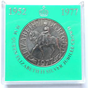
1977 Elizabeth II Jubilee Silver Proof Crown (28.28g)Bazaar of Persia4.3(23)See Sold PriceFeb 24, 2024
1977 Elizabeth II Jubilee Silver Proof Crown (28.28g)Bazaar of Persia4.3(23)See Sold PriceFeb 24, 2024
9 Air Lines & Hertz Advertisements from 1947 to 1960. TWA, Continental, United, British OverseasNorth American Artifact Auctions4.6(182)See Sold PriceApr 20, 2024
AN ANTIQUE FOLDING MAP OF THE BRITISH ISLES DATED 1873Hutchinson Scott Auctioneers4.4(39)See Sold PriceFeb 28, 2024
Chatelain - 3 Maps of the British Isles (England, Ireland, Scotland)Trillium Antique Prints & Rare Books4.5(30)See Sold PriceFeb 24, 2024
De Jode, Rare, pub. 1593 - Map of the British Isles [England, Scotland, Ireland] (Angliae Scotiae etTrillium Antique Prints & Rare Books4.5(30)See Sold PriceFeb 24, 2024
Map: A 17thC engraved map of the British Isles titled A Generall Mapp of the Isles of GreatClaydon Auctioneers Ltd4.3(125)See Sold PriceFeb 26, 2024
Stanford, Edward 1901 Large Map. Geological Map of the British IslesAlbion Auctions4.6(336)See Sold PriceMar 01, 2024
Stanford, Edward 1901 Large Map. Hydrographical Map of the British IslesAlbion Auctions4.6(336)See Sold PriceMar 01, 2024
Stanford, Edward 1901 Large Map. Stereographical Map of The British IslesAlbion Auctions4.6(336)See Sold PriceMar 01, 2024
Tristan da Cunha, British Overseas Territory. Elizabeth II AV Proof 1/8 Sovereign.Fellows4.3(159)See Sold PriceFeb 29, 2024
Tristan da Cunha, British Overseas Territory. Elizabeth II AV Proof Sovereign Set.Fellows4.3(159)See Sold PriceFeb 29, 2024
Tristan da Cunha, British Overseas Territory. Elizabeth II AV Proof 1 Pound.Fellows4.3(159)See Sold PriceFeb 29, 2024
Gibraltar, British Overseas Territory. Elizabeth II AV Proof 1 Pound.Fellows4.3(159)See Sold PriceFeb 29, 2024
Toy (7) Buses {Greyhound, British Overseas]Grant Zahajko Auctions, LLC4.8(1k)See Sold PriceMar 06, 2024


![De Jode, Rare, pub. 1593 - Map of the British Isles [England, Scotland, Ireland] (Angliae Scotiae et (1 of 2)](https://p1.liveauctioneers.com/6581/319571/171593327_1_x.jpg?height=282&quality=70&version=1707853304)


![Toy (7) Buses {Greyhound, British Overseas] (1 of 4)](https://p1.liveauctioneers.com/5755/320282/172113993_1_x.jpg?height=282&quality=70&version=1708463029)