ATLAS of ANTIENT GEOGRAPHY by SAMUEL BUTLER 1843John McInnis Auctioneers,LLC4.6(504)See Sold PriceFeb 24, 2024
18TH C. ANTIQUE MAP: FRENCH & INDIAN WAR, FRAMEDThomaston Place Auction Galleries4.4(389)See Sold PriceFeb 24, 2024
Rand McNally Railroad Map Cabinet w/ 21 Railroad MapsRail & Road Auctions4.6(165)See Sold PriceMar 08, 2024
Keith Haring - Ink on New York Map, Best Buddies, Inscribed, Signed, and DatedSapphire Auction Gallery4.1(67)See Sold PriceMar 02, 2024
LATE 17TH C. FRENCH MAP OF THE NEW WORLD BY ALEXIS-HUBERT JAILLOT (1632-1712)Thomaston Place Auction Galleries4.4(389)See Sold PriceFeb 24, 2024
Central Railroad of New Jersey Map of Sandy Hook Route-ca. 1903JM Hobby Supply and Railroad Artifact Auctions4.4(126)See Sold PriceFeb 24, 2024
Lot of Six Mixed Atlas Box Cars-HO Scale-New in BoxJM Hobby Supply and Railroad Artifact Auctions4.4(126)See Sold PriceFeb 25, 2024
Rand McNally/Santa Fe Railroad Map of Iowa-1912JM Hobby Supply and Railroad Artifact Auctions4.4(126)See Sold PriceFeb 24, 2024
NICOLAES VISSCHER (NETHERLANDS, 1618-1709) MAP OF THE NEW WORLDThomaston Place Auction Galleries4.4(389)See Sold PriceFeb 24, 2024
17TH C. WORLD MAP BY NICOLAES VISSCHER (NETHERLANDS, 1618-1709)Thomaston Place Auction Galleries4.4(389)See Sold PriceFeb 24, 2024
Lot of Six Mixed Atlas Cabooses-HO Scale-New in BoxJM Hobby Supply and Railroad Artifact Auctions4.4(126)See Sold PriceFeb 25, 2024
SoldVuillemin, A 1848 Pair of Maps + Titles PagesIncl "Planisphere" and French Colonies - Iles St. Pierre, Marquises, Madagascar and Guyana. Also Illustrated Title Page, and Decorative Title Page. Steel Engraved Map Published 1848, Paris for "La FraSee Sold Price
NEW UNIV ATLAS-1848-117 maps on 72 hand colored lithosTitle page reads: NEW UNIV ATLAS-1848-117 maps on 72 hand colored lithos though it actually contains 118 maps on 73 hand colored lithos. It includes the extra unpaginated and unlisted Oregon and UpperSee Sold Price
SoldAbert's Report on New MexicoREPORT OF LIEUT. J. W. ABERT, OF HIS EXAMINATION OF NEW MEXICO, IN THE YEARS 1846-'47. [Washington, 1848.] 8vo. 3-132 pp, +24 lithographed plates and 1 large folding map. Lacks title-page. Modern redSee Sold Price
SoldVuillemin (Alexandre) Atlas Universel de GeographiVuillemin (Alexandre) Atlas Universel de Geographie Ancienne et Moderne,engraved title and index page, with 48 maps only (of 50), maps with outline hand-colouring, title and index page with spSee Sold Price
AMERICAS. Gnomonic Projection. Shows Texas as part of Mexico. SDUK 1848 mapTITLE OF MAP (NOT PRINTED ON THE PAGE):'WORLD ON GNOMONIC PROJECTION, II., America' The map was published within the 1848 edition of the SDUK atlas, but the national borders on the map have been drawnSee Sold Price
Vuillemin (Alexandre) Atlas Universel de GeographiVuillemin (Alexandre) Atlas Universel de Geographie Ancienne et Moderne,engraved title and index page, with 48 maps only (of 50), maps with outline hand-colouring, title and index page with spSee Sold Price
ASIA AUSTRALIA. On Gnomonic Projection. China India Persia. SDUK 1848 old mapTITLE OF MAP (NOT PRINTED ON THE PAGE):'WORLD ON GNOMONIC PROJECTION, IV, Asia.' DATE PRINTED: 1848 IMAGE SIZE: Approx 31.0 x 28.5cm, 12.25 x 11.25 inches (Large) TYPE: Antique steel engraved map CONDSee Sold Price
AUSTRALASIA POLYNESIA PACIFIC OCEAN. On Gnomonic Projection. SDUK 1848 old mapTITLE OF MAP (NOT PRINTED ON THE PAGE):'WORLD ON GNOMONIC PROJECTION, III., Polynesia' DATE PRINTED: 1848 IMAGE SIZE: Approx 31.0 x 28.5cm, 12 x 11.25 inches (Large) TYPE: Antique steel engraved map CSee Sold Price
BALKANS ANCIENT. Macedonia, Thracia, Illyria, Moesia and Dacia. SDUK 1848 mapTITLE OF THE MAP: 'Royaumes du Nord' (De L'Europe) Baltic & Scandinavia DATE PRINTED: 1683 IMAGE SIZE: Approx Overall page size 13 x 21cm approximately (5 x 8 inches); image size 10.5 x 14.5cm approxiSee Sold Price
SoldMAP, Title Pages, BlaeuTitle Pages. Blaeu Family, Theatrum Orbis Terrarum, sive Atlas Novus. Partis Secundae Pars Altera, 1640 (published). Hand Color. A fine title page in the classic architectural style of the RenaissanceSee Sold Price
SoldStieler, Adolph 1874 Lot of 10 Maps + Title PageIncl USA, Spain, Germany, East Germany/Poland, UK and France. Plus title page. Steel Engraved Map Published 1874, Gotha, Germany for "Hand-Atlas über alle Theile der Erde und über das Weltgebäude"See Sold Price
SoldMAP TITLE PAGE18TH C. MAP TITLE PAGE. TEAR; WEAR; CREASES. PAGE MEASURES 21 INCHES HIGH X 14 INCHES WIDESee Sold Price
SoldMAP TITLE PAGE18TH C. MAP TITLE PAGE. TEAR; WEAR; CREASES. PAGE MEASURES 21 INCHES HIGH X 14 INCHES WIDESee Sold Price
Sold"Apocryphal" Lewis and Clark with Map, 1809"Apocryphal" account of Lewis and Clark 1809, with fold-out map. Title pages states 5 engravings. The book contains 4 engravings that we believe are original to the book: Sioux Queen (facing title pagSee Sold Price
World Rivers: Lengths of Principal Rivers 1848 MapWorld Rivers: Comparative Lengths of Principal Rivers. Countries.sduk, 1848 Map. Title/content of Map: 'a Map of the Principal Rivers in the World, Shewing Their Courses, Countires and Comparative LenSee Sold Price
Group of (3) booksGroup of (3) books, to include: ''Missionary Travels and Researches in South Africa,'' by David Livingstone, 1858, New York: Harper & Brothers, Publishers, including folding maps, title pages stampedSee Sold Price
David Livingstone, New YorkGroup of (3) books, to include: ''Missionary Travels and Researches in South Africa,'' by David Livingstone, 1858, New York: Harper & Brothers, Publishers, including folding maps, title pages stampedSee Sold Price
Sold'A Voyage to the South-Sea.."''A Voyage to the South-Sea, and along the coasts of Chili and Peru,'' by Monsieur Friezer, 1717, London: Printed for Jonah Bower, with thirty-seven copper plates and (19) folding maps, title page staSee Sold Price
SoldTitle page of Porcacchi atlas.Title/Content of Map: Title page of Porcacchi atlas. Date: 1576-1590. Cartographer: By Porcacchi Size: 8x12”. Provenance: Republic of Venice Reserve: $50.00 Shipping: Domestic: Free shipping to anywSee Sold Price
Sold(CHICAGO) FIRE INSURANCE ATLAS. Insurance Maps of(CHICAGO) FIRE INSURANCE ATLAS Insurance Maps of Chicago. Vol. 2. Chicago: The Central Map Survey and Publishing Company, November 1891. Volume 2 only, with index map title page. 91 (of 95) maps withSee Sold Price
SoldAllen: Antique Title Page, View of China, 1843Title/Content of Map: Title page China views Date Printed: 1843-1865 Cartographer: J.B. Allen Material/Medium: Paper Size: 8" x 10 1/2" Published in London. Hand colored lithograph. Please note that tSee Sold Price
Sold'A Collection of Original Voyages,''''A Collection of Original Voyages,'' ed., by Captain William Hacke, 1699, London: Printed for James Knapton, includes three engraved plates (two folding) and two folding maps, title page stamped ''GeSee Sold Price
[Title Page] Theatrum Orbis Terrarum, Sive Atlas Novus.Title/Content of Map: [Title Page] Theatrum Orbis Terrarum, Sive Atlas Novus. Pars Secunda. Date: 1650 Cartographer: Willem Janszoon Blaeu Material/Medium: Paper Size: 17.25w x 10.75h inches; Frame 24See Sold Price
[Title Page] Parergon, sive Veteris Geograpiæ aliquotTitle/Content of Map: [Title Page] Parergon, sive Veteris Geograpiæ aliquot Tabulæ, Date: 1579 Cartographer: Abraham Ortelius Material/Medium: Paper Size: 16.75 x 10.5 inches Provenance: Robert RossSee Sold Price
1888 Hand Book of the Pennsylvania Lines Containing Maps of Principal Cities - First EditionRail & Road Auctions4.6(165)See Sold PriceMar 07, 2024
1855 Guide for the Pennsylvania Railroad with an Extensive Map from the Pennsylvania RailroadRail & Road Auctions4.6(165)See Sold PriceMar 07, 2024
1848 First Annual Report of Pennsylvania Railroad Chief Engineer with Fold Out PlansRail & Road Auctions4.6(165)See Sold PriceMar 07, 2024
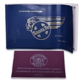
Santa Fe Passenger Train Car Equipment Plans and Southern Pacific Common Standard Plans BooksRail & Road Auctions4.6(165)See Sold PriceMar 08, 2024
The Complete History of World War II 1948North American Artifact Auctions4.6(184)See Sold PriceApr 20, 2024
War Diary of 354th Infantry - 89th Division 1919North American Artifact Auctions4.6(184)See Sold PriceApr 20, 2024
1870 Commentary on the Gospels Vol I St Mathew & Vol II St Mark 1st EditionsNorth American Artifact Auctions4.6(184)See Sold PriceApr 20, 2024
[EROTICA]. FORBERG, F. K. (1770-1848). Figuris Veneris (The...Potter & Potter Auctions4.6(544)See Sold PriceMar 07, 2024
[SHEET MUSIC]. A Pair of Nineteenth-Century Bound Volumes o...Potter & Potter Auctions4.6(544)See Sold PriceMar 07, 2024
1738 BIBLE in DUTCH ILLUSTRATED w/ MAPS MASSIVE FOLIO in DUTCH antique BIBLIAJasper524.5(9.8k)See Sold PriceFeb 27, 2024
1558 SCANDINAVIA SWEDEN ILLUSTRATED HISTORY Gothorum Sveonumque historia antiqueJasper524.5(9.8k)See Sold PriceFeb 27, 2024
PINK FLOYD: THE WALL (1982) - Draft Script with Pair of Crew T-ShirtsPropstore4.2(6)See Sold PriceMar 13, 2024
Carte de la Barbarie… l'empire de Maroc… North Africa Morocco. LAPIE 1829 mapJasper524.5(9.8k)See Sold PriceFeb 28, 2024
Carte d'Afrique. Africa Soudan Zanzibar. LAPIE 1831 old antique map plan chartJasper524.5(9.8k)See Sold PriceFeb 28, 2024
Carte de l'Afrique propre, de la Numidie… North Africa. LAPIE 1829 old mapJasper524.5(9.8k)See Sold PriceFeb 28, 2024
MALLET. Description de l'Univers. Africa. Volume 3 title page. MALLET 1683Jasper524.5(9.8k)See Sold PriceFeb 28, 2024
NORTH AFRICA BARBARY. Parts of Tripoli (Libya) & Egypt. Tribes. SDUK 1848 mapJasper524.5(9.8k)See Sold PriceFeb 28, 2024
1761 SCHIEDAM COAT OF ARMS VELLUM BOUND ANCIENT CICERO RHETORICORUM AD HERENNIUMNY Elizabeth 4.3(85)See Sold PriceMar 03, 2024
ANTIQUE 1686 OPERA OMNIA BY JOHN LIGHTFOOT TELLIMA BOUND FOLIO WITH ISRAEL MAPNY Elizabeth 4.3(85)See Sold PriceMar 03, 2024


![[Title Page] Theatrum Orbis Terrarum, Sive Atlas Novus. (1 of 6)](https://p1.liveauctioneers.com/5584/135983/69195731_1_x.jpg?height=282&quality=70&version=1550020660)
![[Title Page] Parergon, sive Veteris Geograpiæ aliquot (1 of 2)](https://p1.liveauctioneers.com/5584/160636/81086715_1_x.jpg?height=282&quality=70&version=1580865551)


![[EROTICA]. FORBERG, F. K. (1770-1848). Figuris Veneris (The... (1 of 1)](https://p1.liveauctioneers.com/928/318880/171360975_1_x.jpg?height=282&quality=70&version=1707501302)
![[SHEET MUSIC]. A Pair of Nineteenth-Century Bound Volumes o... (1 of 4)](https://p1.liveauctioneers.com/928/318880/171361192_1_x.jpg?height=282&quality=70&version=1707501302)


