ATLAS of ANTIENT GEOGRAPHY by SAMUEL BUTLER 1843John McInnis Auctioneers,LLC4.6(502)See Sold PriceFeb 24, 2024
18TH C. ANTIQUE MAP: FRENCH & INDIAN WAR, FRAMEDThomaston Place Auction Galleries4.4(386)See Sold PriceFeb 24, 2024
Rand McNally Railroad Map Cabinet w/ 21 Railroad MapsRail & Road Auctions4.6(165)See Sold PriceMar 08, 2024
Keith Haring - Ink on New York Map, Best Buddies, Inscribed, Signed, and DatedSapphire Auction Gallery4(67)See Sold PriceMar 02, 2024
LATE 17TH C. FRENCH MAP OF THE NEW WORLD BY ALEXIS-HUBERT JAILLOT (1632-1712)Thomaston Place Auction Galleries4.4(386)See Sold PriceFeb 24, 2024
Central Railroad of New Jersey Map of Sandy Hook Route-ca. 1903JM Hobby Supply and Railroad Artifact Auctions4.4(126)See Sold PriceFeb 24, 2024
Lot of Six Mixed Atlas Box Cars-HO Scale-New in BoxJM Hobby Supply and Railroad Artifact Auctions4.4(126)See Sold PriceFeb 25, 2024
Rand McNally/Santa Fe Railroad Map of Iowa-1912JM Hobby Supply and Railroad Artifact Auctions4.4(126)See Sold PriceFeb 24, 2024
NICOLAES VISSCHER (NETHERLANDS, 1618-1709) MAP OF THE NEW WORLDThomaston Place Auction Galleries4.4(386)See Sold PriceFeb 24, 2024
17TH C. WORLD MAP BY NICOLAES VISSCHER (NETHERLANDS, 1618-1709)Thomaston Place Auction Galleries4.4(386)See Sold PriceFeb 24, 2024
Lot of Six Mixed Atlas Cabooses-HO Scale-New in BoxJM Hobby Supply and Railroad Artifact Auctions4.4(126)See Sold PriceFeb 25, 2024
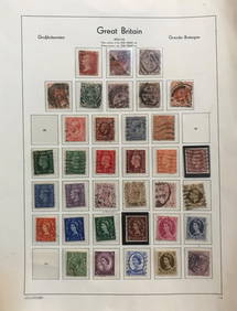
SoldHungarian map of Great Britain c.1800Heading: (Maps) Author: Gabor, Eros Title: Nagy Britannia Place Published: Budapest Publisher: Date Published: c.1800 Description: Engraved map. 44x33.5 cm (17¼x13¼").See Sold Price
Hungarian map of Great Britain c.1800Heading: Author: Gabor, Eros Title: Nagy Britannia Place Published: Budapest Publisher: Date Published: c.1800 Description: Engraved map. 44x33.5 cm (17¼x13¼").See Sold Price
Hungarian map of Great Britain c.1800Heading: Author: Gabor, Eros Title: Nagy Britannia Place Published: Budapest Publisher: Date Published: c.1800 Description: Engraved map. 44x33.5 cm (17¼x13¼"See Sold Price
SoldRailway map, Great Britain, 1839 map of the railways ofRailway map, Great Britain, 1839 map of the railways of Great Britain, by George Bradshaw, January 1839, map is 54.5" by 33.75", reprint (?)See Sold Price
SoldRARE 1697 MAP GREAT BRITAIN - CLUVERRare engraved antique map of Great Britain, with a very decorative cartouch. Map of Great Britain including England, Scotland, and Ireland with an inset map of the Orkney Islands. Locations are givenSee Sold Price
Tallis/Rapkin: Antique Railway Map Great Britain, 1851Title/Content of Map: 'Tallis's Railway Map of Great Britain showing the railways completed, and the stations on each line, up to the present time, with the steamboat tracks from the principal BritishSee Sold Price
Map - Great Britain, France, Ireland.C. 1794An Accurate Map of Great Britain, France, Ireland C. 1794 "With parts of Spain, Germany, Denmark ." Hand-colored lithograph. Published May 12, 1794. Laurie & Whittle London. Condition: Some staining.;See Sold Price
Silk Map.- Great Britain and Ireland for the Year, mapSilk Map.- Great Britain and Ireland for the Year 1832, map printed on silk, browned, folds, 890 x 900mm., 1832.See Sold Price
Sold(Map, Great Britain), Ogilby, John (1600-1676), Th(Map, Great Britain), Ogilby, John (1600-1676), The Road from London to Boston, hand-colored strip map, framed with verre eglomise mat, sight size 17 5/8 x 13 3/8 in. (450 x 340 mm), (minor handling cSee Sold Price
Antique Map - Great Britain & Ireland - 1883Antique Map - Great Britain & Ireland - 1883 Size : 9.25" x 11.25"See Sold Price
Gray's Atlas Map Great Britain and Ireland.Title/Content of Map: Gray's Atlas Map Great Britain and Ireland. Cartographer: GRAY, ORMANDO W. Date: 1873 Publisher: O.W. GRAY & SON Size: 15.5Height - 11.75Width Map of the continent of Europe on rSee Sold Price
Gray's Atlas Map Great Britain and Ireland.Title/Content of Map: Gray's Atlas Map Great Britain and Ireland. Date: 1873 Cartographer: GRAY, ORMANDO W. Size: 15.5x11.75 Map of the continent of Europe on reverse. Dry and flaking. Please note thaSee Sold Price
Bartholomew's Revised Half-Inch Map. Great Britain.Title: Bartholomew's Revised Half-Inch Map. Great Britain. Sheet 30. Lincolnshire. Cartographer: BARTHOLOMEW, JOHN & SON Publisher: The Geographical Institute, John Bartholomew & Son Ltd. Brief DescriSee Sold Price
Antique Map - Great Britain & Ireland - 1883Antique Map - Great Britain & Ireland - 1883 Size : 9.25" x 11.25"See Sold Price
Antique Map - Great Britain & Ireland - 1883Antique Map - Great Britain & Ireland - 1883 Size : 9.25" x 11.25"See Sold Price
(MAPS, GREAT BRITAIN, IRELAND AND ITALY) A collect(MAPS, GREAT BRITAIN, IRELAND AND ITALY) A collection of maps of Great Britain, Ireland and Italy. Property from the Collection of John Sisto, Berwyn, IllinoisSee Sold Price
Cary: Antique Map of Great Britain and Ireland 1789TITLE/CONTENT OF MAP: 'Great Britain and Ireland with ye Judges circuits. Distances of the cities & shire towns in England & Wales' DATE PRINTED: 1789 IMAGE SIZE: Approx 38.5 x 50.5cm, 15 x 19.75 inchSee Sold Price
Great Britain and Ireland.Title/Content of Map: Great Britain and Ireland. Date: 1810-01-01 Cartographer: RUSSELL, JR. Publisher: C. CRADOCK & W. JOY Size: 6Height - 4.75Width ...Engraved for Guy's School Geography. AttractiveSee Sold Price
"Great Britain and Ireland with ye Judges circuits" byTITLE/CONTENT OF MAP: 'Great Britain and Ireland with ye Judges circuits. Distances of the cities & shire towns in England & Wales' DATE PRINTED: 1789 IMAGE SIZE: Approx 38.5 x 50.5cm, 15 x 19.75 inchSee Sold Price
Great Britain and Ireland with ye Judges circuits byTITLE/CONTENT OF MAP: 'Great Britain and Ireland with ye Judges circuits. Distances of the cities & shire towns in England & Wales' The top image on the right hand side shows the entire map. This mapSee Sold Price
British Case Alaska Boundary Commission Appendix.[America/ Alaska] 18 sheets of maps, 2 index maps. Great Britain/Alaska Boundary Tribunal. “British case, Alaska boundary. Appendix Vol. III. -- : portfolio of maps accompanying International BoSee Sold Price
SoldMaps of Great Britain and Ireland (6)BOWEN, Emanuel (c. 1694-1767). A New Map of Ireland. From the Best Observations. 1764. 14 1/8 x 9 1/8 inches; MERCATOR, Gerardus (1512-1594) and HONDIUS. Irlandia regnum. 1613. 16 1/2 x 20 3/4 inches;See Sold Price
Sold17TH-CENTURY MAP OF GREAT BRITAIN AND IRELANDCartographer: Frederick de Wit, framed 75 cm. x 65 cm.See Sold Price
SoldAntique Map of Great Britain(1) 20" x 15". Title: Les Isles Britanniques. Subject: at Britain.See Sold Price
General Books - Four Maps of Great Britain Designed by Matthew Paris About A.D. 1250TimeLine Auctions Ltd.4.5(183)See Sold PriceMar 08, 2024
Jewish National Fund Collection Box - Great BritainLevy Auction House4.3(11)See Sold PriceFeb 27, 2024
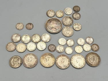
Group of Canada, New Zealand, Australia, Great Britain Silver CoinsDana J. Tharp Auctions4.7(268)See Sold PriceFeb 24, 2024
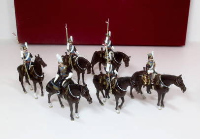
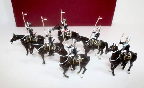
H.M. Of Great Britain "Advancing with Mistletoe"Old Toy Soldier Auctions USA4.8(1.1k)See Sold PriceMar 15, 2024
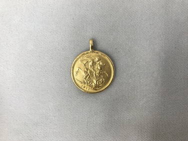
1911 Great Britain Gold Half Sovereign Coin in Bezel George VGalerie Du Louvre4.5(51)See Sold PriceMar 09, 2024
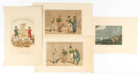
Henry Alken, The National Sports of Great Britain, Four Hand Colored Engravings Ca. 1821Hoch LTD.4.5(73)See Sold PriceFeb 25, 2024
Donovan's The Natural History of British Shells - 5 Volumes in 3 Books with 180 EngravingsTrillium Antique Prints & Rare Books4.5(30)See Sold PriceFeb 24, 2024
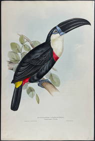
Gould - Natterer's Aracari or ToucanTrillium Antique Prints & Rare Books4.5(30)See Sold PriceFeb 24, 2024
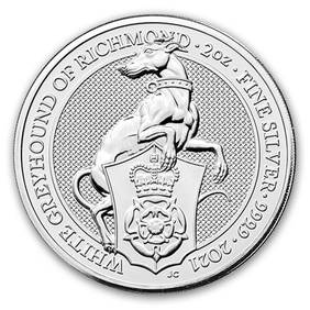
2021 Great Britain 2 oz Silver Queen's Beasts The White GreyhoundGolden Air Auctions4.4(257)See Sold PriceFeb 24, 2024
2021 Great Britain 1 kilo Gold The Gothic Crown Proof (Box & COA)Golden Air Auctions4.4(257)See Sold PriceFeb 25, 2024