SoldOgilby strip map of Road from LondonTitle: The Road from London to Flambourough Head in Com Ebor... Containing 212 mile 6 Furlongs... Author: Ogilby, John Description: Copper-engraved strip map. 34.5x43 cm. (13½x17"), matted & framed uSee Sold Price
SoldSussex.- - A mixed group of mostly smaller maps of theincluding Drayton's Poly-olbion map of Sussex, Surrey and Middlesex, 2 variant states of the Norden/Kip map for Camden's Britannia, Ogilby's strip road map from London to Rye, and others by Blome, MorSee Sold Price
A mixed group of mostly smaller maps of the county,including Drayton's Poly-olbion map of Sussex, Surrey and Middlesex, 2 variant states of the Norden/Kip map for Camden's Britannia, Ogilby's strip road map from London to Rye, and others by Blome, MorSee Sold Price
SoldOgilby (John) Three Strip Road MapsOgilby (John) Three Strip Road Maps, The Road From London To Montgomery, North Wales; The Road From Buckingham To Bridgeworth; The Road From London To Shrewsbury, 3 engraved strip road maps, wSee Sold Price
SoldOgilby strip map of English roadHeading: (Great Britain) Author: Ogilby, John Title: The Continuation of the Extended Road from Buckingham to Bridgnorth in Com Salop… Place Published: London Publisher: Date Published: 1675<See Sold Price
SoldOGILBY, JOHN COLOR ETCHINGS OF ROAD STRIP MAPSJOHN OGILBY, COLOR ETCHINGS OF ROAD STRIP MAPS, 4 PCS., 12" - 14" H. X 17" W.:four double page, color engravings of road strip maps entitled: "The Road From London to Oakeham", "The Road From London tSee Sold Price
SoldMaps: Three road strip maps, comprising the Road fromMaps: Three road strip maps, comprising the Road from London to Buckingham after John Ogilby, a hand coloured example of the same route, and a hand coloured strip map with a survey of the road from GlSee Sold Price
SoldOgilby (John) The Road from London to Holy-headOgilby (John) The Road from London to Holy-head,the first of 4 plates of the route to Holyhead, strip road map from London to Towcester, via St Alban's, Dunstable and Stony Stratford, each strSee Sold Price
SoldOgilby (John) London to Holy=head [1st plate]Ogilby (John) The Road from London to Holy=head [1st plate],strip road map from London to Towcester, via St Alban's, Dunstable and Stony Stratford, each strip with a compass rose, the first ofSee Sold Price
SoldOgilby (John) The Road from London to RyeOgilby (John) The Road from London to Rye,road strip map, London lower left, Rye upper right, with north oriented to the lower left, decorative title cartouche with putti upper centre, engraveSee Sold Price
London.- Ogilby (John) The Road from London to Hith inLondon.- Ogilby (John) The Road from London to Hith in Com. Kent, strip road map with London in the lower left corner, engraving with hand-colouring, platemark 330 x 420 mm (13 x 16 1/2 in), sheet 435See Sold Price
Ogilby, John (Scottish/British 1600-1676) Strip mapsA Set of five framed strip maps from the Britannia series of 100, first published in 1675. Included in this lot: No. 5. The Road from London to Barwick No. 10. The Road from London to Bristol No. 35.See Sold Price
Ogilby, John (Scottish/British 1600-1676) Strip mapsA set of five framed strip maps from the Britannia series of 100, first published in 1675. Included in this lot: No. 5. The Road from London to Barwick No. 10. The Road from London to Bristol No. 35.See Sold Price
Ogilby, John (Scottish/British 1600-1676) Strip mapsA set of five framed strip maps from the Britannia series of 100, first published in 1675. Included in this lot: No. 5. The Road from London to Barwick No. 10. The Road from London to Bristol No. 35.See Sold Price
SoldCornwall.- - A mixed group of road maps and smallcomprising 2 strip maps by Ogilby, The Continuation of the Extended Road from Barstable to Truro, and The Continuation of the Road from London to the Lands-End, with a reduced version of the latter bySee Sold Price
SoldEngraving Road from London to Arundel John OgilbyHand colored engraving of the road from London to Arundel. This was known as a strip map. By John Ogilby, Esquire. (1600-1676) 17 1/2" W x 13" H. In good condition.See Sold Price
Sold[Ogilby (John)] Road from London to Barwick[Ogilby (John)] Road from London to Barwickengraved strip road map from Newcastle to Berwick, decorative cartouche, with hand-colouring, 325 x 445mm., [c.1670], and a map of the British IslesSee Sold Price
Ogilby (John) The Road from London to WeymouthOgilby (John) The Road from London to Weymouth,strip road map extending from Basingstoke to Weymouth, with title cartouche upper centre, engraved map with hand-colouring, 345 x 470mm., centralSee Sold Price
SoldOgilby (John) The Road from London to WeymouthOgilby (John) The Road from London to Weymouth,strip road map extending from Basingstoke to Weymouth, with title cartouche upper centre, engraved map with hand-colouring, 345 x 470mm., centralSee Sold Price
SoldOgilby (John) The Road from London to PortsmouthOgilby (John) The Road from London to Portsmouth,strip road map of the modern day A3 via Wandsworth, Kingston, Cobham, Guildford and Petersfield, decorative title cartouche and royal arms uppeSee Sold Price
SoldOgilby (John) - A Group of Strip Road Maps,The Road from London to Shrewsbury; The Continuation Road from London to Holy-head; The Road from London to Flamourough Head; and 5 others including 1 duplicate , 8 engraved strip road maps, 4 with haSee Sold Price
SoldMap: '' The Road from London to Carlisle '' strip mapMap: '' The Road from London to Carlisle '' strip map from the 'Britannia' by John Ogilby, first published in 1675 with later hand colouring, this was map number 37 of 100 from the atlas.See Sold Price
SoldOgilby (John) The Road from London to AbingdonOgilby (John) The Road from London to St Davids,sheet 1, the section from London to Abingdon, engraved strip road map, with hand-colouring, 305 x 445mm., central vertical fold, a soft horizontSee Sold Price
SoldOgilby (John) The Road from London to OxfordOgilby (John) The Road from London to Aberistwith,sheet 1, the section from London to Oxford, engraved strip road map, with hand-colouring, 325 x 440mm., central vertical fold, creasing to uppSee Sold Price
1892 Adams and Bowles New Road Map of the State of New YorkJM Hobby Supply and Railroad Artifact Auctions4.4(126)See Sold PriceFeb 24, 2024
FLYING A TOURING SERVICE U.S. ROAD MAPS TIN WALL DISPLAY.Dan Morphy Auctions4.2(1.3k)See Sold PriceFeb 25, 2024
17TH C. ENGLISH LINEAR MAP BY OGILBY, FRAMEDThomaston Place Auction Galleries4.4(386)See Sold PriceFeb 24, 2024
Westland Oil Company North Dakota Road MapCheck the Oil Promotions, LLC4.6(275)See Sold PriceFeb 25, 2024
An "Official Disneyland Road Map" Richfield Brochure.Van Eaton Galleries4.6(99)See Sold PriceMar 02, 2024
Keith Haring Artwork Signed on a Shell Oil New York Road Map 18 in. x 24 in.Donny Malone Auctions4.5(1.7k)See Sold PriceMar 04, 2024
Paterson & Mogg 1822 Pair of British Road Maps. Isle of Thanet & WightAlbion Auctions4.6(336)See Sold PriceMar 01, 2024
Paterson & Mogg 1822 Pair of British Road Maps. Rye, Eastbourne, SouthamptonAlbion Auctions4.6(336)See Sold PriceMar 01, 2024
Paterson & Mogg 1822 Pair of British Road Maps. Deal, Hythe, Shoreham, ChichesterAlbion Auctions4.6(336)See Sold PriceMar 01, 2024
A 14ct Gold Half Hunter Pocket Watch by John Myers & Co Ltd of Westminster Bridge Road, London and CHannam's Auctioneers Ltd4.3(386)See Sold PriceFeb 27, 2024
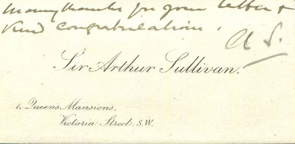
SULLIVAN ARTHUR: (1842-1900)International Autograph Auctions Europe S.L.4.5(52)See Sold PriceMar 13, 2024
CHRISTIE ETHEL: (1898-1952)International Autograph Auctions Europe S.L.4.5(52)See Sold PriceMar 13, 2024
OLD ILLUSTRATED 1902 CROSS-COVERED LANDS JOURNEY TO CALCUTTA, INDIA, 2 VOLUMESNY Elizabeth 4.3(84)See Sold PriceMar 03, 2024


![Ogilby (John) London to Holy=head [1st plate] (1 of 1)](https://p1.liveauctioneers.com/410/16866/5605207_1_x.jpg?height=282&quality=70&version=1220278581)


![[Ogilby (John)] Road from London to Barwick (1 of 1)](https://p1.liveauctioneers.com/410/8611/1592488_1_x.jpg?height=282&quality=70)