SoldCornwall.- - A mixed group of road maps and smallcomprising 2 strip maps by Ogilby, The Continuation of the Extended Road from Barstable to Truro, and The Continuation of the Road from London to the Lands-End, with a reduced version of the latter bySee Sold Price
SoldA mixed group of maps of the British IslesA large mixed group of maps of the British Isles, including several county maps, small road maps (10), and others of England, Wales, Scotland and Ireland, engravings and lithographs, severalSee Sold Price
SoldA small, mixed group of maps of IrelandIreland.- A small, mixed group of maps of Ireland, comprising 3 of Ireland, 2 of Howth Harbour, 1 of the road from Howth Harbour to Dublin, a road map of county Clare, Galway, Roscommon and MaSee Sold Price
SoldSwitzerland.- - A small, mixed, group of maps and3 folding general maps, Carte de la Suisse, by Rodolphe Gross, 1852, Road Map of Switzerland, by Mullhaupt, 1856, and Keller's Second Road Map of Switzerland, 1859, engraved maps, the first named prinSee Sold Price
Switzerland.- - A small, mixed, group of maps and3 folding general maps, Carte de la Suisse, by Rodolphe Gross, 1852, Road Map of Switzerland, by Mullhaupt, 1856, and Keller's Second Road Map of Switzerland, 1859, engraved maps, the first named prinSee Sold Price
SoldA small, mixed group of maps and town plans of EnBritish Isles.- A small, mixed group of maps and town plans of England and Scotland, including several of Kent and the Isle of Thannet, the Isle of White, road maps and town plans, including TSee Sold Price
SoldBritish Isles.- a mixed group of mapsBritish Isles.- a mixed group of maps,including the Isle of Wight, the Isle of Man, 13 Bowen road maps, and with a group of county maps, including Dorset, Devon, Cornwall, Warwickshre, and othSee Sold Price
Switzerland.- - A small, mixed, group of maps and3 folding general maps, Carte de la Suisse, by Rodolphe Gross, 1852, Road Map of Switzerland, by Mullhaupt, 1856, and Keller's Second Road Map of Switzerland, 1859, engraved maps, the first named prinSee Sold Price
SoldA small, mixed gruop of maps of WalesA small, mixed group of maps of Wales, the Mail Roads between Holyhead and Bangor Ferry, the Holyhead road in the county of Salop, the Menai Strait including the Site of the New Bridge & TheSee Sold Price
SoldA small mixed group of English county maps,comprising Cornwall by Robert Morden for 'New Description and State of England', 1701; Northumbriæ Comitatus by Saxton and Hole, and Huntingdon Comitatus by Saxton and Kip, both for Camden's BritSee Sold Price
SoldEngland and Wales.- a small, mixed, group of counA small, mixed, group of county maps,including a small Morden map of Hertfordshire, a Moll map of Cambridgeshire, Owen and Bowen's The Road from Prestain to Carmarthen, and Caermarthen ShireSee Sold Price
A small mixed group of English county maps,comprising Cornwall by Robert Morden for 'New Description and State of England', 1701; Northumbriæ Comitatus by Saxton and Hole, and Huntingdon Comitatus by Saxton and Kip, both for Camden's BritSee Sold Price
A small mixed group of English county maps,comprising Cornwall by Robert Morden for 'New Description and State of England', 1701; Northumbriæ Comitatus by Saxton and Hole, and Huntingdon Comitatus by Saxton and Kip, both for Camden's BritSee Sold Price
Soldgroup of folding British regional mapsBritish Isles.- a small, mixed, group of folding maps,including Great Northern Railway, from Bridlington to Basingstoke, from Wrexham to Great Yarmouth, 1898; Black's Road & Railway TravellingSee Sold Price
SoldA mixed group of small maps of the continent,by or after Porro, Ortelius, van den Keere, Vrints, Morden, Bion, and Mercator, engraved maps, some with text below or on verso, v.s., 85 x 120mm. to 165 x 200mm., occasional slight browning, late 16tSee Sold Price
SoldAntique Printed Europe Map Group18th-19th century AD. A mixed group comprising: a small map of the 'South East part of Germany', by Gibson (1774); a double-page coloured map of 'Prussia' by J. Rapkin; a hand-coloured map of 'FranceSee Sold Price
SoldEurope.- a small mixed group of mapsEurope.- a small mixed group of maps,including 5 maps of Spain and Portugal, and maps of Greece, Sicily, and Corsica, by or after Vandermaelen, Tardieu, Alt, and others, engravings, some hand-See Sold Price
SoldWest Indies.- - A small mixed group of maps,comprising A New and Accurate Map of the Island of Antigua or Antego, by Emanuel Bowen; Map of the Island of Tobago, by Bryan Edwards; The Island of St Christophers alias St. Kits, by Herman Moll; PiaSee Sold Price
SoldA Small, Mixed Group Of Maps Of EuropeA Small, Mixed Group Of Maps Of Europe, including France (16), Russia (12), Spain (8), Sweden and Norway (8), and others, with several small world hemispheres (7), mostly lithographs, a few eSee Sold Price
Soldworld.- a small mixed group of mapsWorld.- a small mixed group of maps,including the British Isles, by Sebastian Munster, hand-coloured woodcut map, 80 x 130mm., mounted close, framed and glazed, c.1545 or later; 2 woodblock maSee Sold Price
Sold-. Sanson (Guillaume) - small mixed group of maps ofincluding the rare map Asia Minor in Epitomen Contracta, from Hellespont to Syria, including Cyprus and the Black Sea, decorative title cartouche above, architectural dedication vignette lower right,See Sold Price
Sold0 A small mixed group of maps0 A small mixed group of maps,including 2 from Thompson's New General Atlas, Austrian Dominions, and Corea and Japan, a Cary map of France, an 18th century map of Holland by Jean Lattré, and aSee Sold Price
A small, mixed group of maps of New ZealandA small, mixed group of maps of New Zealand,lithographs, from 200 x 180mm. to 490 x 600mm., various conditions, various publishers, including the House of Commons, the Journal Of The Royal GeSee Sold Price
SoldA small, mixed group of mapsA small, mixed group of maps,with regional and national maps of South America, Russia, and Africa, engraved maps, v.s., from 170 x 240mm to 350 x 540mm, occasional browning, spotting, surfaceSee Sold Price
Ancient Roman Imperial Coins - Unresearched - Mixed AE3/4 Coin Group [250+]TimeLine Auctions Ltd.4.6(183)See Sold PriceMar 09, 2024
Group of Three Wadhams Mobil Road MapsCheck the Oil Promotions, LLC4.6(327)See Sold PriceFeb 25, 2024
Group of Standard Oil Family Road MapsCheck the Oil Promotions, LLC4.6(327)See Sold PriceFeb 25, 2024
Mixed Group of Railroad Paper - 1895 Telegraph Registers, Art Prints, Profile Blueprint, Way-Bills,Rail & Road Auctions4.6(165)See Sold PriceMar 07, 2024
Assortment of Railroad Paper - Rule Books, Stationary, Ink Blotter, Map, Timetables, and MoreRail & Road Auctions4.6(165)See Sold PriceMar 07, 2024
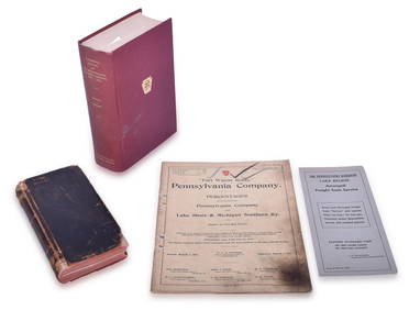
Four Pennsylvania Railroad Paper Items - 1906 CT 1000 Manual, 1913 Percentages, 1949 CentennialRail & Road Auctions4.6(165)See Sold PriceMar 07, 2024
Mixed Group of Eastern Railroad Uniform Cap Badges, Patches, and Pins - Amtrak, Jersey CentralRail & Road Auctions4.6(165)See Sold PriceMar 07, 2024
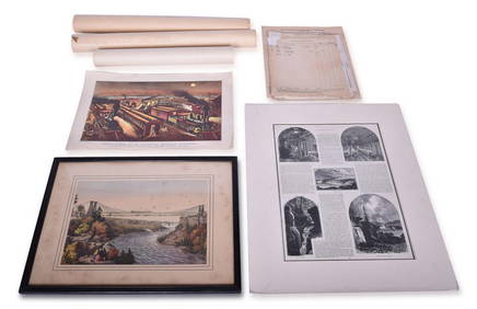
Group of Ten Railroad Photographs, Maps, and Prints - New Jersey, Long Island, and New YorkRail & Road Auctions4.6(165)See Sold PriceMar 07, 2024
Mixed Group of Small Steiff - Mouse, Hedgehog, Pig and MoreAmanda Auction Gallery, LLC4.4(23)See Sold PriceMar 03, 2024


![Ancient Roman Imperial Coins - Unresearched - Mixed AE3/4 Coin Group [250+] (1 of 1)](https://p1.liveauctioneers.com/1191/317894/170617375_1_x.jpg?height=282&quality=70&version=1706620797)