ATLAS of ANTIENT GEOGRAPHY by SAMUEL BUTLER 1843John McInnis Auctioneers,LLC4.5(505)See Sold PriceFeb 24, 2024
18TH C. ANTIQUE MAP: FRENCH & INDIAN WAR, FRAMEDThomaston Place Auction Galleries4.4(393)See Sold PriceFeb 24, 2024
Rand McNally Railroad Map Cabinet w/ 21 Railroad MapsRail & Road Auctions4.6(165)See Sold PriceMar 08, 2024
Keith Haring - Ink on New York Map, Best Buddies, Inscribed, Signed, and DatedSapphire Auction Gallery4(67)See Sold PriceMar 02, 2024
LATE 17TH C. FRENCH MAP OF THE NEW WORLD BY ALEXIS-HUBERT JAILLOT (1632-1712)Thomaston Place Auction Galleries4.4(393)See Sold PriceFeb 24, 2024
Central Railroad of New Jersey Map of Sandy Hook Route-ca. 1903JM Hobby Supply and Railroad Artifact Auctions4.4(127)See Sold PriceFeb 24, 2024
Lot of Six Mixed Atlas Box Cars-HO Scale-New in BoxJM Hobby Supply and Railroad Artifact Auctions4.4(127)See Sold PriceFeb 25, 2024
Rand McNally/Santa Fe Railroad Map of Iowa-1912JM Hobby Supply and Railroad Artifact Auctions4.4(127)See Sold PriceFeb 24, 2024
NICOLAES VISSCHER (NETHERLANDS, 1618-1709) MAP OF THE NEW WORLDThomaston Place Auction Galleries4.4(393)See Sold PriceFeb 24, 2024
17TH C. WORLD MAP BY NICOLAES VISSCHER (NETHERLANDS, 1618-1709)Thomaston Place Auction Galleries4.4(393)See Sold PriceFeb 24, 2024
Lot of Six Mixed Atlas Cabooses-HO Scale-New in BoxJM Hobby Supply and Railroad Artifact Auctions4.4(127)See Sold PriceFeb 25, 2024
SoldTwo Maps by Willem Janszoon Blaeu (1571-1638),Two Maps by Willem Janszoon Blaeu (1571-1638), "Virginiae partis australis et Florida partis orientalis," 1640, hand colored, H. - 15 in., W. - 20 in.; together with India Quae Orientalis Diktur et InSee Sold Price
SoldTwo Maps by Willem Janszoon Blaeu (1571-1638,Two Maps by Willem Janszoon Blaeu (1571-1638, Amsterdam), "Noramndia Ducatus (with History on reverse)," 1640; together with "Languedoc," 1640, hand colored, Languedoc- H. - 19 in., W. 24 in., DucatusSee Sold Price
SoldTwo Maps by Willem Janszoon Blaeu (1571-1638,Two Maps by Willem Janszoon Blaeu (1571-1638, Amsterdam), "Burgundia Ducatus," 1640; together with "Champagne Latine Campania Comitatus," 1640, hand colored, Champagne- H. - 16 in., W. - 23 in., BurguSee Sold Price
SoldTwo 17th Century Continental European MapsOne map of Westphalia by Willem Janszoon Blaeu (1571 -1638) Westphalia Ducatus Auctore Ioh. Gigante Medico et Mathematico, 1662, black and white line engraving with period hand color, 15 x 16-1/2 in.See Sold Price
Blaeu Map of ChiliChili. Willem Janszoon Blaeu (1571-1638). Engraved map with original hand color. Amsterdam: Blaeu, c. 1650. 20 x 23 1/2 inches sheet. Willem Blaeu’s very decorative map of Chile features two large aSee Sold Price
SoldA Very Decorative Map of Poland with two Cartouches andPrinted in Amsterdam, Willem Janszoon (or Jansz.) Blaeu (1571 - 1638) , C. 1648, cartouch reads 'Polonia regnum et Silesia ducatus', copper plate engraving, hand coloured, untrimmed, map showing the rSee Sold Price
SoldEarly American East Coast Map, Willem BleauWillem Janszoon Blaeu (Dutch, 1571-1638). Two conjoined pages to form the single map depicting New Netherlands and New England, with Manhattan and the coast of Long Island. Embellished with ships, figSee Sold Price
SoldGrp: 4 Regional Maps Blaeu OrteliusGroup of four hand colored regional maps. Includes three maps by Willem Janszoon Blaeu (1571-1638), "Prima pars Brabantiae cuius caput Lovanium," a map depicting Tienen and Leuven in Belgium, and "ComSee Sold Price
Sold(2) 18TH C ENGRAVED MAPS - 'Hollandia Comitatus' by(2) 18TH C ENGRAVED MAPS - 'Hollandia Comitatus' by Willem Janszoon Blaeu (1571-1638), Amsterdam, circa 1635. The upper right corner inset with map of the isles Texel, Vlieland and Terschelling; PLUSSee Sold Price
(2) 18TH C ENGRAVED MAPS - 'Hollandia Comitatus' by(2) 18TH C ENGRAVED MAPS - 'Hollandia Comitatus' by Willem Janszoon Blaeu (1571-1638), Amsterdam, circa 1635. The upper right corner inset with map of the isles Texel, Vlieland and Terschelling; PLUSSee Sold Price
SoldMAPS - BRITISH ISLES MAPS - BLAEU, Willem JanszooMAPS - BRITISH ISLES MAPS - BLAEU, Willem Janszoon (1571-1638). Anglia Regnum; Scotia Regnum; Magna Britanniae; Hibernia Regnum.Amsterdam: 1638. 4 engraved maps of the British Isles, French teSee Sold Price
(4) FRAMED LITHOGRAPH MAPS OF AMERICA , ASIA,EUROPE & AFRICA , AFTER WILLEM JANSZOON BLAEU ; 1571-1638- MAP OF AMERICA IS 1634 , ASIA IS 1639, EUROPE IS 1637 & AFRICA IS 1160See Sold Price
SoldWillem Blaeu map of Cambridge, 1645Willem Janszoon Blaeu (1571-1638) map of Cambridge, hand colored, titled "Cantabrigiensis Comitatus, Cambridge Shire", c 1645. Appx 20 1/4" x 23 1/4", frame appx 30 3/4" x 33 7/8". Very good conditionSee Sold Price
Early Copy of Engraved Map of Africa by Willem BlaeuAn early hand-colored copy of a copper engraved map of Africa by Dutch cartographer Willem Janszoon Blaeu (1571-1638). This map is signed and dated 1631 on the lower left. It is presented in a woodenSee Sold Price
Sold16TH C. MAP OF PERU16th century original colored map of Peru by Dutch cartographer Willem Janszoon Blaeu (1571-1638). Good condition, with some light foxing at edges and small tears at center crease edges. Framed and hoSee Sold Price
SoldPrint, After Willem Janszoon BlaeuAfter Willem Janszoon Blaeu (1571-1638), Map of Bermuda, reproduction print with hand coloring, overall (with frame): 29.25"h x 57"w. Provenance: Property from the Spenger's Fish Grotto Collection, BeSee Sold Price
SoldGrp: 3 Maps Eastern Europe Ukraine Romania BlaeuGroup of three maps of Eastern Europe. Includes one map of Walachia, Serbia, Bulgaria, and Romania by Willem Janszoon Blaeu (1571-1638); one map of Slovenia, Croatia, and Bosnia by Blaeu after GerarduSee Sold Price
SoldBlaeu Engraved Map of AfricaAfricae Nova Descriptio. Willem Janszoon Blaeu (1571 - 1638). Engraved map with original hand color in part. Amsterdam, c. 1642-1663. 19 1/2 x 23 inches sheet, 32 1/2 x 28 3/4 inches framed.See Sold Price
SoldBlaeu Map of the Atlantic StatesVirginiae partis Australis et Floridae partis orientalis... Willem Janszoon Blaeu (1571-1638). Engraved map with original hand color. Amsterdam, 1645. 18 x 23 3/4 inches sheet.See Sold Price
MAPS - VIRGINIA - BLAEU, Willem Janszoon (1571-163MAPS - VIRGINIA - BLAEU, Willem Janszoon (1571-1638) Nova Virginiae TabulaAmsterdam: after 1630. 485 x 570 mm (plate 375 x 480 mm). Hand-colored copper engraved map. French text on verso. CondSee Sold Price
Blaeu Map of VenezuelaVenezuela cum parte Australi Novae Andalusiae...Willem Janszoon Blaeu (1571-1638). Engraved map with original hand color. Amsterdam, c. 1640. 19 3/4 x 23 inches sheet.See Sold Price
SoldAttractive old color example of Blaeu’s map of AfricaAfricae nova descriptio. Willem Janszoon Blaeu (1571-1638). Engraved map with original hand color in full. Amsterdam, c. 1642-1663. 19 1/2 x 23 inches sheet, 29 1/2 x 32 1/2 inches framed. Nice old coSee Sold Price
MAPS - VIRGINIA - BLAEU, Willem Janszoon (1571-163MAPS - VIRGINIA - BLAEU, Willem Janszoon (1571-1638) Nova Virginiae TabulaAmsterdam: after 1630. 485 x 570 mm (plate 375 x 480 mm). Hand-colored copper engraved map. French text on verso. CondSee Sold Price
SoldVirginiae Partis Australis et Floridae PartisWillem Janszoon Blaeu (1571-1638). engraved map with orginal hand-color. Amsterdam, 1640. 20 x 22 3/4 inches, 29 1/4 x 32 1/4 inches framed. Blaeu’s map is closely based off of the large Mercator-HoSee Sold Price
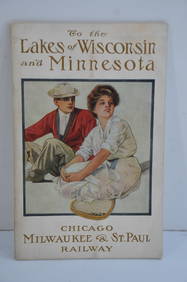
Chicago Milwaukee and St Paul RY To the Lakes of Wisconsin and Minnesota Book-1909JM Hobby Supply and Railroad Artifact Auctions4.4(127)See Sold PriceFeb 24, 2024
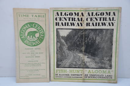
Algoma Central RY March 12, 1944 Public Timetable and BrochureJM Hobby Supply and Railroad Artifact Auctions4.4(127)See Sold PriceFeb 24, 2024
RARE 1638 HONDIUS MAP OF BERMUDA, FRAMEDThomaston Place Auction Galleries4.4(393)See Sold PriceFeb 24, 2024
ABRAHAM ORTELIUS (1527-1598) MAP OF ROMAN GAUL (FRANCE)Thomaston Place Auction Galleries4.4(393)See Sold PriceFeb 24, 2024
WILLEM JANSZOON BLAEU (NETHERLANDS, 1571-1638) MAP OF UMBRIAThomaston Place Auction Galleries4.4(393)See Sold PriceFeb 24, 2024
WILLEM JANSZOON BLAEU (NETHERLANDS, 1571-1638)Thomaston Place Auction Galleries4.4(393)See Sold PriceFeb 24, 2024
Early 1990s Chicago Transit Authority Fiberglass Line MapRail & Road Auctions4.6(165)See Sold PriceMar 08, 2024
An Indiana Jones Adventure Opening Year Field Map.Van Eaton Galleries4.6(99)See Sold PriceMar 02, 2024
Willem Blaeu, Etc. 17th C. Antiquarian Maps, 2Auctions at Showplace4.6(740)See Sold PriceMar 17, 2024
A quantity of World War II / Two military ephemera to include assorted 1940s newspapers pages toClaydon Auctioneers Ltd4.3(125)See Sold PriceFeb 26, 2024