ATLAS of ANTIENT GEOGRAPHY by SAMUEL BUTLER 1843John McInnis Auctioneers,LLC4.6(504)See Sold PriceFeb 24, 2024
18TH C. ANTIQUE MAP: FRENCH & INDIAN WAR, FRAMEDThomaston Place Auction Galleries4.4(389)See Sold PriceFeb 24, 2024
Rand McNally Railroad Map Cabinet w/ 21 Railroad MapsRail & Road Auctions4.6(165)See Sold PriceMar 08, 2024
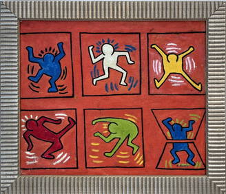
Keith Haring - Ink on New York Map, Best Buddies, Inscribed, Signed, and DatedSapphire Auction Gallery4.1(67)See Sold PriceMar 02, 2024
LATE 17TH C. FRENCH MAP OF THE NEW WORLD BY ALEXIS-HUBERT JAILLOT (1632-1712)Thomaston Place Auction Galleries4.4(389)See Sold PriceFeb 24, 2024
Central Railroad of New Jersey Map of Sandy Hook Route-ca. 1903JM Hobby Supply and Railroad Artifact Auctions4.4(126)See Sold PriceFeb 24, 2024
Lot of Six Mixed Atlas Box Cars-HO Scale-New in BoxJM Hobby Supply and Railroad Artifact Auctions4.4(126)See Sold PriceFeb 25, 2024
Rand McNally/Santa Fe Railroad Map of Iowa-1912JM Hobby Supply and Railroad Artifact Auctions4.4(126)See Sold PriceFeb 24, 2024
NICOLAES VISSCHER (NETHERLANDS, 1618-1709) MAP OF THE NEW WORLDThomaston Place Auction Galleries4.4(389)See Sold PriceFeb 24, 2024
17TH C. WORLD MAP BY NICOLAES VISSCHER (NETHERLANDS, 1618-1709)Thomaston Place Auction Galleries4.4(389)See Sold PriceFeb 24, 2024
Lot of Six Mixed Atlas Cabooses-HO Scale-New in BoxJM Hobby Supply and Railroad Artifact Auctions4.4(126)See Sold PriceFeb 25, 2024
SoldANTIQUE BOOKSCollection of antique books, 19th century, peculiarities, of American Cities, Eighty Years Progress, & more.See Sold Price
SoldAntique Maps: Collection of Five Map Depicting VariousAll unframed. Largest: 14" wd x 8.5" ht.See Sold Price
SoldGROUP STERLING SILVER SOUVENIR SPOONSCollection of 21, antique, vintage and old sterling silver souvenir spoons, all of various American cities and showing ornately decorated handles; with motifs of buildings, monuments and commemorativeSee Sold Price
SoldAntique Map: Estats de l'Empire du Grand Seigneur desSanson's map of the Ottoman Empire, extending from Italy to the Straits of Hormuz. Minor hand-coloring. 21" wd x 16" ht.See Sold Price
SoldKeuffel and Esser Co. Compensating Polar PlanimetersKeuffel and Esser Co. Compensating Polar Planimeters Provenance: The antique map collection of Glen F. Brown. Brown, an American geologist who mapped the Arabian peninsula and divined water where noneSee Sold Price
SoldCollection of Antique Ephemera and MapsGrouping of vintage and antique ephemera to include: a certificate appointing Ezra Mudge (1811-1878), the sixth Mayor of the city of Lynn, MA to the position of "Weigher Manager" to the Custom House iSee Sold Price
SoldAMERICAN STERLING SOUVENIR SPOONS: Various MakersCollection of 25, old and antique American sterling silver souvenir spoons, all of various American cities, with motifs of buildings and monuments, and ornately decorated handles; all stamped sterlingSee Sold Price
Sold2 Maps of US - 18th century1st item: AMERIQUE SEPTENTRION LE DIVISEE EN SES PRINCIPAUX ETATS; A PARIS CHEZ DELAMARCHE GEO. 1783. French engraved and handcolored map of North America, with major American cities noted. 7 3/4" x 1See Sold Price
SoldANTIQUE MAP of MITCHELL'S NATIONAL MAP of the AMERICANMap of 32 of Principal cities and towns. Publiched by S. Augustus Mitchell. Philadelphia. 41 1/4"h. x 53"w.See Sold Price
SoldCalifornia Road and Travel Maps (122314)Large lot of approximately 150 vintage and antique road and travel maps of California's beautiful cities with assorted tourism brochures and pamphlets. Maps date from the 1920's to the 1970's Maps areSee Sold Price
Bradford: Antique Maps of Key US Cities, 1846Title/Content of Map: 1846 Bradford Maps of Key US Cities -- Washington, Louisville and Jeffersonville, New Orleans, Cincinnati Date Printed: 1846 Boston Cartographer: T. Bradford Size: 11 x 13.5 in WSee Sold Price
SoldColton: Antique Map of Louisville & New Orleans, 1861Title/Content of Map: Cities of Louisville & New Orleans Date Printed: 1861 Cartographer: J.H. Colton Material/Medium: Paper Size: 13" x 17" Hand colored, steel engraved. From 'Colton's General Atlas.See Sold Price
SDUK: Antique Map of New York City, 1847Title/Content of Map: 'NEW YORK' Antique town city map plan. Manhattan Brooklyn Jersey. Date Printed: 1847 Image Size: Approx 33.0 x 39.0cm, 13 x 15.25 inches (Large) Type: Antique steel engraved mapSee Sold Price
SoldTanner: Antique Map of New York City, 1843Title/Content of Map: New York City by Tanner Date Printed: 1843 Cartographer: based on the work of H.C. Tanner Material/Medium: Paper Size: 17" x 14" Hand colored engraved Map. From the first editionSee Sold Price
Hooker: Antique Map of Lower & Midtown Manhattan, 1831Map: 1831 Hooker Lower and Midtown Manhattan Map -- Map of the City of New York Cartographer: W Hooker Year / Place: 1871 reissue, New York City Map Dimensions: 15.4 x 12.2 in. Condition: Very Good. CSee Sold Price
SoldCollection of Five Antique Pocket WatchesCollection of Five Antique Pocket Watches. Ansonia Clock Co. with nickel plated brass case and dark face. Coin silver case with no watch. American Watch Co. Joe Marx, Central City, CO. and small sizeSee Sold Price
SoldJohnson: Antique Map of New York City, 1866Title/Content of Map: 1866 Johnson Map of New York City -- Johnson's New York and Brooklyn Date Printed: 1866, New York Cartographer: A Johnson Size: 22.8 x 16.3 in Condition: Very good. Age toning noSee Sold Price
Hooker: Antique Map of Lower & Midtown ManhattanMap: 1831 Hooker Lower and Midtown Manhattan Map -- Map of the City of New York Cartographer: W Hooker Year / Place: 1871 reissue, New York City Map Dimensions: 15.4 x 12.2 in. Condition: Very Good. CSee Sold Price
Marshall: Antique Map Showing New York City in 1776Map: 1807 Marshall Map Showing New York City in 1776 -- Ile de New-York. Partie de Long-Island ou de l'Ile Longue, et Positions des Armees Americaine et Britannique, apres le Combat Livre sur HauteursSee Sold Price
SDUK: Antique Map City Plan of New York City, 1847Title/Content of Map: 'NEW YORK' Antique town city map plan. Manhattan Brooklyn Jersey. Date Printed: 1847 Image Size: Approx 33.0 x 39.0cm, 13 x 15.25 inches (Large) Type: Antique steel engraved mapSee Sold Price
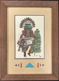
Hopi Signed Cliff Bahnimptewa (1937-1984) Original Painting 1975Cowboy Joe's Antiques4.7(196)See Sold PriceFeb 27, 2024
5 Native American Quill Covered BasketsEpic Auctions and Estate Sales4.6(204)See Sold PriceMar 02, 2024
Universal World History Illustrated Bks 8, 1929The Benefit Shop Foundation Inc.4.3(2.9k)See Sold PriceMar 06, 2024
Antique German Kampen Town Color Copper EtchingHill Auction Gallery 4.7(1k)See Sold PriceFeb 28, 2024
1892 AMERICAN PAINTING BY GEORGE HENRY HALL SIGNEDAntique Arena Inc.4.5(866)See Sold PriceFeb 24, 2024
American Victorian Flip Top Console Card TableAuctions at Showplace4.6(731)See Sold PriceMar 17, 2024
Mitchell - Map of the City of Washington (Washington, DC)Trillium Antique Prints & Rare Books4.5(30)See Sold PriceFeb 24, 2024
Strickler, Rare - San Francisco, CaliforniaTrillium Antique Prints & Rare Books4.5(30)See Sold PriceFeb 24, 2024
Georg Bockler Map of Ancient Jerulsaem EtchingAuctions at Showplace4.6(731)See Sold PriceApr 07, 2024
American Federal Style Stencil Painted ArmchairAuctions at Showplace4.6(731)See Sold PriceFeb 13, 2025
Hudson River Map & North American Postcards, 45Auctions at Showplace4.6(731)See Sold PriceFeb 13, 2025