ATLAS of ANTIENT GEOGRAPHY by SAMUEL BUTLER 1843John McInnis Auctioneers,LLC4.6(502)See Sold PriceFeb 24, 2024
18TH C. ANTIQUE MAP: FRENCH & INDIAN WAR, FRAMEDThomaston Place Auction Galleries4.4(386)See Sold PriceFeb 24, 2024
Rand McNally Railroad Map Cabinet w/ 21 Railroad MapsRail & Road Auctions4.6(165)See Sold PriceMar 08, 2024
Keith Haring - Ink on New York Map, Best Buddies, Inscribed, Signed, and DatedSapphire Auction Gallery4(67)See Sold PriceMar 02, 2024
LATE 17TH C. FRENCH MAP OF THE NEW WORLD BY ALEXIS-HUBERT JAILLOT (1632-1712)Thomaston Place Auction Galleries4.4(386)See Sold PriceFeb 24, 2024
Central Railroad of New Jersey Map of Sandy Hook Route-ca. 1903JM Hobby Supply and Railroad Artifact Auctions4.4(126)See Sold PriceFeb 24, 2024
Lot of Six Mixed Atlas Box Cars-HO Scale-New in BoxJM Hobby Supply and Railroad Artifact Auctions4.4(126)See Sold PriceFeb 25, 2024
Rand McNally/Santa Fe Railroad Map of Iowa-1912JM Hobby Supply and Railroad Artifact Auctions4.4(126)See Sold PriceFeb 24, 2024
NICOLAES VISSCHER (NETHERLANDS, 1618-1709) MAP OF THE NEW WORLDThomaston Place Auction Galleries4.4(386)See Sold PriceFeb 24, 2024
17TH C. WORLD MAP BY NICOLAES VISSCHER (NETHERLANDS, 1618-1709)Thomaston Place Auction Galleries4.4(386)See Sold PriceFeb 24, 2024
Lot of Six Mixed Atlas Cabooses-HO Scale-New in BoxJM Hobby Supply and Railroad Artifact Auctions4.4(126)See Sold PriceFeb 25, 2024
Sold3 Southern Maps, inc. Bellin, Tardieu, ZattaThree (3) Southern maps, including Bellin, Tardieu, and Zatta. 1st item: Carte de la Caroline et Georgie by Jacques Nicolas Bellin (French, 1703-1772) from Histoire Generale des Voyages by Antoine FraSee Sold Price
Sold3 Southern Maps, incl. 2 Antonio Zatta 1778, SC 1796Three (3) Southern Maps, including two (2) Antonio Zatta 1778, one (1) South Carolina 1796. 1st-2nd items: Two (2) Antonio Zatta (Italian, fl. 1757-1797) maps of Virginia, Maryland, and the Carolinas,See Sold Price
Sold3 Early Southern and TN Maps, inc. Mero District plusFour (4) items total, 3 unframed maps and 1 book excerpt. 1st item: Joseph Scott: THE SOUTHWEST TERRITORY, Scott's Gazetteer, Phila. 1795, showing the Mero district, Nashville, Knoxville, ClarksvilleSee Sold Price
Sold3 Nautical Maps inc. Southern 18611st item: Nautical Map: A New Chart of the Western or Atlantic Ocean, Drawn from the Best Authorities by J. S. Norie, printed London, 1831. Shows the coasts of the United States, Labrador and EskmauxSee Sold Price
SoldThree 18th C. U.S. Maps, inc. SouthernThree (3) French and Indian War period maps. 1st item: John Gibson: THE BRITISH GOVERNMENT IN NORTH AMERICA, Laid Down Agreeable To The Proclamation of Oct. 7, 1763. Published in The Gentleman's MagazSee Sold Price
SoldBellin: Antique Map of Southern Philippines, 1740Title/Content of Map: Southern Philippines Date Printed: 1740-70's Cartographer: J.N. Bellin & J.F. La Harpe Material/Medium: Paper Size: 14 1/3" x 9" Copperplate engraved. From the 'Abrege de L'HistoSee Sold Price
Bellin: Antique Map of Brazil Southern Coast, 1740Title/Content of Map: Brazil's southern coast Date Printed: c 1740-70's Cartographer: J.N. Bellin & J.F. La Harpe Material/Medium: Paper Size: 7" x 9 3/4" Copperplate engraved. Published in Paris. FroSee Sold Price
SoldWestern NC and Southern VA Map (after Mitchell, 1773)Antonio Zatta: IL PAESE DE CHERACHESI CON LA PARTE OCCIDENTAL DELLA CAROLINA SETTENTRIONALE, E DELLA VIRGINIA. Section of the Italian edition of Mitchell's 1773 map of North America, from Storia Dell'See Sold Price
Sold3 Bellin Maps, incl. Louisiana, Florida, 1760sThree (3) Jacques-Nicolas Bellin (1703-1772) copper plate engraved maps with hand coloring and decorative cartouches on laid paper, all from "Le Petit Atlas Maritime", 1764. 1st item: Embouchures du FSee Sold Price
Sold3 . WATERPROOF MARINE MAPs TAMPA BAY SOUTHERN PART3 WATERPROOF MARINE MAPs TAMPA BAY SOUTHERN PART.This is a total of THREE marine maps, waterproof, and two of the maps are reversible. One map is of our Tampa Bay area. Anna Maria Sound and Sarasota BSee Sold Price
Sold*3 GROUPS OF O GAUGE ATLAS TRAINS8 Chicago & Northwestern #6222 stock cars, 7 Rio Grande #6223 stock cars, 6 Southern Pacific boxcars, 11 Union Pacific coal cars, 3 Norfolk Southern coal cars, 4 UCR coal cars, 6 flat cars with contaiSee Sold Price
Sold3 Native American Items, incl. A. Zatta MapThree (3) Native American maps and engravings. 1st item: Luigiana Ingelise, Colla Parte Occidentale della Florida, della Giorgia, e Carolina Meridonale, Sheet 10, showing Native American lands, publisSee Sold Price
Sold3 Southwestern Maps3 Framed Southwestern Maps. 1st item: Map showing the Southern boundary of New Mexico, agreed upon by Commissioners Bartlett & Conde, February 7, 1853. 11 1/4" x 7 1/2" sight, 19 1/2" x 15 3/4" mattedSee Sold Price
Sold2 Antique Maps Of Germany, Southern France2 Antique Maps Of Germany and Southern France Measurements: 17 1/4" x 13 5/8" - 26 3/4" x 20 1/4"See Sold Price
Map of Africa (southern) by Colton, 1875Original engraving of the southern portion sheet by Colton, 1875. Map features Madagascar & Cape Colony area. Dimensions: 13 3/4 x 17 1/4 inches.See Sold Price
SoldA LOT OF 3 ANTIQUE MAPS OF THE RUSSIAN EMPIREThis lot includes a map of Crimea by Huot & Demidoff, a Spanish map of the Russian Empire and Scandinavia, and a British made map of the Central, Southern, and Northern parts of the Russian Empire. DiSee Sold Price
SoldG. Mercator map of Virginia and Florida, 1609Gerard Mercator map of Virginia and Florida. Titled "Virginia et Florida" depicting Southern Virginia to what is now known as Northern Georgia, with German text en verso. 7 3/8" H x 9 3/8" W. Germany,See Sold Price
SoldBellin,18th C. French Map of Carolinas & GeorgiaOrnamental title cartouche lower right "Carte De La Caroline Et Georgie"; hand-colored engraving by J. Bellin, Paris, 1757; Southern Virginia to North Florida including Carolinas and Georgia; shows moSee Sold Price
Sold3 European Maps, inc. France & EnglandThree (3) European Maps, including France and England. 1st item: "Carte D'Angleterre 1754" by Jean Palairet. Colored map of England and Wales with French identifications. Counties, cities, towns, riveSee Sold Price
3 Maps incl: KARTE VON DEM LAUFE DES FLUSSES...[Canada/Central Europe/Russia] 3 Maps incl. Bellin "Map Of The Course Of The St. Laurence River From Its Estuary To Quebec" and "Map of the [Range] of the Upper Rhine." Under glass. Not examined out oSee Sold Price
Sold(3) ROAD MAPS(3) ROAD MAPS TO INC: "IMPERIAL" MAP OF CANADA; "PURE OIL COMP. MAP OF NEW YORK 4TH EDITION;"BEACON" BOSTON CHAMBER OF COMMERCE 1928 MAP OF NEW ENGLAND, ALL IN GOOD SHAPE, GREAT COLORSSee Sold Price
Tardieu: Map of Southern India & Ceylon, 1795Title/Content of Map: 'Inde Partie Meridionale de la Presqu'isle en deca du Gange' A map of Southern India and Ceylon (Sri Lanka), including the Laccadives and northern Maldives This map is folding heSee Sold Price
Sold3 Southern Glass Whiskey Bottles, inc. Gunter JackThree (3) Southern glass whiskey bottles, including Gunter Jack Daniels. 1st item: W.T. & C.D. Gunter Jack Daniel's No. 7 clear glass cylinder whiskey bottle with cork finish, quart capacity, embossedSee Sold Price
Sold3 TN and KY maps inc. Finley and 2 GreenleafThree (3) Maps, 1 of Tennessee, 2 of Kentucky and Tennessee. 1st item: "Tennessee" map engraved by Young and Delleker, published by Anthony Finley, Philadelphia, 1824. From "A New General Atlas, ComprSee Sold Price
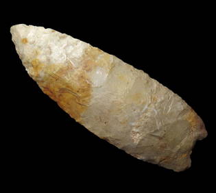
3.5/8" Paleo Lancelot, Lightly fluted on one side, Found in Southern Ohio, Purchased from Bennett'sHeartland Artifact Auctions Inc4.7(780)See Sold PriceFeb 25, 2024
3.3/8" Hopewell Snyders, Southern Illinois. This collection was the property of the Leonard & VivianHeartland Artifact Auctions Inc4.7(780)See Sold PriceFeb 25, 2024
3.3/4" Dover Chert Chisle, Southern Illinois.Heartland Artifact Auctions Inc4.7(780)See Sold PriceFeb 25, 2024
Lot of 3 Fluted Bases Clovis and Dalton From southern IllinoisHeartland Artifact Auctions Inc4.7(780)See Sold PriceFeb 25, 2024
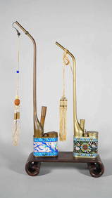
Two Qing Dynasty Chinese Copper Brass Cloisonne Enamel Water or Opium Pipe with Maker SignedNeo FineArts Inc4.4(12)See Sold PriceFeb 25, 2024
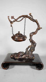
Vintage Chinese Handmade Bronze Hang Incense Burner on Rosewood StandNeo FineArts Inc4.4(12)See Sold PriceFeb 25, 2024
A Chinese Antique Blue & White Porcelain Dragan Bowl with Rice PatternNeo FineArts Inc4.4(12)See Sold PriceFeb 25, 2024
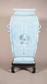
Beautiful Chinese Sky Blue Glaze Squared Porcelain Vase with Qing Dynasty "Qian Long" MarkNeo FineArts Inc4.4(12)See Sold PriceFeb 25, 2024
Large Chinese Famille Rose Porcelain Happy Buddha Statue with Wooden StandNeo FineArts Inc4.4(12)See Sold PriceFeb 25, 2024
Pair of 19th Century Chinese Antique Monochrome Turquoise Crackle Glaze Porcelain Vase Mounted LampsNeo FineArts Inc4.4(12)See Sold PriceFeb 25, 2024
Japanese Antique Meiji Period Kiri Wood Round Braziers/Hibachis with Wood Carved StandNeo FineArts Inc4.4(12)See Sold PriceFeb 25, 2024
Japanese Antique Samurai Katana Sword, with Wooden SheathNeo FineArts Inc4.4(12)See Sold PriceFeb 25, 2024
Early 20th Century Antique Germany "JUNGHANS" Handcarved Wooden Wall Clock with Pendulum, No.1 WorldNeo FineArts Inc4.4(12)See Sold PriceFeb 25, 2024
4 3/8" Celt from Southern France, Ex Bill Kacer Family Collection-Majority of his relics were foundHeartland Artifact Auctions Inc4.7(780)See Sold PriceMar 10, 2024
Five Vintage 1950s Coca-Cola Bottling Company Los Angeles Carrier CratesAbell Auction4.7(632)See Sold PriceFeb 29, 2024
1683 Sanson Map of the Caribbean -- Les Isles Antilles, &c Entre Lesquelles sont les Lucayes, et lesJasper524.5(9.8k)See Sold PriceFeb 27, 2024
1764 Bellin Map of Mari-Galante Near Guadeloupe -- Carte de l'Isle de Mari-GalanteJasper524.5(9.8k)See Sold PriceFeb 27, 2024
1764 Bellin Map of Southern Portion of Martinique -- Partie Meridionale de la MartiniqueJasper524.5(9.8k)See Sold PriceFeb 27, 2024
1764 Bellin Chart of Three South Haitian Bays -- Carte des Bayes du Mesle des Flamands et deJasper524.5(9.8k)See Sold PriceFeb 27, 2024
Partie de la Coste d'Afrique depuis Tanit…' Southern Mauritania BELLIN 1746 mapJasper524.5(9.8k)See Sold PriceFeb 28, 2024