ATLAS of ANTIENT GEOGRAPHY by SAMUEL BUTLER 1843John McInnis Auctioneers,LLC4.6(502)See Sold PriceFeb 24, 2024
18TH C. ANTIQUE MAP: FRENCH & INDIAN WAR, FRAMEDThomaston Place Auction Galleries4.4(386)See Sold PriceFeb 24, 2024
Rand McNally Railroad Map Cabinet w/ 21 Railroad MapsRail & Road Auctions4.6(165)See Sold PriceMar 08, 2024
Keith Haring - Ink on New York Map, Best Buddies, Inscribed, Signed, and DatedSapphire Auction Gallery4(67)See Sold PriceMar 02, 2024
LATE 17TH C. FRENCH MAP OF THE NEW WORLD BY ALEXIS-HUBERT JAILLOT (1632-1712)Thomaston Place Auction Galleries4.4(386)See Sold PriceFeb 24, 2024
Central Railroad of New Jersey Map of Sandy Hook Route-ca. 1903JM Hobby Supply and Railroad Artifact Auctions4.4(126)See Sold PriceFeb 24, 2024
Lot of Six Mixed Atlas Box Cars-HO Scale-New in BoxJM Hobby Supply and Railroad Artifact Auctions4.4(126)See Sold PriceFeb 25, 2024
Rand McNally/Santa Fe Railroad Map of Iowa-1912JM Hobby Supply and Railroad Artifact Auctions4.4(126)See Sold PriceFeb 24, 2024
NICOLAES VISSCHER (NETHERLANDS, 1618-1709) MAP OF THE NEW WORLDThomaston Place Auction Galleries4.4(386)See Sold PriceFeb 24, 2024
17TH C. WORLD MAP BY NICOLAES VISSCHER (NETHERLANDS, 1618-1709)Thomaston Place Auction Galleries4.4(386)See Sold PriceFeb 24, 2024
Lot of Six Mixed Atlas Cabooses-HO Scale-New in BoxJM Hobby Supply and Railroad Artifact Auctions4.4(126)See Sold PriceFeb 25, 2024
SoldItaly.- Robert de Vaugondy (Gilles, publisher) Carte deItaly.- Robert de Vaugondy (Gilles, publisher) Carte de l'Italie dans laquelle sont Tracees les Routes de Postes, large detailed map showing details of the postal routes in Italy and Sicily, engravingSee Sold Price
Italy.- Robert de Vaugondy (Gilles, publisher) Carte deItaly.- Robert de Vaugondy (Gilles, publisher) Carte de l'Italie dans laquelle sont Tracees les Routes de Postes, large detailed map showing details of the postal routes in Italy and Sicily, engravingSee Sold Price
Carte De L'italieTitle/Content of Map: Carte De L'italie Date: 1757 Cartographer: ROBERT DE VAUGONDY, GILLES (1686-1766) Publisher: LES AUTEURS ET BOUDET Size: 18.8Height - 21.25Width dans laquelle sont tracees les roSee Sold Price
Carte De L'italiePublication Date: 1757 Title: Carte De L'italie Cartographer: ROBERT DE VAUGONDY, GILLES (1686-1766) Publisher: LES AUTEURS ET BOUDET Height: 18.8 Width: 21.25 dans laquelle sont tracees les routes deSee Sold Price
Carte Du Duche De Luxembourg,Title/Content of Map: Carte Du Duche De Luxembourg, Date: 1757 Cartographer: ROBERT DE VAUGONDY, GILLES (1686-1766) Publisher: LES AUTEURS ET BOUDET Size: 19Height - 23Width dans laquelle on trouve laSee Sold Price
Carte Des Royaumes D'espagne Et De PortugalTitle: Carte Des Royaumes D'espagne Et De Portugal Cartographer: ROBERT DE VAUGONDY, GILLES (1686-1766) Publisher: LES AUTEURS ET BOUDET Brief Description: dans laquelle sont tracees les routes des poSee Sold Price
Carte Des Royaumes D'espagne Et De PortugalTitle: Carte Des Royaumes D'espagne Et De Portugal Publication Date: 1757 Cartographer: ROBERT DE VAUGONDY, GILLES (1686-1766) Publisher: LES AUTEURS ET BOUDET Height: 18.75 Width: 22.3 dans laquelleSee Sold Price
SoldDe Vaugondy's California & the North West, 1772Heading: Author: Robert de Vaugondy, Gilles and Didier Title: Carte de la Californie et des Pays Nord-Ouest separés de l'Asie par le détroit d'Anian... Place Published: Paris Publisher: Date PubSee Sold Price
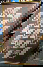
SoldDe Vaugondy/Delamarche "Study Atlas" 1812Heading: Author: Robert de Vaugondy, Gilles and Didier Title: Atlas d'Étude, Pour l'Instruction de la Jeunesse, Composé de Trente-Six Cartes Place Published: Paris Publisher:Chez C. F. Delamarche <See Sold Price
Carte Des Grandes Routes D'angleterre, D'ecosse, EtPublication Date: 1757 Title: Carte Des Grandes Routes D'angleterre, D'ecosse, Et D'irlande Cartographer: VAUGONDY, GILLES ROBERT, sieur de (1686-1766) Publisher: G. ROBERT DE VAUGONDY Height: 21.5 WiSee Sold Price
Carte Des Grandes Routes D'angleterre, D'ecosse, EtPublication Date: 1757 Title: Carte Des Grandes Routes D'angleterre, D'ecosse, Et D'irlande Cartographer: VAUGONDY, GILLES ROBERT, sieur de (1686-1766) Publisher: G. ROBERT DE VAUGONDY Height: 21.5 WiSee Sold Price
Robert de Vaugondy (Gilles & Didier) - Carte de laregional map of the east coast from Philadelphia to the 'Dismal Swamp' and Curratuk Inlet, title cartouche lower right, engraved map with original hand-colouring in outline, 490 x 660mm., central vertSee Sold Price
SoldRobert de Vaugondy, GillesRobert de Vaugondy, Gilles Carte nouvelle de l’Isle de Corse… À Lausanne, chez Marx et Michel Bousquet, 1756, aquarellée. 58 x 44 cm.See Sold Price
SoldRobert de Vaugondy. Carte de la CalifornieRobert de Vaugondy (Gilles & Didier) Carte de la Californie,2 overlying maps of the western seaboard of North America, the main map being after Vischer, the smaller inset map after Petrus PlanSee Sold Price
SoldMap of California as Island and back again 1772Heading: Author: Robert de Vaugondy, Gilles and Didier Title: Carte de la Californie suivant I. La carte manuscrite de l'Amérique de Mathieu Néron Pecci olen dresse à Florence en 1604. II. SansonSee Sold Price
SoldFrench version of Jefferson-Fry Virginia MapHeading: Author: Robert de Vaugondy, Gilles and Didier Title: Carte De La Virginie Et Du Maryland Dressée sur la grande carte Angloise de Mrs. Josué Fry et Pierre Jefferson Place Published: Paris PSee Sold Price
SoldJEFFERYS, THOMAS; and ROBERT de VAUGONDY, GILLJEFFERYS, THOMAS; and ROBERT de VAUGONDY, GILLES. Carte Generale des Decouvertes de l'Amiral Fonte. Double-page engraved map, 325x375 mm, wide margins. Paris, 1772 with--Buache and Robert de Vaugondy.See Sold Price
Gouvernement General Du Languedoc Divise Par Dioceses,Publication Date: 1752 Title: Gouvernement General Du Languedoc Divise Par Dioceses, Cartographer: ROBERT DE VAUGONDY, GILLES (1686-1766) Publisher: ROBERT DE VAUGONDY Height: 18.75 Width: 19 "avec leSee Sold Price
Gouvernement General De L'isle De France Divise ParPublication Date: 1754 Title: Gouvernement General De L'isle De France Divise Par Pays. Cartographer: ROBERT DE VAUGONDY, GILLES (1686-1766) Publisher: ROBERT DE VAUGONDY Height: 18.75 Width: 20.5 "..See Sold Price
Environs de ParisTitle: Environs de Paris Cartographer: ROBERT DE VAUGONDY, GILLES Publisher: LES AUTEURS ET BOUDET Size: 18.75Height - 26Width From their great Atlas Universel of 1757. Top margin waterstained. Some eSee Sold Price
Partie Septentrionale Du Gouvernemt General DePublication Date: 1752 Title: Partie Septentrionale Du Gouvernemt General De Champagne Cartographer: ROBERT DE VAUGONDY, GILLES Publisher: LES AUTEURS ET BOUDET Height: 19 Width: 23.3 ou se trouvent lSee Sold Price
Environs de ParisPublication Date: 1752 Title: Environs de Paris Cartographer: ROBERT DE VAUGONDY, GILLES Publisher: LES AUTEURS ET BOUDET Height: 18.75 Width: 26 From their great Atlas Universel of 1757. Top margin wSee Sold Price
Etat De L'eglise, Grand Duche De Toscane, Et Corse.Publication Date: 1750 Title: Etat De L'eglise, Grand Duche De Toscane, Et Corse. Cartographer: ROBERT DE VAUGONDY, GILLES Publisher: LES AUTEURS ET BOUDET Height: 19 Width: 21.75 From their great AtlSee Sold Price
Partie Meridionale Du Gouvernemt. General De ChampagnePublication Date: 1752 Title: Partie Meridionale Du Gouvernemt. General De Champagne Cartographer: ROBERT DE VAUGONDY, GILLES Publisher: LES AUTEURS ET BOUDET Height: 18.75 Width: 26 qui comprend la CSee Sold Price
QUEEN VICTORIA AUTOGRAPHED CARTE DE VISITE CDV PORTRAITOmnia Auctions4.7(324)See Sold PriceFeb 26, 2024
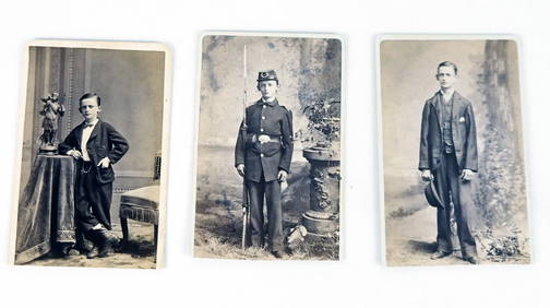
[BASEBALL]. Carte de Visite Full-Length Portrait of...Potter & Potter Auctions4.6(539)See Sold PriceMar 07, 2024
[BASEBALL CARTE DE VISITE ]. Carte de Visite Photograph of ...Potter & Potter Auctions4.6(539)See Sold PriceMar 07, 2024
[BASEBALL CARTE DE VISITE]. Carte de Visite Photograph of a...Potter & Potter Auctions4.6(539)See Sold PriceMar 07, 2024
[BASEBALL CARTE DE VISITE]. Carte de Visite Photograph of F...Potter & Potter Auctions4.6(539)See Sold PriceMar 07, 2024
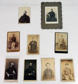
Unique collection of 18 carte de visites of Queen Victoria’s familyJasper524.5(9.8k)See Sold PriceFeb 27, 2024
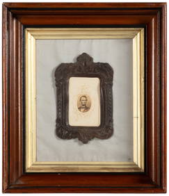
Robert de Vaugondy - Map of Canada - Mer de l' Ouest or Sea of the West and a Northwest PassageProverde Auctions4.3(3)See Sold PriceFeb 28, 2024


![[BASEBALL]. Carte de Visite Full-Length Portrait of... (1 of 1)](https://p1.liveauctioneers.com/928/318880/171361328_1_x.jpg?height=282&quality=70&version=1707501302)
![[BASEBALL CARTE DE VISITE ]. Carte de Visite Photograph of ... (1 of 2)](https://p1.liveauctioneers.com/928/318880/171361404_1_x.jpg?height=282&quality=70&version=1707501302)
![[BASEBALL CARTE DE VISITE]. Carte de Visite Photograph of a... (1 of 2)](https://p1.liveauctioneers.com/928/318880/171361405_1_x.jpg?height=282&quality=70&version=1707501302)
![[BASEBALL CARTE DE VISITE]. Carte de Visite Photograph of F... (1 of 2)](https://p1.liveauctioneers.com/928/318880/171361408_1_x.jpg?height=282&quality=70&version=1707501302)