ATLAS of ANTIENT GEOGRAPHY by SAMUEL BUTLER 1843John McInnis Auctioneers,LLC4.5(505)See Sold PriceFeb 24, 2024
18TH C. ANTIQUE MAP: FRENCH & INDIAN WAR, FRAMEDThomaston Place Auction Galleries4.4(393)See Sold PriceFeb 24, 2024
Rand McNally Railroad Map Cabinet w/ 21 Railroad MapsRail & Road Auctions4.6(165)See Sold PriceMar 08, 2024
Keith Haring - Ink on New York Map, Best Buddies, Inscribed, Signed, and DatedSapphire Auction Gallery4(67)See Sold PriceMar 02, 2024
LATE 17TH C. FRENCH MAP OF THE NEW WORLD BY ALEXIS-HUBERT JAILLOT (1632-1712)Thomaston Place Auction Galleries4.4(393)See Sold PriceFeb 24, 2024
Central Railroad of New Jersey Map of Sandy Hook Route-ca. 1903JM Hobby Supply and Railroad Artifact Auctions4.4(127)See Sold PriceFeb 24, 2024
Lot of Six Mixed Atlas Box Cars-HO Scale-New in BoxJM Hobby Supply and Railroad Artifact Auctions4.4(127)See Sold PriceFeb 25, 2024
Rand McNally/Santa Fe Railroad Map of Iowa-1912JM Hobby Supply and Railroad Artifact Auctions4.4(127)See Sold PriceFeb 24, 2024
NICOLAES VISSCHER (NETHERLANDS, 1618-1709) MAP OF THE NEW WORLDThomaston Place Auction Galleries4.4(393)See Sold PriceFeb 24, 2024
17TH C. WORLD MAP BY NICOLAES VISSCHER (NETHERLANDS, 1618-1709)Thomaston Place Auction Galleries4.4(393)See Sold PriceFeb 24, 2024
Lot of Six Mixed Atlas Cabooses-HO Scale-New in BoxJM Hobby Supply and Railroad Artifact Auctions4.4(127)See Sold PriceFeb 25, 2024
SoldFenning & Collyer 1765 Map of Westphalia, GermanyCopper Engraved Map Published 1764-65, London for "A New System of Geography: or, A General Description of the World" by Daniel Fenning & Joseph Collyer. Maps by G. Rollos, J. Gibson and others, mostlSee Sold Price
Fenning & Collyer 1765 Map of Westphalia, GermanyCopper Engraved Map Published 1764-65, London for "A New System of Geography: or, A General Description of the World" by Daniel Fenning & Joseph Collyer. Maps by G. Rollos, J. Gibson and others, mostlSee Sold Price
SoldFenning & Collyer 1765 Map of Germany & Poland"A Map of the Kingdom of Prussia and Polish Prussia" Copper Engraved Map Published 1764-65, London for "A New System of Geography: or, A General Description of the World" by Daniel Fenning & Joseph CoSee Sold Price
SoldFenning & Collyer 1765 Map of Franconia, GermanyCopper Engraved Map Published 1764-65, London for "A New System of Geography: or, A General Description of the World" by Daniel Fenning & Joseph Collyer. Maps by G. Rollos, J. Gibson and others, mostlSee Sold Price
Fenning & Collyer 1765 Map of Franconia, GermanyCopper Engraved Map Published 1764-65, London for "A New System of Geography: or, A General Description of the World" by Daniel Fenning & Joseph Collyer. Maps by G. Rollos, J. Gibson and others, mostlSee Sold Price
Fenning & Collyer 1765 Map of Franconia, GermanyCopper Engraved Map Published 1764-65, London for "A New System of Geography: or, A General Description of the World" by Daniel Fenning & Joseph Collyer. Maps by G. Rollos, J. Gibson and others, mostlSee Sold Price
SoldFenning & Collyer 1765 Map of Lower Saxony, GermanyCopper Engraved Map Published 1764-65, London for "A New System of Geography: or, A General Description of the World" by Daniel Fenning & Joseph Collyer. Maps by G. Rollos, J. Gibson and others, mostlSee Sold Price
SoldFenning & Collyer 1765 Map of Empire of GermanyCopper Engraved Map Published 1764-65, London for "A New System of Geography: or, A General Description of the World" by Daniel Fenning & Joseph Collyer. Maps by G. Rollos, J. Gibson and others, mostlSee Sold Price
SoldFenning & Collyer 1765 Map of Naples and Sicily. ItalyCopper Engraved Map Published 1764-65, London for "A New System of Geography: or, A General Description of the World" by Daniel Fenning & Joseph Collyer. Maps by G. Rollos, J. Gibson and others, mostlSee Sold Price
SoldFenning & Collyer 1765 Map of ItalyCopper Engraved Map Published 1764-65, London for "A New System of Geography: or, A General Description of the World" by Daniel Fenning & Joseph Collyer. Maps by G. Rollos, J. Gibson and others, mostlSee Sold Price
SoldFenning & Collyer 1765 Map of Scotland by BickhamCopper Engraved Map Published 1764-65, London for "A New System of Geography: or, A General Description of the World" by Daniel Fenning & Joseph Collyer. Maps by G. Rollos, J. Gibson and others, mostlSee Sold Price
SoldFenning & Collyer 1765 Map of Naples and Sicily. ItalyCopper Engraved Map Published 1764-65, London for "A New System of Geography: or, A General Description of the World" by Daniel Fenning & Joseph Collyer. Maps by G. Rollos, J. Gibson and others, mostlSee Sold Price
SoldFenning & Collyer 1765 Map of England & WalesCopper Engraved Map Published 1764-65, London for "A New System of Geography: or, A General Description of the World" by Daniel Fenning & Joseph Collyer. Maps by G. Rollos, J. Gibson and others, mostlSee Sold Price
SoldFenning & Collyer 1765 Map of Silesia. PolandCopper Engraved Map Published 1764-65, London for "A New System of Geography: or, A General Description of the World" by Daniel Fenning & Joseph Collyer. Maps by G. Rollos, J. Gibson and others, mostlSee Sold Price
SoldFenning & Collyer 1765 Map of ItalyCopper Engraved Map Published 1764-65, London for "A New System of Geography: or, A General Description of the World" by Daniel Fenning & Joseph Collyer. Maps by G. Rollos, J. Gibson and others, mostlSee Sold Price
SoldFenning & Collyer 1765 Map of Bohemia. Czech RepublicCopper Engraved Map Published 1764-65, London for "A New System of Geography: or, A General Description of the World" by Daniel Fenning & Joseph Collyer. Maps by G. Rollos, J. Gibson and others, mostlSee Sold Price
SoldFenning & Collyer 1765 Map of AustriaCopper Engraved Map Published 1764-65, London for "A New System of Geography: or, A General Description of the World" by Daniel Fenning & Joseph Collyer. Maps by G. Rollos, J. Gibson and others, mostlSee Sold Price
SoldFenning & Collyer 1765 Map of Spain & PortugalCopper Engraved Map Published 1764-65, London for "A New System of Geography: or, A General Description of the World" by Daniel Fenning & Joseph Collyer. Maps by G. Rollos, J. Gibson and others, mostlSee Sold Price
SoldFenning & Collyer 1765 Map of AustriaCopper Engraved Map Published 1764-65, London for "A New System of Geography: or, A General Description of the World" by Daniel Fenning & Joseph Collyer. Maps by G. Rollos, J. Gibson and others, mostlSee Sold Price
SoldFenning & Collyer 1765 Map of South AmericaCopper Engraved Map Published 1764-65, London for "A New System of Geography: or, A General Description of the World" by Daniel Fenning & Joseph Collyer. Maps by G. Rollos, J. Gibson and others, mostlSee Sold Price
SoldFenning & Collyer 1765 Map of DenmarkCopper Engraved Map Published 1764-65, London for "A New System of Geography: or, A General Description of the World" by Daniel Fenning & Joseph Collyer. Maps by G. Rollos, J. Gibson and others, mostlSee Sold Price
Fenning & Collyer 1765 Map of AustriaCopper Engraved Map Published 1764-65, London for "A New System of Geography: or, A General Description of the World" by Daniel Fenning & Joseph Collyer. Maps by G. Rollos, J. Gibson and others, mostlSee Sold Price
SoldFenning & Collyer 1765 Antique Map of Europe"A New & Accurate Map of Europe" Copper Engraved Map Published 1764-65, London for "A New System of Geography: or, A General Description of the World" by Daniel Fenning & Joseph Collyer. Maps by G. RoSee Sold Price
SoldFenning & Collyer 1765 Copper Plate of Quebec, CanadaCopper Plate Published 1764-65, London for "A New System of Geography: or, A General Description of the World" by Daniel Fenning & Joseph Collyer. Maps by G. Rollos, J. Gibson and others, mostly basedSee Sold Price
HEATH'S Picturesque Annual c1833 Germany Belgium Holland Engravings 1st EditionLuis Porretta Fine Arts4.3(10)See Sold PriceMar 02, 2024
17TH C. ANTIQUE MAP SIEGE OF LA ROCHELLE, FRANCE, FRAMEDThomaston Place Auction Galleries4.4(393)See Sold PriceFeb 24, 2024
18TH C. ANTIQUE MAP: FRENCH & INDIAN WAR, FRAMEDThomaston Place Auction Galleries4.4(393)See Sold PriceFeb 24, 2024
AMBROISE TARDIEU c1822 Napoleonic War Map GermanyLuis Porretta Fine Arts4.3(10)See Sold PriceMar 02, 2024
MAP - AMBROISE TARDIEU c1822 Napoleonic Miltary Map GermanyLuis Porretta Fine Arts4.3(10)See Sold PriceMar 02, 2024
RIGOBERT BONNE c1787 Original Colored Map Germany & Region 15" x 12"Luis Porretta Fine Arts4.3(10)See Sold PriceMar 02, 2024
Rand McNally Railroad Map Cabinet w/ 21 Railroad MapsRail & Road Auctions4.6(165)See Sold PriceMar 08, 2024
Ampol Three Wheeled Car with Spinning Map Parasol - Tin ToyThe RSL Auction Company4.6(240)See Sold PriceMar 09, 2024
17th Century Hand Colored Engraved Map of GermanyGlobal Auctions Company4.3(36)See Sold PriceMar 03, 2024
18th Century Hess Germany Hand colored Engraved MapGlobal Auctions Company4.3(36)See Sold PriceMar 03, 2024
War Diary of 354th Infantry - 89th Division 1919North American Artifact Auctions4.7(198)See Sold PriceApr 20, 2024
1931 Iceland Graf Zeppelin Cover to Cottbus Germany LZ 127 #C9 & C11Mynt Auctions4.6(697)See Sold PriceFeb 25, 2024
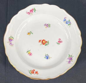
SIX Meissen Germany Hand Painted Porcelain Dessert PlatesBasel Auction House4.5(47)See Sold PriceFeb 24, 2024
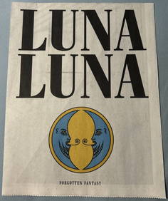
LUNA LUNA - OFFICAL PROGRAM (HARING, BASQUIAT, LICHTENSTEIN, DALI)ArtMeetsStreet x Mercer Auctions4.4(44)See Sold PriceMar 02, 2024
Cooke, George 1801 Antique Map. Germany divided into CirclesAlbion Auctions4.6(341)See Sold PriceMar 01, 2024
1849 Orr & Co. Hand Colored Southern Germany MapMatthew Bullock Auctioneers4.7(1.8k)See Sold PriceMar 02, 2024
Theodor Fischer (1862 - 1938) - Set of 4 Bird Prints - Haliaetos Albicilla - Strix LapponicaProverde Auctions4.3(3)See Sold PriceFeb 28, 2024
Joseph Meyer - Set of 50 Prints - Views of Austria - Germany - Italy - Sweden - France - CzechProverde Auctions4.3(3)See Sold PriceFeb 28, 2024
Joseph Meyer - Set of 50 Prints - Views of Austria - Germany - Italy - Sweden - France - UnitedProverde Auctions4.3(3)See Sold PriceFeb 28, 2024
Set of 4 Maps - Netherlands - Seven United Provinces - Germany - Sweden, Denmark, Norway, FinlandProverde Auctions4.3(3)See Sold PriceFeb 28, 2024