ATLAS of ANTIENT GEOGRAPHY by SAMUEL BUTLER 1843John McInnis Auctioneers,LLC4.6(504)See Sold PriceFeb 24, 2024
18TH C. ANTIQUE MAP: FRENCH & INDIAN WAR, FRAMEDThomaston Place Auction Galleries4.4(389)See Sold PriceFeb 24, 2024
Rand McNally Railroad Map Cabinet w/ 21 Railroad MapsRail & Road Auctions4.6(165)See Sold PriceMar 08, 2024
Keith Haring - Ink on New York Map, Best Buddies, Inscribed, Signed, and DatedSapphire Auction Gallery4.1(67)See Sold PriceMar 02, 2024
LATE 17TH C. FRENCH MAP OF THE NEW WORLD BY ALEXIS-HUBERT JAILLOT (1632-1712)Thomaston Place Auction Galleries4.4(389)See Sold PriceFeb 24, 2024
Central Railroad of New Jersey Map of Sandy Hook Route-ca. 1903JM Hobby Supply and Railroad Artifact Auctions4.4(126)See Sold PriceFeb 24, 2024
Lot of Six Mixed Atlas Box Cars-HO Scale-New in BoxJM Hobby Supply and Railroad Artifact Auctions4.4(126)See Sold PriceFeb 25, 2024
Rand McNally/Santa Fe Railroad Map of Iowa-1912JM Hobby Supply and Railroad Artifact Auctions4.4(126)See Sold PriceFeb 24, 2024
NICOLAES VISSCHER (NETHERLANDS, 1618-1709) MAP OF THE NEW WORLDThomaston Place Auction Galleries4.4(389)See Sold PriceFeb 24, 2024
17TH C. WORLD MAP BY NICOLAES VISSCHER (NETHERLANDS, 1618-1709)Thomaston Place Auction Galleries4.4(389)See Sold PriceFeb 24, 2024
Lot of Six Mixed Atlas Cabooses-HO Scale-New in BoxJM Hobby Supply and Railroad Artifact Auctions4.4(126)See Sold PriceFeb 25, 2024
SoldVINTAGE MAP STATE OF INEBRIATION ISLE OF PLEASUREVintage map print of the State of Inebriation Isle of Pleasure Copyrighted by H. J. Lawrence 1931 - 17" x 20" art - 18.25" x 22" frame - Out of frame inspection confirms that the map has not been glueSee Sold Price
SoldAN VINTAGE MAP, "Gulf States, Western Section,"AN VINTAGE MAP, "Gulf States, Western Section," EARLY/MID 20TH CENTURY, color ink on paper, "Struthers, Servoss & Co., Engr's, N.Y.," with two small maps, "Vicinity of Houston and Galveston," and "VicSee Sold Price
SoldLarge Lot of Vintage Road Maps, State Parks &Large Lot of Vintage Road Maps, State Parks & Historical SitesSee Sold Price
SoldShelf lot of Vintage State MapsIncludes Oklahoma, Iowa, Florida, and more also 1964 life magazineSee Sold Price
SoldSeven vintage 1855 maps of states: Mississippi, ASeven vintage 1855 maps of states: Mississippi, Alabama, Georgia, Arkansas, New York and cities: St. Louis, Chicago, New Orleans, Louisville; some rips and stains, 16" x 14"See Sold Price
SoldSix vintage 1833 maps of states: Mississippi, IlliSix vintage 1833 maps of states: Mississippi, Illinois, Arkansas, Wisconsin, Louisiana and southern states; some rips and stains, 16" x 13 1/2"See Sold Price
Sold9 vintage maps, American cities, states, regions9 vintage maps, American cities, states, regions 9 vintage maps, most late 19th century; 2 hand-colored Johnson's, 1860s-1880s, one of North America, one "Nebraska, Dakota, Idaho,and Montana" 1861-188See Sold Price
SoldNative American Ledger Art, Cheryl GrunloseFramed Native American ledger art by Cheryl A. Grunlose, Colville Tribes, Washington State. Composition of watercolor and chalks on a vintage map of Washington State. The contemporary drawing "an inteSee Sold Price
SoldNative American Ledger Art - Style Cheryl GrunloseFramed Native American ledger art - style by Cheryl A. Grunlose, Colville Tribes, Washington State. Composition of watercolor and chalks on a vintage map of Washington State. The contemporary drawingSee Sold Price
Vintage California State Map Souvenir TableclothVintage California State Map Souvenir Tablecloth This cotton vintage 40's California souvenir tablecloth is in excellent condition, with a couple of very faint spots and no wear. It measures 48" X 52.See Sold Price
Sold12x18" Vintage Framed Map of Meredosia Isle., Antiques12x18" Vintage Framed Map of Meredosia Isle., AntiquesSee Sold Price
Vintage CALIFORNIA State Map Souvenir TableclothThis cotton vintage 40's California souvenir tablecloth is in excellent condition, with a couple of very faint spots and no wear. It measures 48" X 52."The LARGE SIZE and WONDERFUL COLORS make this viSee Sold Price
Vintage ALASKA State Map Souvenir TableclothThis cotton vintage 50's Alaska souvenir tablecloth is in excellent condition, with a couple of small, inconspicuous spots and no wear. It measures 52" X 52" and has nice Alaskan, natural, and EskimoSee Sold Price
Vintage Map of the United States Canvas Reproduction PrintVintage Map of the United States Canvas Reproduction Print This vintage map comes from the Encyclopedia Britannica collection, each state can be seen throughout. Britannica has been the world's pSee Sold Price
Vintage Map of the United States Canvas Reproduction PrintVintage Map of the United States Canvas Reproduction Print This vintage map comes from the Encyclopedia Britannica collection, each state can be seen throughout. Britannica has been the world's pSee Sold Price
SoldVINTAGE MAP OF THE UNITED STATESVintage map of the United States, published by N. & S.S. Jocelyn of New Haven Connecticut. Due to the map ending at Oregon we can date this to ca. 1830s. A few trivial tears at the folds, else fine. OSee Sold Price
Sold32 VINTAGE MAPS OF THE BRITISH ISLES32 VINTAGE MAPS OF THE BRITISH ISLES. Comprising over 30 maps from various makers depicting England, Ireland, Scotland, and Wales including an 1890 George Phillip and Son map of Ireland on two sheetsSee Sold Price
SoldRomper Rooms Vintage Map of the United StatesRomper Rooms Vintage Map of the United StatesSee Sold Price
Vintage Washington State Maps Topography MapsVintage Washington State Maps Topography Maps This is a set of 5 Washington State Topography Maps that show Surveys from the early 1900s. These are vintage reprints of the initial surveys done. TheseSee Sold Price
Vintage Washington State Maps Topography MapsVintage Washington State Maps Topography Maps This is a set of 5 Washington State Topography Maps that show Surveys from the early 1900s. These are vintage reprints of the initial surveys done. TheseSee Sold Price
Vintage Washington State Maps Topography MapsVintage Washington State Maps Topography Maps This is a set of 5 Washington State Topography Maps that show Surveys from the early 1900s. These are vintage reprints of the initial surveys done. TheseSee Sold Price
SoldGroup of 15 Vintage Road Maps with Various StatesFeaturing Shell, Sinclair, Phillips 66, Standard, and TexacoSee Sold Price
SoldLot 5 New York Vintage Maps. Framed. New York StLot 5 New York Vintage Maps. Framed. New York State map. Brooklyn Borough. Patchoque: Town of Brooklyn. (2) Brookhaven, Suffolk County. -- Dimensions: Image Size: H: 15.5 inches: W: 23 inches ---See Sold Price
SoldMap Of The United StatesVintage map of The United States "Bacon's Standard Map Of United States". 36" x 52".See Sold Price
Vintage Estate World Maps II Signed & Framed Art PrintMannys Jewelry4.6(333)See Sold PriceMar 03, 2024
LARGE LATE 17TH C. DUTCH CHART OF CANADA, GREAT LAKES, NEW FRANCE, LABRADOR, HUDSON BAY, BY PIERREThomaston Place Auction Galleries4.4(389)See Sold PriceFeb 24, 2024
Vintage County Map Of NY State Plate EngravingThe Benefit Shop Foundation Inc.4.3(2.9k)See Sold PriceFeb 28, 2024
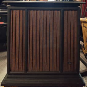
Pair of Vintage JBL C61 Sovereign II Cabinet SpeakersHeritage Gallery Auctions4.4(56)See Sold PriceMar 10, 2024
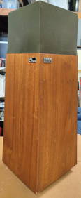
Pair of Vintage OHM Walsh 2 Speakers in Walnut VeneerHeritage Gallery Auctions4.4(56)See Sold PriceMar 10, 2024
Rand McNally & Co's New Ideal State and County Survey and Atlas 1911North American Artifact Auctions4.6(184)See Sold PriceApr 20, 2024
A "Red Book" of the Greatest War of History 1914North American Artifact Auctions4.6(184)See Sold PriceApr 20, 2024
These United States 1968 Folio Size HardbackNorth American Artifact Auctions4.6(184)See Sold PriceApr 20, 2024
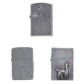
Vietnam War Era Silver Cigarette Lighters 3pc LOTHill Auction Gallery 4.7(1k)See Sold PriceFeb 28, 2024
Putnam - First Map of the State of Ohio by Rufus PutnamTrillium Antique Prints & Rare Books4.5(30)See Sold PriceFeb 24, 2024
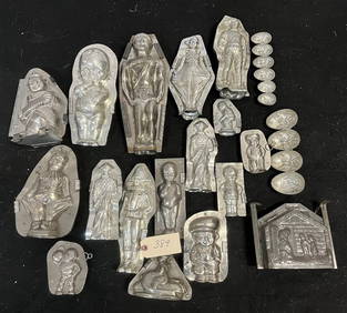
Vintage Commercial Chocolate MoldState Line Auctions & Estate Services4.6(276)See Sold PriceFeb 25, 2024
Le Canal de Mosambique, l'Isle de Madagascar… Mozambique. Africa. BONNE 1788 mapJasper524.5(9.8k)See Sold PriceFeb 28, 2024
Le Canal de Mosambique, l'Isle de Madagascar… Mozambique. Africa. BONNE 1790 mapJasper524.5(9.8k)See Sold PriceFeb 28, 2024
Partie Occidentale de l’Afrique. West Africa coast Canary islands BONNE 1788 mapJasper524.5(9.8k)See Sold PriceFeb 28, 2024
Vintage 1920s Rand McNally Auto Trails MapThe Benefit Shop Foundation Inc.4.3(2.9k)See Sold PriceMar 20, 2024