ATLAS of ANTIENT GEOGRAPHY by SAMUEL BUTLER 1843John McInnis Auctioneers,LLC4.5(505)See Sold PriceFeb 24, 2024
18TH C. ANTIQUE MAP: FRENCH & INDIAN WAR, FRAMEDThomaston Place Auction Galleries4.4(394)See Sold PriceFeb 24, 2024
Rand McNally Railroad Map Cabinet w/ 21 Railroad MapsRail & Road Auctions4.6(165)See Sold PriceMar 08, 2024
Keith Haring - Ink on New York Map, Best Buddies, Inscribed, Signed, and DatedSapphire Auction Gallery4.1(67)See Sold PriceMar 02, 2024
LATE 17TH C. FRENCH MAP OF THE NEW WORLD BY ALEXIS-HUBERT JAILLOT (1632-1712)Thomaston Place Auction Galleries4.4(394)See Sold PriceFeb 24, 2024
Central Railroad of New Jersey Map of Sandy Hook Route-ca. 1903JM Hobby Supply and Railroad Artifact Auctions4.4(127)See Sold PriceFeb 24, 2024
Lot of Six Mixed Atlas Box Cars-HO Scale-New in BoxJM Hobby Supply and Railroad Artifact Auctions4.4(127)See Sold PriceFeb 25, 2024
Rand McNally/Santa Fe Railroad Map of Iowa-1912JM Hobby Supply and Railroad Artifact Auctions4.4(127)See Sold PriceFeb 24, 2024
NICOLAES VISSCHER (NETHERLANDS, 1618-1709) MAP OF THE NEW WORLDThomaston Place Auction Galleries4.4(394)See Sold PriceFeb 24, 2024
17TH C. WORLD MAP BY NICOLAES VISSCHER (NETHERLANDS, 1618-1709)Thomaston Place Auction Galleries4.4(394)See Sold PriceFeb 24, 2024
Lot of Six Mixed Atlas Cabooses-HO Scale-New in BoxJM Hobby Supply and Railroad Artifact Auctions4.4(127)See Sold PriceFeb 25, 2024
Map Showing the Railroad and Canal Lines Used in theReserve Reduced! Title: Map Showing the Railroad and Canal Lines Used in the Determination of Elevations Publication Date: 1874 Cartographer: GARDNER, JAMES T. Publisher: U.S.G.S. Size (inches): H15 -See Sold Price
SoldGreat early map of Iowa by Cowperthwait, 1855Early and desirable map of Iowa, hand colored by counties, showing railroads, stage lines, canals, forts, towns, roads, rivers, lakes and more. Possibly one of the very best early maps of this state.See Sold Price
SoldTwo Pocket Maps of California (117240)Two pocket maps: "Complete Map of California," "Showing principal automobile roads," (handwritten, "after 1909"). Electric lines, railroads, M.O. post office, banks, rivers, canals, and last U.S. CensSee Sold Price
SoldTwo Pocket Maps of California (117240)Two pocket maps: "Complete Map of California," "Showing principal automobile roads," (handwritten, "after 1909"). Electric lines, railroads, M.O. post office, banks, rivers, canals, and last U.S. CensSee Sold Price
Scarce 1910 Railroad map of Oklahoma from elusive Cram atlasIncredibly detailed, large format railroad map of Oklahoma showing every railroad line operating in the territory during this time period. Shows both steam and electric lines and displays them in a coSee Sold Price
SoldScarce and huge RR map of Florida – 1898Scarce, detailed railroad map of Florida, showing counties, railroad lines, towns, rivers, township surveys, lakes, mountains, creeks, waterfalls, and a much other information. Shows routes for 36 difSee Sold Price
SoldExt. scarce 1910 railroad map of CincinnatiAn unusual map showing not only the railroad lines running through Cincinnati in the early part of the 1900s, but also depicting every streetcar route as well. From an extremely scarce atlas, one of tSee Sold Price
Extremely scarce RR map of Utah from 1910 Cram Std. Amer. Railway atlasImpossibly scarce, large format railroad map of Utah, showing counties, railroad lines, towns, mines, rivers, township surveys, Indian reservations, lakes, mountains, creeks, waterfalls, and a host ofSee Sold Price
Cuba Map, Rand-McNally, 1901Cuba Map. A meticulously detailed map of the island showing 18 railroad lines, all station stops, clear topography, and countless towns and place names, with inset plans of Havana Harbor, Port MatanzaSee Sold Price
Rand-McNally: Antique Cuba Railroads Map, 1901Cuba. A meticulously detailed map of the island showing 18 railroad lines, all station stops, clear topography, and countless towns and place names, with inset plans of Havana Harbor, Port Matanzas, CSee Sold Price
Rand, McNally Vest Pocket Map of New Mexico.c1919 Title: Rand, McNally Vest Pocket Map of New Mexico. Cartographer: Publisher: RAND, MCNALLY & CO. Height: 19 Width: 25.5 Map showing counties (separately colored), railroads & electric lines (indSee Sold Price
Sold* Maine Railroad Map Framed 1914A large Railroad map of Maine dated to 1914. This map has been professionally framed. The frame measures 27" by 35". It's heavy. The map has a key showing the different railroad lines and each countySee Sold Price
SoldRare railroad broadside with mapHeading: Author: Elliott, S.G. Title: Map of Central California Showing the different Railroad Lines Completed & Projected. Compiled by S. G. Elliott, C.E. 1860. Published by W.W. Welch, Nevada PlaceSee Sold Price
Massachusetts. Atlas Plate No.7 [Plymouth]Title: Massachusetts. Atlas Plate No.7 [Plymouth] Publication Date: c1891 Cartographer: ANONYMOUS Publisher: GEO. H. WALKER & CO. Size: 17.5Height - 26Width Road and railroad map showing proposed lineSee Sold Price
ChicagoTitle/Content of Map: Chicago Date: 1881 Cartographer: MITCHELL, S.A., JR.(?) Size: 17.8X14 Map showing wards separately colored, streets (named), railroads, canal, parks, etc. With index at bottom ofSee Sold Price
ChicagoPublication Date: 1881 Title: Chicago Cartographer: MITCHELL, S.A., JR.(?) Height: 17.8Width: 14 Map showing wards separately colored, streets (named), railroads, canal, parks, etc. With index at bottSee Sold Price
OhioTitle: Ohio Publication Date: 1842 Cartographer: MORSE & BREESE Publisher: MORSE & BREESE Size: 13.8Height - 11.3Width Map showing details such as counties, towns, railroads, canals, topography and toSee Sold Price
New YorkPublication Date: 1856 Title: New York Cartographer: COLTON, J.H. Publisher: J.H. COLTON & CO. Height: 16 Width: 23.3 Map showing counties separately colored, railroads, common roads, canals, county tSee Sold Price
Vermont and New HampshireReserve Reduced! Item: Vermont and New Hampshire Date: 1842 Cartographer: MORSE & BREESE Publisher: MORSE & BREESE Size (inches): 14X11 Map showing counties, towns, townships, canals, railroads, topogSee Sold Price
Roessler Map of TexasROESSLER, Anton (d. 1893).New Map of Texas.Lithograph.New York, 1875.15 3/4" x 17 1/4" sheet, 26" x 27 1/2" framed.Great map of Texas showing forts, telegraph lines, proposed railroad lines, Indian teSee Sold Price
SoldAN ANTIQUE MAP, "Vertical Map of Texas," LATEAN ANTIQUE MAP, "Vertical Map of Texas," LATE 19TH/EARLY 20TH CENTURY, ink on paper, showing railroad lines, counties and Indian territories. 13" x 10" Note: After Rand McNally's 1876, Jones and HamilSee Sold Price
SoldTWO VINTAGE MAPS, "Vertical Map of Texas," CHICAGO,TWO VINTAGE MAPS, "Vertical Map of Texas," CHICAGO, EARLY 20TH CENTURY, color engravings on paper, published by Rand McNally, showing railroad lines, counties and Indian territories and a portionSee Sold Price
SoldHinomaru flag with a map of China.A Japanese soldier's Hinomaru's flag. Showing railroad lines and cities from Nanking (now Nanjing) to Shanghai. Zhenjiang, Wuxi and Suzhou are shown. Date reads: "Showa 12 (1937), 9 Gatsu 9 Nichi JoriSee Sold Price
SoldUnited States, Exhibiting the Railroads & CanalsReserve Reduced! Title: United States, Exhibiting the Railroads & Canals Publication Date: 1835 Cartographer: BRADFORD, T.G. Publisher: BRADFORD, T.G. Size (inches): 7.4Height - 9.8Width Map showing tSee Sold Price
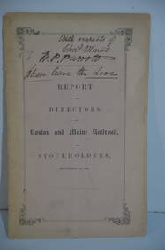
Boston and Maine RR Annual Report-September 12, 1849JM Hobby Supply and Railroad Artifact Auctions4.4(127)See Sold PriceFeb 24, 2024
Lake Superior and Mississippi River RR 1869 Seven Percent Bonds Book/Report-1869JM Hobby Supply and Railroad Artifact Auctions4.4(127)See Sold PriceFeb 24, 2024
1892 Adams and Bowles New Road Map of the State of New YorkJM Hobby Supply and Railroad Artifact Auctions4.4(127)See Sold PriceFeb 24, 2024
Crams Colored Railway Map and Shippers Guide of South Dakota 1908-1909JM Hobby Supply and Railroad Artifact Auctions4.4(127)See Sold PriceFeb 24, 2024
Crams Railroad Map of New York-1881JM Hobby Supply and Railroad Artifact Auctions4.4(127)See Sold PriceFeb 24, 2024
Rand McNally Railroad Map of Arizona-1909JM Hobby Supply and Railroad Artifact Auctions4.4(127)See Sold PriceFeb 24, 2024
Rand McNally Railroad Map of Colorado-1929JM Hobby Supply and Railroad Artifact Auctions4.4(127)See Sold PriceFeb 24, 2024
Rand McNally/Santa Fe Railroad Map of Iowa-1912JM Hobby Supply and Railroad Artifact Auctions4.4(127)See Sold PriceFeb 24, 2024
Union Pacific RR Map of the United States-1926JM Hobby Supply and Railroad Artifact Auctions4.4(127)See Sold PriceFeb 24, 2024
Erie Railway Tourist Book/Magazine-1874JM Hobby Supply and Railroad Artifact Auctions4.4(127)See Sold PriceFeb 24, 2024
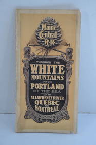
Maine Central RR Through the White Mtns-Portland to the St Lawrence River Book-1901JM Hobby Supply and Railroad Artifact Auctions4.4(127)See Sold PriceFeb 24, 2024
Union Pacific RR Across The Continent West From Omaha, NE Book-April 2, 1868JM Hobby Supply and Railroad Artifact Auctions4.4(127)See Sold PriceFeb 24, 2024
Chicago and Northwestern RY April 20, 1906 Public TimetableJM Hobby Supply and Railroad Artifact Auctions4.4(127)See Sold PriceFeb 24, 2024
Early 1900's Railway Service Map, Illinois, Ohio, Indiana, Kentucky, TennesseeConnoisseur Auctions3.9(337)See Sold PriceFeb 24, 2024
Pair of Early Railroad Maps - 1862 Pittsburgh, Ft. Wayne & Chicago Railway and 1873 PennsylvaniaRail & Road Auctions4.6(165)See Sold PriceMar 07, 2024
Fifteen Kansas City Southern Lines Railroad Playing Card DecksRail & Road Auctions4.6(165)See Sold PriceMar 08, 2024
Six 1900s ICS Books on Railroad Locomotives and Air BrakesRail & Road Auctions4.6(165)See Sold PriceMar 08, 2024


![Massachusetts. Atlas Plate No.7 [Plymouth] (1 of 1)](https://p1.liveauctioneers.com/5584/138985/70466031_1_x.jpg?height=282&quality=70&version=1554250661)