ATLAS of ANTIENT GEOGRAPHY by SAMUEL BUTLER 1843John McInnis Auctioneers,LLC4.6(502)See Sold PriceFeb 24, 2024
18TH C. ANTIQUE MAP: FRENCH & INDIAN WAR, FRAMEDThomaston Place Auction Galleries4.4(386)See Sold PriceFeb 24, 2024
Rand McNally Railroad Map Cabinet w/ 21 Railroad MapsRail & Road Auctions4.6(165)See Sold PriceMar 08, 2024
Keith Haring - Ink on New York Map, Best Buddies, Inscribed, Signed, and DatedSapphire Auction Gallery4(67)See Sold PriceMar 02, 2024
LATE 17TH C. FRENCH MAP OF THE NEW WORLD BY ALEXIS-HUBERT JAILLOT (1632-1712)Thomaston Place Auction Galleries4.4(386)See Sold PriceFeb 24, 2024
Central Railroad of New Jersey Map of Sandy Hook Route-ca. 1903JM Hobby Supply and Railroad Artifact Auctions4.4(126)See Sold PriceFeb 24, 2024
Lot of Six Mixed Atlas Box Cars-HO Scale-New in BoxJM Hobby Supply and Railroad Artifact Auctions4.4(126)See Sold PriceFeb 25, 2024
Rand McNally/Santa Fe Railroad Map of Iowa-1912JM Hobby Supply and Railroad Artifact Auctions4.4(126)See Sold PriceFeb 24, 2024
NICOLAES VISSCHER (NETHERLANDS, 1618-1709) MAP OF THE NEW WORLDThomaston Place Auction Galleries4.4(386)See Sold PriceFeb 24, 2024
17TH C. WORLD MAP BY NICOLAES VISSCHER (NETHERLANDS, 1618-1709)Thomaston Place Auction Galleries4.4(386)See Sold PriceFeb 24, 2024
Lot of Six Mixed Atlas Cabooses-HO Scale-New in BoxJM Hobby Supply and Railroad Artifact Auctions4.4(126)See Sold PriceFeb 25, 2024
Sold2 Hand Colored Maps - MichiganTwo Gray's Atlas Maps on one sheet - Michigan & Lake Superior and the Northern Part of Michigan Depicts railroad lines, common roads, canals, topography, etc. Maps are on eaSee Sold Price
SoldMitchell's Map Ohio Indiana Illinois Michigan 1837Mitchell's Map of Ohio, Indiana, Illinois, and Michigan. Embossed brown leather cover with gilt lettering. 5-1/4" x 3-1/4". Map 18" x 21-1/2". Handcolored. Published by S. Augustus Mitchell PhiladelphSee Sold Price
SoldColton: Antique Map of Lake Superior & Michigan, 1859Title/Content of Map: Lake Superior & UP of Michigan by Colton Date Printed: 1859 Cartographer: H. J. Colton Material/Medium: Paper Size: 17 1/2" x 15" Hand colored engraved. Published in New York inSee Sold Price
SoldGroup of six 19th century hand colored engraved maps toGroup of six 19th century hand colored engraved maps to include New Jersey, Wisconsin, Florida, Eastern United States, Maryland and Michigan. sight size: 14" x 11 1/2" to 11 1/2" x 14".See Sold Price
SoldMichigan. 1850 by ThomasTitle: Michigan. 1850 by Thomas Date/Period: c1850. Materials: Hand colored steel engraved Size: 16 1/2 x 13 1/2 inches. c1850 by Thomas, Cowperthwait & Co. From 'A New Universal Atlas' Published in PSee Sold Price
SoldTHREE EARLY TRAVEL GUIDES AND MAPS.Includes Map of the States of Ohio, Indiana, and Illinois with the Settled Parts of Michigan and Wisconsin, Philadelphia: Augustus Mitchell, 1844, fold-out, handcolored, 17 3/4" x 21 1/2" map bound inSee Sold Price
Sold2 Hand Colored Maps - Florida & AlabamaTwo Gray's Atlas Maps on one sheet - Florida & Alabama Depicts railroad lines, common roads, canals, topography, etc. Maps are on each side of one sheet. A beautiful & rarSee Sold Price
Sold2 Hand Colored MapsThomas Jefferys map illustrating Europe and Turkey. Herman Moll: "Atlas Minor." (9.5" X 11.5" (15.25" X 17.25")) (East 86 Street Estate)See Sold Price
Sold2 Hand Colored Maps - Louisiana - MississippiTwo Gray's Atlas Maps on one sheet - Louisiana & Mississippi Depicts railroad lines, common roads, canals, topography, etc. Maps are on each side of one sheet. A bSee Sold Price
Sold2 Hand Colored Maps - Georgia & South CarolinaTwo Gray's Atlas Maps on one sheet - Georgia and South Carolina Inset of Charleston on South Carolina map. Depicts railroad lines, common roads, canals, topography,See Sold Price
Sold2 hand-colored maps: [Ca. 1600], [Ca. 1575].[Braun & Hogenberg]. 2 engraved maps from Civitates Orbis Terrarum. Hand-colored birds-eye view of cities, sourrounded by colorful scenery, including sailing ships. ++ Byzantium, Nunc ConstantinopolisSee Sold Price
Sold2 hand-colored maps after Janssoriusafter Joannes Janssonius- ''Haemisphaeri Graphicun Coelitiet''; ''Hemisphae Aliccoeli Sphaerigra- 2 engravings with hand-coloring, aged unknown, staining throughout. 17 x18 3/4'' ea.See Sold Price
Sold(2) HANDCOLORED MAPS OF ASIABurma, Siam, French Indo-China and Straits Settlements and Physical Map of Asia . Dimensions: H 9.75" x W 12.75" Condition: Folding, toning and a tear to the middle of the Map of Asia.See Sold Price
SoldSouth America: 2 hand-colored maps, Zatta, 1785.[South America]. 2 double-page engraved maps by G. Pitteri. Venice: Antonio Zatta, 1785. ++ La Terra Ferma La Guiana Spagnola, Olandese, Francese, e Portughese. E la Parte Settentrie del Bresil. 16 1/See Sold Price
SoldBAKER, Samuel W., Sir (1821-1893). Ismailïa. London:BAKER, Samuel W., Sir (1821-1893). Ismailïa. London: Macmillan and Co., 1874. 2 volumes, 4to (220 x 144 mm). 2 hand-colored maps (1 folding, torn from stub); numerous plates including frontispieces.See Sold Price
SoldMAP OF 17TH CENTURY HONDIUS.AMERICA SEPTENTRIO NALIS. 21 X 18 1/2". HAND COLORED. MAP APPEARS TO BE A LATER PRINTING.See Sold Price
Sold2 Early Handcolored Maps2 Handcolored Maps,1 of Switzerland Circa 1625 and 1 of Savoie Circa 1642 - Frame approx 25" x 21" and 22" x 17"See Sold Price
Sold2 Antique Hand Colored Maps East & West Indies2 Antique Hand Colored Maps of The East & West Indies. Including map of Batavia and Jamaica Map measures 17 inches high x 21 inches wide. Frame measures 19 inches high x 23 inches wide.See Sold Price
Sold(2) HAND-COLORED GERMANIC MAPS, NUREMBERG(lot of 2) Framed hand-colored engravings on paper, maps of Central Europe, including: (1) "Tabula Geographica: Principatus Gotha, Coburg et Altenburg," Johann Baptist Homann (1663-1724), Nuremberg, sSee Sold Price
SoldLot of 2 early hand colored maps entitled Edimbourg andLot of 2 early hand colored maps entitled Edimbourg and Escossi, both in good condition - one with label on the back identifying date as 1683.See Sold Price
Sold[2] Hand colored engraved maps, Louisiana, by S.[2] Hand colored engraved maps, Louisiana, by S. Augustus Mitchell, Philadelphia, 1847. Foxing. Sight size: 10 ¾ x 13 ½Â”; Alabama, Mississippi, Lousiana & Arkansas, by J.H. Young, 18See Sold Price
Sold(2) antique hand-colored maps: Poland, Ukraine, et(2) antique hand-colored maps: Poland, Ukraine, etc., 17th/18th century, Danckerts and Sansone larger: 17" x 21", unframedSee Sold Price
Sold(2) antique hand-colored maps: Palestine(2) antique hand-colored maps: Palestine, 17th/18th century, Danckerts and another, larger: 21" x 24.5", unframedSee Sold Price
Sold2 pieces. Hand-Colored Maps - North America: Bowe2 pieces. Hand-Colored Maps - North America: Bowen, Thomas. A New and Accurate Map of North America." [London], [1779]. Engraving. 10 1/2 x 17 1/2 inches; 260 x 430 mm. Orig. color, slightly age tonedSee Sold Price
MARTINET / DE VRIES Catechism of Nature 4 Vol. Set c1788 Engravings Rare!Luis Porretta Fine Arts4.3(10)See Sold PriceMar 02, 2024
17TH C. ANTIQUE MAP SIEGE OF LA ROCHELLE, FRANCE, FRAMEDThomaston Place Auction Galleries4.4(386)See Sold PriceFeb 24, 2024
EARLY 18TH C. MAP OF ITALY, FRAMEDThomaston Place Auction Galleries4.4(386)See Sold PriceFeb 24, 2024
18TH C. ANTIQUE MAP: FRENCH & INDIAN WAR, FRAMEDThomaston Place Auction Galleries4.4(386)See Sold PriceFeb 24, 2024
17TH C. ENGLISH LINEAR MAP BY OGILBY, FRAMEDThomaston Place Auction Galleries4.4(386)See Sold PriceFeb 24, 2024
ABRAHAM ORTELIUS (1527-1598) MAP OF ROMAN GAUL (FRANCE)Thomaston Place Auction Galleries4.4(386)See Sold PriceFeb 24, 2024
NICOLAES VISSCHER (NETHERLANDS, 1618-1709) MAP OF THE NEW WORLDThomaston Place Auction Galleries4.4(386)See Sold PriceFeb 24, 2024
Early 1900's Railway Service Map, Illinois, Ohio, Indiana, Kentucky, TennesseeConnoisseur Auctions4(333)See Sold PriceFeb 24, 2024
Willem Blaeu, Etc. 17th C. Antiquarian Maps, 2Auctions at Showplace4.5(726)See Sold PriceMar 17, 2024
Hand Colored Engraved Map of Europe, Jean Baptiste Bourguignon Anville 1754Global Auctions Company4.3(36)See Sold PriceMar 03, 2024
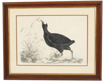
Prideaux John Selby, "Common Coot" EtchingStefek's Auctioneers & Appraisers4.5(105)See Sold PriceFeb 28, 2024
Hamilton - Engraving of a Painting from a Grecian Vase. 2Trillium Antique Prints & Rare Books4.5(30)See Sold PriceFeb 24, 2024
Wilson - Wood Thrush, Red-breasted Thrush or Robin, & Nuthatches. 2Trillium Antique Prints & Rare Books4.5(30)See Sold PriceFeb 24, 2024
Two Hand-Colored 19th Century Maps of New Orleans and Louisiana, Larger- H.- 12 1/2 in., W.- 15 1/2Crescent City Auction Gallery4.3(229)See Sold PriceMar 08, 2024
1849 Orr & Co. Hand Colored Southern Germany MapMatthew Bullock Auctioneers4.7(1.8k)See Sold PriceMar 02, 2024


![2 hand-colored maps: [Ca. 1600], [Ca. 1575]. (1 of 2)](https://p1.liveauctioneers.com/179/12368/3396978_1_x.jpg?height=282&quality=70&version=1175725014)


![[2] Hand colored engraved maps, Louisiana, by S. (1 of 9)](https://p1.liveauctioneers.com/4503/154077/77880003_1_x.jpg?height=282&quality=70&version=1573177471)