SoldBELLIN, JACQUES NICOLAS. Carte de la Baye de HBELLIN, JACQUES NICOLAS. Carte de la Baye de Hudson. Engraved folding map, 225x305 mm, wide margins; slightly but evenly toned overall. Kershaw II:423. Paris, 1744 All items are offered for sale subjeSee Sold Price
MAP - Southeastern China. BellinSoutheastern China. Jacques Nicolas Bellin, Carte de la Baye d'Hocsieu et des Entrees de la Riviere de Chang, dans la Province de Fokyen, en Chine, 1764 (circa). Hand Color. This attractive chart of tSee Sold Price
SoldBellin, Jacques Nicolas (1703-1772) Plan de la VilBellin, Jacques Nicolas (1703-1772) Plan de la Ville de Boston, and Carte de la Baye de Baston [sic]. from Petit Atlas Maritime. Paris, 1764. Two small folio engraved mSee Sold Price
Bellin chart of Changchow Bay China c.1750Title: Carte de la Baye de Chin-Chew ou Chang-Chew avec les Isles d'Emowi et de Quemowi Dressée sur Divers Manuscrits Author: Bellin, Jacques Nicolas Description: Copper-engraved map. 21x30 cm. (8½xSee Sold Price
SoldJACQUES NICOLAS BELLIN (FRANCE 1702-1873), MAP OFJACQUES NICOLAS BELLIN (FRANCE 1702-1873), MAP OF CHESAPEAKE BAY, 1ST EDITION, "CARTE DE LA BAYE DE CHESAPEACK ET PAYS VOISINS...", C.1757. SIGHT 8 1/4 X 12"; FRAMED AND GLAZED 12 X 15 3/4"See Sold Price
SoldBellin map of Virginia and the Chesapeake 1757Title: Carte de la Virginie, de la Baye Chesapeack, et Pays Voisins. Pour servir à l'Histoire Générale des Voyages Author: Bellin, Jacques Nicolas Description: Copper-engraved map. 18.5x28.4 cm. (7See Sold Price
SoldBellin map of Virginia and the Chesapeake 1757Title: Carte de la Virginie, de la Baye Chesapeack, et Pays Voisins. Pour servir à l'Histoire Générale des Voyages Author: Bellin, Jacques Nicolas Description: Copper-engraved map. 18.5x28.4 cm. (7See Sold Price
Jacques Nicolas BellinJacques Nicolas Bellin,Carte Particuliere Des Costes Occidentales D'Irlande Qui Comprend la Baye de Galloway et la Riviere de Lymerick, Circa 1740 90 x 64 cm.See Sold Price
SoldJacques Nicolas Bellin (1703-1772), "Carte de Isle deJacques Nicolas Bellin (1703-1772), "Carte de Isle de La Jamaique," 1758, hand colored, H. - 8 in., W. - 12 in.See Sold Price
SoldTwo Maps- Jacques Nicolas Bellin (1703-1772), "Carte deTwo Maps- Jacques Nicolas Bellin (1703-1772), "Carte de la Louisiane," 1757: and "Carte de la Caroline et Georgia," 1757, two hand colored engravings, matted, unframed, H.- 7 7/8 in., W.- 11 5/8 in. (See Sold Price
SoldJACQUES NICOLAS BELLIN (FRENCH, 1703-1772) MAP OFJACQUES NICOLAS BELLIN (FRENCH, 1703-1772) MAP OF VIRGINIA, engraving on laid paper, titled "CARTE DE LA VIRGINIE DE LA BAYE CHESAPEACK ET PAYS VOISINS", published 1757 in Paris. Housed in a modern frSee Sold Price
SoldCarte Du Bresil, Prem. Partie. 1758.[Brazil] Bellin, Jacques Nicolas. “Carte Du Bresil, Prem. Partie. Depuis la Riviere des Amazones jusq'a la Baye de Tous les Saints. Trie de la Carte de l'Amerique de Mr. D'Anville.” Paris,See Sold Price
SoldBellin, Jacques Nicolas (French, 1703-1772). CarteBellin, Jacques Nicolas (French, 1703-1772). Carte Reduite des Costes de la Louisiane et de la Floride...MDCCLXIV, 1764, Hand-colored on laid paper. Plate dimensions: h: 23 1/2 x w: 34 1/2 in.See Sold Price
Carte Du Bresil, Prem. Partie. 1758.[Brazil] Bellin, Jacques Nicolas. “Carte Du Bresil, Prem. Partie. Depuis la Riviere des Amazones jusq'a la Baye de Tous les Saints. Trie de la Carte de l'Amerique de Mr. D'Anville.” Paris,See Sold Price
Didot/Bellin: Carte De La Tartarie Orientale, 1749Map: Carte De La Tartarie Orientale Publication Date: 1749 Authors: DIDOT, BELLIN, JACQUES NICOLAS, ELDER (1703-1772) Publisher: DIDOT Size: Quarto – 8.25 H x 12.30 W Inches "pour servir a l'HistoirSee Sold Price
Bellin/Didot: Carte De La Tartarie Orientale, 1749Map: Carte De La Tartarie Orientale Publication Date: 1749 Authors: DIDOT, BELLIN, JACQUES NICOLAS, ELDER (1703-1772) Publisher: DIDOT Size: Quarto – 8.25 H x 12.30 W Inches "pour servir a l'HistoirSee Sold Price
Didot/Bellin: Map of Lake of Mexico in Aztec Times,Map: Carte Des Environs De La Ville De Mexico Pour L'histoire Gene. Des Voyages. 1754. Date: 1754 Authors: DIDOT, BELLIN, JACQUES NICOLAS, ELDER (1703-1772) Publisher: DIDOT Size: Octavo – 7.90 H xSee Sold Price
SoldMap, Jacques-Nicolas BellinJacques-Nicolas Bellin (French, 1703-1772), "Carte de l'Entree de la Riviere de Canton Dressee sur les Observations les pls recentes," 1764, hand-colored engraving, image (sight): 10"h x 8"w, overallSee Sold Price
SoldDidot/Bellin: Antique Map of Madagascar, 1747Map: Carte De Toute Les Isles Connues a La Coste De Languebar Et Madagascar Publication Date: 1747 Authors: DIDOT, BELLIN, JACQUES NICOLAS, ELDER (1703-1772) Publisher: DIDOT Size: Octavo – 9.25 H xSee Sold Price
SoldBELLIN, JACQUES NICOLAS. Carte de la Louisiane et desBELLIN, JACQUES NICOLAS. Carte de la Louisiane et des Pays Voisins. Double-page engraved map of eastern North America. 21x29 inches sheet size, wide margins; original hand-color in outline; printed slSee Sold Price
Bellin, Jacques Nicolas. Plan de la Baye de ChibouctouBellin, Jacques Nicolas Plan de la Baye de Chibouctou nommee par les Anglois Halifax 1763 Copperplate engraving; original coloured Printed size: 34.8 x 21.9 cm; 13.7 x 8.6 in This handsome copper engrSee Sold Price
(MAP) BELLIN, JACQUES NICOLAS. Carte de la Tartarie(MAP) BELLIN, JACQUES NICOLAS Carte de la Tartarie Occidentale. Double-page uncolored engraved map of the Western Tartars from an edition of Prevost's L'histoire generale des voyages. London, 1753. FrSee Sold Price
SoldBELLIN, JACQUES NICOLAS. Carte de la Baie desBELLIN, JACQUES NICOLAS. Carte de la Baie des Chaleurs a la Cote Occidentale du Golfe de St. Laurent. Engraved map, 610x430 mm, wide margins; scattered removable foxing. Paris: Depot General de la MarSee Sold Price
(MAP) BELLIN, JACQUES NICOLAS. Carte de la Tartarie Occ(MAP) BELLIN, JACQUES NICOLAS Carte de la Tartarie Occidentale. From an edition of Prevost's L'histoire Generale des Voyages. London, 1753. Engraved map of the Western Tartars. Uncolored. Framed. CreaSee Sold Price
1758 MAP PARTIE DE LA MER GLACIALE contenants La Nouvelle Zemble RUSSIA antiqueJasper524.5(9.8k)See Sold PriceFeb 27, 2024
1749 MAP CARTE DE LA TARTARIE ORIENTALE RUSSIA & CHINA antique EASTERN TARTARYJasper524.5(9.8k)See Sold PriceFeb 27, 2024
Multiple artists - Set of 10 prints from the 19th Century, vers 1870NCAG4.4(32)See Sold PriceMar 10, 2024
1764 Bellin Map of St. Kitts -- Carte de l'Isle St. ChristopheJasper524.5(9.8k)See Sold PriceFeb 27, 2024
1764 Bellin Map of Antigua -- Carte de l'Isle d'Antigue Situee par la Latitude 17 Degres et par laJasper524.5(9.8k)See Sold PriceFeb 27, 2024
Coste Occidentale d’Afrique…' Arguin Bay Cap Blanc Mauritania. BELLIN 1746 mapJasper524.5(9.8k)See Sold PriceFeb 28, 2024
Partie de la Coste d'Afrique depuis Tanit…' Southern Mauritania BELLIN 1746 mapJasper524.5(9.8k)See Sold PriceFeb 28, 2024
Coste Orientale d’Afrique…' South Africa. Mozambique channel. BELLIN 1746 mapJasper524.5(9.8k)See Sold PriceFeb 28, 2024
Coste Occidentale d’Afrique…' West Africa. Gulf of Guinea. BELLIN 1746 mapJasper524.5(9.8k)See Sold PriceFeb 28, 2024
Plan de la Baye & Isle d'Arguim'. Mauritania. Arguin island. BELLIN 1746 mapJasper524.5(9.8k)See Sold PriceFeb 28, 2024
Coste Orientale d’Afrique…' East Africa Kenya Tanzania Somalia. BELLIN 1746 mapJasper524.5(9.8k)See Sold PriceFeb 28, 2024
Coste Occidentale d’Afrique…' Namibia South Africa Angola coast BELLIN 1746 mapJasper524.5(9.8k)See Sold PriceFeb 28, 2024
Barthelemy, Jean 1790 Map. Greece - Essa sur la Bataille de PlateeAlbion Auctions4.6(341)See Sold PriceMar 01, 2024
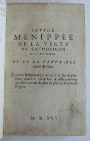
OLD SATIRICAL WORK, 1595 SATYRE MENIPPEE DE LA VERTU DU CATHOLICON D'ESPAGNENY Elizabeth 4.3(85)See Sold PriceMar 03, 2024
Jacques Nicolas Bellin - Antique Map - Vue de la Rade de Tiniam, double antique coast view of theProverde Auctions4.3(3)See Sold PriceFeb 28, 2024