Sold(MARITIME CHARTS.) Track Charts of the SquadroSINGAPORE AND HONG KONG. (MARITIME CHARTS.) Track Charts of the Squadron Employed on the East India and China Station. Commodore G. R. Lambert - Commander in Chief [cover title]. Bound volume containSee Sold Price
Sold2 on-board kept whaling charts. These are Lieut.M. Maury Nautical wind and current charts used by many whalers. The track of two voyages were recorded daily on the same two charts. A) ship Alexander Coffin, Sept. 30, 1849 - Oct. 20, 1849 transportiSee Sold Price
SoldForty Pennsylvania and Pennsylvania Central Railroad Maintenance Programs and Track Charts - 1965 toA group of forty maintenance programs and track charts for Pennsylvania and Pennsylvania Central Railroad spanning 1965 to 1972. Divisions among the Central and Western Regions of the group include FoSee Sold Price
SoldLot Assorted RR track charts and diagramsLot Assorted RR track charts and diagrams including; Reading Co., Norfolk & Western Railway, Central Railroad of New Jersey, Wilmington & Northern RR Condition; some wear especially on edges and corneSee Sold Price
Sold7 Conrail Track Charts7 Conrail Track Charts, 4 spiral bound, including: 3 Phila division, & 1 Harrisburg div. plus 2 Harrisburg div, & 1 Septa commuter region, 1980s, 90s.CONDITION: Some wear to covers.See Sold Price
SoldEmployee Related timetables, Track Charts, etc.A nice selection of track charts (MEC, B&M) and some employee timetables and most interesting record from the Boston & Maine of who took exams from 1944-1949. Loads of employee data in this book. SomeSee Sold Price
SoldLot of Assorted RR Track Charts & DiagramsLot of Assorted RR Track Charts & Diagrams, Conrail, Jersey Central, Reading Co. & other. CONDITION: Normal wear from age & use.See Sold Price
Sold29 NYC memos, track charts, telegraphsNice group of twenty nine packets of New York Central memos, telegraphs, track charts, lease notes and more. Subject material includes roundhouse removal at Kendallville Indiana, Corunna Indiana highwSee Sold Price
SoldConrail 1985 Maintenance Program and Track ChartConrail 1985 Maintenance Program and Track Chart Southern Region / Southwest DivisionConrail 1985 Maintenance Program and Track Chart Southern Region / Southwest Division. Measures 14 1/2" x 11&qSee Sold Price
SoldLarge lot Reading Co. Track ChartLarge lot Reading Co. track chart, most in blue print form, early to mid 20th C., folded. CONDITION: Some wear at edges & folds, some tears & bending.See Sold Price
SoldFLOWN Gemini 11 Dick Gordon Orbital Track ChartFLOWN Gemini Orbital Track Chart (13x7.75") Double-sided orbital chart depicting the spacecraft's course over Earth. The orbits are printed on transparent plastic, which is taped over a paper map of tSee Sold Price
Chart: Track of Flagships of The U.S. Japan ExpeditionTitle/Content of Map: Chart Showing the Track of the Flagships of The U.S. Japan Expedition Cartographer: SELZ, EDWARD ? Size: 10.25X36.3 "to the Eastd. of the Cape of Good Hope 1853 & 1854" Outline mSee Sold Price
SoldTrack chart of USS Nautilus- First TransarcticTrack chart of USS Nautilus- First Transarctic Submarine journey August 3 1958 from Arthur Wegner Executive for Raytheon and Pratt & WhitneySee Sold Price
Sold5 - Space Shuttle Mission Tracking ChartsFive different Space Shuttle Mission Ground Track Charts from NASA. These charts are used to track the location of the Shuttle while in Orbit. They cover the STS-35, STS-37, STS-39, STS-98 and STS-99See Sold Price
SoldNew York Central log books, steam loco charts, eNew York Central railroadiana. Includes 1953-1961 track maintainer log book for northern Indiana, 1936 New York Central locomotive number change packet, Penn Central track charts for northeast IndianaSee Sold Price
SoldAdmiralty Sea Chart of the World 1874Carrington, R. C. Track Chart of the World...Published at the Admiralty ... Under The Superintendence of Rear Admiral G.H. Richards, C.B. F.R.S. Hydrographer. Lithographed map. London: Royal Navy HydrSee Sold Price
SoldHOWDY DOODY BEHAVIOR CHART No. 2011949 HOWDY DOODY BEHAVOIR CHART, IN ORIGINAL BOX. COLORFUL WALL DECORATION OF HOWDY DOODY, CLARABELL, AND FLUB-A-DUB. CHART TRACKS THE CHILD'S GOOD BEHAVIOR WITH STARS AND WHEN FILLED UP, THE CHILD GESee Sold Price
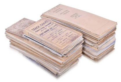
SoldThirty-One Track Program Charts Fort Wayne Division Toledo Branch Pennsylvania Railroad - 1960'sA group of thirty-one Pennsylvania Railroad track program charts for the Toledo Branch Fort Wayne Division, Lake Region, and Western Region. Dates include 1961, 1962, 1964, 1965, 1966, 1967, and 1968.See Sold Price
SoldEleven Track Program Charts Fort Wayne District Pennsylvania Railroad - 1960'sA group of eleven Pennsylvania Railroad track program charts for the Fort Wayne District Main Line and Grand Rapids BR. Dates include 1961 to 1967. Group varies in condition from good to fair and showSee Sold Price
Chart Showing the Track of the Flagships of The U.S.Map: Chart Showing the Track of the Flagships of The U.S. Japan Expedition Date: 1856 Cartographer: SELZ, EDWARD ? Publisher: NAVY DEPARTMENT Size (inches): 10.25X36.3 "to the Eastd. of the Cape of GoSee Sold Price
Sold"A Chart, Shewing the Tracks & Discoveries in the"A Chart, Shewing the Tracks & Discoveries in the Pacific Ocean, Made By Capt. Cook and Capt. Clerke, in His Majestys Ships Resolution and Discovery, in the Years 1777, 1778, 1779, 1780." [London, 178See Sold Price
Sold1849 Pacific chart with pencil tracks of shipsHeading: Author: Blunt, Edward and George W. Title: North Pacific Ocean Place Published: London, Connecticut Publisher: Date Published: 1849 Description: Engraved chart. BlSee Sold Price
SoldRare broadside on Transatlatic Telegraph 1858Heading: Author: Lloyd, H.H., & Co. Title: Telegraph Chart / Chart Showing the Track of the Great Submarine Atlantic Telegraph with the Principal Land & Submarine Telegraph Lines in Europe & America.See Sold Price
Sold(World View), Imray, James, An Outline Chart of th(World View), Imray, James, An Outline Chart of the World Intended for the Purpose of Marking off a Ship's Track, London, 1878, Chart No. 3, uncolored, 41 1/4 x 75 in., (wrinkled, minor tears to rightSee Sold Price
CHART "LONG ISLAND SOUND FROM NEW YORK TO MONTOCK POINT ..." New York, 1830 21" x 77" sight. FramedEldred's4.7(423)See Sold PriceFeb 27, 2024
CHART "SOUTHERN COAST OF LONG ISLAND FROM MONTAUK POINT TO EAST HAMPTON" Circa 1877 11.25" x 22.75"Eldred's4.7(423)See Sold PriceFeb 27, 2024
Vtg Grow Up Illustr Chart Functional Design Inc 1940The Benefit Shop Foundation Inc.4.3(3k)See Sold PriceFeb 28, 2024
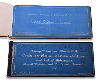
Chicago & Eastern Illinois Railroad 1901 Coal Mine Track and 1896 Brazil Division Track Chart BooksRail & Road Auctions4.6(165)See Sold PriceMar 08, 2024
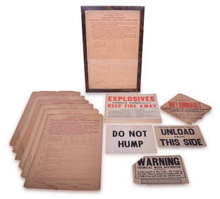
32 Railroad Loading Charts and Explosive Placards - Monon, Illinois Central, Northern Pacific, etc.Rail & Road Auctions4.6(165)See Sold PriceMar 08, 2024
Sex Pistols The Filthy Lucre Tour Original PosterShakespeare Auctions4.3(1)See Sold PriceFeb 25, 2024
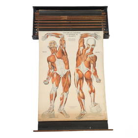
Nystrom 20C. Antique Illustrated Anatomical ChartsHill Auction Gallery 4.7(1k)See Sold PriceFeb 28, 2024
Anatomical Charts, AJ Nystrom 1918-1922State Line Auctions & Estate Services4.6(281)See Sold PriceFeb 25, 2024
1764 Bellin Chart of Three South Haitian Bays -- Carte des Bayes du Mesle des Flamands et deJasper524.5(9.9k)See Sold PriceFeb 27, 2024
Southern Africa Cape of Good Hope-Madagascar ADMIRALTY sea chart 1935 (1955) mapJasper524.5(9.9k)See Sold PriceFeb 28, 2024
Gulf of Guinea. Ghana Togo Benin Nigeria. ADMIRALTY sea chart 1928 (1954) mapJasper524.5(9.9k)See Sold PriceFeb 28, 2024
South Namibia coast. Walvis Bay-Orange River ADMIRALTY sea chart 1881 (1954) mapJasper524.5(9.9k)See Sold PriceFeb 28, 2024
CHARTS: United States - East Coast New Jersey/ PASSAIC AND HACKENSACK RIVERSChurchill Galleries3.7(217)See Sold PriceFeb 26, 2024