2 Illuminated Books of Hours LeavesSchmidt's Antiques Inc. Since 19114.8(431)See Sold PriceMar 02, 2024
Illuminated Manuscript Leaf of The CrucifixionSchmidt's Antiques Inc. Since 19114.8(431)See Sold PriceMar 02, 2024
RARE 1930s AUTOGRAPH BOOK FEATURING RUTH & GEHRIGJohn McInnis Auctioneers,LLC4.6(502)See Sold PriceFeb 25, 2024
Timetable, Paper and Ephemera Lot-Eastern USA RailroadsJM Hobby Supply and Railroad Artifact Auctions4.4(126)See Sold PriceFeb 24, 2024
SCARCE 1971 Kim Il Sung Signed Book "ON THE WORK OF THE WOMAN'S UNION"Rbfinearts4.4(571)See Sold PriceFeb 24, 2024
1885 CIVIL WAR 1ed Famous Memoirs US Grant Sheridan Sherman 6v RARE LOT MapsSchilb Antiquarian Rare Books4.8(421)See Sold PriceMar 10, 2024
"WINTER AND SUMMER IN MAINE" 1904 PHOTO ALBUMJohn McInnis Auctioneers,LLC4.6(502)See Sold PriceFeb 25, 2024
1821 THE (3) VOYAGES of CAPT JAMES COOK VOL. I-VIIJohn McInnis Auctioneers,LLC4.6(502)See Sold PriceFeb 24, 2024
[BASEBALL]. [SHEET MUSIC]. KALBFLEISCH, J. H. The Live Oak ...Potter & Potter Auctions4.6(539)See Sold PriceMar 07, 2024
Illuminated Manuscript Leaf of The VisitationSchmidt's Antiques Inc. Since 19114.8(431)See Sold PriceMar 02, 2024
Illuminated Manuscript Leaf of GethsemaneSchmidt's Antiques Inc. Since 19114.8(431)See Sold PriceMar 02, 2024
c1700s RARE Arabic Handwritten Manuscript Middle East Persia Journal ARABIASchilb Antiquarian Rare Books4.8(421)See Sold PriceMar 10, 2024
Sold
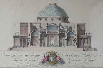
Pair Antique 16th Century Hand Colored MapsAntique pair of maps one of northern France, one of Kings Forrest dated 1558, on laid paper, originally from a manuscript, one description edited Descripta a Nicolas Delphinate , 1558, antique maps, aSee Sold Price
SoldCOLLECTION OF 51 16TH CENTURY HAND COLORED MAPSDEPICTING CITIES AND COUNTRIES OF THE WORLD SUCH AS ROMA, MEXICO, LEIDA, ANOCNA AND MESSANA , POSSIBLY FROM A 1575 ATLAS. ALL MAPS HAVE DESCRIPTIONS ON VERSO. THE MAPS APPEAR TO BE SEPARATE PAGES OF ASee Sold Price
SoldAntique John Blaeu Hand Colored Map of Wales 18.75"x23.Antique John Blaeu Hand Colored Map of Wales 18.75"x23.25" Sheet Size. Loose in matt. Undated but likely 16th/17th century.See Sold Price
SoldPair of Baroque Celestial Maps, Johann ZahnPair of 17th century hand colored, copper plate engraved Baroque Celestial maps by Johann or Johannes Zahn (1641-1707), "Facies Hemisphaerii Coelestis Inferior Austalis" and "Facies Hemisphaerii CoeleSee Sold Price
SoldAntique Map of Volga RiverCartographer, Adam Olearius. Hand colored engraving, 16th/17th century. In two parts. Sight size 19 3/4 x 23 inches. Framed. Notice to bidders: Condition reports and additional photographs are provideSee Sold Price
SoldAntique Map Lithographs New York City, World MapPair Antique Hand Colored Map Lithographs of New York City, and a World Map. Unframed 18 inches x 23 inchesSee Sold Price
SoldLate 16th c. hand colored map of IrelandGerhard Mercator (German-Flemish, 1512-1594), late 16th century hand-colored map of Ireland in two parts, titled 'Irlandiae Regnum Miliaria Irlandica Communia,' 17"h x 21"w sight of each sheet, overalSee Sold Price
Sold16C Map Belgium & English Coast "Belgii Veteris"16th Century hand colored marine map outlining the coastal region of Belgium including inland towns and the English Coast "Belgii Veteris". Detailed regional inscription en verso. Excellent condition.See Sold Price
SoldPr. Antique Hand Colored MapsPair of antique hand colored maps of Praga and Insbuck, inscribed "from the Countess Carnaratons Collection," 15 1/2" h x 20" w (view), 18" h x 22 1/2" w (frame). Provenance: From the personal lifetimSee Sold Price
SoldPair Holstein & Macedonia Hand Colored Etching MapPair of antique hand colored maps. Features a map of Holstein measuring 13" x 9". Housed in frame measuring 16 3/4" x 12 3/4". Also comes with a lithograph map of Macedonia with hand colored embellishSee Sold Price
SoldAntique 18th C Hand Colored Engraving Map AntillesAntique 18th Century Hand Colored Engraving Map of Antilles. Depicting the West Indies. Professionally framed and matted. Map measures 19 inches high x 23 inches wide. Frame measures 25.25 inches highSee Sold Price
SoldMaps, Blaeuw, Schenk, Flandriae(Lot of 6) Framed 16th-18th century hand-colored copper engraved maps including: ''Marcha Anconae,'' 1572; ''Germaniae Inferiors,'' 1704, by P. Schenk; ''Corsica,'' 16th century; ''Pictov/Pictonum VicSee Sold Price
SoldEarly Hand-Colored Map of VeniceItaly, ca. 16th-17th century. Fine hand-colored engraved map of "Venetia" with boats in harbor and compass rose. Handsomely framed. MEASUREMENTS Sight wide: 5 7/8 / 15 cm. Sight height: 4 1/2 / 11.5 cSee Sold Price
Sold[Georgia, Maps, a Pair]A pair of 19th century maps, including one hand-colored map of Georgia and Alabama, with inset plans of Atlanta and Savannah, measured from neatlines 21.25" x 13.5", from a Mitchell's Atlas, ca. 1876.See Sold Price
SoldMap Of The Iberian PeninsulaOriginal hand colored 16th century map of the Iberian Peninsula by Ortelius , Abraham decorated with strap work, cartouche, ships and sea-monsters. 1575 Latin Edition published in Antwerp by ChristophSee Sold Price
Blaeu: Antique Map of Italy & Islands, 1635Title: "Nova Italiae Delineatio", Beautiful mid-17th century hand-colored map of Italy and surrounding islands Map maker: Willem Janszoon Blaeu Place and Year: Amsterdam, c. 1635 Dimensions: 51.0 x 59See Sold Price
SoldAntique Hand Colored Maps of Fairfield County CTAntique Hand Colored Maps of Fairfield County CT. This lot includes three 19th century hand colored maps from the "Atlas of Fairfield County CT" by F.W. Beers. Includes one map of Bethel, one map of DSee Sold Price
SoldAntique Hand Colored Maps of Westchester County NYAntique Hand Colored Maps of Westchester County NY. This lot includes four 19th century hand colored maps from the "Atlas of New York and Vicinity" by F.W. Beers. Includes one map of Mamaroneck/Rye NeSee Sold Price
SoldAntique Hand Colored Maps of Westchester County NYAntique Hand Colored Maps of Westchester County NY. This lot includes four 19th century hand colored maps from the "Atlas of New York and Vicinity" by F.W. Beers. Includes one map of Bedford, one mapSee Sold Price
SoldLate 16th Century Maps, Incl. Siege of La Rochelle &Two maps on one sheet. Hand-colored map of Ghent (approx. 8.5 x 11 in.), tipped onto reverse side of page with map of the Siege of La Rochelle (approx. 8.25 x 11 in. plate size). Both maps printed witSee Sold Price
Sold18th century hand colored map, titled "A New andAccurate Map of the Colony of Massachusetts Bay in North America from a Late Survey". Published in London, 1780, by John Hinton. Sight size 10 3/8" x 12 7/8". In a modern burlwood frame with multi-laySee Sold Price
SoldAntique Hand Colored Maps of Westchester County NYAntique Hand Colored Maps of Westchester County NY. This lot includes three 19th century hand colored maps from the "Atlas of Westchester County, NY" by G.W. Bromley & Co. Includes one map of the VillSee Sold Price
SoldAntique Hand Colored Maps of Westchester County NYAntique Hand Colored Maps of Westchester County NY. This lot includes three 19th century hand colored maps from the "Atlas of Westchester County NY" by G.W. Bromley and Co. Includes one map of HastingSee Sold Price
SoldAntique Hand Colored Maps of Westchester County NYAntique Hand Colored Maps of Westchester County NY. This lot includes four 19th century hand colored maps from the "Atlas of Westchester County, NY" by G.W. Bromley & Co. Includes one map of PeekskillSee Sold Price
MAP OF SALZBURG BY GEORGE BRAUN & FRANS HOGENBURG. 1588Thomaston Place Auction Galleries4.4(386)See Sold PriceFeb 24, 2024
Charles Dupuis French 18th century, Pair Hand Colored Engravings, ArchitecturalGlobal Auctions Company4.3(36)See Sold PriceMar 03, 2024
17th Century Hand Colored Engraved Map of GermanyGlobal Auctions Company4.3(36)See Sold PriceMar 03, 2024
18th Century Hess Germany Hand colored Engraved MapGlobal Auctions Company4.3(36)See Sold PriceMar 03, 2024
Pair of Antique 19th C. Italian Warrior SculpturesNapoleon's Fine Art4.4(75)See Sold PriceFeb 25, 2024
ANTIQUE AMERICAN CIVIL WAR HAND COLORED LITHOGRAPHSAntique Arena Inc.4.5(852)See Sold PriceFeb 24, 2024
Willem Blaeu, Etc. 17th C. Antiquarian Maps, 2Auctions at Showplace4.5(726)See Sold PriceMar 17, 2024
Framed Hand Colored Antique Map of the Department of Nord, FranceDonny Malone Auctions4.5(1.7k)See Sold PriceMar 04, 2024
Mitchell - Map of the City of Washington (Washington, DC)Trillium Antique Prints & Rare Books4.5(30)See Sold PriceFeb 24, 2024
Donovan - Pair: Rufous Orang Outang (Orangutan): Wild Man of the Woods & Two Studes of the HeadTrillium Antique Prints & Rare Books4.5(30)See Sold PriceFeb 24, 2024
1564 CHRONICA CARIONIS antique 16th CENTURY HAND TOOLED PIGSKIN w/ CLAPS GermanJasper524.5(9.8k)See Sold PriceFeb 27, 2024
Antique COLORED GLASS YELLOW GOLD PIN PENDANT Brooch Clip 15th-16th CenturyJasper524.5(9.8k)See Sold PriceFeb 27, 2024
Pair of Hand Colored Heraldic EngravingsBroken Arch Auction Gallery NCFL#93994.6(294)See Sold PriceMar 04, 2024
Pair of Antiques 19th Century French Porcelain and Bronze VasesCoral Gables Auction4.4(503)See Sold PriceFeb 28, 2024
Rare 19thc Colton Map, Argentine Republic, Chile, Uruguay, PataguayConnoisseur Auctions4(333)See Sold PriceMar 16, 2024
Pair of Antique Japanese Ando Hiroshige (1797-1858) Hand Colored Signed Woodblock PrintsHess Fine Auctions4.5(197)See Sold PriceMar 02, 2024
Galliae Regionis Nova Descriptio Hand Colored Map of France on Laid Paper, Ca. 16th Century, H 10" WDuMouchelles4.6(825)See Sold PriceMar 15, 2024