ATLAS of ANTIENT GEOGRAPHY by SAMUEL BUTLER 1843John McInnis Auctioneers,LLC4.6(502)See Sold PriceFeb 24, 2024
18TH C. ANTIQUE MAP: FRENCH & INDIAN WAR, FRAMEDThomaston Place Auction Galleries4.4(386)See Sold PriceFeb 24, 2024
Rand McNally Railroad Map Cabinet w/ 21 Railroad MapsRail & Road Auctions4.6(165)See Sold PriceMar 08, 2024
Keith Haring - Ink on New York Map, Best Buddies, Inscribed, Signed, and DatedSapphire Auction Gallery4(67)See Sold PriceMar 02, 2024
LATE 17TH C. FRENCH MAP OF THE NEW WORLD BY ALEXIS-HUBERT JAILLOT (1632-1712)Thomaston Place Auction Galleries4.4(386)See Sold PriceFeb 24, 2024
Central Railroad of New Jersey Map of Sandy Hook Route-ca. 1903JM Hobby Supply and Railroad Artifact Auctions4.4(126)See Sold PriceFeb 24, 2024
Lot of Six Mixed Atlas Box Cars-HO Scale-New in BoxJM Hobby Supply and Railroad Artifact Auctions4.4(126)See Sold PriceFeb 25, 2024
Rand McNally/Santa Fe Railroad Map of Iowa-1912JM Hobby Supply and Railroad Artifact Auctions4.4(126)See Sold PriceFeb 24, 2024
NICOLAES VISSCHER (NETHERLANDS, 1618-1709) MAP OF THE NEW WORLDThomaston Place Auction Galleries4.4(386)See Sold PriceFeb 24, 2024
17TH C. WORLD MAP BY NICOLAES VISSCHER (NETHERLANDS, 1618-1709)Thomaston Place Auction Galleries4.4(386)See Sold PriceFeb 24, 2024
Lot of Six Mixed Atlas Cabooses-HO Scale-New in BoxJM Hobby Supply and Railroad Artifact Auctions4.4(126)See Sold PriceFeb 25, 2024
Early 1900s Map of French Colonies -- Ligue Maritime etTitle/Content of Map: Early 1900s Map of French Colonies -- Ligue Maritime et Coloniale Francaise Date: early 1900s Cartographer: Reconnue d'Utilite Publique Size: 29.5 X 44.5 in. This is a fantasticSee Sold Price
Early 1900s Map of French Colonies -- Ligue Maritime etTitle/Content of Map: Early 1900s Map of French Colonies -- Ligue Maritime et Coloniale Francaise Date: early 1900s Cartographer: Reconnue d'Utilite Publique Size: 29.5 X 44.5 in. This is a fantasticSee Sold Price
SoldEarly 1900s World Map of French Colonies -- LigueTitle: Early 1900s World Map of French Colonies -- Ligue Maritime et Coloniale Francaise Date: early 1900s Cartographer: Reconnue d'Utilite Publique Size: 29.5 X 44.5 in. Additional Information: ThisSee Sold Price
Early 1900s World Map of French Colonies -- LigueTitle: Early 1900s World Map of French Colonies -- Ligue Maritime et Coloniale Francaise Date: early 1900s Cartographer: Reconnue d'Utilite Publique Size: 29.5 X 44.5 in. Additional Information: ThisSee Sold Price
Early 1900s World Map of French Colonies -- LigueReserve Reduced! Title/Content of Map: Early 1900s World Map of French Colonies -- Ligue Maritime et Coloniale Francaise Date: early 1900s Cartographer: Reconnue d'Utilite Publique Size: 29.5 X 44.5 iSee Sold Price
Early 1900s World Map of French Colonies -- LigueTitle/Content of Map: Early 1900s World Map of French Colonies -- Ligue Maritime et Coloniale Francaise Date: early 1900s Cartographer: Reconnue d'Utilite Publique Size: 29.5 X 44.5 in. This is a fantSee Sold Price
SoldSeven French Bronze Commemorative MedalsA Group of Seven French Bronze Commemorative Medals, including two WWI medals, two aviation, one Washington/Lafayette from 1931, one Ligue Maritime et Coloniale Francaise, and one plaquette from CariaSee Sold Price
Early 1900s French or Swiss Mountains Photo 2nd of 21900s tourist photo entitled Le Fayet et Le Mont Blanc with Dome de Mirage, Aig de Bionnassay and Le Mont Blanc indicated in photo. Verso bears the label of J.C. Walcott Picture Framing Topeka Kansas.See Sold Price
Early 1900s French or Swiss Mountains Photo 1st of 2Early 1900s French or Swiss tourist photo entitled Le Fayet et La Valle De Sallanches with Pointe d Areu, Pointe Percee, Mont Fleuri and Pointe de Charvay indicated in photo. Verso bears the originalSee Sold Price
EARLY MAPS OF FRENCH GUIANA (3)Fine lot of three eighteenth-century maps depicting the colony of French Guiana. The first, 9 3/4' x 14 3/4', was created by cartographer M. Bonne circa 1780, and shows the small colony shortly afterSee Sold Price
VERY RARE EARLY FRENCH MAP OF CHINA - "Carte d'uneVERY RARE EARLY FRENCH MAP OF CHINA - "Carte d'une Partie de la Chine sur laquelle est tracee la Route qu'a suivie l'Auteur deouis Quanton jusqu' a Peking et depuis Peking jusqu' a Quanton dans les AnSee Sold Price
SoldAn Early French Map,titled "Gouvernment General de L'Isle de France........", by Chez F. de Witt and Chez I(J). Covens et C. Mortier, on early paper and with hand coloring. Unframed, 20 3/4" high, 25" wide. Repairs, staiSee Sold Price
VERY RARE EARLY FRENCH MAP OF CHINACarte d'une Partie de la Chine sur laquelle est tracee la Route qu'a suivie l'Auteur deouis Quanton jusqu' a Peking et depuis Peking jusqu' a Quanton dans les Annees 1794 et 1795", from Voyages a PekiSee Sold Price
SoldMonin, V. 1833 Lot of 5 French Colony Maps. Reunion etcPlus Guadeloupe, Guyana, Alger, and Senegambie ou Senegal. Steel Engraved Maps Published 1833, Paris for "Petit Atlas National des départements de la France et de ses colonies" by V. Monin. Paper SizSee Sold Price
(2) EARLY FRENCH MAPS OF SOUTH AMERICA"Carte Generale de Colombie, de la Guyane Francaise, Hollandaise et Anglaise", 1826, by Adrien Hubert Brue, (1786-1832). From 1830 "Atlas de choix ou Recueil de cartes de geographie ancienne et modernSee Sold Price
(2) EARLY FRENCH MAPS OF SOUTH AMERICA"Carte Generale de Colombie, de la Guyane Francaise, Hollandaise et Anglaise", 1826, by Adrien Hubert Brue, (1786-1832). From 1830 "Atlas de choix ou Recueil de cartes de geographie ancienne et modernSee Sold Price
Sold(2) EARLY FRENCH MAPS OF SOUTH AMERICA"Carte Generale de Colombie, de la Guyane Francaise, Hollandaise et Anglaise", 1826, by Adrien Hubert Brue, (1786-1832). From 1830 "Atlas de choix ou Recueil de cartes de geographie ancienne et modernSee Sold Price
(2) EARLY FRENCH MAPS OF SOUTH AMERICA"Carte Generale de Colombie, de la Guyane Francaise, Hollandaise et Anglaise", 1826, by Adrien Hubert Brue, (1786-1832). From 1830 "Atlas de choix ou Recueil de cartes de geographie ancienne et modernSee Sold Price
SoldVaugondy: Antique Map of Hispaniola & Martinique, 1750Saint Domingue ou Hispaniola et...Martinique'. Santo Domingo. The map shows the French colonies in the West Indies of Hispaniola (which at the time was part French and part Spanish) - today comprisingSee Sold Price
Vaugondy: Map of Saint Domingue ou Hispaniola, 1750Map: Saint Domingue ou Hispaniola et...Martinique'. Santo Domingo. VAUGONDY 1750 map. The map shows the French colonies in the West Indies of Hispaniola (which at the time was part French and part SpaSee Sold Price
Algeria. Africa. 1871.Physical and political map of The French colonies in Algeria. Europe/Africa. 1871.Print from steel engraving titled „Carte physique et politique de L‘ Algerie colonies Francaises“.Author/compileSee Sold Price
Monin, V 1833 Maps (3) Alger, Guyane, Sengal. Africa3 French Colony Maps. One of French Guiana, the others North and West Africa. Steel Engraved Maps Published 1833, Paris for "Petit Atlas National des départements de la France et de ses colonies" bySee Sold Price
Monin, V 1833 Maps (3) Alger, Guyane, Sengal. Africa3 French Colony Maps. One of French Guiana, the others North and West Africa. Steel Engraved Maps Published 1833, Paris for "Petit Atlas National des départements de la France et de ses colonies" bySee Sold Price
SoldVuillemin, A 1848 Group of 4 Decorative French MapsCharente Inferieure, Cher, Cantal, Charente. Steel Engraved Maps Published 1848, Paris for "La France et ses colonies" by Alexandre Vuillemin & Migeon. Paper Size: 13 x 10 inch (33 x 25cm) Good ConditSee Sold Price
M. de BOILEAU Satires & Works First 1st 1737 Edition Amsterdam Printing FrenchLuis Porretta Fine Arts4.3(10)See Sold PriceMar 02, 2024
Italo-Corinthian Terracotta Aryballos with SoldiersTimeLine Auctions Ltd.4.5(183)See Sold PriceMar 06, 2024
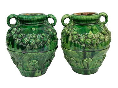
Pair of Early 1900's French Provincial Green Glazed Terracotta VesselsDana J. Tharp Auctions4.7(268)See Sold PriceFeb 24, 2024
Willem Blaeu, Etc. 17th C. Antiquarian Maps, 2Auctions at Showplace4.5(726)See Sold PriceMar 17, 2024
Vaillant - Hawaii: Stranding in the Sandwich Islands (Echouage aux Iles Sandwich). 43Trillium Antique Prints & Rare Books4.5(30)See Sold PriceFeb 24, 2024
Vaillant - Kealakekua Bay, Hawaii (Village de Kearakekoua, Iles Sandwich). 44Trillium Antique Prints & Rare Books4.5(30)See Sold PriceFeb 24, 2024
Vaillant - Honolulu, Hawaii (Vue de Honolulu, Iles Sandwich). 45Trillium Antique Prints & Rare Books4.5(30)See Sold PriceFeb 24, 2024
Vaillant - Hawaiian Dance (Scene de Danse aux Iles Sandwich). 42Trillium Antique Prints & Rare Books4.5(30)See Sold PriceFeb 24, 2024
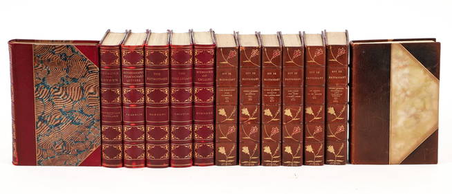
Mixed set of 13 leather bound antique books MaupassantConcept Art Gallery4.7(508)See Sold PriceMar 06, 2024
CHRISTOFLE & BB - ANTIQUE LOUIS XVI FRENCH 950 STERLING SILVER TEA SET - EARLY 1900s !!Jasper524.5(9.8k)See Sold PriceFeb 27, 2024
Sous La Terreur Journal D'une Amie De Philippe-EgaliteRapid Estate Liquidators and Auction Gallery4.5(1.1k)See Sold PriceFeb 24, 2024
Memoires Secrets Sur La Regence Souvenirs De DuclosRapid Estate Liquidators and Auction Gallery4.5(1.1k)See Sold PriceFeb 24, 2024
Lettres Ecrites De France Et D'Italie HardcoverRapid Estate Liquidators and Auction Gallery4.5(1.1k)See Sold PriceFeb 25, 2024
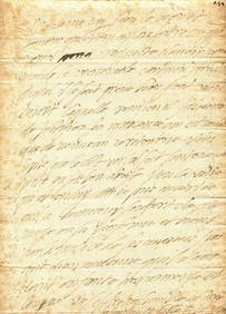
ELISABETH OF VALOIS: (1545-1568)International Autograph Auctions Europe S.L.4.5(52)See Sold PriceMar 14, 2024
La France Heroique Et Ses Allies 1916-1919 HCRapid Estate Liquidators and Auction Gallery4.5(1.1k)See Sold PriceFeb 29, 2024
La France Heroique Et Ses Allies 1914-1916 HCRapid Estate Liquidators and Auction Gallery4.5(1.1k)See Sold PriceFeb 29, 2024
Le General Ambert - Sa Vie Et Ces OeuvresRapid Estate Liquidators and Auction Gallery4.5(1.1k)See Sold PriceFeb 29, 2024