ATLAS of ANTIENT GEOGRAPHY by SAMUEL BUTLER 1843John McInnis Auctioneers,LLC4.6(502)See Sold PriceFeb 24, 2024
18TH C. ANTIQUE MAP: FRENCH & INDIAN WAR, FRAMEDThomaston Place Auction Galleries4.4(386)See Sold PriceFeb 24, 2024
Rand McNally Railroad Map Cabinet w/ 21 Railroad MapsRail & Road Auctions4.6(165)See Sold PriceMar 08, 2024
Keith Haring - Ink on New York Map, Best Buddies, Inscribed, Signed, and DatedSapphire Auction Gallery4(67)See Sold PriceMar 02, 2024
LATE 17TH C. FRENCH MAP OF THE NEW WORLD BY ALEXIS-HUBERT JAILLOT (1632-1712)Thomaston Place Auction Galleries4.4(386)See Sold PriceFeb 24, 2024
Central Railroad of New Jersey Map of Sandy Hook Route-ca. 1903JM Hobby Supply and Railroad Artifact Auctions4.4(126)See Sold PriceFeb 24, 2024
Lot of Six Mixed Atlas Box Cars-HO Scale-New in BoxJM Hobby Supply and Railroad Artifact Auctions4.4(126)See Sold PriceFeb 25, 2024
Rand McNally/Santa Fe Railroad Map of Iowa-1912JM Hobby Supply and Railroad Artifact Auctions4.4(126)See Sold PriceFeb 24, 2024
NICOLAES VISSCHER (NETHERLANDS, 1618-1709) MAP OF THE NEW WORLDThomaston Place Auction Galleries4.4(386)See Sold PriceFeb 24, 2024
17TH C. WORLD MAP BY NICOLAES VISSCHER (NETHERLANDS, 1618-1709)Thomaston Place Auction Galleries4.4(386)See Sold PriceFeb 24, 2024
Lot of Six Mixed Atlas Cabooses-HO Scale-New in BoxJM Hobby Supply and Railroad Artifact Auctions4.4(126)See Sold PriceFeb 25, 2024
SoldVintage A.J. Nystrom & Co. Unrivaled Map of IllinoisIncludes Wall Mount Bracket, 40 x 55 inches, Some Staining at Base. Complied by the Clason Map. Co. Denver and Published by A.J. Nystrom ; Co ChicagoSee Sold Price
SoldVintage (1949) A.J. Nystrom and Co. Pull Down Map of55 x 66 inches. Canvas. Wallace W Atwood, some damage. Third party shipping or pick up at our Gallery in Ottawa is recommendedSee Sold Price
SoldVintage (1950) A.J. Nystrom and Co. World Pull Down Map67 x 58 1/2 inches. Canvas. Made in the USA. Flawed roller. Third party shipping or pick up at our Gallery in Ottawa is recommendedSee Sold Price
SoldVINTAGE PULL DOWN MAP OF PENNSYLVANIAVINTAGE PULL DOWN MAP OF PENNSYLVANIA - No PS137; Published by AJ Nystrom & Co, Chicago; all county lines drawn; cities labeled; terrain mapped in high color; great teaching tool ; Condition - Map pulSee Sold Price
Unrivaled Series South America - BlackboardTitle: Unrivaled Series South America - Blackboard Publication Date: c1950 Publisher: A.J. Nystrom & Co. Size: 50Height - 44Width Reserve: $190.00 Shipping: Domestic: Flat-rate of $30.00 to anywhere wSee Sold Price
SoldVintage (1950) A.J. Nystrom Pull Down Map of Europe54 1/2 x 66 1/2 inches. Canvas. Atwood Regional Political Series, published by A.J. Nystrom and Co. Chicago. Third party shipping or pick up at our Gallery in Ottawa is recommendedSee Sold Price
SoldA.J. Nystrom & Co. Geographic School MapsA.J. Nystrom & Co. Geographic School Maps Cloth rolled maps Category: Books & Ephemera > Maps Shipping Status: 3rd Party Shipping; the shipping cost may be high; please contact The UPS Store #3571 (31See Sold Price
Simplified Landform Regional World. Boggs Equal AreaTitle: Simplified Landform Regional World. Boggs Equal Area Projection Publication Date: 1954 Cartographer:BOGGS Publisher: A.J. Nystrom & Co. Brief Description: Map No. LP 97. Some water damage and bSee Sold Price
World Occupations and Ocean Trade Routes | WorldTitle: World Occupations and Ocean Trade Routes | World Vegetation Publication Date: 1920 Cartographer:VAN DER GRINTEN | ROLLAND AND CARQUEVILLE CO. Publisher: A.J. Nystrom & Co. Brief Description: MaSee Sold Price
SoldVintage (1949) A.J. Nystrom Pull Down Map of Australia54 x 79 inches. Canvas. Map No. ar80, Wallace W Atwood. Third party shipping or pick up at our gallery in Ottawa is recommendedSee Sold Price
Simplified Landform Regional World. Boggs Equal AreaTitle/Content of Map: Simplified Landform Regional World. Boggs Equal Area Projection Cartographer: BOGGS Date: 1954 Publisher: A.J. Nystrom & Co. Size: 42Height - 62.5Width Map No. LP 97. Some waterSee Sold Price
Europe. American Geographers SeriesPublication Date: c1933 Title: Europe. American Geographers Series Cartographer: PARKINS, A. F./W. M. GREGORY/MARK JEFFERSON, et al. Publisher: A.J. Nystrom & Co. Height: 50 Width: 60 School room mapSee Sold Price
Pictorial Relief With Merging Colors AfricaTitle/Content of Map: Pictorial Relief With Merging Colors Africa Cartographer: BARTON, THOMAS F./CLYDE F. KOHN Date: 1961 Publisher: A.J. Nystrom & Co. Size: 64Height - 42.3Width Schoolroom map on spSee Sold Price
Mexico, Central America and West Indies PhysicalTitle: Mexico, Central America and West Indies Physical Political Publication Date: c1960 Publisher: A.J. Nystrom & Co. Height: 44 Width: 64 Large wall map on rods emphasizing Height of land and depthSee Sold Price
Nystrom Readiness United StatesPublication Date: c1960 Title: Nystrom Readiness United States Cartographer: NYSTROM, A. J. Publisher: A.J. Nystrom & Co. Height: 60 Width: 63.5 Official map on spring roller. Markable surface. InsetsSee Sold Price
Mexico, Central America and West Indies PhysicalTitle: Mexico, Central America and West Indies Physical Political Publisher: A.J. Nystrom & Co. Height: 44 Width: 64 Large wall map on rods emphasizing Height of land and depths of oceans from southerSee Sold Price
SoldLot of 2 Vintage Roll-Down Educational Posters.A Diagram of Types of Stems and Roots, and an Anatomical Chart of the Human Head, Mouth and Throat. Both are by A.J. Nystrom & Co. - The Anatomical one is Copyrighted 1918, and Signed Max Brodel, 1919See Sold Price
SoldVintage "Botany Sheets for Beginners" Wall Chart.An Educational Chart - Sheet 5, of Flowers, and Sheet 6, of Fruits. By Alexander Johnston, F.G.S. - Produced by W. & A.K. Johnston, and Distributed by A.J. Nystrom & Co., Chicago. Chart Measures 56 1/See Sold Price
Sold12 Part School MapPublished by A.J. Nystrom & Co., Chicago. 58" wide x 76" high. Some tears and losses. Maps detached from canvas.See Sold Price
SoldAN A.J. NYSTROM & CO. GRAPHIC PROJECT GLOBEFloor standing model with stair-step round base, steel globe with enamel painted map, designed for aviation or military use. Shows continents, oceans and with a writeable surface. 20 inch diameter gloSee Sold Price
Sold1920's Schoolroom Map1920’s A.J. Nystrom Co. Sanford Gordy American History Series with European Backgrounds and Beginnings retractable wall hanging schoolroom map consisting of map S-G 15“Expansion of the American NaSee Sold Price
SoldLarge U.S. Wall Map dated 194143" width x 62" length A.J. Nystrom & Co. Made in 1941, just prior to U.S. entry into World War 2.See Sold Price
Webster-Knowlton-Hazen European History Maps. the AgeTitle: Webster-Knowlton-Hazen European History Maps. the Age of Discovery. Publication Date: c1925 Cartographer: WEBSTER, HUTTON/DANIEL C. KNOWLTON/CHARLES DOWNER HAZEN Publisher: A.J. Nystrom & Co. BSee Sold Price
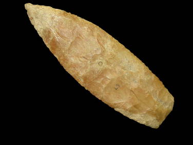
SoldAsia [With Europe]Title: Asia [With Europe] Publication Date: c1960 Cartographer: A.J. Nystrom & Co. Publisher:A.J. Nystrom & Co. Size: 050.0"Height - Width Markable surface schoolroom map showing land masses but nothiSee Sold Price
Stunning Creek Stained Red Ochre Blade. 6.3/4" Long. Found in Macoupin Co Illinois. Very thin forHeartland Artifact Auctions Inc4.7(780)See Sold PriceFeb 25, 2024
Hunter's Prize Vintage Cigar Label Stone Lithograph Art Copyright 1899 Inner and Outer Label. TheNorth American Artifact Auctions4.6(182)See Sold PriceApr 20, 2024
Dandy Shape Vintage Salesman Sample Cigar Label Stone Lithograph Art Dated from the late 1800's toNorth American Artifact Auctions4.6(182)See Sold PriceApr 20, 2024
Rand McNally & Co's New Ideal State and County Survey and Atlas 1911North American Artifact Auctions4.6(182)See Sold PriceApr 20, 2024
War Diary of 354th Infantry - 89th Division 1919North American Artifact Auctions4.6(182)See Sold PriceApr 20, 2024
1849 THE NEW-ENGLAND MERCANTILE UNIONNorth American Artifact Auctions4.6(182)See Sold PriceApr 20, 2024
HAMMOND'S READY REFERENCE HISTORICAL ATLAS 1920North American Artifact Auctions4.6(182)See Sold PriceApr 20, 2024
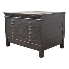
Antique Arts & Crafts Ebonized Oak Architect's Blueprint Flat File Cabinet, Circa 1900Liberty & 33rd Furniture Co.See Sold PriceFeb 27, 2024
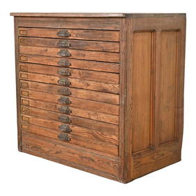
Antique Pine 12-Drawer Blueprint Flat File Cabinet by Hamilton, Circa 1900Liberty & 33rd Furniture Co.See Sold PriceFeb 27, 2024
Antique Arts & Crafts Oak Architect's Blueprint Flat File Cabinet, Circa 1900Liberty & 33rd Furniture Co.See Sold PriceFeb 27, 2024
1905 20th Century Atlas of Boone County IllinoisMatthew Bullock Auctioneers4.7(1.8k)See Sold PriceFeb 24, 2024
Group of 15+ Vintage Elgin Eagle Brew. Co. Porcelain Beer StopsMatthew Bullock Auctioneers4.7(1.8k)See Sold PriceFeb 24, 2024
Vintage Holy Bible Old & New Testaments Illustrated 1904The Benefit Shop Foundation Inc.4.3(2.9k)See Sold PriceMar 13, 2024
Mexico, Central America and West Indies Physical PoliticalJasper524.5(9.8k)See Sold PriceFeb 27, 2024
Francis McNally - Antique Map of Illinois, Missouri & IowaProverde Auctions4.3(3)See Sold PriceFeb 28, 2024
Monmouth, Illinois Vintage Topography MapRapid Estate Liquidators and Auction Gallery4.5(1.1k)See Sold PriceFeb 28, 2024
Vintage 1942 Syroco* Hillbilly Band - MusiciansRapid Estate Liquidators and Auction Gallery4.5(1.1k)See Sold PriceFeb 28, 2024


![Asia [With Europe] (1 of 6)](https://p1.liveauctioneers.com/5584/161711/81649448_1_x.jpg?height=282&quality=70&version=1582126150)