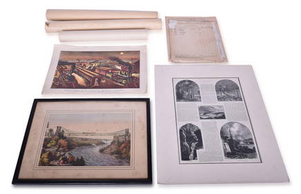
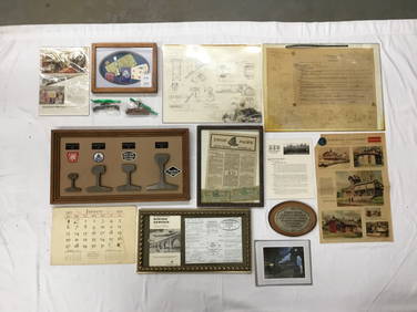
SoldEurope. a mixed group of maps and plansEurope. a mixed group of national and regional maps and plans,including A New Map of Muscovy, from the English edition Olearius's The Voyages & Travels of the Ambassador Sent by Frederick DukeSee Sold Price
Sold-. large mixed group of maps, plans, and topograp-. large mixed group of maps, plans, and topographical views (A)including maps of Europe, Asia Minor, and with plans of Venice and Rome, an elevation of the facade of the Orangery at VersaillSee Sold Price
SoldEurope.- A mixed group of mapsEurope.- A mixed group of maps,including regional and national maps, with the 'Plans of the provinical towns of Ireland for Mr Tindal's Continuation of Mr Rapin's History', a map of BirminghamSee Sold Price
SoldEurope.- - A small mixed group of views,including a bird's-eye plan/view of Cagliari, Calaris die hauptstatt in Sardinia, c.1550, by Sebastian Munster, Sicilia der Insel, probably for Polybius' Der Romischen Historien, c.1570, woodcuts, 180See Sold Price
SoldGreek Islands.- a mixed group of maps and plansGreek Islands.- a mixed group of maps and plans,including Tobias Conrad Lotter's Graeciae Antiquae Designatio Nova ..., and with maps by or after Kauffer, Tardieu, d'Anville, and others, engraSee Sold Price
SoldMediterranean.- A mixed group of maps and plansMediterranean.- A mixed group of maps and plans,including 43 maps by Joseph Roux, from 'Plans et Rades de la Méditerraneé', and others by or after Tardieu, Bernard, Gouffier, and others, engraSee Sold Price
Solda mixed group of maps and plansa mixed group of maps and plans,including maps by or after Blome, Bowen, Arrowsmith, and others, mainly of the Middle East, particularly of the Levant, with a small section of plates relatingSee Sold Price
SoldLow Countries.- A mixed group of maps and plans ofLow Countries.- A mixed group of maps and plans of Holland and Belgium,by or after Tardieu, Harrewyn, Kitchin, Archer and others, including SDUK and Tallis plans of Brussels, engraved and lithSee Sold Price
Europe. a mixed group of mapsEurope.- a mixed group of maps mostly national and regional maps of Germany, Austria, Denmark, the Low Countries, Croatia and elsewhere, by or after Mercator, Tirion, Vaugondy, Bowen, Cary, anSee Sold Price
SoldA mixed group of maps and plans of London and envA mixed group of maps and plans of London and environs,City Wards, plans for reconstructing the City after the Great Fire, maps of 20 miles around London, some incomplete sections of larger sSee Sold Price
SoldLondon.- Mixed group London plansMixed group of maps and plans of London,including a small group of city ward plans from Stow's Survey,1755, several by Stockdale, including Stepney, Limehouse, Peckham, Hampstead, Greewich anSee Sold Price
SoldEurope.- a small mixed group of mapsEurope.- a small mixed group of maps,including 5 maps of Spain and Portugal, and maps of Greece, Sicily, and Corsica, by or after Vandermaelen, Tardieu, Alt, and others, engravings, some hand-See Sold Price
SoldA mixed group of regional maps and plans of England andincluding a locally published cloth Map of the Country Eight Miles Round Malvern, by H. Lamb & Son; a locally published cloth 'weather-proof' edition of Bacon's map of the Isle of Wight, by W. CouldreSee Sold Price
SoldA small, mixed group of maps and town plans of EnBritish Isles.- A small, mixed group of maps and town plans of England and Scotland, including several of Kent and the Isle of Thannet, the Isle of White, road maps and town plans, including TSee Sold Price
SoldA small, mixed group of national maps and town plBritish Isles.- A small, mixed group of national maps and town plans, including plans of New York, Brussels, Liverpool, Odessa and others, mostly European, engraved and lithographic maps, someSee Sold Price
SoldEurope.- Mixed group of 17th and 18th century mapsEurope.- Mixed group of 17th and 18th century maps,regions in France and Italy and the counties of Hereford, Hampshire and Berkshire, engraved maps, two with hand-colouring, v.s., average 180See Sold Price
SoldHouse Of Commons. mixed plans of LondonHouse Of Commons. Publisher A mixed group of plans and maps of London, including several of Downing Street and the Foreign Office, several of the Embankment and sewer networks, several plans oSee Sold Price
SoldEurope.- A mixed group of national and regional maEurope.- A mixed group of national and regional maps and plansIncluding Amsterdam, Ghent, the Danube, Austria and elsewhere, engraved maps, some with hand-colouring, v.s., various conditions,See Sold Price
SoldA Small, Mixed Group Of Maps Of EuropeA Small, Mixed Group Of Maps Of Europe, including France (16), Russia (12), Spain (8), Sweden and Norway (8), and others, with several small world hemispheres (7), mostly lithographs, a few eSee Sold Price
Solda mixed group of maps of Europe and Asia,a mixed group of maps of Europe and Asia, national and regional, including China and Japan, France, Spain and Italy, and a few English counties, and Scotland, by Hall, Wyld, Weller, Teesdale,See Sold Price
SoldCambridgeshire.- a mixed group of county mapsCambridgeshire.- a mixed group of small county maps,some with inset plans or vignette views and other ornamentation, by, for or after Blome, Cary, Moll, Morden, Moule, Ramble, Rocque, Seller,See Sold Price
SoldA small, mixed group of mapsBritish Isles.- A small, mixed group of maps, of Europe, the Middle East, India, Russia, Brazil and the world, engravings, from 180 x 110 to 200 x 510mm., various conditions, mostly 19th centuSee Sold Price
SoldA mixed group of maps of North AmericaA mixed group of maps of North America,including a plan of New York, and parts of Canada, by Sidney Hall, Johnston, Day & Son, and others, engravings, lithographs, some printed in colour, v.sSee Sold Price
SoldCambridgeshire.- a mixed group of county maps-. a mixed group of small county maps,including a detailed plan of Bury St Edmunds, by Henshall after Dawson, and the Fens of the Bedford Levels, by R. Walker, some of the county maps with insSee Sold Price
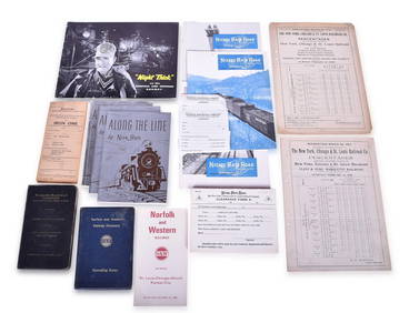
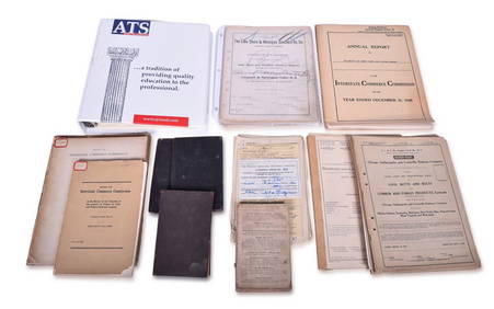
Mixed Group of Railroad Paper - 1895 Telegraph Registers, Art Prints, Profile Blueprint, Way-Bills,Rail & Road Auctions4.6(165)See Sold PriceMar 07, 2024
Mixed Group of Railroad Paper - Nickel Plate Road, Norfolk & Western, and WabashRail & Road Auctions4.6(165)See Sold PriceMar 07, 2024
Assortment of Railroad Paper - Rule Books, Stationary, Ink Blotter, Map, Timetables, and MoreRail & Road Auctions4.6(165)See Sold PriceMar 07, 2024
Group of Lake Shore & Michigan Southern Railroad PaperRail & Road Auctions4.6(165)See Sold PriceMar 07, 2024
Mixed Group of Railroad Paper, Cross Sections, and Ephemera - Pennsylvania, Reading, Union Pacific,Rail & Road Auctions4.6(165)See Sold PriceMar 07, 2024
Mixed Group of Eastern Railroad Uniform Cap Badges, Patches, and Pins - Amtrak, Jersey CentralRail & Road Auctions4.6(165)See Sold PriceMar 07, 2024
Group of Ten Railroad Photographs, Maps, and Prints - New Jersey, Long Island, and New YorkRail & Road Auctions4.6(165)See Sold PriceMar 07, 2024
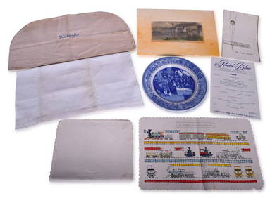
Mixed Group of Railroad Items - Baltimore & Ohio Railroad Menus, Sesquicentennial Plate, WabashRail & Road Auctions4.6(165)See Sold PriceMar 08, 2024
Two (2) Antique 18th C. Copper Engraved Framed Maps - America & EuropeMagnusson Art Group4.5(46)See Sold PriceMar 14, 2024
Mixed Group Sterling and Silver PlateBroken Arch Auction Gallery NCFL#93994.6(294)See Sold PriceMar 04, 2024
Mixed group of Lionel postwar O accessoriesToystrainsandotheroldstuff LLC4.8(439)See Sold PriceMar 02, 2024
Mixed Group of Ten American Federal Carved Mahogany Dining Chair, early 19th c., Largest Armchair-Crescent City Auction Gallery4.3(229)See Sold PriceMar 09, 2024
Mixed Group of Small Steiff - Mouse, Hedgehog, Pig and MoreAmanda Auction Gallery, LLC4.4(13)See Sold PriceMar 03, 2024