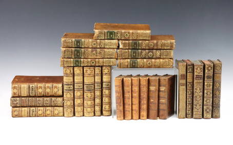
Sold(Maps) Group of Six 17th, 18th and 19th Century Map(Maps) Group of Six 17th, 18th and 19th Century Maps of the Holy Land, comprising: Palaestina by Mons. D'Anville, London, 1794; Judaea Seu Palaestinia by Johann Baptista Homann, c. 1707; Facies PalaesSee Sold Price
SoldGroup Six Framed Maps, 18th/19th CenturyGroup of six framed maps, 18th/19th C., including Chesapeake Bay, Louisiana, West India Isles and others. Framed, not examined out of frames. Sight size: largest 18 1/4" high, 20" wide; smallest: 9" hSee Sold Price
SoldGrp: 10 Maps of New York City 18th-Early 20th c.Group of 18th to early 20th century maps of New York City. Multiple are 19th-20th c. reprints of 17th-18th c. maps. Includes a small census map of New York City from 1850 with populations of New YorkSee Sold Price
Sold24 misc. Maps on Europe/World. 18th-19th century.[Various] 24 maps. Miscellaneous group of 24 18th-19th century maps depicting Europe and the World. Measurements range from approximately 10” x 7 3/4” to 21 1/4” x 15 5/8”. A fSee Sold Price
SoldGrp: 13 Maps of Italy and from Munster's CosmograGroup of 17th-19th century maps. This lot includes four pages from Sebastian Munster's "Cosmographia" including a map of Elba, a map of Italian mainland cities, a map of Sicily, and a map of Africa. TSee Sold Price
SoldEurope.- Mixed group of 17th and 18th century mapsEurope.- Mixed group of 17th and 18th century maps,regions in France and Italy and the counties of Hereford, Hampshire and Berkshire, engraved maps, two with hand-colouring, v.s., average 180See Sold Price
SoldGrp: 6 Maps of Italy 18th-19th c.Group of 18th and 19th century maps of Italy. This group includes one map of Italy, Sardinia, Corsica, and Sicily by Carolo Allard; one map of Sicily by Jan Jansson (1588-1664) with an insert detailinSee Sold Price
SoldGroup of seven maps, 18th & 19th century to includeGroup of seven maps, 18th & 19th century to include framed small engraved map "The States of Maryland and Delaware from the latest survey 1790", "A Map of Connecticut 1799", Georgia Western TerritorySee Sold Price
SoldGrp: Assorted Maps of EuropeLarge group of assorted 18th and 19th century maps of Europe. Includes two overall maps of Europe, one map of England and Wales, one map of Scotland, one map of France, one map of Greece, two maps ofSee Sold Price
Sold6 mid-19th C. Maps incl. TN & KY MapGroup of six (6) mid-19th century maps. 1st item: MAP OF TENNESSEE AND KENTUCKY by G.W. Boynton & Co., showing railroads and canals. 9 3/4" x 12 5/8". 2nd item: MIDDLE STATES map engraved by J. T. HamSee Sold Price
SoldGrp: 5 Maps of Sicily Italy 18th/19th c. JaillotGroup of five 18th and 19th century maps of Sicily. Includes Hubert Jaillot , "La Sicile divisee en ses trois Provinces ou Valees, scavoir Valle Demona, Valle Di Noto, et Valle Di Mazara;" and GuillauSee Sold Price
6 18th/19th C. Hand Colored Engraved MapsLot of six 18th/19th century hand colored engraved maps of Milanese states, Northern Asia, England and Wales, Turkey, Canada and Nova Belgica et Anglica, largest measures 21 1/4" h x 27" w. ProvenanceSee Sold Price
LOT OF (2) ANTIQUE MAPS17th/18th Century map of Suriname- 9 1/8"x 17 1/4" (Sight) 19th Century map of Burma- 9 3/4" x 13 1/2" (Sight)See Sold Price
SoldSMALL GROUP OF ANTIQUE MAPS17th and 18th Century undated maps include four small 17th Century maps of England and a 17th or 18th Century map of North Africa. Interesting grouping. Largest is 10 1/2" x 11"See Sold Price
SoldGroup of French Maps Guillaume de l'Isle SansonGroup of four 17th and 18th century French maps. Guillaume Delisle (1675-1726) hand colored engraved map of Picardie, 1748. Two maps by Nicolas Sanson (1600-1677), "Le Roayaume de France" and "GouvernSee Sold Price
SoldGroup of six 19th century hand colored engraved maps toGroup of six 19th century hand colored engraved maps to include New Jersey, Wisconsin, Florida, Eastern United States, Maryland and Michigan. sight size: 14" x 11 1/2" to 11 1/2" x 14".See Sold Price
SoldLarge lot 28x) of antique German engravings / maps etLarge lot 28x) of antique German engravings / maps et cetera.  17th - 18th - 19th - 20th Century.  Size: 12 - 52 cm.  In fair / good condition.See Sold Price
Sold18th/19th C. Maps and Colored Engravings(4)18th and 19th century maps and colored engravings. Group of four. Measure 13.375 in. - 18.5 in. x 9.625 in. - 11.25 in. F-G/G to G-VG. Unframed, loose and not mounted or glued down. If lot is absent oSee Sold Price
SoldSix Hand-Colored Engraved Maps, 18th/19th c.[18th and 19th c. Maps], a group of six hand-colored, engraved maps from Robert Sayer's @A General Atlas@, 1780, engraved by Thomas Kitchen, and others, including: "The Kingdoms of Spain and Portugal"See Sold Price
Sold(MISCELLANEOUS MAPS.) Group of 10 double-page engraved(MISCELLANEOUS MAPS.) Group of 10 double-page engraved maps. European makers, 17th-18th centuries. - Vp, vd Ogilby/Montanus. Peru. 15½x17 inches sheet size, wide margins; hand-colored; age toningSee Sold Price
SoldGrp: 54 Maps of the World 18th and 19th c.Group of 54 maps of various regions of the world, dating from the 18th and 19th century. Foldable Map of Navarre on paper attached to linen, Tomás López de Vargas Machuca (1730-1802) "Map of theSee Sold Price
SoldA lot of 6 Maps of Israel and Jerusalemsix framed maps engravings and copies of Israel and Jerusalem. Made according to maps from the 17th and 18th century. All of the maps are in good condition and in quality framing.See Sold Price
A GRAY AND BLACK JADE 'CAT AND YOUNG' GROUP, CHINA, 17TH-18TH CENTURYGalerie Zacke 4.4(50)See Sold PriceMar 01, 2024
1849 Mitchell School ATLAS 24 MAPS America Holy Land France Africa Egypt AsiaSchilb Antiquarian Rare Books4.8(428)See Sold PriceMar 31, 2024
[PHOTOGRAPHS]. Large 19th century Photo Album lot. Large ca...Potter & Potter Auctions4.6(545)See Sold PriceMar 07, 2024
Willem Blaeu, Etc. 17th C. Antiquarian Maps, 2Auctions at Showplace4.6(740)See Sold PriceMar 17, 2024
1758 MAP PARTIE DE LA MER GLACIALE contenants La Nouvelle Zemble RUSSIA antiqueJasper524.5(9.9k)See Sold PriceFeb 27, 2024
A group of mostly 18th/19th century French booksAndrew Jones Auctions4.7(208)See Sold PriceFeb 28, 2024
1825 Vandermaelen Map of the Curacao, Aruba -- Amer. Sep. Curacao No. 74.Jasper524.5(9.9k)See Sold PriceFeb 27, 2024
WEST AFRICA Niger/Gambia rivers tribes towns. 'Pays des Negres'. MALLET 1683 mapJasper524.5(9.9k)See Sold PriceFeb 28, 2024
États du Roi de Maroc… d’Alger, Tunis & Tripoli. North Africa. BONNE 1790 mapJasper524.5(9.9k)See Sold PriceFeb 28, 2024
Le Canal de Mosambique, l'Isle de Madagascar… Mozambique. Africa. BONNE 1788 mapJasper524.5(9.9k)See Sold PriceFeb 28, 2024
WEST CENTRAL AFRICA. Congo Angola Gabon Cameroon Sao Tome. MALLET 1683 old mapJasper524.5(9.9k)See Sold PriceFeb 28, 2024
NUBIA. 'Nubie'. Nile Valley. Sudan Ethiopia Egypt. MALLET 1683 old antique mapJasper524.5(9.9k)See Sold PriceFeb 28, 2024
SUB-SAHARAN AFRICA. 'Ancienne Ethiopie'. Ancient Ethiopia. MALLET 1683 old mapJasper524.5(9.9k)See Sold PriceFeb 28, 2024
Two Hand-Colored 19th Century Maps of New Orleans and Louisiana, Larger- H.- 12 1/2 in., W.- 15 1/2Crescent City Auction Gallery4.3(231)See Sold PriceMar 08, 2024
SIX LATE 18TH/19TH CENTURY WORCESTER PORCELAIN CUPS in various forms and sizes. (7)Hannam's Auctioneers Ltd4.3(396)See Sold PriceFeb 27, 2024
SIX 18TH/19TH CENTURY CHAMBERLAINS WORCESTER CUPS in various forms and designs. (6)Hannam's Auctioneers Ltd4.3(396)See Sold PriceFeb 27, 2024
Late 18th century map of England and Wales sampler and two printsFellows4.3(159)See Sold PriceMar 05, 2024
[FROM PENICUIK HOUSE] GROUP OF SIX SILK EMBROIDERED PANELSLyon & Turnbull4.3(51)See Sold PriceMar 13, 2024


![[PHOTOGRAPHS]. Large 19th century Photo Album lot. Large ca... (1 of 6)](https://p1.liveauctioneers.com/928/318880/171361492_1_x.jpg?height=282&quality=70&version=1707501302)


![[FROM PENICUIK HOUSE] GROUP OF SIX SILK EMBROIDERED PANELS (1 of 1)](https://p1.liveauctioneers.com/94/320325/172143438_1_x.jpg?height=282&quality=70&version=1708531096)


