ATLAS of ANTIENT GEOGRAPHY by SAMUEL BUTLER 1843John McInnis Auctioneers,LLC4.6(502)See Sold PriceFeb 24, 2024
18TH C. ANTIQUE MAP: FRENCH & INDIAN WAR, FRAMEDThomaston Place Auction Galleries4.4(386)See Sold PriceFeb 24, 2024
Rand McNally Railroad Map Cabinet w/ 21 Railroad MapsRail & Road Auctions4.6(165)See Sold PriceMar 08, 2024
Keith Haring - Ink on New York Map, Best Buddies, Inscribed, Signed, and DatedSapphire Auction Gallery4(67)See Sold PriceMar 02, 2024
LATE 17TH C. FRENCH MAP OF THE NEW WORLD BY ALEXIS-HUBERT JAILLOT (1632-1712)Thomaston Place Auction Galleries4.4(386)See Sold PriceFeb 24, 2024
Central Railroad of New Jersey Map of Sandy Hook Route-ca. 1903JM Hobby Supply and Railroad Artifact Auctions4.4(126)See Sold PriceFeb 24, 2024
Lot of Six Mixed Atlas Box Cars-HO Scale-New in BoxJM Hobby Supply and Railroad Artifact Auctions4.4(126)See Sold PriceFeb 25, 2024
Rand McNally/Santa Fe Railroad Map of Iowa-1912JM Hobby Supply and Railroad Artifact Auctions4.4(126)See Sold PriceFeb 24, 2024
NICOLAES VISSCHER (NETHERLANDS, 1618-1709) MAP OF THE NEW WORLDThomaston Place Auction Galleries4.4(386)See Sold PriceFeb 24, 2024
17TH C. WORLD MAP BY NICOLAES VISSCHER (NETHERLANDS, 1618-1709)Thomaston Place Auction Galleries4.4(386)See Sold PriceFeb 24, 2024
Lot of Six Mixed Atlas Cabooses-HO Scale-New in BoxJM Hobby Supply and Railroad Artifact Auctions4.4(126)See Sold PriceFeb 25, 2024
Dudley Map of Papua New GuineaDUDLEY, Sir Robert (1574-1649). Carta particolare dell' mare e Isole scoperte... (Papua New Guinea). Copperplate engraving. Florence: Francesco Onofri, 1646-47. 21 x 32 1/4 inches sheet The First EnglSee Sold Price
Dudley Map of New GuineaDUDLEY, Robert (1573-1649). [New Guinea] Carta particolare dell'mare e Isole scoperte dal capitono Jacomo Maier Olandese ne 1617. Con Parte della nuova Guinea. Engraved map. Florence: Francesco OnofriSee Sold Price
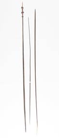
SoldPapua New Guinea. a large quantity of military mapPapua New Guinea. a large quantity of military maps of Papua New Guinea,c.1420 sheets, mostly duplicates, of c.190 maps, Australian and American military maps of Papua New Guinea, including PoSee Sold Price
Antique Papua/British New Guinea Coast sea chart 1880TITLE/CONTENT OF MAP: 'Papua or New Guinea Sheet 6 - British New Guinea South Coast - Round Head to Orangerie Bay' DATE PRINTED: Surveyed 1850; Published 1852; Revised to 1880 IMAGE SIZE: Approx 98.0See Sold Price
British New Guinea South Coast Aird River sea chartTITLE/CONTENT OF MAP: 'Papua or New Guinea Sheet 4 - British New Guinea South Coast - Aird River to Freshwater Bay' DATE PRINTED: Surveyed 1846; Published 1852; Revised to 1880 IMAGE SIZE: Approx 99.5See Sold Price
Papua New Guinea Large quantity of MapsPapua New Guinea. a large quantity of military maps of Papua New Guinea,c.1420 sheets, mostly duplicates, of c.190 maps, Australian and American military maps of Papua New Guinea, including PoSee Sold Price
1943 US Army Photo Map, Cape Killerton Papua New GuineaTitle/Content of Map: 1943 US Army Photo Map of Cape Killerton, Papua New Guinea -- Photo Map of Cape Killerton Date Printed: 1943 Cartographer: US Army Size: 18.8 x 15 in. This is a highly detailed aSee Sold Price
Antique Map - Solomon Islands - Papua New Guinea - Carteret Islands - OceaniaTitle/Content: Antique Map - Solomon Islands - Papua New Guinea - Carteret Islands - Oceania Date: 1774 Material: Paper Dimensions: 16.5” x 11” inches / 42 cm x 27 cm Description: This capSee Sold Price
1943 US Army Photo Map of Cape Killerton, Papua NewTitle/Content of Map: 1943 US Army Photo Map of Cape Killerton, Papua New Guinea -- Photo Map of Cape Killerton Date: 1943 Cartographer: US Army Size: 18.8 x 15 in. This is a highly detailed aerial maSee Sold Price
1943 US Army Photo Map of Cape Killerton, Papua NewTitle: 1943 US Army Photo Map of Cape Killerton, Papua New Guinea -- Photo Map of Cape Killerton Date: 1943 Cartographer: US Army Size: 18.8 x 15 in. Additional Information: This is a highly detailedSee Sold Price
1943 US Army Photo Map of Cape Killerton, Papua NewTitle/Content of Map: 1943 US Army Photo Map of Cape Killerton, Papua New Guinea -- Photo Map of Cape Killerton Date: 1943 Cartographer: US Army Size: 18.8 x 15 in. This is a highly detailed aerial maSee Sold Price
SoldGeelkerken (Nicolaas van) [South East Asia]Geelkerken (Nicolaas van) [South East Asia],southern China and Malaysia, the Philippines and partial outline of Papua New Guinea, with inset map of Buton island off Sulawesi, upper right, compSee Sold Price
SoldAustralasia.- Papua New Guinea.- Rosenberg (C.B.H. von)Australasia.- Papua New Guinea.- Rosenberg (C.B.H. von) Reistochten naar de Geelvinkbaai op Nieuw-Guinea..., first edition, tinted lithographed portrait and 19 plates and maps, some tinted, 5 of birdsSee Sold Price
SoldJansson (Jan) & Hondius (Henricus) Asia recens summaJansson (Jan) & Hondius (Henricus) Asia recens summa cura delineata, the continent of Asia from Greece and the Horn of Africa to Japan and Papua New Guinea, the later issue of the 1623 map without theSee Sold Price
SoldDe Leth (Henri) - L'Asie Divisée en sesthe continent of Asia by Robert de Vaugondy after Sanson, including the Horn of Africa, the tip of Alaska and most of Papua New Guinea, title cartouche upper left, scale cartouche upper right, engraveSee Sold Price
Coronelli (Vincenzo Maria) [Het Niew Hollandt. NuovaCoronelli (Vincenzo Maria) [Het Niew Hollandt. Nuova Guinea], 1 leaf (pp. 147-148) from ‘Atlante Veneto’ , depicting the Dutch discoveries in the Spice Islands, Papua New Guinea and Australia,See Sold Price
SoldJansson (Jan) Indiæ OrientalisJansson (Jan) Indiæ Orientalis Nova Descriptio,map of the East Indies, including Duyfkens Eyland south of Papua New Guinea, as very early evidence of the voyage of the eponymous ship that firsSee Sold Price
SoldDe l'Isle (G.) Asia Accurate in in ImperiaDe l'Isle (Guillaume) Asia Accurate in in Imperia, Regna, Status & Popolos Divisa,from Italy, upper left, to Papua New Guinea, lower right, with inset map of Irkutz, upper right, title carSee Sold Price
SoldDe l'Isle (Guillaume) Carte d'AsieDe l'Isle (Guillaume) and Phillipe Buache. Carte d'Asie, Dressée pour l'instruction,from Italy, upper left, to Papua New Guinea, lower right, with inset map of Irkutz, upper right, with titleSee Sold Price
SoldDe l'Isle (G) Carte des Indes et de la ChineDe l'Isle (Guillaume) Carte des Indes et de la Chine, south-east Asia, from the Indus river to Papua New Guinea, including Japan and the Mariana Islands, engraved map with original outline hanSee Sold Price
De l'Isle (G.) Carte des Indes et de la ChineDe l'Isle (Guillaume) Carte des Indes et de la Chine,Asia from the Caspian Sea to Japan, and the Maldives to Papua New Guinea, title panel centre above, engraved map with original hand-colouriSee Sold Price
SoldBritish New Guinea Official Sealed Proclamation 19British New Guinea Official Sealed Proclamation 1900. 3 various signed documents: Hon. M. Staniforth C. SMITH signed type written letter on Territory of Papua letterhead regarding New Guinea maps sentSee Sold Price
SoldMAP: "Chart of the Pacific Ocean" circa 1820 showingMAP: "Chart of the Pacific Ocean" circa 1820 showing New Holland with incomplete northern and southern coastlines and only the east coast of Van Diemen's Land; Papua or New Guinea largely incompleSee Sold Price
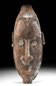
Papua New Guinea Kaminimbit Tribal Mask 29inThe Benefit Shop Foundation Inc.4.3(2.9k)See Sold PriceFeb 28, 2024
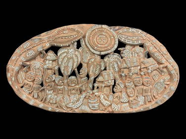
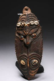
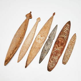
Papua New Guinea Storyboard Carved Wood PanelDana J. Tharp Auctions4.7(268)See Sold PriceFeb 24, 2024
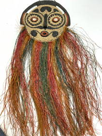
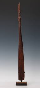
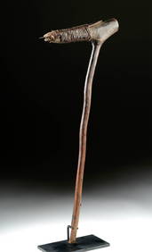
Food Spatula, Geelvink Bay, Northwest Coast Papua New Guinea, Early 20th C. or OlderMaterial Culture4.6(765)See Sold PriceFeb 29, 2024
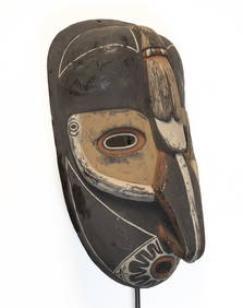
Papua New Guinea Exceptional wooden mask from Sepik River 3kg-53cmArs Coin Wien4.5(42)See Sold PriceFeb 25, 2024
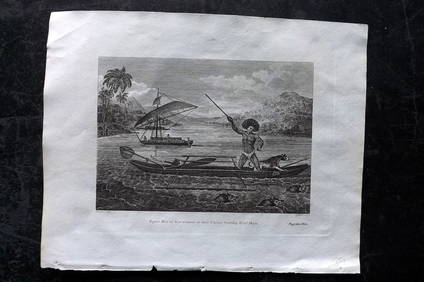
Cooke, George 1801 Print. Papua New Guinea Man hunting Wild HogsAlbion Auctions4.6(336)See Sold PriceMar 07, 2024
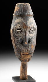
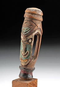
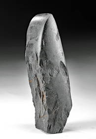
Early Papua New Guinea Wood Finial (Abstract Face)Artemis Fine Arts4.8(1.4k)See Sold PriceFeb 26, 2024
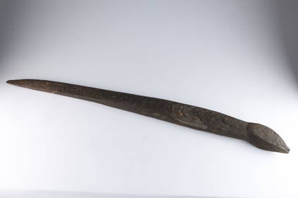
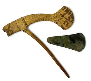
19th C. Papua New Guinea Stone Adze Blade, ex-Sotheby'sArtemis Fine Arts4.8(1.4k)See Sold PriceFeb 26, 2024
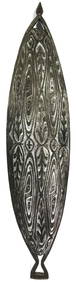
AN EARLY PAPUA NEW GUINEA TRIBAL CARVED WOOD VOTIVE. 25 cm high.Hannam's Auctioneers Ltd4.3(386)See Sold PriceFeb 27, 2024


![Geelkerken (Nicolaas van) [South East Asia] (1 of 1)](https://p1.liveauctioneers.com/410/19007/6434159_1_x.jpg?height=282&quality=70)