ATLAS of ANTIENT GEOGRAPHY by SAMUEL BUTLER 1843John McInnis Auctioneers,LLC4.6(502)See Sold PriceFeb 24, 2024
18TH C. ANTIQUE MAP: FRENCH & INDIAN WAR, FRAMEDThomaston Place Auction Galleries4.4(386)See Sold PriceFeb 24, 2024
Rand McNally Railroad Map Cabinet w/ 21 Railroad MapsRail & Road Auctions4.6(165)See Sold PriceMar 08, 2024
Keith Haring - Ink on New York Map, Best Buddies, Inscribed, Signed, and DatedSapphire Auction Gallery4(67)See Sold PriceMar 02, 2024
LATE 17TH C. FRENCH MAP OF THE NEW WORLD BY ALEXIS-HUBERT JAILLOT (1632-1712)Thomaston Place Auction Galleries4.4(386)See Sold PriceFeb 24, 2024
Central Railroad of New Jersey Map of Sandy Hook Route-ca. 1903JM Hobby Supply and Railroad Artifact Auctions4.4(126)See Sold PriceFeb 24, 2024
Lot of Six Mixed Atlas Box Cars-HO Scale-New in BoxJM Hobby Supply and Railroad Artifact Auctions4.4(126)See Sold PriceFeb 25, 2024
Rand McNally/Santa Fe Railroad Map of Iowa-1912JM Hobby Supply and Railroad Artifact Auctions4.4(126)See Sold PriceFeb 24, 2024
NICOLAES VISSCHER (NETHERLANDS, 1618-1709) MAP OF THE NEW WORLDThomaston Place Auction Galleries4.4(386)See Sold PriceFeb 24, 2024
17TH C. WORLD MAP BY NICOLAES VISSCHER (NETHERLANDS, 1618-1709)Thomaston Place Auction Galleries4.4(386)See Sold PriceFeb 24, 2024
Lot of Six Mixed Atlas Cabooses-HO Scale-New in BoxJM Hobby Supply and Railroad Artifact Auctions4.4(126)See Sold PriceFeb 25, 2024
Soldde Vaugondy / Fortin: Land of the IsraelitesMap: Carte de la Terre des Hebreux ou Israelites partagee selon l'ordre de Dieu aux douze tribus descendantes des douze fils de Jacob Cartographer: Robert de Vaugondy / Fortin Place/Date: Paris / 1778See Sold Price
de Vaugondy / Fortin: Map of the Land of Israel, 1778Carte de la Terre des Hebreux ou Israelites partagee selon l'ordre de Dieu aux douze tribus descendantes des douze fils de Jacob Robert de Vaugondy's superb map of "the land of the Hebrews or IsraelitSee Sold Price
de Vaugondy: Antique Map of Land of the Hebrews, 1778Map: Carte de la Terre des Hebreux ou Israelites partagee selon l'ordre de Dieu aux douze tribus descendantes des douze fils de Jacob Cartographer: Robert de Vaugondy / Fortin Place & Date: Paris / 17See Sold Price
MAP - Holy Land. Robert de VaugondyHoly Land. Gilles Robert de Vaugondy, Carte de la Terre des Hebreux ou Israelites Partagee Selon l'Ordre de Dieu aux Douze Tribus Descendantes des Douze Fils de Jacob..., 1745 (dated). Hand Color. LovSee Sold Price
Map of The Holy Land. Robert de Vaugondy, Gilles,"Cart de la Terre des Hebreuxou Israelites partgeeselonl'ordre de Dieu aux douzetribus." Map of the Holy Land divided into 12 tribes pursuant to the Sanson map. Coastline from Sidon in the North to RaSee Sold Price
MAP - Holy Land. Robert de VaugondyHoly Land. Gilles Robert de Vaugondy, Terre de Chanaan ou Terre Promise a Abraham..., 1743 (dated). Hand Color. This decorative Holy Land map is based on the work of Guillaume Sanson. The main map traSee Sold Price
MAP - Holy Land. Robert de VaugondyHoly Land. Gilles Robert de Vaugondy, Terre de Chanaan ou Terre Promise a Abraham..., 1743 (dated). Hand Color. This decorative Holy Land map is based on the work of Guillaume Sanson. The main map traSee Sold Price
Sold1795 c. Robert de Vaugondy Map of the Holy Land --Title/Content of Map: 1795 c. Robert de Vaugondy Map of the Holy Land -- Judee ou Terre Sainte Cartographer: Robert de Vaugondy [Family] Year/Place: 1795 c., Paris Size: 9.8 X 8.8 in. This is an excelSee Sold Price
Robert de Vaugondy: Map of Judea, the Holy Land, 1657Carte de la Terre de Canaan ou Terre Promise a Abraham et la Posterite dans Laquelle on a Trace la fortie du people…. By: Robert de Vaugondy Date: 1657 (circa) Paris Dimensions: 18.75 x 23 inches (4See Sold Price
Soldde Vaugondy: Antique Map of Judea / Holy Land, 1795Title/Content of Map: Judée ou Terre Sainte Cartographer: Robert de Vaugondy/Lamarche Place & Date: Paris / 1795 Size: 8 1/2" x 9 5/8" Condition: outline color; overall age toning, spotting and someSee Sold Price
SoldDidier ROBERT DE VAUGONDY - Amérique ou Indes OccidentaDidier ROBERT DE VAUGONDY - Amérique ou Indes Occidentales. Paris, Fortin, 1778. Carte aux pourtours rehaussés. 520 x 653 mm au TC. Légèrement froissée sur la partie droite, l'une ou l'autre petiSee Sold Price
Sold3 Holy Land Maps.3 Holy Land Maps. Including: 1. Robert de Vaugondy Gilles (1688-1766) - Judee ou Terre Sainte, map of the holy land, copper engraving, 25x22cm. 2. Canaan or the Holy Land in Tribes Map, Published by TSee Sold Price
SoldRobert de Vaugondy. A New Map of CanadaRobert de Vaugondy (Gilles & Didier) After. A New Map of Canada, Also the North Parts of New England and New York, with Nova Scotia and Newfound Land,with inset map of the Great Lakes, froSee Sold Price
Didier ROBERT DE VAUGONDY - Mappe-Monde : dressée suivaDidier ROBERT DE VAUGONDY - Mappe-Monde : dressée suivant les nouvelles relations et assujettie aux observations astronomiques. Paris, Fortin, 1778. Carte en noir, pourtours rehaussés. 467 x 730 mm.See Sold Price
Didier ROBERT DE VAUGONDY - Asie divisée en ses principDidier ROBERT DE VAUGONDY - Asie divisée en ses principaux Etats, Empires & Royaumes. Paris, Fortin, 1778. Carte en noir, pourtours rehaussés. Cartouche en haut et en bas à gauche. Colonne de texteSee Sold Price
SoldDidier ROBERT DE VAUGONDY - Afrique divisée en ses prinDidier ROBERT DE VAUGONDY - Afrique divisée en ses principaux Empires et Royaumes. Paris, Fortin, 1778. Carte aux pourtours rehaussés. Cartouches en haut à droite et en bas à gauche. Texte sur laSee Sold Price
SoldDidier ROBERT DE VAUGONDY - Carte des Royaumes d'EspagnDidier ROBERT DE VAUGONDY - Carte des Royaumes d'Espagne et de Portugal divisés par Provinces. Paris, Fortin, 1780. Carte aux pourtours rehaussés. 556 x 716 au TC. Pli médian froissé. Joint: - DidSee Sold Price
Gilles Robert de Vaugondy 1688-1766 (French)Gilles Robert de Vaugondy 1688-1766 (French) 'Carte de la terre des Hebreux ou Israelites partage selon l'ordre de Dieu aux douze tribus descendantes des douze fils de Jacob..' etching 51 x 76 cm (20See Sold Price
Gilles Robert de Vaugondy 1688-1766 (French)Gilles Robert de Vaugondy 1688-1766 (French) 'Carte de la terre des Hebreux ou Israelites partage selon l'ordre de Dieu aux douze tribus descendantes des douze fils de Jacob..' 51 x 76 cm (20 x 30 in.See Sold Price
SoldVAUGONDY, R. de / DELAMARCHE MAPLa Monarchie des Hebreux sous Salamon, ou le royaume. A fine example of Delamarche's exceptional 1745 map of the Holy Land, Israel, or Palestine. Details the region on both sides of the Jordan River wSee Sold Price
Map of the Holy Land. Willem Albert Bachiene.Afbeeldinge van 'T Land Kanaan nog bewoond door Deszelvs Allereerste Bezitters de Nakomelingen Kanaans. Map of the Holy Land before its conquest by the Israelites. Copperplate engraving. Black and whtSee Sold Price
Prince Israelite. Melchizedek, King of Salem. 1859.Prince Israelite. Melchizedek, King of Salem. Holy Land. 1859.Print of steel engraving titled „Prince Israelite. Melchisedech Roi de Salem“.Drawn by Lalaise.Engraved by Bosserodon.From „Le MondeSee Sold Price
Sold2 Maps of Jerusalem, Holy Land 1712 & 1875Description Geographique de la Terre Promise, Terre des Hebreux, et des Israelites Partagée selon l’ordre de Dieu, Aux Douze Tribus Descendantes des Douze Fils de Jacob . . . By Moullart-SaSee Sold Price
de Vaugondy: Antique Map of the Americas, 1771Title/Content of Map: Amerique ou Indes Occidentales Cartographer: Robert de Vaugondy Place & Date: Paris / 1771 Size: 25" x 20" Condition: outline color; light overall age toning; minor staining alonSee Sold Price
EARLY 18TH C. DUTCH CHART OF PACIFIC OCEAN BY FREDERIK DE WIT (1629-1706) WITH CALIFORNIA AS ANThomaston Place Auction Galleries4.4(386)See Sold PriceFeb 24, 2024
[LOUISIANA]. Manuscript document related to "Mr. Simon," a "homme de couleur libre," orFreeman's | Hindman4.4(1.6k)See Sold PriceFeb 27, 2024
Exceptional and Great Nativity on board. Attributed to Master of Tejerina, Juan (active in ParedesTemplum Fine Art Auctions4.3(8)See Sold PriceFeb 28, 2024
D'Entrecasteaux - Australia: Coasts of Van Diemen's Land (New Holland). 9Trillium Antique Prints & Rare Books4.5(30)See Sold PriceFeb 24, 2024
D'Entrecasteaux - Australia: Chart of Van Diemen's Land (New Holland). 3Trillium Antique Prints & Rare Books4.5(30)See Sold PriceFeb 24, 2024
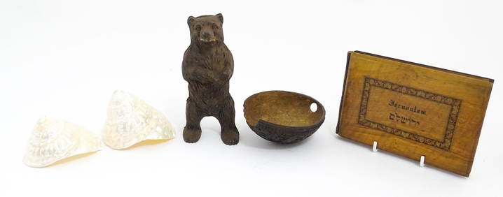
A quantity of assorted items to include a souvenir album of Jerusalem with Flowers of the Holy LandClaydon Auctioneers Ltd4.3(125)See Sold PriceFeb 26, 2024
1764 Bellin Map of Fort Louis Area of Guadeloupe -- Environs du Fort Louis de la GuadeloupeJasper524.5(9.8k)See Sold PriceFeb 27, 2024
Robert de Vaugondy - Map of Canada - Mer de l' Ouest or Sea of the West and a Northwest PassageProverde Auctions4.3(3)See Sold PriceFeb 28, 2024


![[LOUISIANA]. Manuscript document related to "Mr. Simon," a "homme de couleur libre," or (1 of 2)](https://p1.liveauctioneers.com/197/319238/171468064_1_x.jpg?height=282&quality=70&version=1707520367)