ATLAS of ANTIENT GEOGRAPHY by SAMUEL BUTLER 1843John McInnis Auctioneers,LLC4.6(502)See Sold PriceFeb 24, 2024
18TH C. ANTIQUE MAP: FRENCH & INDIAN WAR, FRAMEDThomaston Place Auction Galleries4.4(386)See Sold PriceFeb 24, 2024
Rand McNally Railroad Map Cabinet w/ 21 Railroad MapsRail & Road Auctions4.6(165)See Sold PriceMar 08, 2024
Keith Haring - Ink on New York Map, Best Buddies, Inscribed, Signed, and DatedSapphire Auction Gallery4(67)See Sold PriceMar 02, 2024
LATE 17TH C. FRENCH MAP OF THE NEW WORLD BY ALEXIS-HUBERT JAILLOT (1632-1712)Thomaston Place Auction Galleries4.4(386)See Sold PriceFeb 24, 2024
Central Railroad of New Jersey Map of Sandy Hook Route-ca. 1903JM Hobby Supply and Railroad Artifact Auctions4.4(126)See Sold PriceFeb 24, 2024
Lot of Six Mixed Atlas Box Cars-HO Scale-New in BoxJM Hobby Supply and Railroad Artifact Auctions4.4(126)See Sold PriceFeb 25, 2024
Rand McNally/Santa Fe Railroad Map of Iowa-1912JM Hobby Supply and Railroad Artifact Auctions4.4(126)See Sold PriceFeb 24, 2024
NICOLAES VISSCHER (NETHERLANDS, 1618-1709) MAP OF THE NEW WORLDThomaston Place Auction Galleries4.4(386)See Sold PriceFeb 24, 2024
17TH C. WORLD MAP BY NICOLAES VISSCHER (NETHERLANDS, 1618-1709)Thomaston Place Auction Galleries4.4(386)See Sold PriceFeb 24, 2024
Lot of Six Mixed Atlas Cabooses-HO Scale-New in BoxJM Hobby Supply and Railroad Artifact Auctions4.4(126)See Sold PriceFeb 25, 2024
1829 Malte-Brun Map of France -- Royaume de France enTitle/Content of Map: 1829 Malte-Brun Map of France -- Royaume de France en 1829 Date: 1829, Paris Cartographer: M Malte-Brun Size: 8.7 X 11.7 in. An attractive map of France showing its political divSee Sold Price
1829 Malte-Brun Map of France -- Royaume de France enTitle/Content of Map: 1829 Malte-Brun Map of France -- Royaume de France en 1829 Date: 1829, Paris Cartographer: M Malte-Brun Size: 8.7 X 11.7 in. An attractive map of France showing its political divSee Sold Price
1829 Malte-Brun Map of France -- Royaume de France enTitle/Content of Map: 1829 Malte-Brun Map of France -- Royaume de France en 1829 Date: 1829, Paris Cartographer: M Malte-Brun Size: 8.7 X 11.7 in. An attractive map of France showing its political divSee Sold Price
1829 Malte-Brun Map of France -- Royaume de France enTitle/Content of Map: 1829 Malte-Brun Map of France -- Royaume de France en 1829 Date Printed: 1829, Paris Cartographer: M Malte-Brun Size: 8.7 X 11.7 in. An attractive map of France showing its politSee Sold Price
1829 Malte-Brun Map of France -- Royaume de France enTitle: 1829 Malte-Brun Map of France -- Royaume de France en 1829 Cartographer: M Malte-Brun Year / Place: 1829, Paris Map Dimension (in.): 8.7 X 11.7 in. An attractive map of France showing its politSee Sold Price
SoldDelamarche, Felix 1829 Map of France"Royaume de France divise en 32 Gouvernemens" Copper Engraved Map Published 1829, Paris for "Atlas de La Geographie..." by Felix Delamarche. Contemporary outline hand colour. Centre fold as published.See Sold Price
SoldDelamarche, Felix 1829 Pair of French Maps"Royaume de France divise en 52 Gouvernemens" and "Royaume de France divise en 86 Departemens" Copper Engraved Map Published 1829, Paris for "Atlas de La Geographie..." by Felix Delamarche. ContemporaSee Sold Price
Delamarche, Felix 1829 Pair of French Maps"Royaume de France divise en 52 Gouvernemens" and "Royaume de France divise en 86 Departemens" Copper Engraved Map Published 1829, Paris for "Atlas de La Geographie..." by Felix Delamarche. ContemporaSee Sold Price
Delamarche, Felix 1829 Pair of French Maps"Royaume de France divise en 52 Gouvernemens" and "Royaume de France divise en 86 Departemens" Copper Engraved Map Published 1829, Paris for "Atlas de La Geographie..." by Felix Delamarche. ContemporaSee Sold Price
Map of Kingdom of France divided into 32 governments.Map of Kingdom of France divided into 32 governments. 1829.Print of steel engraving titled Royaume de France divise en 32 Gouvernemens“.Author Fellx Delamarche.Engraved by unknown.From Atlas de la GSee Sold Price
SoldRoyaume de France, divisé en Gouvernements. Provinces.TITLE/CONTENT OF MAP: 'Royaume de France, divisé en Gouvernements [The Kingdom of France, divided into Provinces]' DATE PRINTED: 1789 IMAGE SIZE: Approx 24.5 x 36.0cm, 9.75 x 14.25 inches (Large); PlSee Sold Price
Malte-Brun: Antique Map of the Netherlands, 1829Title/Content of Map: 1829 Malte-Brun Map of the Netherlands -- Royaume des Pays-Bas en 1829 Date Printed: 1829, Paris Cartographer: M Malte-Brun Size: 11.7 x 8.8 in. A handsome map of the NetherlandsSee Sold Price
1829 Malte-Brun Map of the Netherlands -- Royaume desTitle/Content of Map: 1829 Malte-Brun Map of the Netherlands -- Royaume des Pays-Bas en 1829 Date: 1829, Paris Cartographer: M Malte-Brun Size: 11.7 x 8.8 in. A handsome map of the Netherlands and LuxSee Sold Price
1812 Malte-Brun Map of Southern France -- Partie Occidentale de l'Empire FrancaisTitle: 1812 Malte-Brun Map of Southern France -- Partie Occidentale de l'Empire Francais Cartographer: M Malte-Brun Year / Place: 1812, Paris Map Dimension (in.): 11.7 x 8.8 in. An attractive map of sSee Sold Price
Malte-Brun: Antique Map of Southern France, 1812Title/Content of Map: 1812 Malte-Brun Map of Southern France -- Partie Occidentale de l'Empire Francais Date Printed: 1812, Paris Cartographer: M Malte-Brun Size: 11.7 x 8.8 in. An attractive map of sSee Sold Price
1812 Malte-Brun Map of Southern France -- PartieTitle/Content of Map: 1812 Malte-Brun Map of Southern France -- Partie Occidentale de l'Empire Francais Date: 1812, Paris Cartographer: M Malte-Brun Size: 11.7 x 8.8 in. An attractive map of southernSee Sold Price
1829 Malte-Brun Map of FranceItem: 1829 Malte-Brun Map of France Description: Map of France showing its political divisions, settlements along with its topography. M Malte-Brun, 1829, Paris. Dimensions: 8.7 X 11.7 in. Please noteSee Sold Price
SoldMalte-Brun: Map of North France Belgium & Holland, 1812Map: 1812 Malte-Brun Map of Northern France, Belgium and Holland -- Partie Septentrionale de l'Empire Francis Cartographer: M Malte-Brun Year / Place: 1812, Paris Dimensions: 8.7 X 11.7 in. Condition:See Sold Price
Malte-Brun: Antique Map of France & Northern Italy 1812Title/Content of Map: 1812 Malte-Brun Map of France and Northern Italy -- Empire Francais et Royaume d'Italie Date Printed: 1812, Paris Cartographer: M Malte-Brun Size: 8.7 X 11.7 in. An attractive maSee Sold Price
1812 Malte-Brun Map of France and Northern Italy --Title/Content of Map: 1812 Malte-Brun Map of France and Northern Italy -- Empire Francais et Royaume d'Italie Date: 1812, Paris Cartographer: M Malte-Brun Size: 8.7 X 11.7 in. An attractive map of FraSee Sold Price
1812 Malte-Brun Map of France and Northern Italy --1812 Malte-Brun Map of France and Northern Italy -- Empire Francais et Royaume d'Italie 1812, Paris M Malte-Brun 8.7 X 11.7 in. An attractive map of France and Northern Italy showing its political divSee Sold Price
1812 Malte-Brun Map of France and Northern Italy --Title/Content of Map: 1812 Malte-Brun Map of France and Northern Italy -- Empire Francais et Royaume d'Italie Date: 1812, Paris Cartographer: M Malte-Brun Size: 8.7 X 11.7 in. An attractive map of FraSee Sold Price
1812 Malte-Brun Map of France and Northern Italy --Title/Content of Map: 1812 Malte-Brun Map of France and Northern Italy -- Empire Francais et Royaume d'Italie Cartographer: M Malte-Brun Year/Place: 1812, Paris Size: 8.7 X 11.7 in. An attractive mapSee Sold Price
Malte-Brun: Antique Map of France & Northern Italy 1812Title/Content of Map: 1812 Malte-Brun Map of France and Northern Italy -- Empire Francais et Royaume d'Italie Date Printed: 1812, Paris Cartographer: M Malte-Brun Size: 8.7 X 11.7 in. An attractive maSee Sold Price
LARGE LATE 17TH C. DUTCH CHART OF CANADA, GREAT LAKES, NEW FRANCE, LABRADOR, HUDSON BAY, BY PIERREThomaston Place Auction Galleries4.4(386)See Sold PriceFeb 24, 2024
ORGIAZZI 14 x Folio Sized Engravings Roman Road Signs etc. c1802 Aix FranceLuis Porretta Fine Arts4.3(10)See Sold PriceMar 02, 2024
MAP - Dufour, A. H. ( Malte / Brun ) :MAP - ESPAGNE PARTIE SUD DIVISEE EN PROVINCES ANCIENNES ( MAPLuis Porretta Fine Arts4.3(10)See Sold PriceMar 02, 2024
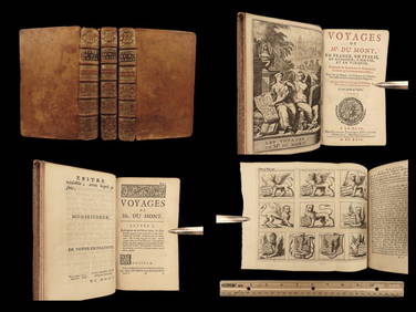
1699 Jean Dumont VOYAGES in France Italy Germany ROME Malta Turkey Ottoman 3vSchilb Antiquarian Rare Books4.8(421)See Sold PriceMar 31, 2024
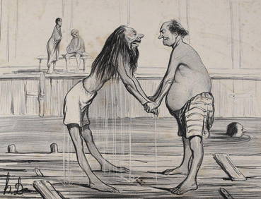
Honore Daumier France 1808 -1879 Lithograph No 13 from Les BaigneursGlobal Auctions Company4.3(36)See Sold PriceMar 03, 2024
Honore Daumier France 1808-1879 Lithograph LE JOUR DE L'AN 1838 Large headsGlobal Auctions Company4.3(36)See Sold PriceMar 03, 2024
Pierre-Auguste Renoir (French, 1841-1919) - Pierre Goujon en Costume MarinFreeman's | Hindman4.5(158)See Sold PriceFeb 27, 2024
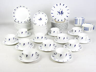
Jean PICART LE DOUX (1902-1982) d'après : Partie de service à thé-café et à dessert enValoir Pousse-Cornet4.3(4)See Sold PriceFeb 24, 2024
Raoul GUYS (XXe): Table de section carré en fer rond et perforé laqué orange. France vers 1950.Valoir Pousse-Cornet4.3(4)See Sold PriceFeb 24, 2024
D'Entrecasteaux - Australia: Coasts of Van Diemen's Land (New Holland). 9Trillium Antique Prints & Rare Books4.5(30)See Sold PriceFeb 24, 2024
D'Entrecasteaux - Tasmania, Australia: Map of the Northern Portion of Recherche Bay. 5Trillium Antique Prints & Rare Books4.5(30)See Sold PriceFeb 24, 2024
D'Entrecasteaux - Australia: Chart of Van Diemen's Land (New Holland). 3Trillium Antique Prints & Rare Books4.5(30)See Sold PriceFeb 24, 2024
D'Entrecasteaux - Map of Australia (New Holland), New Zealand, and southern Asia and surroundingTrillium Antique Prints & Rare Books4.5(30)See Sold PriceFeb 24, 2024
Jules Verne, De La Terre a La Lune, Au Steamer Red MacaronLion and Unicorn4.7(1.8k)See Sold PriceMar 10, 2024
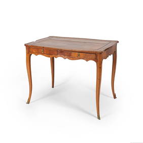
Table bureau en placage de bois de rose et satiné. France, époque Louis XVBonhams4.1(305)See Sold PriceMay 21, 2024
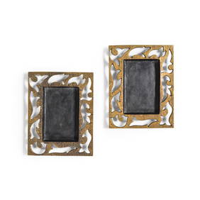
Elisabeth Garouste (France, née en 1949) & Mattia Bonetti (Suisse, né en 1953). Paire ...Bonhams4.1(305)See Sold PriceMay 21, 2024