ATLAS of ANTIENT GEOGRAPHY by SAMUEL BUTLER 1843John McInnis Auctioneers,LLC4.6(502)See Sold PriceFeb 24, 2024
18TH C. ANTIQUE MAP: FRENCH & INDIAN WAR, FRAMEDThomaston Place Auction Galleries4.4(386)See Sold PriceFeb 24, 2024
Rand McNally Railroad Map Cabinet w/ 21 Railroad MapsRail & Road Auctions4.6(165)See Sold PriceMar 08, 2024
Keith Haring - Ink on New York Map, Best Buddies, Inscribed, Signed, and DatedSapphire Auction Gallery4(67)See Sold PriceMar 02, 2024
LATE 17TH C. FRENCH MAP OF THE NEW WORLD BY ALEXIS-HUBERT JAILLOT (1632-1712)Thomaston Place Auction Galleries4.4(386)See Sold PriceFeb 24, 2024
Central Railroad of New Jersey Map of Sandy Hook Route-ca. 1903JM Hobby Supply and Railroad Artifact Auctions4.4(126)See Sold PriceFeb 24, 2024
Lot of Six Mixed Atlas Box Cars-HO Scale-New in BoxJM Hobby Supply and Railroad Artifact Auctions4.4(126)See Sold PriceFeb 25, 2024
Rand McNally/Santa Fe Railroad Map of Iowa-1912JM Hobby Supply and Railroad Artifact Auctions4.4(126)See Sold PriceFeb 24, 2024
NICOLAES VISSCHER (NETHERLANDS, 1618-1709) MAP OF THE NEW WORLDThomaston Place Auction Galleries4.4(386)See Sold PriceFeb 24, 2024
17TH C. WORLD MAP BY NICOLAES VISSCHER (NETHERLANDS, 1618-1709)Thomaston Place Auction Galleries4.4(386)See Sold PriceFeb 24, 2024
Lot of Six Mixed Atlas Cabooses-HO Scale-New in BoxJM Hobby Supply and Railroad Artifact Auctions4.4(126)See Sold PriceFeb 25, 2024
Sold1842 Zadock Thompson with colored map1842 Zadock Thompson History of Vermont, Natural, Civil, and Statistical with colored map of Vermont. Published Burlington VT By Chauncey Goodrich. Original leather bound.See Sold Price
Sold1842 Zadock Thompson with colored map1842 Zadock Thompson History of Vermont, Natural, Civil, and Statistical with colored map of Vermont. Published Burlington VT By Chauncey Goodrich. Original leather bound.See Sold Price
Sold1842 Zadock Thompson with colored map1842 Zadock Thompson History of Vermont, Natural, Civil, and Statistical with colored map of Vermont. Published Burlington VT By Chauncey Goodrich. Original leather bound.See Sold Price
Sold1842 Zadock Thompson History of Vermont- Burlington, w/1842 Zadock Thompson History of Vermont- Burlington, w/ fold out hand colored mapSee Sold Price
Sold1842 Zadock Thompson History of Vermont with folding1842 Zadock Thompson History of Vermont with folding map, stains, foxingSee Sold Price
Sold1824 Zadock Thompson Gazetteer of VT1824 Zadock Thompson "A Gazetteer of the State of Vermont" w/ fold-out hand colored map of the stateSee Sold Price
Sold1842 Zadock Thompson History of Vermont1842 Zadock Thompson History of Vermont, crisp uncolored fold out map, with appendix bound in, sound full leather binding, few scuffs & scrapesSee Sold Price
Sold1853 Zadock Thompson History of Vermont, with map- top1853 Zadock Thompson History of Vermont, with map- top board loose, & extra hand colored mapSee Sold Price
SoldProceedings of VT Historical society circa 1913Proceedings of Vermont Historical Society 6 volumes from 1910's, with 19 Indexes of 1842 Zadock Thompson History of VT published by same 1913., 5 Phonography containing system of Shorthand Writing 6thSee Sold Price
MAP, Vermont, ThompsonVermont. Zadock Thompson, Map of the State of Vermont, 1842 (published). Black & White. This county map of the state of Vermont gives great detail of roads, townships, lakes, and the river system. ThiSee Sold Price
SoldHISTORY OF VERMONT NATURAL, CIVIL, AND STATISTICAL"History of Vermont; Natural, Civil and Statistical, in Three Parts, with a New Map of the State, and 200 Engravings" by Zadock Thompson. Published by Chauncey Goodrich, Burlington, VT, 1842. Book isSee Sold Price
Sold1824 Zadock Thompson w map & 1852 Appendix1824 Zadock Thompson A Gazetteer of the State of Vermont containing a brief general view of the state, A Historical and topographical. Montpelier published by E P Walton and the author. Containing oriSee Sold Price
1842 Hand Colored Map of RussiaA HAND-COLORED MAP OF THE RUSSIAN DOMINION IN EUROPE, 1842, published by J. Wyld, Geographer to the Queen at Charing Cross, London, 1842, 59.5 x 96 cm (23 3/8 x 37 3/4 in.), with text in English and tSee Sold Price
Sold1842 Map - The Most Recent Antarctic DiscoveriesHistoric Maps 1842 Hand-Colored Antarctic Exploration Map 1842, Hand-Colored Map of the Most Recent Antarctic Discoveries, Choice Extremely Fine. This is a beautiful mid-19th Century map, with choiceSee Sold Price
Sold1842 Map - The Most Recent Antarctic DiscoveriesHistoric Maps 1842 Hand-Colored Antarctic Exploration Map 1842, Hand-Colored Map of the Most Recent Antarctic Discoveries, Choice Extremely Fine. This is a beautiful mid-19th Century map, with choiceSee Sold Price
SoldSDUK, Central AmericaSDUK Central America including Texas, California and the Northern States of Mexico Hand colored map, 1842 Plate: 12 x 15.50 inches/ 30.5 x 39.3 centimeters Frame: 20.75 x 23 inches/ 52.7 x 58.4 centimSee Sold Price
SoldVermont historical booksVermont Historical books (15 pcs), 1842 Thompson's Vermont with map, 1871 Abby Maria Hemenway Vermont Historical Gazetteer Vol II, 2 vols History of the Adirondacks, local historiesSee Sold Price
Sold(VERMONT.) Directory and Rules of the Senate a(VERMONT.) Directory and Rules of the Senate and House of Representatives [of Vermont] for October Session 1857. Engraved folding map by Zadock Thompson. Small 8vo, original lettered wrappers; early oSee Sold Price
SoldMap of Virginia, 1842Map of Virginia, 1842, colored, from an atlas. Matted and framed under glass in a 19th C. carved oak frame. Frame measures 19-5/8†in height by 23-5/8†in width by 1†in depth with sigSee Sold Price
SoldMexico with Texas Republic, 1842Heading: Author: Greenleaf, Jeremiah Title: The United States of Mexico Place Published: Brattleboro Publisher: Date Published: 1842 Description: Engraved map, hand-coloredSee Sold Price
SoldNorth America with maximum Texas 1842Heading: (Texas) Author: Society for the Diffusion of Useful Knowledge Title: North America Place Published: London Publisher: Date Published: 1842 Description: Engraved mapSee Sold Price
SoldTwo Vermont Histories- Zadock Thompson- History ofTwo Vermont Histories- Zadock Thompson- History of Vermont- Goodrich 1842;A History of Windsor County Vermont - D Mason 1891See Sold Price
SoldWILKES, CHARLES Narrative of the United States ExWILKES, CHARLES Narrative of the United States Exploring Expedition During the Years 1838-1842 10 folding maps (several colored), three folding charts, and woodcut illustrations in text. 5 vols. 8vo,See Sold Price
NYS Guide-1842-Text with Large Fldg Hand Colored MapTitle: NYS Guide-1842-Text with Large Fldg Hand Colored Map Provenance/Additional Info: About this Item: J. Disturnell, Albany, 1842. Hardcover. Condition: Very Good+. Early Printing edition. . .ContaSee Sold Price
Crams Township and Railroad Map of Pennsylvania-1898JM Hobby Supply and Railroad Artifact Auctions4.4(126)See Sold PriceFeb 24, 2024
Rand McNally Railroad Map of Washington-1906JM Hobby Supply and Railroad Artifact Auctions4.4(126)See Sold PriceFeb 24, 2024
Rand McNally Township County and Railroad Map of Indiana-1880JM Hobby Supply and Railroad Artifact Auctions4.4(126)See Sold PriceFeb 24, 2024
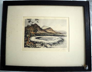
PHILIP NORMAN FSA Hand Colored Engraving c1910 Loch White Fairies SIGNED Listed ScotlandLuis Porretta Fine Arts4.3(10)See Sold PriceMar 02, 2024
PIETER SCHENK / VALK / JANSSEN Hand Colored Map of Rhodes Greece ca1702 vgcLuis Porretta Fine Arts4.3(10)See Sold PriceMar 02, 2024
RIGOBERT BONNE c1787 Original Colored Map Germany & Region 15" x 12"Luis Porretta Fine Arts4.3(10)See Sold PriceMar 02, 2024
THOMAS MOULE 1837 Colored Map of Warwickshire Framed vgcLuis Porretta Fine Arts4.3(10)See Sold PriceMar 02, 2024
Hand Colored Map of the city of Amsterdam 1720Global Auctions Company4.3(36)See Sold PriceMar 03, 2024
HAMMOND'S READY REFERENCE HISTORICAL ATLAS 1920North American Artifact Auctions4.6(182)See Sold PriceApr 20, 2024
[CHICAGO]. Rare Pre-Fire Illinois Map: “Blanchard’s Map of ...Potter & Potter Auctions4.6(539)See Sold PriceMar 07, 2024
[MAPS]. DUFOUR, Auguste-Henri (1795-1865). Bound Volume of ...Potter & Potter Auctions4.6(539)See Sold PriceMar 07, 2024
[MAP]. [ALBRIZZI, Giambatista, 1698-1777]. Carta Geografica...Potter & Potter Auctions4.6(539)See Sold PriceMar 07, 2024
West Africa. Sahara caravan routes. Tribes Kingdoms Empires. LIZARS 1842 mapJasper524.5(9.8k)See Sold PriceFeb 28, 2024
Rare 19thc Colton Map, Argentine Republic, Chile, Uruguay, PataguayConnoisseur Auctions4(333)See Sold PriceMar 16, 2024
Galliae Regionis Nova Descriptio Hand Colored Map of France on Laid Paper, Ca. 16th Century, H 10" WDuMouchelles4.6(825)See Sold PriceMar 15, 2024


![[CHICAGO]. Rare Pre-Fire Illinois Map: “Blanchard’s Map of ... (1 of 2)](https://p1.liveauctioneers.com/928/318880/171361260_1_x.jpg?height=282&quality=70&version=1707501302)
![[MAPS]. DUFOUR, Auguste-Henri (1795-1865). Bound Volume of ... (1 of 2)](https://p1.liveauctioneers.com/928/318880/171361279_1_x.jpg?height=282&quality=70&version=1707501302)
![[MAP]. [ALBRIZZI, Giambatista, 1698-1777]. Carta Geografica... (1 of 1)](https://p1.liveauctioneers.com/928/318880/171361280_1_x.jpg?height=282&quality=70&version=1707501302)


