ATLAS of ANTIENT GEOGRAPHY by SAMUEL BUTLER 1843John McInnis Auctioneers,LLC4.6(502)See Sold PriceFeb 24, 2024
18TH C. ANTIQUE MAP: FRENCH & INDIAN WAR, FRAMEDThomaston Place Auction Galleries4.4(386)See Sold PriceFeb 24, 2024
Rand McNally Railroad Map Cabinet w/ 21 Railroad MapsRail & Road Auctions4.6(165)See Sold PriceMar 08, 2024
Keith Haring - Ink on New York Map, Best Buddies, Inscribed, Signed, and DatedSapphire Auction Gallery4(67)See Sold PriceMar 02, 2024
LATE 17TH C. FRENCH MAP OF THE NEW WORLD BY ALEXIS-HUBERT JAILLOT (1632-1712)Thomaston Place Auction Galleries4.4(386)See Sold PriceFeb 24, 2024
Central Railroad of New Jersey Map of Sandy Hook Route-ca. 1903JM Hobby Supply and Railroad Artifact Auctions4.4(126)See Sold PriceFeb 24, 2024
Lot of Six Mixed Atlas Box Cars-HO Scale-New in BoxJM Hobby Supply and Railroad Artifact Auctions4.4(126)See Sold PriceFeb 25, 2024
Rand McNally/Santa Fe Railroad Map of Iowa-1912JM Hobby Supply and Railroad Artifact Auctions4.4(126)See Sold PriceFeb 24, 2024
NICOLAES VISSCHER (NETHERLANDS, 1618-1709) MAP OF THE NEW WORLDThomaston Place Auction Galleries4.4(386)See Sold PriceFeb 24, 2024
17TH C. WORLD MAP BY NICOLAES VISSCHER (NETHERLANDS, 1618-1709)Thomaston Place Auction Galleries4.4(386)See Sold PriceFeb 24, 2024
Lot of Six Mixed Atlas Cabooses-HO Scale-New in BoxJM Hobby Supply and Railroad Artifact Auctions4.4(126)See Sold PriceFeb 25, 2024
SoldAmerican Heritage Early Maps of America Reproductions(6) maps include the New World 1500 & 1600, New France 1745, the Known Globe 1667, and more, also includes a collection of noteble early maps of America Booklet See Sold Price
SoldA COLLECTION OF EARLY 1900s SOUTHERN RAILWAY MAPS ETCThirty-three items include brochures, maps and company correspondence. We happily provide seamless in-house packing and shipping services on nearly everything we sell.See Sold Price
SoldEarly Los Angeles Map Collection [135820]Lot of 11, most different. Included: City & Harbor of Los Angeles, 1921; Special Sightseeing Map of Los Angeles & Vicinity, 1930; Official Transportation and City Map of Los Angeles, Cal and Suburbs,See Sold Price
SoldCollection of Early Childrens GamesCollection of Early Childrens Games. 1898 Home Scroll Puzzle, No. 240, 1887 Locomotive Picture Puzzle (incomplete), Dissected Map of the United States (incomplete), 1900 Game of Leap Frog, No. 5126 (iSee Sold Price
SoldA New Map of North America"A New Map of North America". Early 18th cent. Dedicated to his highness William Duke of Glocester. 17" x 20". The Old Print Shop. A Private Collection.See Sold Price
SoldAntique Atlas Brass Pepper MillEarly 20th century, made in Greece. Having a nice surface and in working order. H7 1/2" Sold from the collection of a private Bamberg South Carolina family.See Sold Price
Sold1895 8 Book Lot Cloth Binding Hunting George Washington1895 8 Book Lot Cloth Binding Hunting George Washington Europe Illustrated MAPS A unique collection of 8 rare late 19th century and early 20th century cloth bound books ranging in topics from duck shoSee Sold Price
SoldEarly Map LotLot of misc. early assorted maps. Funds to Benefit St. Judes Research Hospital.See Sold Price
SoldTwo Small Framed Early Mapsincluding Connecticut and Virginia. Not examined out of frames. Largest frame size: 11 1/3" high, 13 3/4" wide. Stains, toning, creases. Provenance: Property of a Madison, CT Collector. VirSee Sold Price
SoldCollection, Early Baseball Tobacco Cards, (10pc)Collection of ten early 20th C. Baseball tobacco cards, including: Sweet Corporal, Lenox and Mecca "Double Plays". Cards are in good used condition.See Sold Price
SoldGroup of Early MapsGroup of Early Maps. Americae Nova description Impensis Anae Seile, 1663(14" x 16 1/2"); William C. Woodbridge United States Map, 1821 (12 1/2" x 19 1/2"); A New Map of America, 1799, by Mr. WauthierSee Sold Price
SoldEarly Map: "A New Map Of North America...."Early map: "A New Map Of North America Showing its Principal Divisions....Dedicated To His Highness William Duke Of Gloucester...". Dated 1573. Sight 15" x 19 1/2".See Sold Price
SoldStamp album, collection early US stampsStamp album, collection early US stamps, 30 full pages 19th Century & 20th Century, great collection These stamps came from a longtime private collector and include a great many pieces that could notSee Sold Price
SoldEARLY MAP EUROPAColor engraving of Europe in 1595; Clariss D. Nicolao, toning; 17" x 21", F-GSee Sold Price
SoldEARLY MAP OF A HUDSON RIVER TOWN (18TH / 19TH CEN)Engraved map of Hudson River bordering town. Town unidentified on map. Dimensions: (Frame) H 18” x W 30.5” (Paper) H 15” x W 27.5” Condition: Trimmed to border. Paper with some toning, spots,See Sold Price
SoldSeutter Early Map Transylvania, RomaniaEarly map: Transylvaniae Principatus. Hand-colored engraving. Matthaus Seutter, Augsburg, 18th Century. 20 1/4" x 24".See Sold Price
Sold(3) EARLY MAPS and a PRINT AFTER WILLIAM BLAKEIncluding: 1886 Fulton's Territory of Alaska, Hawaiian Group or Sandwich Islands, New Zealand, Feejee Islands, 1867 "The World in Two Hemispheres" by Mitchell (colored) and "The Day of Judgement" prinSee Sold Price
Sold(2pc) EARLY MAPS OF THE MEDITERRANEANboth by Abraham Ortelius, including ‘THRACIAE VETERIS TYPUS’, engraving with hand-coloring, Amsterdam [1619?], depicting Turkey, Greece, and the Black Sea [16 x 21 in. (sight), 18-1/2 x 23 in. (ovSee Sold Price
SoldCollection early glass Christmas lightsLarge collection early Christmas lights, glass containers holding candles, in various colors, 29 count, some chips. please refer to images for general condition issues, all items are sold as is, as foSee Sold Price
SoldLarge collection early photographs, including NYC and aLarge collection early photographs, including NYC and a selection of photographs from an old Tarrytown family, also includes photos by Susan Sherman & some glass negatives.See Sold Price
SoldStamped Marked Collection Early Ceramic VesselsBottles, jugs, vase, salt glazed ceramics, stamped, trademarked, stamped, one reads Skey Tamworth, one reads Hein Preusseu, one reads Dalton Lambeth, some illegible, tallest measures app 12 inches, coSee Sold Price
LARGE GULF SERVICE STATION MAP COLLECTION WITH DISPLAY STAND.Dan Morphy Auctions4.2(1.3k)See Sold PriceFeb 24, 2024
1977 JRR Tolkien 1st ed Silmarillion Lord of the Rings Middle Earth + MAPSchilb Antiquarian Rare Books4.8(421)See Sold PriceMar 31, 2024
WEST AFRICA Explorers' routes Senegal Ashanti. Mountains of Kong. SDUK 1857 mapJasper524.5(9.8k)See Sold PriceFeb 28, 2024
AFRICA. Map pre-dating much exploration. Mountains of Kong. SDUK 1851 oldJasper524.5(9.8k)See Sold PriceFeb 28, 2024
WEST AFRICA explorers' routes. Beaufort Gray Park Dochard Caillie. SDUK 1874 mapJasper524.5(9.8k)See Sold PriceFeb 28, 2024
WEST AFRICA I Explorers' routes Senegal Ashanti Ivory Gold Coast. SDUK 1851 mapJasper524.5(9.8k)See Sold PriceFeb 28, 2024
WEST AFRICA showing early explorers' routes & Mountains of Kong. SDUK 1844 mapJasper524.5(9.8k)See Sold PriceFeb 28, 2024
PRE COLONIAL WESTERN AFRICA. Shows Mountains of Kong. Tribes. WELLER 1863 mapJasper524.5(9.8k)See Sold PriceFeb 28, 2024
Photography - Set of 150 Photos - Nature Photos - Lanscapes and people’s livesProverde Auctions4.3(3)See Sold PriceFeb 28, 2024
Photography - Lot of 40 photos - Wildlife, nature and portraits photo from EuropeProverde Auctions4.3(3)See Sold PriceFeb 28, 2024
Photography - Lot of 50 photos - Wildlife, nature and portraits photo from EuropeProverde Auctions4.3(3)See Sold PriceFeb 28, 2024
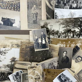
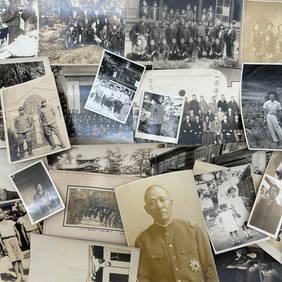
Photography - Set of 30 Photos from Japan - Group photographs - Military photographsProverde Auctions4.3(3)See Sold PriceFeb 28, 2024
Photography - Set of 30 Photos from Japan - Group photographs - LandscapesProverde Auctions4.3(3)See Sold PriceFeb 28, 2024
Photography - Set of 30 Photos from Japan - Group photographs and portraits of Japanese peopleProverde Auctions4.3(3)See Sold PriceFeb 28, 2024


![Early Los Angeles Map Collection [135820] (1 of 1)](https://p1.liveauctioneers.com/2699/211814/108066471_1_x.jpg?height=282&quality=70&version=1626720358)