Marc Chagall-Limited Edition -Paris Opera Ceiling after ChagallArt Legacy Auctions4.5(219)See Sold PriceFeb 24, 2024
Salvador Dali Pantagruel Limited Edition Lithograph Hand signed and numberedArt Legacy Auctions4.5(219)See Sold PriceFeb 24, 2024
Pablo Picasso Bouquet of Peace Collection Domaine Picasso Limited Edition on paper.Art Legacy Auctions4.5(219)See Sold PriceFeb 24, 2024
A RARE MAXFIELD PARRISH JACK AND THE BEANSTALK PRINTSoulis Auctions4.8(953)See Sold PriceFeb 24, 2024
LARGE MECHANICAL PRINT 'STARS' AFTER MAXFIELD PARRISHSoulis Auctions4.8(953)See Sold PriceFeb 24, 2024
Heinrich Aldegrever, etc. 15 old master prints. 16th-17th centuries. Aldegrever works include "ManTremont Auctions4.6(294)See Sold PriceFeb 25, 2024
SoldMap of Mexico, Central America, and the West IndieSamuel Augustus Mitchell, Map of Mexico, Central America, and the West Indies. [with insets:] Map of the Island of Cuba [and] Map of the Island of Jamaica, lithograph (hand colored), 1860, 21 x 13 21See Sold Price
Sold[MAP]. MITCHELL. Mexico & Guatemala. 1846[MAP]. MITCHELL, Samuel Augustus (publisher). Mexico & Guatemala: Published by S. Augustus Mitchell, N.E. corner of Market & 7th. Streets Philada. 1846. [inset map at upper right]: Guatemala [See Sold Price
SoldSamuel Augustus Mitchell/ PublisherSamuel Augustus Mitchell/ Publisher, "Map of Mexico, including Yucatan & Upper California...", 1847, Philadelphia, with original rollers, illustrates the chief cities, towns, and principal traveling rSee Sold Price
SoldMexico and Guatimala [sic.],J. H. Young / Samuel Augustus Mitchell, Mexico and Guatimala [sic.], lithograph (hand colored), probably from Travellers Guide through the U.S. (Philadelphia, 1835) , 10 x 8 10 x 8See Sold Price
[MAP]. MITCHELL. Mexico. 1847[MAP]. MITCHELL, Samuel Augustus (publisher). Map of Mexico, Including Yucatan & Upper California, Exhibiting the Chief Cities and Towns, the Principal Travelling Routes &c. Philadelphia: PublSee Sold Price
[MAP]. MITCHELL. Mexico. 1848. 3rd. ed.[MAP]. MITCHELL, Samuel Augustus (publisher). Map of Mexico, Including Yucatan & Upper California, Exhibiting the Chief Cities and Towns, The Principal Travelling Routes &c. Philadelphia:See Sold Price
[MAP]. MITCHELL. Mexico. 1848. 3rd. ed. sep. iss.[MAP]. MITCHELL, Samuel Augustus (publisher). Map of Mexico, Including Yucatan & Upper California, Exhibiting the Chief Cities and Towns, The Principal Travelling Routes &c. Philadelphia: PublSee Sold Price
Sold(MEXICAN WAR.) Mitchell, Samuel Augustus. MapPOCKET MAP OF TEXAS. (MEXICAN WAR.) Mitchell, Samuel Augustus. Map of Mexico, including Yucatan & Upper California. Hand-colored engraved folding pocket map, with an inset showing the battlefield ofSee Sold Price
[MAP]. MITCHELL. Map of Mexico.... 1846[MAP]. MITCHELL, Samuel Augustus (publisher). Map of Mexico, Including Yucatan & Upper California, Exhibiting the Chief Cities and Towns, the Principal Travelling Routes &c. Philadelphia: PublSee Sold Price
SoldMitchell map of West with Gold Region 1849Title: Oregon, Upper California & New Mexico Author: Mitchell, Samuel Augustus Description: Engraved map, hand-colored. 41x32 cm. (16¼x12½") including decorative border.Western America at the beginnSee Sold Price
SoldMitchell map of West with Gold Region 1849Title: Oregon, Upper California & New Mexico Author: Mitchell, Samuel Augustus Description: Engraved map, hand-colored. 41x32 cm. (16¼x12½") including decorative border.Western America at the beginnSee Sold Price
SAMUEL AUGUSTUS MITCHELL - MAP OF THE UNITED STATES ANDSamuel Augustus Mitchell - Map Of The United States And Texas, Mexico And Guatimala, 1839 - 36 X 23 5/8 In. - This Giclée Print Is Gallery Stretched And Ready To Hang Or Lean Against A Wall, Or DisplSee Sold Price
Samuel Augustus Mitchell - Map Of The United States AndSamuel Augustus Mitchell - Map Of The United States And Texas, Mexico And Guatimala, 1839 Size: 36 X 23 5/8 In. - This Is A Gallery Stretched Giclee Print On Canvas. The Piece Was Printed On High QualSee Sold Price
SAMUEL AUGUSTUS MITCHELL - MAP OF THE UNITED STATESSamuel Augustus Mitchell - Map Of The United States And Texas, Mexico And Guatimala, 1839 - Giclée On Canvas 36 X 23 5/8 In. - A Giclée Print Is The Highest Quality Print Available Today. Because ThSee Sold Price
SAMUEL AUGUSTUS MITCHELL - MAP OF THE UNITED STATES ANDSamuel Augustus Mitchell - Map Of The United States And Texas, Mexico And Guatimala, 1839 - 36 X 23 5/8 In. - This Giclée Print Is Gallery Stretched And Ready To Hang Or Lean Against A Wall, Or DisplSee Sold Price
SAMUEL AUGUSTUS MITCHELL - MAP OF THE UNITED STATES ANDSamuel Augustus Mitchell - Map Of The United States And Texas, Mexico And Guatimala, 1839 - 30 X 19 5/8 In. - This Giclée Print Is Gallery Stretched And Ready To Hang Or Lean Against A Wall, Or DisplSee Sold Price
SoldMost Complete Version of Mitchell’s Mexican War MapHeading: (Mexican-American War) Author: Mitchell, Samuel Augustus Title: Map of Mexico, Including Yucatan & Upper California, Exhibiting the Chief Cities and Towns, The Principal Travelling Routes &c.See Sold Price
SoldSamuel Augustus Mitchell (American, 1792-1868)Samuel Augustus Mitchell (American, 1792-1868), "Map of Mexico, Including Yucatan & Upper California, exhibiting the Chief Cities and Towns, the Principal Travelling Routes &c.", Philadelphia, 1847, tSee Sold Price
After Samuel Augustus Mitchell (American, 1790-1After Samuel Augustus Mitchell (American, 1790-1860)Map of Mexico Including Yucatan & Upper CalSee Sold Price
Mexico & Guatemala by Mitchell, 1850Original engraving of Mexico & Guatemala by Samuel Augustus Mitchell from Mitchell’s Universal Atlas, 1850. Map features Isthmus of Tehuantepec, Nicaragua, Guatemala & the Valley of Mexico. DimensioSee Sold Price
SoldMitchell Map of MexicoMITCHELL, Samuel Augustus (1792-1868).Map of Mexico, Including Yucatan & Upper California, exhibiting the Chief Cities and Towns, the Principal Travelling Routes & c.Lithographed map with hand color.PSee Sold Price
SoldPrint, After Samuel Augustus MitchellAfter Samuel Augustus Mitchell (American, 1792-1868), "Arizona and New Mexico," 1882, copper engraved map with hand coloring, entered according to the Act of Congress in 1882, overall (with frame): 19See Sold Price
SoldSamuel A. Mitchell Hand Colored Lithograph MapSamuel Augustus Mitchell, American (1792-1868). Hand colored lithograph of Mexico, Central America, West Indies, 1860. Mounted in silver tone wood frame and includes paperwork. Measures 20"H x 27.75"WSee Sold Price
Portfolio of 15 County Maps by Robert Morden (English 1650-1703)Nadeau's Auction Gallery4.7(405)See Sold PriceFeb 24, 2024
1849 Mitchell School ATLAS 24 MAPS America Holy Land France Africa Egypt AsiaSchilb Antiquarian Rare Books4.8(422)See Sold PriceMar 31, 2024
Arrowsmith & Lewis - Map of North AmericaTrillium Antique Prints & Rare Books4.5(30)See Sold PriceFeb 24, 2024
Arrowsmith & Lewis - Map of the World on Mercator's ProjectionTrillium Antique Prints & Rare Books4.5(30)See Sold PriceFeb 24, 2024
Arrowsmith & Lewis - Map of LouisianaTrillium Antique Prints & Rare Books4.5(30)See Sold PriceFeb 24, 2024
Arrowsmith & Lewis - Map of the United StatesTrillium Antique Prints & Rare Books4.5(30)See Sold PriceFeb 24, 2024
Mitchell - Map of the City of Washington (Washington, DC)Trillium Antique Prints & Rare Books4.5(30)See Sold PriceFeb 24, 2024
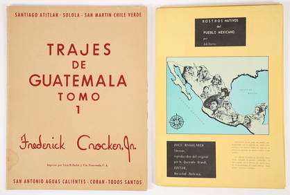
2 color portfolios Natives of Mexico and GuatemalaConcept Art Gallery4.7(509)See Sold PriceMar 06, 2024
Map of Mexico, Central America, New Grenada, Venzuela and the West IndiesJasper524.5(9.8k)See Sold PriceFeb 27, 2024
Two Hand-Colored 19th Century Maps of New Orleans and Louisiana, Larger- H.- 12 1/2 in., W.- 15 1/2Crescent City Auction Gallery4.3(231)See Sold PriceMar 08, 2024


![[MAP]. MITCHELL. Mexico & Guatemala. 1846 (1 of 5)](https://p1.liveauctioneers.com/514/95447/48676194_1_x.jpg?height=282&quality=70&version=1477936208)

![Mexico and Guatimala [sic.], (1 of 1)](https://p1.liveauctioneers.com/457/2714/1174422_1_x.jpg?height=282&quality=70)
![[MAP]. MITCHELL. Mexico. 1847 (1 of 5)](https://p1.liveauctioneers.com/514/95447/48676191_1_x.jpg?height=282&quality=70&version=1477936208)
![[MAP]. MITCHELL. Mexico. 1848. 3rd. ed. (1 of 10)](https://p1.liveauctioneers.com/514/95447/48676192_1_x.jpg?height=282&quality=70&version=1477936208)
![[MAP]. MITCHELL. Mexico. 1848. 3rd. ed. sep. iss. (1 of 7)](https://p1.liveauctioneers.com/514/95447/48676193_1_x.jpg?height=282&quality=70&version=1477936208)

![[MAP]. MITCHELL. Map of Mexico.... 1846 (1 of 4)](https://p1.liveauctioneers.com/514/95447/48676190_1_x.jpg?height=282&quality=70&version=1477936208)