ATLAS of ANTIENT GEOGRAPHY by SAMUEL BUTLER 1843John McInnis Auctioneers,LLC4.6(504)See Sold PriceFeb 24, 2024
18TH C. ANTIQUE MAP: FRENCH & INDIAN WAR, FRAMEDThomaston Place Auction Galleries4.4(389)See Sold PriceFeb 24, 2024
Rand McNally Railroad Map Cabinet w/ 21 Railroad MapsRail & Road Auctions4.6(165)See Sold PriceMar 08, 2024
Keith Haring - Ink on New York Map, Best Buddies, Inscribed, Signed, and DatedSapphire Auction Gallery4.1(67)See Sold PriceMar 02, 2024
LATE 17TH C. FRENCH MAP OF THE NEW WORLD BY ALEXIS-HUBERT JAILLOT (1632-1712)Thomaston Place Auction Galleries4.4(389)See Sold PriceFeb 24, 2024
Central Railroad of New Jersey Map of Sandy Hook Route-ca. 1903JM Hobby Supply and Railroad Artifact Auctions4.4(126)See Sold PriceFeb 24, 2024
Lot of Six Mixed Atlas Box Cars-HO Scale-New in BoxJM Hobby Supply and Railroad Artifact Auctions4.4(126)See Sold PriceFeb 25, 2024
Rand McNally/Santa Fe Railroad Map of Iowa-1912JM Hobby Supply and Railroad Artifact Auctions4.4(126)See Sold PriceFeb 24, 2024
NICOLAES VISSCHER (NETHERLANDS, 1618-1709) MAP OF THE NEW WORLDThomaston Place Auction Galleries4.4(389)See Sold PriceFeb 24, 2024
17TH C. WORLD MAP BY NICOLAES VISSCHER (NETHERLANDS, 1618-1709)Thomaston Place Auction Galleries4.4(389)See Sold PriceFeb 24, 2024
Lot of Six Mixed Atlas Cabooses-HO Scale-New in BoxJM Hobby Supply and Railroad Artifact Auctions4.4(126)See Sold PriceFeb 25, 2024
Hall: Antique Map of Egypt, 1829TITLE/CONTENT OF MAP: 'Egypt' This fascinating map covers Egypt and the Red Sea including the Gulf of Aqaba and the Gulf of Suez. Tiran and Sanafir Islands are marked as "Pirates Isles". The town of ASee Sold Price
Hall: Antique Map of Egypt, 1829TITLE/CONTENT OF MAP: 'Egypt' This fascinating map covers Egypt and the Red Sea including the Gulf of Aqaba and the Gulf of Suez. Tiran and Sanafir Islands are marked as "Pirates Isles". The town of ASee Sold Price
Hall: Antique Map of Egypt, Red Sea Nile, 1829TITLE/CONTENT OF MAP: 'Egypt' This fascinating map covers Egypt and the Red Sea including the Gulf of Aqaba and the Gulf of Suez. Tiran and Sanafir Islands are marked as "Pirates Isles". The town of ASee Sold Price
1829 Hall Antique Map of South East Asia, incl. MyanmarTitle/Content of Map: 1829 Hall Map of South East Asia, incl. Myanmar (Burma) and Thailand -- Birmah with Part of Anam and Siam Date Printed: 1829, London Cartographer: S Hall Size: 20.1 x 16.1 in AnSee Sold Price
Hall: Antique Map of South East Asia, 1829Title/Content of Map: 1829 Hall Map of South East Asia, incl. Myanmar (Burma) and Thailand -- Birmah with Part of Anam and Siam Date Printed: 1829, London Cartographer: S Hall Size: 20.1 x 16.1 in AnSee Sold Price
SoldSidney Hall: Antique Map of Chili Bolivia Peru, 1829Title: Map of Chili, La Plata, and Bolivia or Upper Peru by Sidney Hall Date: c. 1829 Medium: Copper Engraving Dimensions (in): 19 x 24 Condition: Good Condition, small rip on the right No Reserve:See Sold Price
Hall: Antique Map of Turkey in Asia, 1829Title/Content of Map: Turkey in Asia Cartographer: Sidney Hall Size: 16 inX20 in Sidney Hall's fine representation of the Mid East in 1829. Shows in great detail Asia Minor, Syria, Armenia, Irak, AlgeSee Sold Price
1828 Map of Ancient EgyptAuthor: Hall Title: 1828 Map of Ancient Egypt Medium: Ink on Paper Dimensions: 8.5"X10.5" Map of Ancient Egypt dated 1828. Part of Butler's Antique World Atlas. Drawn and engraved by Sydney Hall. PublSee Sold Price
1828 Map of Ancient EgyptTitle: 1828 Map of Ancient Egypt Medium: Ink on Paper Dimensions: 8.5"X10.5" Description: Map of Ancient Egypt dated 1828. Part of Butler's Antique World Atlas. Drawn and engraved by Sydney Hall. PublSee Sold Price
SoldTravels in North America 1827-28, Capt. B. Hall,Travels in North America 1827-28, Capt. B. Hall, three vol. 1829, with mapSee Sold Price
SoldSidney Hall: Antique Map Humboldt's Plant DistributionTitle/Content of Map: 'Humboldt's distribution of plants in Equinoctial America, according to elevation above the level of the sea' Date Printed: 1856 Image Size: Approx 27.5 x 39.5cm, 10.75 x 15.5 inSee Sold Price
SoldSidney Hall: Antique Map of the West Indies, 1856Title/Content of Map: 'West Indies [inset: Panama Railway, Jamaica]' Date Printed: 1856 Image Size: Approx 29.0 x 42.0cm, 11.25 x 16.5 inches (Large) Type: Antique atlas map with original hand colouriSee Sold Price
Hall: Antique Map of Ireland, 1856TITLE/CONTENT OF MAP: 'Ireland' showing counties & railways DATE PRINTED: 1856 IMAGE SIZE: Approx 54.0 x 41.5cm, 21.25 x 16.25 inches (Large); Please note that this is a folding map. TYPE: Antique atlSee Sold Price
Sidney Hall: Antique Map of Gold Rush Australia, 1856Title/Content of Map: 'Australia [inset: Van Diemen's Land]' Gold rush Australia showing gold districts in yellow. Date Printed: 1856 Image Size: Approx 43.5 x 58.0cm, 17 x 23 inches (Large); Please nSee Sold Price
Sidney Hall: Antique Map of Turkey in Europe, 1856TITLE/CONTENT OF MAP: 'Turkey in Europe [inset: The Bosphorus]' DATE PRINTED: 1856 IMAGE SIZE: Approx 28.0 x 40.0cm, 11 x 15.75 inches (Large) TYPE: Antique atlas map with original hand colouring / coSee Sold Price
SoldHall: Antique Map of Asia, 1856TITLE/CONTENT OF MAP: 'Asia' Siam Birmah Cochin China Niphon Persia Arabia DATE PRINTED: 1856 IMAGE SIZE: Approx 28.5 x 40.5cm, 11.25 x 16 inches (Large) TYPE: Antique atlas map with original hand colSee Sold Price
SoldSidney Hall: Antique Map of British India & AfghanistanTITLE/CONTENT OF MAP: 'Hindustan, with part of Caubul' British India & Afghanistan. DATE PRINTED: 1856 IMAGE SIZE: Approx 41.0 x 28.5cm, 16 x 11.25 inches (Large) TYPE: Antique atlas map with originalSee Sold Price
SoldSidney Hall: Antique Map of South Italy, 1856Title/Content of Map: 'Italy, south part [inset: Malta and its dependencies]' Sardinia Sicily. Date Printed: 1856 Image Size: Approx 28.5 x 41.0cm, 11.25 x 16 inches (Large) Type: Antique atlas map wiSee Sold Price
SoldSidney Hall: Antique Map of Europe, 1847Map: Europe. Publication Date: 1847 Authors: Adam & Charles Black, Sidney Hall Publisher: Adam & Charles Black Size: Folio – 10.50 H x 14.75 W Inches Polar projection. Rather detailed.Browned.See Sold Price
SoldHall: Antique Map of Mexico and Guatemala, 1828Title/Content of Map: Mexico. and Guatimala. Date Printed: 03/01/1828 Cartographer: HALL, SIDNEY Size: 16.03X20 A handsome outline hand colored map of all Hispanic North America in the period betweenSee Sold Price
SoldSidney Hall: Antique Map of South America, 1820Title: Map of South America Maker: Sidney Hall Date: c. 1820 Dimensions (inches): 19 x 24 Medium: Hand Colored Engraving Condition: Good Condition small rips along right side No Reserve: This lot starSee Sold Price
Sidney Hall: Antique Map of Early Colonial Africa, 1856Title/Content of Map: 'Africa [inset: Madeira, port of Aden]' Early colonial Africa. Date Printed: 1856 Image Size: Approx 40.5 x 29.5cm, 16 x 11.75 inches (Large) Type: Antique atlas map with originaSee Sold Price
Sidney Hall: Antique Map of British India, 1856Title/Content of Map: 'India [inset: Singapore]' British India. Inset Singapore plan. Date Printed: 1856 Image Size: Approx 59.5 x 43.5cm, 23.25 x 17 inches (Large); Please note that this is a foldingSee Sold Price
Sidney Hall: Antique Map of the World in HemispheresTitle/Content of Map: 'The World: Western Hemisphere, Eastern Hemisphere' Date Printed: 1856 Image Size: Approx 25.0 x 40.5cm, 9.75 x 16 inches (Large) Type: Antique atlas map with original hand colouSee Sold Price
Mckenney & Hall - Two Octavo Volumes of Text with Rare Plate of Billy BowlegsTrillium Antique Prints & Rare Books4.5(30)See Sold PriceFeb 24, 2024
Carte de la Barbarie… l'empire de Maroc… North Africa Morocco. LAPIE 1829 mapJasper524.5(9.8k)See Sold PriceFeb 28, 2024
NORTH AFRICA OF BABRBARY V Parts of Tripoli & Egypt. Libya Tribes. SDUK 1846 mapJasper524.5(9.8k)See Sold PriceFeb 28, 2024
Northern & Southern Africa. Maghreb. Orange River Sovereignty. HALL 1854 mapJasper524.5(9.8k)See Sold PriceFeb 28, 2024
NORTH AFRICA BARBARY. Parts of Tripoli (Libya) & Egypt. Tribes. SDUK 1844 mapJasper524.5(9.8k)See Sold PriceFeb 28, 2024
Carte d'Afrique. Africa Soudan Zanzibar. LAPIE 1831 old antique map plan chartJasper524.5(9.8k)See Sold PriceFeb 28, 2024
Early colonial Africa. Inset Madeira & Aden. SIDNEY HALL 1856 old antique mapJasper524.5(9.8k)See Sold PriceFeb 28, 2024
NORTH AFRICA BARBARY. Parts of Tripoli (Libya) & Egypt. Tribes. SDUK 1844 mapJasper524.5(9.8k)See Sold PriceFeb 28, 2024
NILE VALLEY. Upper & Lower. Egypt Sinai Nubia Sudan Abyssinia. BLACKIE 1886 mapJasper524.5(9.8k)See Sold PriceFeb 28, 2024
NORTH AFRICA OF BABRBARY V Parts of Tripoli & Egypt. Libya Tribes. SDUK 1851 mapJasper524.5(9.8k)See Sold PriceFeb 28, 2024
Northern & Southern Africa. Maghreb. Orange River Sovereignty. HALL 1856 mapJasper524.5(9.8k)See Sold PriceFeb 28, 2024
NORTH AFRICA. Morocco Algeria Tunis Tunisia Egypt. Cairo. BARTHOLOMEW 1912 mapJasper524.5(9.8k)See Sold PriceFeb 28, 2024
Carte de l'Afrique propre, de la Numidie… North Africa. LAPIE 1829 old mapJasper524.5(9.8k)See Sold PriceFeb 28, 2024
NORTH AFRICA. Morocco Algeria Tunis Tunisia Egypt. Cairo. BARTHOLOMEW 1901 mapJasper524.5(9.8k)See Sold PriceFeb 28, 2024
NILE VALLEY. Upper & Lower. Egypt Sinai Nubia Sudan Abyssinia. BLACKIE 1882 mapJasper524.5(9.8k)See Sold PriceFeb 28, 2024
NORTH AFRICA. Barbary. Morocco Tunisia Libya Egypt. 'Barbarie'. MALLET 1683 mapJasper524.5(9.8k)See Sold PriceFeb 28, 2024
EGYPT SUDAN ABYSSINIA. Alexandria; Eastern Continuation; Aden 1907 old mapJasper524.5(9.8k)See Sold PriceFeb 28, 2024
NORTH EAST AFRICA. Libya Egypt Sudan Ethiopia Ubangi-Shari Chad 1952 old mapJasper524.5(9.8k)See Sold PriceFeb 28, 2024
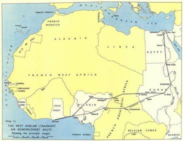
West Africa WW2 Nigeria Sudan Egypt. Takoradi air reinforcement route 1954 mapJasper524.5(9.8k)See Sold PriceFeb 28, 2024
NORTH AFRICA BARBARY. Parts of Tripoli (Libya) & Egypt. Tribes. SDUK 1848 mapJasper524.5(9.8k)See Sold PriceFeb 28, 2024
NUBIA. 'Nubie'. Nile Valley. Sudan Ethiopia Egypt. MALLET 1683 old antique mapJasper524.5(9.8k)See Sold PriceFeb 28, 2024
Early colonial Africa. Inset Madeira & Aden. SIDNEY HALL 1854 old antique mapJasper524.5(9.8k)See Sold PriceFeb 28, 2024
Egypte, Nubie et Abissinie. Egypt, Nubia & Abyssinia. Sudan. BONNE 1788 mapJasper524.5(9.8k)See Sold PriceFeb 28, 2024