ATLAS of ANTIENT GEOGRAPHY by SAMUEL BUTLER 1843John McInnis Auctioneers,LLC4.5(505)See Sold PriceFeb 24, 2024
18TH C. ANTIQUE MAP: FRENCH & INDIAN WAR, FRAMEDThomaston Place Auction Galleries4.4(393)See Sold PriceFeb 24, 2024
Rand McNally Railroad Map Cabinet w/ 21 Railroad MapsRail & Road Auctions4.6(165)See Sold PriceMar 08, 2024
Keith Haring - Ink on New York Map, Best Buddies, Inscribed, Signed, and DatedSapphire Auction Gallery4.1(67)See Sold PriceMar 02, 2024
LATE 17TH C. FRENCH MAP OF THE NEW WORLD BY ALEXIS-HUBERT JAILLOT (1632-1712)Thomaston Place Auction Galleries4.4(393)See Sold PriceFeb 24, 2024
Central Railroad of New Jersey Map of Sandy Hook Route-ca. 1903JM Hobby Supply and Railroad Artifact Auctions4.4(127)See Sold PriceFeb 24, 2024
Lot of Six Mixed Atlas Box Cars-HO Scale-New in BoxJM Hobby Supply and Railroad Artifact Auctions4.4(127)See Sold PriceFeb 25, 2024
Rand McNally/Santa Fe Railroad Map of Iowa-1912JM Hobby Supply and Railroad Artifact Auctions4.4(127)See Sold PriceFeb 24, 2024
NICOLAES VISSCHER (NETHERLANDS, 1618-1709) MAP OF THE NEW WORLDThomaston Place Auction Galleries4.4(393)See Sold PriceFeb 24, 2024
17TH C. WORLD MAP BY NICOLAES VISSCHER (NETHERLANDS, 1618-1709)Thomaston Place Auction Galleries4.4(393)See Sold PriceFeb 24, 2024
Lot of Six Mixed Atlas Cabooses-HO Scale-New in BoxJM Hobby Supply and Railroad Artifact Auctions4.4(127)See Sold PriceFeb 25, 2024
Sketch of General Progress of the Surveys Locating theTitle/Content of Map: Sketch of General Progress of the Surveys Locating the Boundary Between Alaska and British Possessions in North America Date Printed: 1895 Cartographer: U.S. COAST AND GEODETIC SSee Sold Price
SoldANTIQUE 1881 US MAP:United States Coast and Geodetic Survey "Sketch of General Progress", June 30, 1881. Eastern sheet. Matted and framed. Good condition, with light creases and foxing. 30"H X 23.25"W, sight.See Sold Price
SoldU S Coast Survey 1896 LG Map. West USA California Texas"Sketch of General Progress June 30. 1896." Showing Central and Western US, with part of Mexico. From Mississippi/Wisconsin through to West Coast. Large Lithograph Map Published 1896, Washington for "See Sold Price
SoldU S Coast Survey 1896 LG Map. New Orleans Texas Florida"Sketch of General Progress June 30. 1896" Showing Southern, Eastern and Mid West States, incl Florida, Texas, Gulf of Mexico, Georgia etc. Large Lithograph Map Published 1896, Washington for "U.S. CoSee Sold Price
General Progress Sketch Hawaiian Islands | Porto RicoTitle: General Progress Sketch Hawaiian Islands | Porto Rico Printing Date: 6/30/1910 Cartographer: U.S. GEOLOGICAL SURVEY Publisher: U.S. GEOLOGICAL SURVEY Size: 14Height - 14.3Width Additional InforSee Sold Price
Sketch F Showing the Progress of the Survey in SectionTitle/Content of Map: Sketch F Showing the Progress of the Survey in Section Vi With a General Reconnoissance of The Western Coast Of Florida 1848-55 Publication Date: 1855 Cartographer: U.S. COAST SUSee Sold Price
Sketch of the Public Surveys in Iowa TerritoryTitle/Content of Map: Sketch of the Public Surveys in Iowa Territory Date: 1845 Cartographer: GENERAL LAND OFFICE Size: 12.8Height - 11.6Width Publisher: GENERAL LAND OFFICE Grid map locating regionsSee Sold Price
Sketch F Showing the Progress in Section No. VI ...Title: Sketch F Showing the Progress in Section No. VI ... 1849 & '50 [General Florida Reef and the Keys] Publication Date: 1850 Cartographer: U.S. COAST SURVEY Publisher: U.S. COAST SURVEY Size: 12.5See Sold Price
General Progress Sketch Hawaiian Islands | Porto RicoTitle/Content of Map: General Progress Sketch Hawaiian Islands | Porto Rico Date: 1907 Cartographer: U.S. COAST AND GEODETIC SURVEY Publisher: GPO Size: 14.25Height - 14.5Width Reserve: $50.00 ShippinSee Sold Price
General Progress Sketch Hawaiian Islands | Porto RicoTitle/Content of Map: General Progress Sketch Hawaiian Islands | Porto Rico Date: 1907 Cartographer: U.S. COAST AND GEODETIC SURVEY Publisher: GPO Size: 14.25Height - 14.5Width Reserve: $40.00 ShippinSee Sold Price
General Progress Sketch Hawaiian Islands | Porto RicoTitle/Content of Map: General Progress Sketch Hawaiian Islands | Porto Rico Date Printed: 6/30/1910 Cartographer: U.S. GEOLOGICAL SURVEY Size: 14X14.3 Two maps on same sheet. Shows triangulated areas,See Sold Price
General Progress Sketch Hawaiian Islands | Porto RicoTitle/Content of Map: General Progress Sketch Hawaiian Islands | Porto Rico Date: 1907 Cartographer: U.S. COAST AND GEODETIC SURVEY Size: 14.25 X 14.5 Please note that this lot has a confidential reseSee Sold Price
SoldU S Coast Survey 1896 LG Map. Gulf Coast. Florida, MI"Sketch Showing Progress of Surveys on the Gulf Coast Lake Pontchartrain Mobile and Pensacola Bays" Detailed map showing New Orleans to Santa Rosa Sound, with inset showing Tortugas Harbor. Large LithSee Sold Price
USCGS: Antique Map of Florida East Coast, 1881United States Coast and Geodetic survey progress sketch sec. VI East Coast of Florida Halifax river to cape Canaveral' Daytona Beach. Notes on the historical context / background to the map can be vieSee Sold Price
SoldSketch Showing the Progress of the Survey On The Atlantic, Gulf of Mexico and Pacific Coast Of ThePublication Date: 1870 Title: Sketch Showing the Progress of the Survey On The Atlantic, Gulf of Mexico and Pacific Coast Of The United States to November 1870 Cartographer: PIERCE, BENJAMIN PublisherSee Sold Price
Sketch Showing the Progress of the Survey On The Atlantic, Gulf of Mexico and Pacific Coast Of ThePublication Date: 1866 Title: Sketch Showing the Progress of the Survey On The Atlantic, Gulf of Mexico and Pacific Coast Of The U.S. to Nov. 1866 Cartographer: BACHE, A.D. Publisher: U.S. COAST SURVESee Sold Price
Sketch Showing the Progress of the Survey in SectionTitle: Sketch Showing the Progress of the Survey in Section No.VI (Lower Sheet) from Key West to Cape Romano ... June 30, 1889 Publication Date: 1889 Cartographer: U.S. COAST AND GEODETIC SURVEY PubliSee Sold Price
Sketch Showing the Progress of the Survey On ThePublication Date: 1861 Title: Sketch Showing the Progress of the Survey On The Atlantic, Gulf of Mexico and Pacific Coast Of The United States Of November 1860 Cartographer: U.S. COAST SURVEY PublisheSee Sold Price
Sketch Showing the Progress of the Survey in SectionTitle/Content of Map: Sketch Showing the Progress of the Survey in Section No.Xi (Upper Sheet) from Tillamook Bay to The Boundary ... June 30, 1889 Date: 1889 Cartographer: U.S. COAST SURVEY Size: 28HSee Sold Price
Sketch Showing the Progress of the Survey On The Atlantic, Gulf of Mexico and Pacific Coast Of ThePublication Date: 1865 Title: Sketch Showing the Progress of the Survey On The Atlantic, Gulf of Mexico and Pacific Coast Of The U.S. to Nov. 1865 Cartographer: BACHE, A.D. Publisher: U.S. COAST SURVESee Sold Price
Sketch Showing the Progress of the Survey in SectionTitle: Sketch Showing the Progress of the Survey in Section No.X (Middle Sheet) from Pt. Sal to Tomales Bay Publication Date: 1889 Cartographer: U.S. COAST AND GEODETIC SURVEY Publisher: U.S. C. & G.SSee Sold Price
USCGS: Antique Survey Map of New England, 1889United States Coast and Geodetic survey sketch showing the progress of the survey in sections 1&2 Inset maps of St. Croix River and N.E. Boundary; sketch showing the progress of the survey in SectionSee Sold Price
Maritime Chart, U.S. Coast Survey, San Diego To PtCHART. U.S. Coast Survey, Sketch showing the progress of the survey in Section no. X, (lower sheet), from San Diego to Pt. Sal, from 1850-1877, scale 600.000, 1877, good condition, folds, 29 1/2" T xSee Sold Price
U.S. Coast Survey From San Diego to Pt. Sal. 1875.EARLY CALIFORNIA CHART. U.S. Coast Survey, Sketch showing the progress of the survey in Section no. X, (lower sheet), from San Diego to Pt. Sal, from 1850-1877, scale 600.000, 1877, good condition, foSee Sold Price
FINE CHINESE ENAMEL COPPER SNUFF BOTTLE GENERAL ZHAN FEI QIANLONG MARKNoble House Collection Gallery4.5(123)See Sold PriceFeb 28, 2024
SUPERB CHINESE ENAMELED SNUFF BOTTLE HERO GENERAL ON HORSE KANGXI MARKNoble House Collection Gallery4.5(123)See Sold PriceFeb 28, 2024
WILLIAM HENRY DETHLEF KOERNER (NJ/NY/MT, 1878-1938)Thomaston Place Auction Galleries4.4(393)See Sold PriceFeb 25, 2024
American Revolution prints. 19th century. To include: 1) "The Death of General Montgomery". FrenchTremont Auctions4.5(297)See Sold PriceFeb 25, 2024
Norman McLaren Signed 1946 Abstract Sketch DrawingKavanagh Auctions4.6(311)See Sold PriceFeb 24, 2024
ELEGANT CHINESE PEKING GLASS SNUFF BOTTLE GENERAL ON HORSE QIANLONG SEALNoble House Collection Gallery4.5(123)See Sold PriceFeb 28, 2024
[WORLD’S FAIRS]. A Group of Nearly 40 Postcards, Brochures,...Potter & Potter Auctions4.6(545)See Sold PriceMar 07, 2024
A "There's a Great Big Beautiful Tomorrow" Record.Van Eaton Galleries4.6(99)See Sold PriceMar 02, 2024
SUPERB SIGNED CHINESE SNUFF BOTTLE GENERAL ON HORSE QIANLONG SEALNoble House Collection Gallery4.5(123)See Sold PriceFeb 28, 2024
Incredible named and researched Brigadier general GroupingEagles Corps International LLC4.5(107)See Sold PriceMar 10, 2024
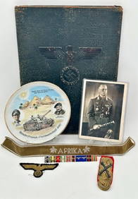
Incredible Named WW2 WWII Luftwaffe Generals German Desk Flag Paperweight with Presentation boxEagles Corps International LLC4.5(107)See Sold PriceMar 10, 2024
Louis Corinth ( German 1858 - 1925) Framed sketch of a female 29 x 23 cm.Hannam's Auctioneers Ltd4.3(396)See Sold PriceMar 01, 2024
[Constructivism]. The general plan of reconstruction of Moscow. - Moscow: Moscow Worker, 1936. -ARTMAXIMUM4.3(4)See Sold PriceMar 14, 2024
Disney Mulan's Original Character Sketches Chi FuRapid Estate Liquidators and Auction Gallery4.5(1.1k)See Sold PriceFeb 27, 2024


![[WORLD’S FAIRS]. A Group of Nearly 40 Postcards, Brochures,... (1 of 4)](https://p1.liveauctioneers.com/928/318880/171361564_1_x.jpg?height=282&quality=70&version=1707501302)


![[Constructivism]. The general plan of reconstruction of Moscow. - Moscow: Moscow Worker, 1936. - (1 of 6)](https://p1.liveauctioneers.com/6171/320219/172084257_1_x.jpg?height=282&quality=70&version=1708525949)


